


Why visit Bernhardswald
Townapedia lists 15 museums and landmarks, 7 parks and trails, 28 places to eat, 1 place to stay and 10 attractions in and around town.
Highlights include Hoher Stein, Walhalla, Heimatmuseum Altenthann and Golf- und Landclub Regensburg e.V..
Weather in Bernhardswald
Forecast from MET Norway (CC BY 4.0). Full forecast
About Bernhardswald
Bernhardswald is a municipality in the district of Regensburg in Bavaria in Germany.
From the Wikipedia article Bernhardswald (this version), under CC BY-SA 4.0.
Things to do10

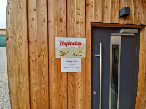
Felsengruppe
Scenic view · 6.5 km
Große interessante Felsengruppe ohne spezielle Aussicht
Megalith - Menhir - Steinzeitkalender
Scenic view · 6.2 km
In combination with the bucket seat and the nearby rocking stone (Wackelstein), this is a stone age calendar
Wackelstein - Schalensitz - Opferstelle
Scenic view · 6.2 km
In combination with the "Megalit" nearby, this is a stone age calendar
Museums and landmarks15

Walhalla
Monument and historic site · 6.9 km
Nach Walhall, „Halle der Gefallenen“
Apr-Oct: Mo-Su 09:00-18:00, Nov-Mar: 10:00-12:00,13:00-16:00

Donaustauf Castle
Monument and historic site · 7.3 km
Building in Donaustauf, Upper Palatinate, Germany

Walhalla memorial
Monument and historic site · 6.9 km
Memorial in Donaustauf, Bavaria




3 more on the map.
Parks, trails and playgrounds7



Restaurants and cafes28

Historisches Armen Spital
Restaurant · Bavarian · 7.1 km
9 Walhallastraße, Donaustauf
Mo,We-Fr 13:00-21:00; PH,Sa,Su 11:00-21:00


Bäckerei Schifferl
Bakery · 4.0 km
22 Hauptstraße, Wenzenbach
Mo-Fr 06:00-18:00; Sa 06:00-13:00; Su 07:00-18:00
Sportgaststätte Bernhardswald
Restaurant · International · 0.6 km
Su 11:00-14:00,17:00-22:00; Th-Sa 17:00-21:00
Zum Kneißl
Restaurant · 4.0 km
8A Jahnweg, Wenzenbach
We-Fr 11:00-14:00,17:00-22:00; Sa,Su,PH 11:00-22:00
Waldgaststätte Otterbachtal - Koreawirt
Restaurant · Regional · 4.2 km
1 Bruckhaus, Altenthann
We-Fr 13:00+; Sa,Su,PH 11:00+
Erlebnishof Auszeit
Cafe · Cake, Breakfast, Bavarian, Ice Cream · 0.6 km
Fr-Su 08:30-17:00
Osteria dei Vini
Restaurant · Italian · 4.3 km
Bahnhofstraße, Wenzenbach
We-Mo 11:00-14:00, 17:00-00:00
16 more on the map.
Where to stay1
Churches and places of worship28
Wallfahrtskirche St. Salvator
Church · Roman Catholic · 7.1 km
10 Walhallastraße, Donaustauf
Maria Himmelfahrt
Church · Roman Catholic · 6.8 km
7 Grünthaler Straße, Wenzenbach
Dietrich-Bonhoeffer-Kirche
Church · Protestant · 4.2 km
10 Bahnhofstraße, Wenzenbach
Shopping6
Gas and EV charging2
Schools, colleges and libraries8
Healthcare4
Map of Bernhardswald
109 places. The map loads OpenStreetMap tiles when you open it.
Getting there and nearby towns
Flugplatz Straubing-Wallmühle (RBM) is the nearest airport with scheduled flights listed in OpenStreetMap, 29 km away.
- Regenstauf 9 km west, about 9 min by car
- Zeitlarn 10 km west, about 10 min by car
- Neutraubling 12 km south, about 12 min by car
- Regensburg 14 km southwest, about 14 min by car
- Lappersdorf 12 km southwest, about 12 min by car
- Maxhütte-Haidhof 17 km northwest, about 17 min by car
- Pentling 18 km southwest, about 18 min by car
- Burglengenfeld 19 km northwest, about 19 min by car
- Bad Abbach 23 km southwest, about 23 min by car
- Roding 23 km northeast, about 23 min by car
Drive times are estimates from straight-line distance, not routes.
Local news
Headlines from INDB.
Reviews, tips and questions
Loading what members have shared...
Sources and licences
- GeoNames (CC BY 4.0): population, coordinates, regions and time zone
- Mapillary (see each image): photos
- OpenStreetMap contributors (ODbL 1.0): places, airports, map data
- Wikidata (CC0 1.0): elevation, founding date, time zone, website, landmarks and historic places
- Wikimedia Commons (see each image): photos
- Wikipedia (CC BY-SA 4.0): overview and history text
Photo credits
- Schloss Kürn (Bernhardswald), Johanning, CC BY-SA 3.0
- Burg bei Donaustauf 3, Bkmd, Public domain
- Brennberg, Kloster Frauenzell 001, Mattana, CC BY-SA 3.0
- Walhalla-Memorial 01, SimonWaldherr, CC BY-SA 4.0
- Schoenfeld (Landkreis Cham) St Aegidius, Hersendis (Winkel und Zuschnitt Rabanus Flavus, CC BY-SA 3.0
- Leo von Klenze Salvatorkirche und Walhalla, Leo von Klenze, Public domain
- P1170637 - Kirche Rückansicht, ChristiansFotos, CC BY-SA 4.0
- Donaustauf-Sulzbach-Kirche-Sankt-Nepomuk, Elcom.stadler, CC BY-SA 3.0
- Loretokirche in Kürn, MagnusBB, CC0
- 14.06.19 Lambertsneukirchen St. Lambert, Gehsport-sepp ( Diskussion ), CC BY-SA 4.0
- Mariä Himmelfahrt Pettenreuth, Matchboxler, CC BY-SA 4.0
- Schloss Schönberg (Wenzenbach), Johanning, CC BY-SA 3.0
- St. Peter Wenzenbach 2014, Johanning, CC BY-SA 3.0
- St. Andreas Birkenhof 2014, Johanning, CC BY-SA 4.0
- Irlbach Mariä Himmelfahrt, H.Helmlechner, CC BY-SA 4.0
- Kapelle zum Gegeißelten Heiland Thanhausen 2014, Johanning, CC BY-SA 4.0
- Walhalla - Donaustauf - 2015, Avda, CC BY-SA 3.0
- Kirchberg Regenstauf Orgel Hirnschrodt, Regerman, CC BY-SA 4.0
- Larven bockkaefer, Harald Kloth, CC BY-SA 4.0
- Mehrere Buchdrucker, Borkenkäfer, Harald Kloth, CC BY-SA 4.0
- Larvengaenge buchdrucker, Harald Kloth, CC BY-SA 4.0
- Street-level photo, SuedOstLink, CC BY-SA 4.0
- Street-level photo, SuedOstLink, CC BY-SA 4.0
- Street-level photo, Guenni1963, CC BY-SA 4.0
- Street-level photo, SuedOstLink, CC BY-SA 4.0
- Street-level photo, Guenni1963, CC BY-SA 4.0


Page built November 9, 2026. Spotted a mistake? Tell us or suggest a place.