


Blaubeuren, Germany
Blaubeuren is a town of 11,797 people in Baden-Wurttemberg, Germany.
Why visit Blaubeuren
Townapedia lists 43 museums and landmarks, 16 parks and trails, 69 places to eat, 17 places to stay and 39 attractions in and around town.
Highlights include Schimmelmühle Blaubeuren, Theater in der Talmühle, Hohle Fels and Urgeschichtliches Museum.
Weather in Blaubeuren
Forecast from MET Norway (CC BY 4.0). Full forecast
About Blaubeuren
Blaubeuren (German pronunciation: [ˌblaʊ̯ˈbɔʏʁən] ) is a town in the district of Alb-Donau near Ulm in Baden-Württemberg, Germany.
From the Wikipedia article Blaubeuren (this version), under CC BY-SA 4.0.
Things to do39
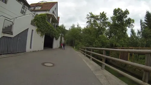
Schimmelmühle Blaubeuren
Farm and orchard
5 Mühlweg, Blaubeuren
Mo,We,Fr 10:30-12:15, 16:00-18:00; Tu,Th 16:00-18:00; Sa...



Biolandhof Mollenkopf
Farm and orchard · 7.4 km
4 Treffensbuch, Berghülen
27 more on the map.
Museums and landmarks43

Hohle Fels
Monument and historic site · 4.3 km
Cave in Germany
May-Oct: We-Fr 14:00-17:00; May-Oct: Sa 12:00-17:00, May-Oct: Su...

Urgeschichtliches Museum
Museum
10 Kirchplatz, Blaubeuren
Apr-Nov: Tu-Su 10:00-17:00; Dec-Mar: Tu,Sa 14:00-17:00; Dec-Mar:...


Ruckenkreuz
Monument and historic site · 0.6 km
World War I memorial in Baden-Württemberg, Germany

Brillenhöhle
Monument and historic site · 0.9 km
Cave and archaeological site in Germany





31 more on the map.
Parks, trails and playgrounds16






4 more on the map.
Restaurants and cafes69

BeckaBeck
Bakery · Cake, Pastry
Bäckerei mit Café
2 Weilerstraße, Blaubeuren
Mo-Sa 06:00-18:00; Su,PH 07:30-18:00
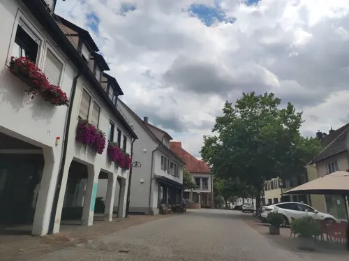
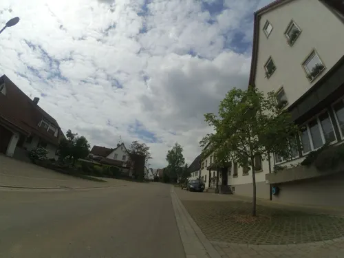
Gasthof-Hotel Zum Ochsen
Restaurant · Regional · 5.9 km
14 Blaubeurer Straße, Berghülen
Mo 17:00-22:00; Tu-Su 11:30-22:00
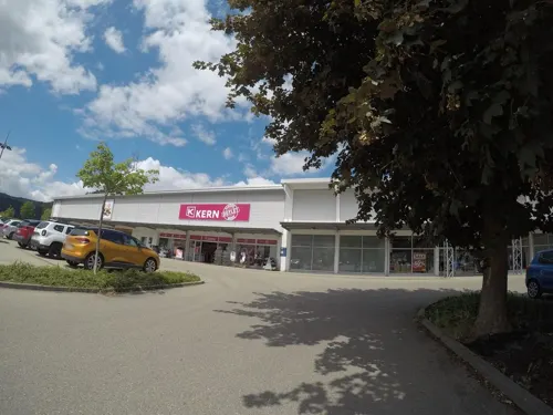
BeckaBeck
Cafe · Breakfast, Cake, Pastry, Regional · 1.2 km
16 Württemberger Straße, Blaubeuren
Mo-Fr 07:00-19:00; Sa 07:00-18:00; Su,PH 08:00-18:00

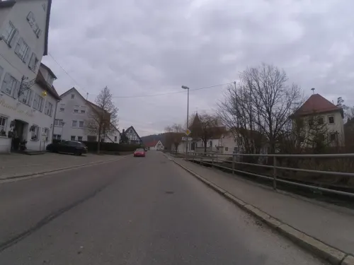
Pizzeria Ristorante Zur Sonne
Restaurant · Italian · 7.4 km
50 Hauptstraße, Schelklingen
Th-Su,PH 11:30-14:00,17:00-22:30
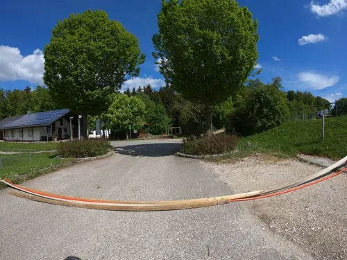


Sportgaststätte Ringingen
Restaurant · Regional, German · 7.1 km
80 Blaubeurer Straße, Erbach
Th-Fr 17:00-22:00, Sa 16:00-22:00, Su 10:30-20:00
Vylian - Vietnamese & Asian Cuisine
Restaurant · Vietnamese, Sushi
20 Marktstraße, Blaubeuren
Tu-Su 11:30-14:30,17:00-22:00
Gasthof Blautopf – Das Steakhouse
Restaurant · Steak House
4 Blautopfstraße, Blaubeuren
Tu-Fr 17:00-21:00; Sa,Su,PH 11:30-21:00; Mo off
57 more on the map.
Where to stay17
Churches and places of worship39
Evangelische Pfarrkirche "Zu unserer lieben Frau"
Church · Protestant · 3.9 km
2 Bei der Hüle, Blaubeuren
Katholische Pfarrkirche Mariä Heimsuchung
Church · Roman Catholic · 0.6 km
51 Karlstraße, Blaubeuren
Marienkirche
Church · Roman Catholic · 7.2 km
1 Erminger Straße, Blaustein
Unserer Lieben Frau
Church · Protestant · 6.9 km
13 Lautern, Blaustein
Zu Unserer Lieben Frau
Church · Protestant · 6.1 km
10 Prinz-Eugen-Straße, Blaustein
Shopping12
Gas and EV charging6
Schools, colleges and libraries19
Healthcare5
Map of Blaubeuren
250 places. The map loads OpenStreetMap tiles when you open it.
Getting there and nearby towns
Manfred Rommel Airport Stuttgart (STR) is the nearest airport with scheduled flights listed in OpenStreetMap, 52 km away.
- Laichingen 11 km northwest, about 11 min by car
- Erbach 12 km southeast, about 12 min by car
- Ehingen 15 km south, about 15 min by car
- Ulm 15 km east, about 15 min by car
- Münsingen 21 km west, about 21 min by car
- Laupheim 22 km south, about 22 min by car
- Geislingen an der Steige 24 km north, about 24 min by car
- Langenau 26 km east, about 26 min by car
- Gerstetten 29 km northeast, about 29 min by car
- Bad Urach 30 km west, about 30 min by car
Drive times are estimates from straight-line distance, not routes.
Local news
Headlines from INDB.
Reviews, tips and questions
Loading what members have shared...
Sources and licences
- GeoNames (CC BY 4.0): population, coordinates, regions and time zone
- Mapillary (see each image): photos
- OpenStreetMap contributors (ODbL 1.0): places, airports, map data
- Wikidata (CC0 1.0): elevation, founding date, time zone, website, landmarks and historic places
- Wikimedia Commons (see each image): photos
- Wikipedia (CC BY-SA 4.0): overview and history text
Photo credits
- Blaubeuren, die Karlstraße, Dguendel, CC BY 3.0
- Stadtkirche Blaubeuren 2022-09-08 1, Z thomas, CC BY-SA 4.0
- Ziegelgasse - Blaubeuren, Reutlingendorf, CC BY-SA 4.0
- Gewölbe, Stadtkirche Blaubeuren, PiotrMig, CC BY-SA 4.0
- Kanzel, Stadtkirche Blaubeuren, PiotrMig, CC BY-SA 4.0
- Stadtkirche Blaubeuren, exterior, PiotrMig, CC BY-SA 4.0
- Maßwerk, Stadtkirche Blaubeuren, PiotrMig, CC BY-SA 4.0
- Chor, Stadtkirche Blaubeuren, PiotrMig, CC BY-SA 4.0
- Blaubeuren church square - Preview (Andreas Mischok via Poly Haven), Andreas Mischok ( https://polyhaven.com/all?a=Andreas%20Mischok / https://web.archive.org/web/20230911202739/https://polyhaven.com/all?a=Andreas%20Mischok ), CC0
- Blaubeuren church square - Panorama (Andreas Mischok via Poly Haven), Andreas Mischok ( https://polyhaven.com/all?a=Andreas%20Mischok / https://web.archive.org/web/20230911202739/https://polyhaven.com/all?a=Andreas%20Mischok ), CC0
- Ceiling, Stadtkirche Blaubeuren, PiotrMig, CC BY-SA 4.0
- Wirtshausschild - Gasthaus zum Grünen Baum - Blaubeuren, Reutlingendorf, CC BY-SA 4.0
- Blaubeuren Fountain, PiotrMig, CC BY-SA 4.0
- Presbyterium ceiling, Stadtkirche Blaubeuren, PiotrMig, CC BY-SA 4.0
- Blaubeuren 2022-09-08 8, Z thomas, CC BY-SA 4.0
- Wirtshausschild - Gasthaus zum Adler - Blaubeuren, Reutlingendorf, CC BY-SA 4.0
- Baptismal font, Stadtkirche Blaubeuren, PiotrMig, CC BY-SA 4.0
- Stadtkirche Blaubeuren, interior, PiotrMig, CC BY-SA 4.0
- Stadtkirche Blaubeuren 2022-09-08 2, Z thomas, CC BY-SA 4.0
- Oberamteigasse - Blaubeuren, Reutlingendorf, CC BY-SA 4.0
- Adlergasse - Blaubeuren, Reutlingendorf, CC BY-SA 4.0
- 2014, Ausflug nach Blaubeuren (14516435108), marsupium photography, CC BY-SA 2.0
- BW Blaubeuren museum, PaulT (Gunther Tschuch), CC BY-SA 4.0
- Blaubeuren meteorite 4, Thilo Parg, CC BY-SA 4.0
- Blaubeuren meteorite 5, Thilo Parg, CC BY-SA 4.0
- Blaubeuren meteorite 2, Thilo Parg, CC BY-SA 4.0
- Blaubeuren meteorite 3, Thilo Parg, CC BY-SA 4.0
- Blaubeuren meteorite 1, Thilo Parg, CC BY-SA 4.0
- Blaubeuren 2022-09-08 5, Z thomas, CC BY-SA 4.0
- MeteoritBlaubeuren Info1, Catatine, CC0
- Blaubeuren 2022-09-09 15, Z thomas, CC BY-SA 4.0
- Blaubeuren, Gasthof "Zum Löwen" mit Marktbrunnen, Dguendel, CC BY 3.0
- MeteoritBlaubeuren Info2, Catatine, CC0
- Blaubeuren 2022-09-08 9, Z thomas, CC BY-SA 4.0
- Blaubeuren 2022-09-08 7, Z thomas, CC BY-SA 4.0
- Blaubeuren 2022-09-09 14, Z thomas, CC BY-SA 4.0
- Karlstraße - Blaubeuren, Reutlingendorf, CC BY-SA 4.0
- Blaubeuren 2022-09-09 16, Z thomas, CC BY-SA 4.0
- Hohler Fels, Dr. Eugen Lehle, CC BY-SA 3.0
- Geißenklösterle, Unknown author, CC BY-SA 3.0
- Brillenhoehle Blaubeuren innen, Thilo Parg, CC BY-SA 3.0
- Herrlingen Villa Lindenhof, SchorSch, CC BY-SA 3.0
- Schelklingen - Sirgensteinhöhle im Achtal, Franzfoto, CC BY-SA 4.0
- Blaubeuren Kloster, Photo: Andreas Praefcke, CC BY 3.0
- Blautopf-tuerkis, Björn Appel, CC BY-SA 3.0
- Sirgenstein, Peter Kreuzmann, CC BY-SA 4.0
- Blaustein - Kleines Lautertal, Talaue mit Felsen, Franzfoto, CC BY-SA 3.0
- Urspringschule, Eugen Lehle, CC BY-SA 3.0
- Rusenschloß, Dr. Eugen Lehle, CC BY-SA 3.0
- Urgeschichtliches Museum Blaubeuren, Tomatenpflanze, CC BY-SA 4.0
- 2016-06-06-Sotzenhausen-160, Barockspot, CC BY-SA 4.0
- Moss-Highways, SilenceStar, CC BY-SA 4.0
- 2016-07-16-Gerhausen-68, Barockspot, CC BY-SA 4.0
- Berghulen, Ev. Kirche, Orgel (18), Subbass1, CC BY-SA 4.0
- Wippingen Kirche, Franzpaul, CC BY-SA 3.0
- Evangelische Kirche in Lautern, Die ältesten Spuren der Kirche gehen in das achte Jahrhundert zurück. - panoramio, qwesy qwesy, CC BY 3.0
- Klosterkirche Blaubeuren, Alb-Donau-Kreis, Olga Ernst, CC BY-SA 4.0
- Mariä Heimsuchung Blaubeuren, Memorino, CC BY-SA 3.0
- Stadtkirche Blaubeuren, Memorino, CC BY-SA 3.0
- Evangelische Kirche in Asch - panoramio, qwesy qwesy, CC BY 3.0
- Blaubeuren Stadtbücherei 2, Photo: Andreas Praefcke, CC BY 3.0
- Bühlenhausen; Kirche St. Veit, Dr. Eugen Lehle, CC BY-SA 3.0
- Die evangelische Kirche St. Martin in Bermaringen3, Roland Puskaric, CC BY-SA 4.0
- Arnegg Kirche, Dr. Eugen Lehle, CC BY-SA 3.0
- Ruckenkreuz01s, Traveler100, CC BY-SA 3.0
- Street-level photo, Nora93, CC BY-SA 4.0
- Street-level photo, ray66, CC BY-SA 4.0
- Street-level photo, ray66, CC BY-SA 4.0
- Street-level photo, tst, CC BY-SA 4.0
- Street-level photo, ray66, CC BY-SA 4.0
- Street-level photo, gpsvid, CC BY-SA 4.0
- Street-level photo, tst, CC BY-SA 4.0
- Street-level photo, Nora93, CC BY-SA 4.0
- Street-level photo, ray66, CC BY-SA 4.0
- Street-level photo, gpsvid, CC BY-SA 4.0
- Street-level photo, ray66, CC BY-SA 4.0
- Street-level photo, plexi32, CC BY-SA 4.0
- Street-level photo, VIA_CH, CC BY-SA 4.0
- Street-level photo, ray66, CC BY-SA 4.0
- Street-level photo, ray66, CC BY-SA 4.0
- Street-level photo, ray66, CC BY-SA 4.0
- Street-level photo, VIA_CH, CC BY-SA 4.0


Page built November 8, 2026. Spotted a mistake? Tell us or suggest a place.