


Blomberg, Germany
Blomberg is a town of 17,183 people in North Rhine-Westphalia, Germany.
Why visit Blomberg
Townapedia lists 35 museums and landmarks, 35 parks and trails, 77 places to eat, 23 places to stay and 73 attractions in and around town.
Highlights include Sennenhof, Straußenhof Möller, Papiermühle Plöger and Alt-Schieder.
Weather in Blomberg
Forecast from MET Norway (CC BY 4.0). Full forecast
About Blomberg
Blomberg (German pronunciation: [ˈblɔmbɛʁk] ) is a town in the Lippe district of North Rhine-Westphalia, Germany, with c. 15,100 inhabitants (2019).
From the Wikipedia article Blomberg, North Rhine-Westphalia (this version), under CC BY-SA 4.0.
Things to do73

Sennenhof
Farm and orchard · 8.2 km
Fleisch- und Wurstwaren
20 Alter Schulweg, Dörentrup
Fr 17:00-19:00; PH off
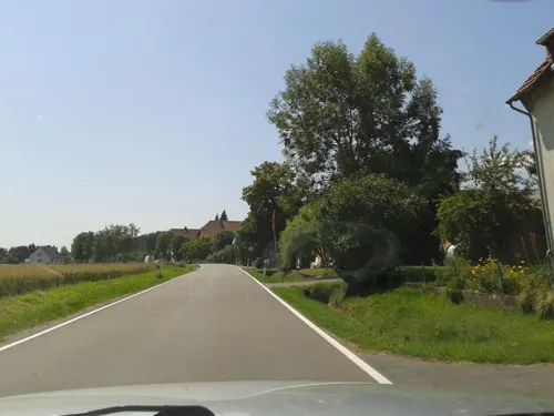
Straußenhof Möller
Farm and orchard · 6.3 km
61 Billerbeckerstraße, Horn-Bad Meinberg
Apr-Oct: Sa 14:00-16:00
Familie Ehlerts Schweinerei
Farm and orchard · 7.1 km
15 Barntruper Straße, Dörentrup
Mo-Su,PH 06:00-22:00


61 more on the map.
Museums and landmarks35

Papiermühle Plöger
Museum · 5.2 km
11 Im Niesetal, Schieder-Schwalenberg
May-Oct: Sa 10:00-17:00; Su 10:00-12:00,15:00-17:00


Herlingsburg
Monument and historic site · 6.7 km
Voreisenzeitliche Wall- und Fliehburg


Schloss Schieder
Monument and historic site · 5.2 km
1 Im Kurpark, Schieder-Schwalenberg




23 more on the map.
Parks, trails and playgrounds35

Norderteich mit Naptetal
Hiking and trails · 7.9 km
Großflächiger, bereits im Mittelalter aufgestauter Teich mit angrenzenden, sehr naturnah ausgeprägten Röhrichten, Bruchwäldern und...


23 more on the map.
Restaurants and cafes77
Café Restaurant Breitengrad
Restaurant · Pizza, Burger, Coffee Shop, Regional · 5.6 km
3 Kronenbruch, Schieder-Schwalenberg
Mo-Su 11:00-20:00

Schauinsland
Cafe · 8.1 km
51 Pyrmonter Straße, Horn-Bad Meinberg
Mo-Su,PH 11:00-18:00 open "Mittag 11:30-13:30, Kaffe und Kuchen...
Bäckerei Engel
Bakery · 5.4 km
1 Schwalenberger Straße, Schieder-Schwalenberg
Mo-Sa 06:00-18:00, Su 07:30-17:00
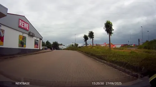
Knusperstübchen 2 – Stadtbäckerei Strate
Bakery · 7.6 km
13 Alter Schulweg, Dörentrup
Mo-Fr 06:00-13:00; Sa 07:00 - 12:00

Kromes Backstube
Bakery · 7.7 km
31 Wöbbeler Straße, Steinheim
Mo-Fr 06:00-18:00; Sa 06:00-16:00,07:00-12:00



65 more on the map.
Where to stay23
Hotel-Pension Waldfrieden
Motel and hotel · 5.8 km
40 Bergstraße, Schieder-Schwalenberg
Churches and places of worship25
Evangelisch-reformierte Kirche Wöbbel
Church · Reformed · 5.2 km
2 Am Kirchborn, Schieder-Schwalenberg
Katholische Kirche St. Peter und Paul
Church · Catholic · 5.6 km
23 Hamelner Straße, Barntrup
Shopping21
Der Fliegende Hollander
Shop · 5.6 km
19 Schwalenberger Straße, Schieder-Schwalenberg
Gas and EV charging12
Schools, colleges and libraries25
Healthcare7
Map of Blomberg
250 places. The map loads OpenStreetMap tiles when you open it.
Getting there and nearby towns
Flugplatz Bielefeld (BFE) is the nearest airport with scheduled flights listed in OpenStreetMap, 38 km away.
- Steinheim 8 km south, about 8 min by car
- Lügde 11 km east, about 11 min by car
- Detmold 15 km west, about 15 min by car
- Lemgo 16 km northwest, about 16 min by car
- Aerzen 16 km northeast, about 16 min by car
- Lage 21 km west, about 21 min by car
- Hameln 25 km northeast, about 25 min by car
- Brakel 26 km south, about 26 min by car
- Höxter 27 km southeast, about 27 min by car
- Rinteln 27 km north, about 27 min by car
Drive times are estimates from straight-line distance, not routes.
Local news
Headlines from INDB.
Reviews, tips and questions
Loading what members have shared...
Sources and licences
- GeoNames (CC BY 4.0): population, coordinates, regions and time zone
- Mapillary (see each image): photos
- OpenStreetMap contributors (ODbL 1.0): places, airports, map data
- Wikidata (CC0 1.0): elevation, founding date, time zone, website
- Wikimedia Commons (see each image): photos
- Wikipedia (CC BY-SA 4.0): overview and history text
Photo credits
- Neuetorstraße02, Nikater, CC BY-SA 3.0
- Blomberg-burg02, Nikater, CC BY-SA 3.0
- RathausBlomberg, MAWspitau, CC BY-SA 2.0 de
- Blomberg-burg03, Nikater, CC BY-SA 3.0
- Blomberg-burg01, Nikater, CC BY-SA 3.0
- Blomberg - 2025-03-16 - ND Burglinde (DSC05646), Tsungam, CC BY-SA 4.0
- Blomberg - 2025-03-16 - ND Burglinde (DSC05645), Tsungam, CC BY-SA 4.0
- An der Großen Mauer 15, 1, Blomberg, Landkreis Lippe, GeorgDerReisende, CC BY-SA 4.0
- Blomberg - 2026-09-19 - LSG Talbereich der Diestelbachaue mit Nebentälern (DSC01475), Tsungam, CC BY-SA 4.0
- Blomberg - 2026-09-19 - LSG Talbereich der Diestelbachaue mit Nebentälern (DSC01474), Tsungam, CC BY-SA 4.0
- An der Großen Mauer 15, 2, Blomberg, Landkreis Lippe, GeorgDerReisende, CC BY-SA 4.0
- Blomberg - 2026-09-19 - LSG Talbereich der Diestelbachaue mit Nebentälern (DSC01470), Tsungam, CC BY-SA 4.0
- Blomberg - 2026-09-19 - LSG Talbereich der Diestelbachaue mit Nebentälern (DSC01471), Tsungam, CC BY-SA 4.0
- Blomberg - 2026-09-19 - LSG Talbereich der Diestelbachaue mit Nebentälern (DSC01468), Tsungam, CC BY-SA 4.0
- Blomberg - 2026-09-19 - LSG Talbereich der Diestelbachaue mit Nebentälern (DSC01472), Tsungam, CC BY-SA 4.0
- Blomberg - 2026-09-19 - LSG Talbereich der Diestelbachaue mit Nebentälern (DSC01473), Tsungam, CC BY-SA 4.0
- Blomberg - 2026-09-19 - LSG Talbereich der Diestelbachaue mit Nebentälern (DSC01476), Tsungam, CC BY-SA 4.0
- Blomberg - 2026-09-19 - LSG Talbereich der Diestelbachaue mit Nebentälern (DSC01467), Tsungam, CC BY-SA 4.0
- Blomberg - 2025-03-16 - Weinberggasse 1 (DSC05647), Tsungam, CC BY-SA 4.0
- Gut Blomberg 1, ehemalige Meierei der Grafen zu Lippe 12, Bernd Schwabe in Hannover, CC BY-SA 4.0
- Blomberg, Lippischer Ganzmeilenstein I (b), Manfred Schröter, Berga, CC BY-SA 4.0
- Blomberg, Lippischer Ganzmeilenstein I (a), Manfred Schröter, Berga, CC BY-SA 4.0
- Gut Blomberg 1, ehemalige Meierei der Grafen zu Lippe 9, Bernd Schwabe in Hannover, CC BY-SA 4.0
- Gut Blomberg 1, ehemalige Meierei der Grafen zu Lippe 10, Bernd Schwabe in Hannover, CC BY-SA 4.0
- Gut Blomberg 1, ehemalige Meierei der Grafen zu Lippe 6, Bernd Schwabe in Hannover, CC BY-SA 4.0
- Gut Blomberg 1, ehemalige Meierei der Grafen zu Lippe 8, Bernd Schwabe in Hannover, CC BY-SA 4.0
- Martin-Luther-Kirche, 1, Blomberg, Landkreis Lippe, GeorgDerReisende, CC BY-SA 4.0
- Schieder-Schwalenberg - Befestigungsanlage Alt Schieder (3), Tsungam, CC0
- Ev-Kirche-Wöbbel, Grugerio, CC BY-SA 3.0
- EvKirche-Reelkirchen, Grugerio, CC BY-SA 3.0
- Schieder-Schwalenberg - 20 - Im Kurpark 1 (3), Tsungam, CC BY-SA 3.0
- Herlingsburg-Wall-Eingang, Grugerio, CC BY-SA 3.0
- Klosterkirche-Blomberg-Südseite, Grugerio, CC BY-SA 3.0
- Schieder-Schwalenberg - 107 - Kahlenbergturm (2), Tsungam, CC BY-SA 3.0
- Blomberg - 2025-03-22 - Schloss Reelkirchen (DSC05661), Tsungam, CC BY-SA 4.0
- Schieder-Schwalenberg - 48 - Im Niesetal 11 (11), Tsungam, CC BY-SA 3.0
- Schloss-Wöbbel, Grugerio, CC BY-SA 3.0
- Siekholzer-Schanze Schieder-Schwalenberg, Grugerio, CC BY-SA 3.0
- Blomberg Katholische-Kirche Kopie, Grugerio, CC BY-SA 3.0
- Katholische-Kirche-Barntrup, Grugerio, CC BY-SA 3.0
- Schalenstein Bennerberg-Schieder-Schwalenberg, Grugerio, CC BY-SA 3.0
- Blomberg - 2015-07-12 - Kirche Cappel (01)-Pano, Tsungam, CC BY-SA 4.0
- Belle (Horn-Bad Meinberg) Ev.-ref.-Kapelle, Grugerio, CC BY-SA 3.0
- Schloss Barntrup 01, Grugerio, CC BY-SA 3.0
- Blomberg - 2022-02-05 - Kirche Istrup (DSC04283), Tsungam, CC BY-SA 4.0
- Martin-Luther-Kirche-Blomberg, Grugerio, CC BY-SA 3.0
- Bad Pyrmont - 2022-01-30 - Kapelle Hagen (DSC 4285), Tsungam, CC BY-SA 4.0
- Norderteich Nordostufer, Α 72 22:26, 7. Aug. 2008 (CEST) (Alexander Leischner), CC BY-SA 3.0 de
- Lemgo - 2019-04-27 - LIP-036 Begatal (DSC00936), Tsungam, CC BY-SA 4.0
- Blomberg - 2025-03-02 - Hügelgrab Beller Wald (DSC05618), Tsungam, CC BY-SA 4.0
- Horn-Bad Meinberg - 2015-02-08 - Beller Holz (21), Tsungam, CC BY-SA 4.0
- Barntrup - 2015-05-22 - LIP-072 Biotopkomplex am Muehlenturm (19), Tsungam, CC BY-SA 3.0
- Schieder-Schwalenberg - 2015-05-12 - Emmertal (3), Tsungam, CC BY-SA 3.0
- Blomberg - 2015-06-14 - LIP-053 Hurn (31), Tsungam, CC BY-SA 4.0
- Blomberg - 2015-08-04 - LIP-052 Marpetal (15), Tsungam, CC BY-SA 4.0
- Schieder-Schwalenberg - 2015-06-04 - LIP-025 Nieseniederung (2), Tsungam, CC BY-SA 4.0
- Blomberg - 2015-06-17 - LIP-051 Quellgebiet der Dorla (01), Tsungam, CC BY-SA 4.0
- Horn-Bad Meinberg - 2015-05-07 - LIP-022 Sannenbruch (14), Tsungam, CC BY-SA 3.0
- Blomberg - 2015-06-14 - LIP-055 Talsystem des Königsbaches (Borkhausen) (2), Tsungam, CC BY-SA 4.0
- Street-level photo, thetornado76, CC BY-SA 4.0
- Street-level photo, thetornado76, CC BY-SA 4.0
- Street-level photo, thetornado76, CC BY-SA 4.0
- Street-level photo, thetornado76, CC BY-SA 4.0
- Street-level photo, thetornado76, CC BY-SA 4.0
- Street-level photo, thetornado76, CC BY-SA 4.0
- Street-level photo, derlipper, CC BY-SA 4.0
- Street-level photo, sidogs33, CC BY-SA 4.0
- Street-level photo, thetornado76, CC BY-SA 4.0
- Street-level photo, thetornado76, CC BY-SA 4.0
- Street-level photo, Schmarvis, CC BY-SA 4.0
- Street-level photo, thetornado76, CC BY-SA 4.0
- Street-level photo, thetornado76, CC BY-SA 4.0
- Street-level photo, steinm, CC BY-SA 4.0
- Street-level photo, thetornado76, CC BY-SA 4.0
- Street-level photo, thetornado76, CC BY-SA 4.0
- Street-level photo, derlipper, CC BY-SA 4.0
- Street-level photo, Schmarvis, CC BY-SA 4.0
- Street-level photo, thetornado76, CC BY-SA 4.0
- Street-level photo, Hightower-, CC BY-SA 4.0
- Street-level photo, thetornado76, CC BY-SA 4.0
- Street-level photo, thetornado76, CC BY-SA 4.0
- Street-level photo, thetornado76, CC BY-SA 4.0


Page built November 8, 2026. Spotted a mistake? Tell us or suggest a place.