


Why visit Lage
Townapedia lists 37 museums and landmarks, 66 parks and trails, 149 places to eat, 10 places to stay and 25 attractions in and around town.
Highlights include Detmolder Sommertheater, Landestheater Detmold, LWL-Museum Ziegelei Lage and Ziegelei Lage.
Weather in Lage
Forecast from MET Norway (CC BY 4.0). Full forecast
About Lage
Lage (German pronunciation: [ˈlaːɡə] ) is a town in the Lippe district of North Rhine-Westphalia, Germany, approximatively 8 km northwest of the administrative centre Detmold. It has 34,818 inhabitants (2025). The coat of arms of Lage depicts a farmer's plough. The city is not far from the Teutoburg Forest.
From the Wikipedia article Lage, North Rhine-Westphalia (this version), under CC BY-SA 4.0.
Photos of Lage


Things to do25

Detmolder Sommertheater
Cinema and theater · 8.9 km
Theatre in Detmold, Germany

Landestheater Detmold
Cinema and theater · 8.4 km
Theatre and opera house in Detmold, Germany


Blaurocks Bauernladen
Farm and orchard · 4.5 km
157 Helpuper Straße, Lage
Mo-Fr 08:30-12:30,14:30-18:30; Sa 08:00-14:00


13 more on the map.
Museums and landmarks37


Detmold Open-air Museum
Museum · 9.3 km
Open-air museum in Detmold, North Rhine-Westphalia, Germany

Hermannsdenkmal
Monument and historic site · 9.5 km
Monument in North Rhine-Westphalia, Germany

Alte Burg
Monument and historic site
Durch Bauzaun verschlossene Mauerreste. Kein Zugang.

Gut Braunbruch
Monument and historic site · 7.0 km
51 Heidenoldendorfer Straße, Detmold




25 more on the map.
Parks, trails and playgrounds66


Hasselbach/Schwarzenbrink/Heidemoor am Kupferberg
Hiking and trails · 5.4 km



Waldfreibad Fischerteich
Sports field and stadium · 6.7 km
5 Am Fischerteich, Detmold
Mo 10:00-19:30; Tu 13:00-19:30; We-Fr 10:00-19:30; Sa,Su,PH 10:00-18:30
54 more on the map.
Restaurants and cafes149

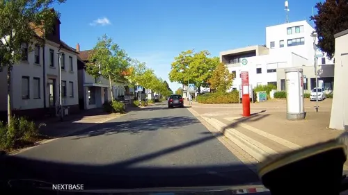
Café 104
Cafe · Cake · 6.8 km
2 Kirchweg, Leopoldshöhe
Th 11:30-18:00; Fr 10:00-18:00; Sa,Su 13:00-18:00
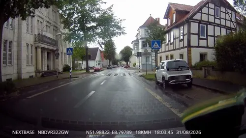
Da Adriano
Restaurant · Italian · 0.6 km
130 Lange Straße, Lage
We-Su,Mo 12:00-14:30,18:00-23:00; Tu off
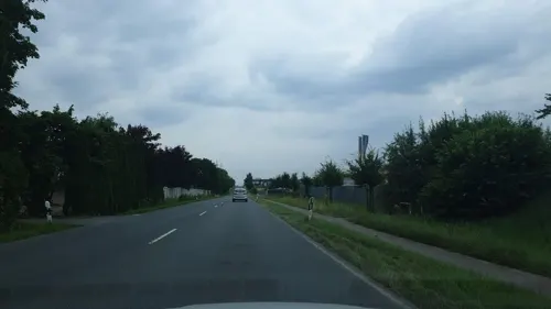
Freiraum
Restaurant · Pizza, Burger, Pasta · 2.5 km
15a Daimlerstraße, Lage
Mo-Th 17:00-22:00; Fr 17:00-24:00; Sa 16:00-24:00; Su 16:00-22:00
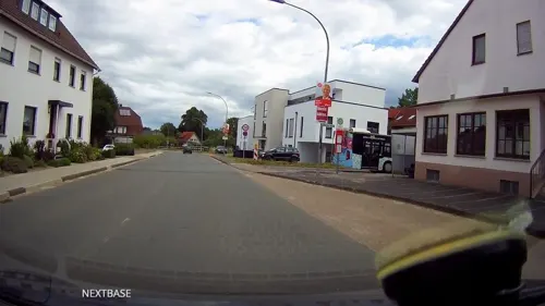
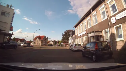
La Grappa
Restaurant · Italian · 6.1 km
259 Bielefelder Straße
Mo, We, Th 12:00-14:00, 18:00-23:00; Fr, Sa 12:00-14:30,...
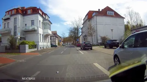
Pizzeria Alta Riva
Restaurant · Italian
107 Lange Straße, Lage
We-Sa 17:00-22:00; Su 11:30-14:00,17:00-22:00; Mo,Tu off
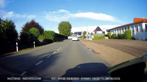
Restaurant Syrtaki
Restaurant · Greek · 5.3 km
258 Lagesche Straße, Detmold
Mo-Su 11:30-14:30,17:30-24:00

Kohlpott
Restaurant · German · 4.4 km
1 Pivitsheider Straße, Detmold
Mo off; Tu-Sa 17:00+; Su 11:00-14:00,17:00+
137 more on the map.
History
Numerous finds indicate a colonization of the location since the Neolithic times (2400 to 1800 b.c.).
Around 900 a.d. the parish church of St. Johann (today's Marktkirche) has been founded on a hillhock at the river Werre and is the origin of today's city Lage. In 1274, Lage is mentioned the first time in a document for the life annuity of the local clergy by the sentence "Jordanus plebanis in Lagis". In 1539, with the election of the first mayor self-administration rights are provable.
In 1843, borough rights were awarded by ruler Leopold II, Prince of Lippe. In the years after 1880 the construction of the railway lines Herford to Detmold (1880) and Bielefeld to Lemgo (1893) linked Lage to the surrounding cities by train and created an interchange station.
During World War I (1914-1918) the hospital served as a military hospital. Sections of the Infantry Regiment 67 were quartered in the town. On 9 January 1933, Adolf Hitler spoke on a central square (Jahnplatz) in Lage. During World War II (1939-1945) several attacks by Allied bombers hit the center of Lage, causing over 60 casualties in the local population and destroying many houses.
Read more of the history
In 1970, the city merged to form a large municipality with a population of 32,000 with the surrounding communities Billinghausen, Ehrentrup, Hagen, Hardissen, Hedderhagen, Heiden, Heßloh, Horste, Kachtenhausen / Wellentrup, Müssen, Ohrsen, Pottenhausen, Stapelage, Waddenhausen and Wissentrup after local government reorganization.
Lage is about 195 kilometres (121 mi) from Cologne, the largest city in the North Rhine-Westphalia. It was the host of the 1996 European Cup Combined Events championships and hosts other international sport of athletics competitions.
From the History section of Lage, North Rhine-Westphalia on Wikipedia, under CC BY-SA 4.0.
Notable people from Lage
- Fritz BrachtGerman politician (1899-1945)
- Heinemann VogelsteinGerman rabbi (1841–1911)
- Ingo AlthöferGerman mathematician
- Gottlieb Friedrich ReberSwiss art dealer and art collector (1880-1959)
- Georg BöningGerman officer and Knight's Cross recipient (1913-1945)
- Johannes BargeGerman General and Knight's Cross recipient
- Hans-Georg SchierholzGerman soldier and Knight's Cross recipient (1921-1996)
Born in Lage, according to Wikidata (CC0). Each name links to its Wikipedia article.
Where to stay10
Pfadfinderheim Stamm der Ritter Lage / Pfadfindergruppe Lage (Lippe) e.V.
Motel and hotel · 0.8 km
1 Am Obstgarten, Lage
Churches and places of worship49
Evangelisch-reformierte Kirche Helpup
Church · Evangelical · 6.1 km
36 Lagesche Straße, Oerlinghausen
Shopping50
Gas and EV charging17
Schools, colleges and libraries44
Bunte Schule Grundschulverbund Hörste Müssen/Teilstandort Hörste
School · 5.8 km
18 Hörster Bruch, Lage
Healthcare15
Map of Lage
250 places. The map loads OpenStreetMap tiles when you open it.
Getting there and nearby towns
Flugplatz Bielefeld (BFE) is the nearest airport with scheduled flights listed in OpenStreetMap, 17 km away.
- Leopoldshöhe 7 km west, about 7 min by car
- Detmold 8 km southeast, about 8 min by car
- Lemgo 8 km northeast, about 8 min by car
- Oerlinghausen 10 km southwest, about 10 min by car
- Augustdorf 10 km southwest, about 10 min by car
- Bad Salzuflen 11 km north, about 11 min by car
- Herford 16 km northwest, about 16 min by car
- Dörentrup 15 km east, about 15 min by car
- Bielefeld 18 km west, about 18 min by car
- Vlotho 20 km north, about 20 min by car
Drive times are estimates from straight-line distance, not routes.
Towns near Lage


Keep exploring
Local news
Headlines from INDB.
Reviews, tips and questions
Loading what members have shared...
Sources and licences
- GeoNames (CC BY 4.0): population, coordinates, regions and time zone
- Mapillary (see each image): photos
- OpenStreetMap contributors (ODbL 1.0): places, airports, map data
- Wikidata (CC0 1.0): elevation, founding date, time zone, website, landmarks and historic places
- Wikimedia Commons (see each image): photos
- Wikipedia (CC BY-SA 4.0): overview and history text
Photo credits
- Innenstadt Lage (Lippe), Tola69, CC BY-SA 3.0
- Peter und Paul, Lage, 5, Aisano, CC BY-SA 3.0
- Lage Lutherische Kirche, Daniel Brockpähler, CC BY-SA 3.0
- Burgruine Lage, Falko Sieker, CC BY-SA 4.0
- Lage St. Peter und Paul Kirche, Daniel Brockpähler, CC BY-SA 3.0
- Lage - 31 - Rhienstr. 6, Tsungam, CC BY-SA 3.0
- Lage - 02 - Bergstr. 23, Tsungam, CC BY-SA 3.0
- Lage - 05 - Rhienstr. 16, Tsungam, CC BY-SA 3.0
- Lage - 69 - Gerichtsstraße 3, Tsungam, CC BY-SA 3.0
- Kriegerdenkmal im Friedenspark Lage (Lippe), Deus Figendi, CC BY 4.0
- Lage - 29 - Bergstr. 12, Tsungam, CC BY-SA 3.0
- Lage - Lange Straße 70, Ath, CC0
- Skulptur im Friedenspark Lage (Lippe), Deus Figendi, CC BY 4.0
- Lage - 30 - Lange Str. 64, Tsungam, CC BY-SA 3.0
- Lage - 10 - Lange Str. 63, Tsungam, CC BY-SA 3.0
- Lage - 08 - Lange Str. 72, Tsungam, CC BY-SA 3.0
- Lage - 11 - Lange Str. 65, Tsungam, CC BY-SA 3.0
- Altes Rathaus Lage, Falko Sieker, CC BY-SA 4.0
- Neues Rathaus Lage, Falko Sieker, CC BY-SA 4.0
- Infokasten der EV. Kirchengemeinde Lage, Deus Figendi, CC BY 4.0
- Lage - 74 - Lange Straße 81, Tsungam, CC BY-SA 3.0
- Lage - 72 - Lange Straße 89, Tsungam, CC BY-SA 3.0
- Lage Lutherische Kirche 2, Daniel Brockpähler, CC BY-SA 3.0
- Linie RB72, 2, Lage, Kreis Lippe, GeorgDerReisende, CC BY-SA 4.0
- Bahnhof Lage (Lippe), 1, Aisano, CC BY-SA 3.0
- Linie RB72, 3, Lage, Kreis Lippe, GeorgDerReisende, CC BY-SA 4.0
- Lage Bahnhof, Daniel Brockpähler, CC BY-SA 3.0
- Linie RB72, 1, Lage, Kreis Lippe, GeorgDerReisende, CC BY-SA 4.0
- Lage - 2022-04-10 - Platane Technikum (DSC 5710), Tsungam, CC BY-SA 4.0
- ERB-643 VT 2 2006-05-15 13-50 Lage RB EBIL - ELGO, Christian Schulz, CC BY-SA 3.0
- Lage - 73 - Friedrich-Ebert-Straße 4, Tsungam, CC BY-SA 3.0
- Lage St. Peter und Paul Turm, Daniel Brockpähler, CC BY-SA 3.0
- Lage St. Peter und Paul Wandbild, Daniel Brockpähler, CC BY-SA 3.0
- Lage St. Peter und Paul Gemeindezentrum, Daniel Brockpähler, CC BY-SA 3.0
- Sommertheater01, Nikater, CC BY-SA 3.0
- Theater01, Nikater, CC BY-SA 4.0
- Detmold Freilichtmuseum1, Itti, CC BY-SA 3.0
- Hermannsdenkmal 2015, Thomas Wolf , www.foto-tw.de, CC BY-SA 3.0 de
- Hochschule für Musik, Detmold, Juni 2008, Maschinenjunge, CC BY-SA 3.0
- Ziegelei Lage Ansicht, Axel Hindemith, CC BY 3.0
- Alter Krug Helpup02, Nikater, Public domain
- Dietrich-Bonhoeffer-Berufskolleg Lippe-Detmold 08.09.2020, Spacekid, CC BY-SA 4.0
- Detmold - 305 - Wilhelm-Mellies-Straße 25 (2), Tsungam, CC0
- Ev. ref. Kirche Helpup, Tola69, CC BY-SA 3.0
- Leopoldshöhe Markt, Leopold070, CC BY-SA 3.0
- Detmold - 2015-06-08 - Felix-Fechenbach-Berufskolleg (2), Tsungam, CC BY-SA 4.0
- Detmold - Kupferberg, Tsungam, CC BY-SA 3.0
- Schloss iggenhausen 01, Grugerio, CC0
- Detmold - 653 - Heidenoldendorfer Straße 51, Tsungam, CC BY-SA 3.0
- Lage - 2016-05-31 - Johannissteine (007), Tsungam, CC BY-SA 4.0
- Detmold - Pauluskirche, Tsungam, CC BY 3.0
- Bauernburg-Stapelage-19, Grugerio, CC BY-SA 3.0
- Lage - 2015-08-27 - LIP-086 Rethlager Bach (09), Tsungam, CC BY-SA 4.0
- Detmold - 2014-06-15 - LIP-023 - Dörenschlucht (30), Tsungam, CC BY-SA 3.0
- Lage - 2015-05-17 - LIP-084 Grutt- und Sunderbach (4), Tsungam, CC BY-SA 3.0
- Lage - 2015-05-17 - LIP-009 Hardisser Moor (3), Tsungam, CC BY-SA 3.0
- Detmold - 2015-06-06 - LIP-090 Schwarzenbrink (6), Tsungam, CC BY-SA 4.0
- Leopoldshöhe - 2015-06-07 - LIP-019 Heipker See (3), Tsungam, CC BY-SA 4.0
- Bad Salzuflen - 2015-06-07 - LIP-045 Holzhauser Bruch (12), Tsungam, CC BY-SA 4.0
- Lemgo - 2015-05-17 - LIP-096 Mittellauf der Bega (4), Tsungam, CC BY-SA 3.0
- Lage - 2015-05-17 - LIP-083 Oetternbach (2), Tsungam, CC BY-SA 3.0
- Auenlandschaft am Oetternbach, Otterdiene, CC BY-SA 4.0
- Lage - 2014-06-15 - LIP-069 (21), Tsungam, CC BY-SA 3.0
- Heim Pfadfindergruppe Lage, SebastianHa, CC BY-SA 3.0
- Johanneskirche Kachtenhausen, Jochen Löscher, CC BY-SA 3.0
- Lage - 2020-09-09 - Kirche Heiden (DSC 9715), Tsungam, CC BY-SA 4.0
- Kirche in Stapelage01, User:Nikater, CC BY-SA 4.0
- Lage - 2022-04-10 - Marktkirche (DSC 5691), Tsungam, CC BY-SA 4.0
- Lage - 2022-04-10 - Lange Straße 79 (DSC 5696), Tsungam, CC BY-SA 4.0
- TH OWL - LE Panorama, Gut informiert, CC BY-SA 4.0
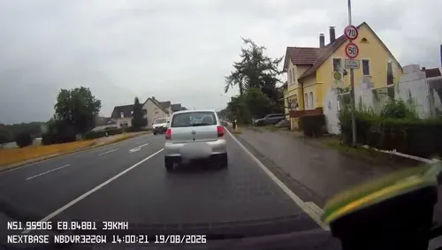
- Street-level photo, derlipper, CC BY-SA 4.0
- Street-level photo, derlipper, CC BY-SA 4.0
- Street-level photo, derlipper, CC BY-SA 4.0
- Street-level photo, derlipper, CC BY-SA 4.0
- Street-level photo, pommes, CC BY-SA 4.0
- Street-level photo, Schmarvis, CC BY-SA 4.0
- Street-level photo, derlipper, CC BY-SA 4.0
- Street-level photo, derlipper, CC BY-SA 4.0
- Street-level photo, derlipper, CC BY-SA 4.0
- Street-level photo, derlipper, CC BY-SA 4.0
- Street-level photo, Schmarvis, CC BY-SA 4.0
- Street-level photo, derlipper, CC BY-SA 4.0
- Street-level photo, derlipper, CC BY-SA 4.0
- Street-level photo, derlipper, CC BY-SA 4.0
- Street-level photo, derlipper, CC BY-SA 4.0
- Street-level photo, derlipper, CC BY-SA 4.0
- Street-level photo, prodd, CC BY-SA 4.0
- Street-level photo, derlipper, CC BY-SA 4.0
- Street-level photo, derlipper, CC BY-SA 4.0
- Street-level photo, derlipper, CC BY-SA 4.0
- Street-level photo, zuse, CC BY-SA 4.0
- Street-level photo, derlipper, CC BY-SA 4.0
- Street-level photo, derlipper, CC BY-SA 4.0
- Street-level photo, derlipper, CC BY-SA 4.0
- Street-level photo, Schmarvis, CC BY-SA 4.0
- Street-level photo, derlipper, CC BY-SA 4.0
- Street-level photo, derlipper, CC BY-SA 4.0
- Street-level photo, derlipper, CC BY-SA 4.0
- Street-level photo, derlipper, CC BY-SA 4.0
- Street-level photo, derlipper, CC BY-SA 4.0


Page built November 9, 2026. Spotted a mistake? Tell us or suggest a place.