


Why visit Höxter
Townapedia lists 159 museums and landmarks, 53 parks and trails, 153 places to eat, 35 places to stay and 34 attractions in and around town.
Highlights include Rodeneckturm, Bismarckturm Höxter, Corvey and Schloss Fürstenberg.
Weather in Höxter
Forecast from MET Norway (CC BY 4.0). Full forecast
About Höxter
Höxter (German pronunciation: [ˈhœkstɐ] ) is a town in eastern North Rhine-Westphalia, Germany on the left bank of the river Weser, 52 km (32 miles) north of Kassel. It lies in the heart of the Weser Uplands, and is the seat of the Höxter district. The district of Höxter has a population of 30,000, with the city itself making up around half of the population. Historical place names of Höxter are Hoxer and Huxaria.
From the Wikipedia article Höxter (this version), under CC BY-SA 4.0.
Photos of Höxter


Things to do34


Bismarckturm Höxter
Scenic view · 3.5 km
Dem Ersten Kanzler des Deutschen Reiches Die Stadt Höxter



Helle Bauer
Farm and orchard · 4.8 km
15 Zur Helle, Höxter
May-Nov: We 09:00-12:00,16:00-17:00; May-Nov: Sa 09:00-12:00


22 more on the map.
Museums and landmarks159


Schloss Fürstenberg
Museum · 5.0 km
2 Meinbrexener Straße, Fürstenberg

Station Nr. 29 des Preußischen optischen Telegrafen
Monument and historic site · 8.7 km
Station Nr. 29 des preußischen optischen Telegrafen Berlin-Köln-Koblenz (1832 - 1849): „Telegraphenberg“ Lügde-Köterberg

Der Umfahrstein
Monument and historic site · 7.3 km
Schutz-Monolith
2 Johannismarkt, Holzminden
Emperor William Tower
Monument and historic site · 6.2 km
Tower in Germany


Berliner Meilenstein (Ersatzübergangsstelle)
Monument and historic site · 7.0 km
Der Berliner Meilenstein in Wehrden. Derartige Meilensteine wurden in ganz Westdeutschland errichtet, um das Bewusstsein für West-Berlin...

Forum Anja Niedringhaus
Museum
33 Westerbachstraße, Höxter
Apr-Oct: Tu-Su,PH 10:00-17:00; Nov-Mar: open "Besuch/Führung...
Forum Jacob Pins
Museum
35-37 Westerbachstraße, Höxter
Apr 01-Nov 01: Tu-Th 10:00-17:00; Apr 01-Nov 01: Fr 10:00-19:30;...
147 more on the map.
Parks, trails and playgrounds53


Buchenwälder zwischen Wildburg und Heineberg
Hiking and trails · 8.7 km

Buchenwälder zwischen Ziegenberg und Langer Berg
Hiking and trails · 4.2 km


41 more on the map.
Restaurants and cafes153

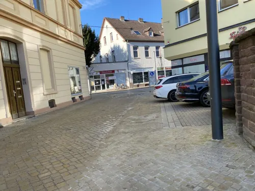
Agohan
Restaurant · Sushi, Vietnamese
1 Stummrigestraße, Höxter
Mo-Th 11:00-22:30; Fr-Sa 11:00-23:00; Su 12:00-22:30
Café am Räuschenberg
Cafe · Breakfast, Cake, Coffee Shop · 3.6 km
100 Räuschenbergstraße, Höxter
Tu-Sa 11:00-18:00; Su 09:30-18:00
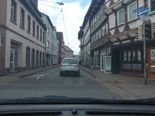
Eis Engelchen Höxter
Ice cream · Ice Cream
1 Marktstraße, Höxter
Mo-Th 13:00-17:00; Fr 13:00-18:00; Sa 11:00-17:00; Su 12:00-18:00
Felsenkeller Holzminden
Restaurant · German · 7.3 km
24 Hoher Weg, Holzminden
We-Sa 11:00-24:00; Su 11:00-21:00
Gasthaus und Pension Kirchhoff
Restaurant · 7.5 km
1 Drenker Straße, Beverungen
Mo,Tu,Th-Su 10:00-24:00; We off
Hoa Hong ASIA
Restaurant · Vietnamese
14 Corbiestraße, Höxter
Tu-Sa 12:00-14:30,17:30-22:00; Su closed; PH closed

Das Ehrlich
Restaurant · Pizza, Seafood
3 Am Markt, Höxter
We 11:00-14:00, 17:00-22:00; Th-Sa 17:00-22:00; Su 11:00-14:00, 17:00-21:00
141 more on the map.
History
Höxter (Latin: Huxaria) in the time of Charlemagne was a villa regia, and was the scene of a battle between his forces and the Saxons. Under the protection of the Princely Abbey of Corvey it gradually increased in prosperity, and became the chief town of the principality of Corvey. Later it asserted its independence and joined the Hanseatic League.
Höxter was located on the long distance trade-route known as Hellweg. Rivalry with Corvey Abbey and the nearby town known as Corvey increased, and in 1265, the burghers of Höxter allied themselves with the Bishop of Paderborn. Their troops destroyed the town of Corvey and damaged the abbey.
Höxter was severely affected by the Thirty Years' War. In 1634, Imperial troops laid siege to the town in what became known as the Blutbad von Höxter (massacre of Höxter).
After the Peace of Westphalia in 1648, it was united with Brunswick; in 1802, it passed to Nassau, and in 1807 to the Kingdom of Westphalia, after the dismemberment of which in 1814, it came into the possession of Prussia.
In 2005, an explosion within a house in the historic town centre damaged the town hall and many other significant buildings and resulted in three deaths.
Read more of the history
Albaxen had its first documentary mention, under the name Albachtessen, on the occasion of the neighbouring Corvey Abbey's founding in 822, and by 900, it was known by its current name. The Albaxen parish church was likewise first mentioned in the 9th century. The Tonenburg, a medieval building complex near Albaxen, was built in 1350 by Corvey Abbey.
In 854, Lüchtringen was first mentioned under the name Lutringi in Corvey Abbey's annals and belonged to the fourth archdeaconate of Höxter-Corvey of the Bishopric of Paderborn beginning in 1230. Before it became Prussian in 1813, Lüchtringen belonged to the Principality of Orange-Nassau in Fulda from 1803. In 1970, Lüchtringen lost its independence and became a constituent community of Höxter.
Lüchtringen is North Rhine-Westphalia's easternmost community.
From the History section of Höxter on Wikipedia, under CC BY-SA 4.0.
More about Höxter
Economy
The town's main manufactured products are linen, cotton, cement and gutta-percha latex, and shipping trade is a major source of income.
Höxter is a garrison town, and the presence of the military plays a large role in the local economy.
Arts and culture
Höxter has a medieval town hall and historic houses with high gables and carved façades from the 15th and 16th centuries. Many of the buildings in this area were damaged or destroyed by the great explosion in 2005. Amongst the most well-known churches in Höxter is the Protestant church of Saint Kilian, with a pulpit dating from 1595 and a font dating from 1631. The Weser is crossed here by a stone bridge about 150 m in length, erected in 1833.
On the Brunsberg abutting the town is an old watchtower, said to be the remains of a fortress built by Widukind's brother Bruno.
The half-timbered old town, built in Weser Renaissance style. Notable among these are the Adam-und-Eva-Haus and the old Dechanei (Deacon's House) on the marketplace, featuring over 60 carved rosettes.
Schloss Corvey, formerly Corvey Abbey, lies on Höxter's outskirts on the bank of the Weser. The abbey church has a Carolingian crypt as well as an imposing westwork. The poet Hoffmann von Fallersleben, who wrote Das Lied der Deutschen, worked in the abbey as a librarian and is buried next to the church.
As part of the Erlebniswelt Renaissance ("Renaissance Adventure World"), there is a town walk with the theme "market", on which visitors may solve a murder case from 1617.
The Obermühle Höxter ("Höxter Upper Mill") is a former watermill that once belonged to Corvey Abbey. Today it houses the Mühlencafé.
From the Wikipedia article Höxter, under CC BY-SA 4.0.
Notable people from Höxter
 Koray GünterTurkish-German association football player (born 1994)Photo: Ultraslansi, CC BY-SA 4.0
 Thomas von HeesenGerman association football player and managerPhoto: die Bildermacherei Cuxhaven, Kerstin Tietje, CC BY-SA 4.0
 Wolfgang BeltracchiGerman art forger (born 1951)Photo: Jindřich Nosek (NoJin), CC BY 4.0
 Merle SpellerbergGerman politicianPhoto: Grüne Sachsen, CC BY 3.0
 Christian HaaseGerman politicianPhoto: Jenny Paul, CC BY-SA 4.0
 Wolf-Michael CatenhusenGerman politician (1945-2019)Photo: Oeko-Institut e.V., CC BY 2.0
 Max RobitzschGerman meteorologist (1887–1952)Photo: Max Robitzsch, Public domain
 Ludwig HolloniusGerman playwrightPhoto: Mateusz War., CC BY-SA 3.0
- Anja NiedringhausGerman photojournalist (1965–2014)
- Jacob PinsIsraeli artist (1917–2005)
- August PotthastGerman historian (1824–1898)
- Vitus Georg TönnemannGerman theologian and priest (1659-1740)
Born in Höxter, according to Wikidata (CC0). Each name links to its Wikipedia article.
Where to stay35
Churches and places of worship42
Koptisch-Othodoxes Kloster der heiligen Jungfrau Maria und des heiligen Mauritius
Church · Coptic Orthodox · 3.7 km
1a Propsteistraße, Höxter
Shopping41
Gas and EV charging13
Schools, colleges and libraries31
Technische Hochschule Ostwestfalen Lippe (Campus Höxter)
School · 1.2 km
44 An der Wilhelmshöhe, Höxter
Healthcare15
Map of Höxter
250 places. The map loads OpenStreetMap tiles when you open it.
Getting there and nearby towns
Kassel Airport (KSF) is the nearest airport with scheduled flights listed in OpenStreetMap, 40 km away.
- Holzminden 7 km northeast, about 7 min by car
- Beverungen 12 km south, about 12 min by car
- Brakel 15 km southwest, about 15 min by car
- Schieder-Schwalenberg 17 km northwest, about 17 min by car
- Nieheim 19 km west, about 19 min by car
- Dassel 21 km east, about 21 min by car
- Stadtoldendorf 21 km northeast, about 21 min by car
- Uslar 22 km southeast, about 22 min by car
- Steinheim 23 km northwest, about 23 min by car
- Lügde 22 km northwest, about 22 min by car
Drive times are estimates from straight-line distance, not routes.
Towns near Höxter


Keep exploring
Local news
Headlines from INDB.
Reviews, tips and questions
Loading what members have shared...
Sources and licences
- GeoNames (CC BY 4.0): population, coordinates, regions and time zone
- Mapillary (see each image): photos
- OpenStreetMap contributors (ODbL 1.0): places, airports, map data
- Wikidata (CC0 1.0): elevation, founding date, time zone, website, landmarks and historic places
- Wikimedia Commons (see each image): photos
- Wikipedia (CC BY-SA 4.0): overview and history text
Photo credits
- Bushaltestelle Stadthaus, 1, Höxter, Landkreis Höxter, GeorgDerReisende, CC BY-SA 4.0
- Stolpersteinlage Höxter Marktstraße 12, Gmbo 2013, CC0
- Höxter Denkmal-Nr-15 Marktstraße-21, Spunky, Public domain
- Marktstraße 21 höxter 2020-10-05 2, Z thomas, CC BY-SA 4.0
- Stolperstein Höxter Marktstraße 12 Leo Pins, Gmbo 2013, CC0
- Stolperstein Höxter Marktstraße 12 Ida Pins, Gmbo 2013, CC0
- Stolpersteine Höxter Marktstraße 12, Gmbo 2013, CC0
- Höxter 04, ErwinMeier, CC BY-SA 4.0
- Stolperstein Höxter Marktstraße 15 Hedwig Frank, Gmbo 2013, CC0
- Stolperstein Höxter Marktstraße 15 Gustav Frank, Gmbo 2013, CC0
- Stolpersteine Höxter Marktstraße 15, Gmbo 2013, CC0
- Stolpersteinlage Höxter Marktstraße 15, Gmbo 2013, CC0
- Marktstraße 20 höxter 2020-10-05 3, Z thomas, CC BY-SA 4.0
- Marktstraße 18 höxter 2020-10-05 1, Z thomas, CC BY-SA 4.0
- Stolpersteinlage Höxter Marktstraße 27, Gmbo 2013, CC0
- Stolpersteine Höxter Marktstraße 27, Gmbo 2013, CC0
- Stolperstein Höxter Marktstraße 27 Goldine J Wolff, Gmbo 2013, CC0
- Stolperstein Höxter Marktstraße 27 Berta Kaufmann, Gmbo 2013, CC0
- Stolperstein Höxter Marktstraße 27 Karoline Goldschmidt, Gmbo 2013, CC0
- Stolperstein Höxter Marktstraße 27 Samuel J Wolff, Gmbo 2013, CC0
- Gedenktafel Besuch Wilhelm höxter 2020-10-05 1, Z thomas, CC BY-SA 4.0
- Gedenktafel Besuch Wilhelm höxter 2020-10-05 2, Z thomas, CC BY-SA 4.0
- St. Kiliani Höxter 2020-10-05, Z thomas, CC BY-SA 4.0
- St. Kiliani Höxter 02, Helmlechner, CC0
- Westerbachstraße 2 4 höxter 2020-10-05, Z thomas, CC BY-SA 4.0
- Westerbachstraße, 2, Höxter, Landkreis Höxter, GeorgDerReisende, CC BY-SA 4.0
- Rathaus HöxterRathaus Höxter 2020-10-05, Z thomas, CC BY-SA 4.0
- Westerbach, 19, Höxter, Landkreis Höxter, GeorgDerReisende, CC BY-SA 4.0
- Bushaltestelle Kilianikirche, 1, Höxter, Landkreis Höxter, GeorgDerReisende, CC BY-SA 4.0
- Hänsel Gretel Brunnen Höxter 2020-10-05 1, Z thomas, CC BY-SA 4.0
- Hänsel Gretel Brunnen Höxter 2020-10-05 2, Z thomas, CC BY-SA 4.0
- Hänsel Gretel Brunnen Höxter 2020-10-05 4, Z thomas, CC BY-SA 4.0
- Höxter 03, ErwinMeier, CC BY-SA 4.0
- St. Kiliani Höxter 07, Helmlechner, CC0
- Weserstraße, 1, Höxter, Landkreis Höxter, GeorgDerReisende, CC BY-SA 4.0
- Kaiser Wilhelm Turm (Holzminden), Fchristian, CC BY-SA 4.0
- Corvey Anlage vom Torhaus, Aeggy, CC BY 3.0
- Monumenta Paderbornensia-Brunsberg, Johann Georg Rudolphi, Public domain
- Ersatzuebergangsstelle Wehrden, Norialis at German Wikipedia, CC BY-SA 3.0
- Heilige Familie und Heiliger Stephanus Wehrden, Stefan Flöper, CC BY-SA 4.0
- Kilianikirche, Marohx, CC BY-SA 3.0
- Marienkirche Hoexter aussen, Sabine Schmithals, CC BY 3.0
- Höxter - 2017-04-17 - Kloster Brenkhausen (23), Tsungam, CC BY-SA 4.0
- Höxter König-Wilhelm-Gymnasium, Spunky, Public domain
- Castle Fürstenberg Fürstenberg 1057, TijsB, CC BY-SA 2.0
- St. Nicolai-Kirche (Höxter), Bodo Kubrak, CC0
- Tom Roden 3, Spunky, Public domain
- Tonenburg Albaxen 2009, Varus111, Public domain
- St. Ansgar Krankenhaus Höxter 2026-05, Gerd Fahrenhorst, CC BY 4.0
- Höxter - 2018-05-20 - Rodeneckturm (03), Tsungam, CC BY-SA 4.0
- Lutherkirche Holzminden, Jan Stubenitzky ( Dehio ), CC BY-SA 3.0
- StJosef Holzminden, Jan Stubenitzky ( Dehio ), CC BY-SA 4.0
- Asklepios Weserbergland-Klinik 1, Gerd Fahrenhorst, CC BY 4.0
- Bismarckturm Höxter 1, Spunky, Public domain
- Höxter - 2023-04-07 - Telegrafenstation Bödexen (DSC 1040), Tsungam, CC BY-SA 4.0
- Holzminden Umfahrstein, Reise Reise, CC BY-SA 4.0
- Wehrden Berliner Meilenstein, TeWeBs, CC BY-SA 4.0
- Höxter - 2018-04-17 - LSG-4122-0034 Feldberg bei Stahle (24), Tsungam, CC BY-SA 4.0
- Höxter - 2018-07-29 - HX-012 Bielenberg (01), Tsungam, CC BY-SA 4.0
- Beverungen - 2017-04-27 - HX-014 Stockberg (18), Tsungam, CC BY-SA 4.0
- Höxter - 2022-05-24 - NSG Albaxer Trift (DSC 7348), Tsungam, CC BY-SA 4.0
- Höxter - 2019-05-01 - HX-044 Auf dem Berenbruch (DSC01130), Tsungam, CC BY-SA 4.0
- Höxter - 2022-06-04 - NSG Auf dem Eschenberg (DSC 8146), Tsungam, CC BY-SA 4.0
- Höxter - 2022-06-04 - NSG Bramberg (DSC 7988), Tsungam, CC BY-SA 4.0
- Beverungen - 2018-06-17 - HX-052 Buchenwälder zwischen Wildburg und Heineberg (27), Tsungam, CC BY-SA 4.0
- 20151030 mk nsg buchenwaelder ziegenberg 005, Matthias Kaiser, CC BY-SA 4.0
- Höxter - 2023-05-25 - NSG Finkenbruch (DSC 1989), Tsungam, CC BY-SA 4.0
- Höxter - 2018-05-20 - HX-057 Grundlose - Taubenborn (11), Tsungam, CC BY-SA 4.0
- Höxter - 2022-06-11 - NSG Heinenwiese (DSC 8320), Tsungam, CC BY-SA 4.0
- Amelunxen evangelische Kirche, Spunky, Public domain
- Corvey Westwerk, Spunky, Public domain
- Bosseborn Kirche 1, Spunky, Public domain
- StPeter und Paul Amelunxen, Dehio, CC BY-SA 4.0
- TH OWL - LE Panorama, Gut informiert, CC BY-SA 4.0
- Höxter - 2018-04-17 - LSG-4122-0034 Feldberg bei Stahle (22), Tsungam, CC BY-SA 4.0
- Street-level photo, zoegglmeyr, CC BY-SA 4.0
- Street-level photo, changchun1, CC BY-SA 4.0
- Street-level photo, cageythree, CC BY-SA 4.0
- Street-level photo, ImoEx, CC BY-SA 4.0
- Street-level photo, ImoEx, CC BY-SA 4.0
- Street-level photo, ma1pp1er, CC BY-SA 4.0
- Street-level photo, Langfahrer, CC BY-SA 4.0
- Street-level photo, cageythree, CC BY-SA 4.0
- Street-level photo, ma1pp1er, CC BY-SA 4.0
- Street-level photo, ma1pp1er, CC BY-SA 4.0
- Street-level photo, imoex69, CC BY-SA 4.0
- Street-level photo, imoex69, CC BY-SA 4.0
- Street-level photo, zoegglmeyr, CC BY-SA 4.0
- Street-level photo, klausx, CC BY-SA 4.0
- Street-level photo, Perestine, CC BY-SA 4.0
- Street-level photo, ma1pp1er, CC BY-SA 4.0
- Street-level photo, zoegglmeyr, CC BY-SA 4.0
- Street-level photo, ImoEx, CC BY-SA 4.0
- Street-level photo, zoegglmeyr1, CC BY-SA 4.0
- Street-level photo, cageythree, CC BY-SA 4.0
- Street-level photo, ma1pp1er, CC BY-SA 4.0
- Street-level photo, amenophis, CC BY-SA 4.0
- Street-level photo, Langfahrer, CC BY-SA 4.0
- Street-level photo, ma1pp1er, CC BY-SA 4.0
- Street-level photo, ma1pp1er, CC BY-SA 4.0
- Street-level photo, hotteliene, CC BY-SA 4.0


Page built November 9, 2026. Spotted a mistake? Tell us or suggest a place.