


Why visit Blumberg
Townapedia lists 51 museums and landmarks, 17 parks and trails, 39 places to eat, 17 places to stay and 30 attractions in and around town.
Highlights include Eichberg, Fürstenberg, Kriegerdenkmal and Blauer Stein.
Weather in Blumberg
Forecast from MET Norway (CC BY 4.0). Full forecast
About Blumberg
Blumberg (German pronunciation: [ˈbluːmbɛʁk] ) is a municipality situated in the Schwarzwald-Baar region of Baden-Württemberg, Germany. Nineteen kilometers (12 miles) south of Donaueschingen, it lies between the southern edge of the Schwarzwald, the Black Forest, the border with Switzerland's Canton of Schaffhausen, and Lake Constance.
From the Wikipedia article Blumberg (this version), under CC BY-SA 4.0.
Things to do30



Vier-Bahnen-Blick
Scenic view · 2.0 km
Von diesem Aussichtspunkt oberhalb des Biesenbach-Viadukts kann man viermal die Strecke der Sauschwänzlebahn sehen.
18 more on the map.
Museums and landmarks51




39 more on the map.
Parks, trails and playgrounds17

Panoramabad Blumberg
Sports field and stadium · 0.9 km
26 Schwimmbadstraße
Mo, We, Fr-Su 09:30-20:00; Tu, Th 07:30-20:00

Wutachschlucht
Park · 7.6 km
Nature reserve in Baden-Württemberg, Germany



Helmut-Groß-Platz
Park · 8.0 km
Helmut Groß 42 Jahre Bürgermeister von Tengen von ...-...


5 more on the map.
Restaurants and cafes39
Gasthaus Adler
Restaurant · 6.9 km
Landgasthof
4 Ortsstraße, Hüfingen
Tu,Th,Fr,Sa 16:30-22:00; Su 10:00-14:00, 16:30-22:00

Burgmühle
Restaurant · 7.5 km
4 Burgmühle, Löffingen
Apr-Oct: Tu-Fr 11:00-17:00; Apr-Oct: Sa-Su 10:00-18:00; Mo off

Bäckerei Knöpfle
Cafe
60 Tevesstraße, Blumberg
Mo-Fr 06:00-18:30; Sa 06:00-12:30; Su 07:30-10:30; PH off

Bäckerei Knöpfle
Bakery · 1.6 km
27 Schaffhauser Straße, Blumberg
Mo-Fr 06:00-18:30; Sa 06:00-17:30; Su 08:00-17:30
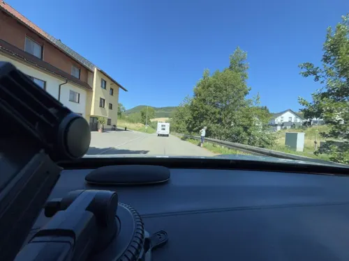
Gasthaus Linde
Restaurant · Regional · 2.6 km
11 Kommentalstraße, Blumberg
Mo off
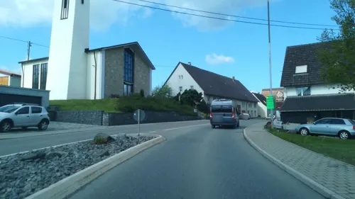
Hotel Gasthof zum Rössle
Restaurant · Regional · 5.9 km
12 Zähringerstraße, Hüfingen
Mo 18:00-22:00; Tu-Sa 11:30-13:45,18:00-22:00; Th off; Su...


27 more on the map.
History
The town of Blumberg is in the region where the source of the Danube is situated, the glacial valley between Eichberg and Buchberg. The town's official origins date from the 13th century, with the Masters of Blumberg first mentioned in 1260. However, one of the oldest settlements, the Steppacher Hof, was already documented in the 12th century, and the town itself is believed to have originated long before that time, as archaeological finds have shown the area was inhabited during the Stone Age.
The Wutach is a 90-kilometer (56 mi) tributary of the Rhine that changes name twice as it passes through the southern Black Forest. Blumberg was established in the Wutach valley near the Wutach Gorge.
Built above the town in the Middle Ages, Blumberg Castle contributed significantly to the development of the surrounding settlements, and while ruled by the princely Fuerstenberg family, who owned a brewery from 1283 until 2004. Blumberg was elevated from a town (Städtle) to a city in 1559.
During the Thirty Years' War from 1618 to 1648, the castle was destroyed. Thanks to its Doggererz iron ore reserves, the town experienced a short-lived expansion after the war's end.
From the History section of Blumberg on Wikipedia, under CC BY-SA 4.0.
Where to stay17
Churches and places of worship33
St. Genesius
Church · Roman Catholic · 3.3 km
2 Kardinal-Bea-Straße, Blumberg
St. Georg
Church · Roman Catholic · 5.7 km
28 Peter-Thumb-Straße, Hüfingen
Shopping6
Gas and EV charging3
Schools, colleges and libraries7
Map of Blumberg
203 places. The map loads OpenStreetMap tiles when you open it.
Getting there and nearby towns
Friedrichshafen Airport (FDH) is the nearest airport with scheduled flights listed in OpenStreetMap, 76 km away.
- Donaueschingen 13 km north, about 13 min by car
- Gottmadingen 22 km southeast, about 22 min by car
- Villingen-Schwenningen 25 km north, about 25 min by car
- Singen 25 km east, about 25 min by car
- Rielasingen-Worblingen 26 km southeast, about 26 min by car
- Tuttlingen 27 km northeast, about 27 min by car
- Titisee-Neustadt 27 km west, about 27 min by car
- Trossingen 28 km north, about 28 min by car
- Spaichingen 30 km northeast, about 30 min by car
- Waldshut-Tiengen 34 km southwest, about 34 min by car
Drive times are estimates from straight-line distance, not routes.
Local news
Headlines from INDB.
Reviews, tips and questions
Loading what members have shared...
Sources and licences
- GeoNames (CC BY 4.0): population, coordinates, regions and time zone
- Mapillary (see each image): photos
- OpenStreetMap contributors (ODbL 1.0): places, airports, map data
- Wikidata (CC0 1.0): elevation, founding date, time zone, website, landmarks and historic places
- Wikimedia Commons (see each image): photos
- Wikipedia (CC BY-SA 4.0): overview and history text
Photo credits
- View over Achdorf in Blumberg, Stephen Lea, CC BY-SA 4.0
- SWV Wegweiser VSBL103 Blumberg Tourist-Information, Karthoo, CC0
- SWV Wegweiser VSBL084 Blumberg Gänseliesel, Karthoo, CC0
- SWV Wegweiser VSBL101 Blumberg Ev. Kirche, Karthoo, CC0
- Infotafel - Burg in Blumberg, PantaRhei, CC BY-SA 4.0
- Schleifenbachwasserfall - Blumberg Bild 2, PantaRhei, CC BY-SA 4.0
- SWV Wegweiser VSBL099 Blumberg Feldbergweg, Karthoo, CC0
- Blumberg - Schleifenbachwasserfälle, PantaRhei, CC BY-SA 4.0
- Schleifenbachwasserfall - Blumberg Bild 1, PantaRhei, CC BY-SA 4.0
- Wutachschlucht, Beredt, CC BY-SA 2.0 de
- Fürstenberg zu Beginn des 19 Jhdt, unbekannt (Transferred by Terfili /Original uploaded by Engie ), Public domain
- BB Burg Blumberg (Futtermauer des Halsgrabens), GerhardSchuhmacher ( talk ) 18:18, 23 August 2018 (UTC), CC BY-SA 4.0
- Zinnfigurenklause 1030108, Flominator ( talk ), CC BY-SA 3.0
- Schwarze Stein, Adrian Michael, CC BY-SA 4.0
- Flora am Hondinger Zisiberg, Sebastian Süß, CC BY-SA 3.0
- Naturschutzgebiet Wutachflühen 2018 Bild 5, PantaRhei, CC BY-SA 4.0
- 04, Burg Fürstenberg (Hüfingen), Joachim Haller, CC BY 3.0
- Riedböhringen - St. Genesius 02, Llez, CC BY-SA 3.0
- Fützen (Blumberg), St. Vitus (22), Subbass1, CC BY-SA 4.0
- St. Georg - Mundelfingen - Exterior 01, H. Zell, CC BY-SA 3.0
- Achdorf, a.froese, CC BY-SA 2.0
- Kircheblumberg, Papa1234, CC BY-SA 3.0
- Kommingen, katholische Kirche St. Cyriak, Rauenstein, Public domain
- Kommingen, Kirche St. Johannes, Rauenstein, Public domain
- Hondingen (Blumberg)-0393, DKrieger, CC BY-SA 4.0
- BB Burg Blumberg (Tafelzeichnung), GerhardSchuhmacher ( talk ) 18:07, 23 August 2018 (UTC), CC BY-SA 4.0
- Naturschutzgebiet Wutachflühen 2018 Bild 3, PantaRhei, CC BY-SA 4.0
- Naturschutzgebiet Billibuck, Imprimatur, CC BY-SA 4.0
- SWV Wegweiser VSBL077 Scheibenrain, Karthoo, CC0
- SWV Wegweiser VSBL059 Wanderparkplatz Eichberg, Karthoo, CC0
- SWV Wegweiser VSBL098 Bei den Schleifenbachfällen, Karthoo, CC0
- Schachbrett Falter (Melanargia galathea) - Flickr - HeinzDS, Heinz Bunse, CC BY-SA 2.0
- Blauer Stein (Randen)-0231 (02), DKrieger, CC BY-SA 4.0
- Street-level photo, tasmaniadevil, CC BY-SA 4.0
- Street-level photo, mr4703, CC BY-SA 4.0
- Street-level photo, tasmaniadevil, CC BY-SA 4.0
- Street-level photo, mr4703, CC BY-SA 4.0
- Street-level photo, pablopita, CC BY-SA 4.0
- Street-level photo, aceini, CC BY-SA 4.0
- Street-level photo, aceini, CC BY-SA 4.0
- Street-level photo, lin_wang, CC BY-SA 4.0
- Street-level photo, v0174, CC BY-SA 4.0
- Street-level photo, mr4703, CC BY-SA 4.0
- Street-level photo, nvbwseifert, CC BY-SA 4.0
- Street-level photo, tasmaniadevil, CC BY-SA 4.0
- Street-level photo, poseidon69, CC BY-SA 4.0
- Street-level photo, stefan005, CC BY-SA 4.0
- Street-level photo, aceini, CC BY-SA 4.0
- Street-level photo, changchun1, CC BY-SA 4.0
- Street-level photo, changchun1, CC BY-SA 4.0


Page built November 8, 2026. Spotted a mistake? Tell us or suggest a place.