


Why visit Büchenbach
Townapedia lists 20 museums and landmarks, 14 parks and trails, 69 places to eat, 9 places to stay and 8 attractions in and around town.
Highlights include Kulturfabrik Roth, Erlberg, Steinkreuz and Steinkreuz.
Weather in Büchenbach
Forecast from MET Norway (CC BY 4.0). Full forecast
About Büchenbach
Büchenbach (German pronunciation: [ˈbyːçn̩bax]) is a municipality in the district of Roth, in Bavaria, Germany.
From the Wikipedia article Büchenbach (this version), under CC BY-SA 4.0.
Things to do8

Kulturfabrik Roth
Cinema and theater · 3.2 km
7 Stieberstraße, Roth
Tu,We,Th 09:00-15:00; Fr 09:00-12:00; Mo,Sa,Su,PH off



Museums and landmarks20


Schloss Ratibor
Monument and historic site · 3.4 km
1 Hauptstraße, Roth



8 more on the map.
Parks, trails and playgrounds14



Kinderspielplatz Büchenbacher Weg
Playground · 3.0 km
Kinderspielplatz und Bolzplatz
08:00-20:00

2 more on the map.
Restaurants and cafes69
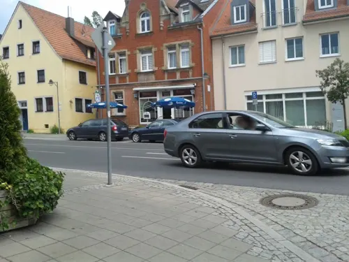
Gartenlaube
Restaurant · Franconian · 3.5 km
Bis etwa Ende 2023 "Landgasthof Kraft"
22 Münchener Straße, Roth
Tu-Su 11:00-23:00
Aeropoli
Restaurant · Greek · 4.0 km
41 Hilpoltsteiner Straße, Roth
Mo off; Tu-Su,PH 11:00-14:00; 17:00-22:30

Bäcker Schmidt
Cafe · 4.0 km
Bäckerei, Café und Restaurant (ab 17 Uhr mit Bedienung am Platz)
4 Ostring, Roth
Mo-Th 06:00-22:00, Fr,Sa 06:00-23:00, Su 07:00-22:00

Da Gianni (Pizza)
Restaurant · Croatian, German · 0.9 km
30 Willi-Memmert-Straße, Büchenbach
Tu-Fr 11:00-14:00;17:00-21:15; Sa 11:30-14:00;17:00-21:15, Su 17:00-21:15
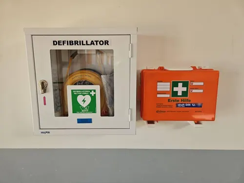
Der kleine Italiener
Restaurant · Italian, German · 0.7 km
2 Rothauracher Straße, Büchenbach
Mo-Fr 11:00-14:00; 16:30-21:00; Sa-Su 16:30-21:00
Gasthaus Heyder
Restaurant · German · 0.6 km
20 Rother Straße, Büchenbach
Th-Tu 10:00-14:00, 17:00-22:00
Pizzeria Taormina
Restaurant · Pizza, Italian · 4.1 km
2 Fuggerstraße
Mo off; Tu-Sa 11:00-14:30,17:00-22:00; Su,PH 11:00-14:30,16:00-22:00
Zum goldenen Schwan
Restaurant · German · 3.2 km
48 Hauptstraße, Roth
Mo-Fr 17:30+; Sa,Su 11:30-14:30,17:30+
Barossa
Restaurant · 3.9 km
3 Rathausplatz, Rednitzhembach
Mo-Fr 16:00-24:00; Sa 11:00-14:00,17:00-24:00; Su...
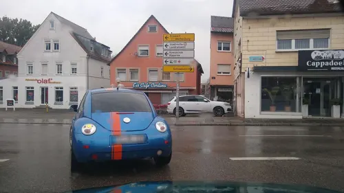



Lederer
Bakery · 4.1 km
13b Bahnhofstraße, Rednitzhembach
Mo-Fr 05:30-18:00; Sa 05:30-13:00; Su,PH 07:00-12:00
57 more on the map.
History
During the Thirty Years' War the population decreased very sharp. Later protestant refugees came from Austria. In 1886 the train station was opened. In 1913 electricity was installed. In 1939 Büchenbach had 705 inhabitants. After 1945 refugees came to Büchenbach, so in 1962 there were 2200 inhabitants.
From the History section of Büchenbach on Wikipedia, under CC BY-SA 4.0.
Where to stay9
Churches and places of worship13
Katholische Pfarrei Heilig Kreuz Rednitzhembach
Church · Roman Catholic · 3.9 km
Untermainbacher Weg, Rednitzhembach
Shopping19
Gas and EV charging12
Aral Tankstelle Marianne Frieser e.K.
Gas station · 3.3 km
33 Allersberger Straße, Roth
Schools, colleges and libraries15
Bildungszentrum für Pflegeberufe der Kreisklinik Roth
School · 3.6 km
12 Weinbergweg, Roth
Healthcare10
Psychiatrische Institutsambulanz und Tagesklinik in Roth
Hospital · 3.6 km
12a Weinbergweg, Roth
Map of Büchenbach
189 places. The map loads OpenStreetMap tiles when you open it.
Getting there and nearby towns
Albrecht Dürer Airport Nuremberg (NUE) is the nearest airport with scheduled flights listed in OpenStreetMap, 26 km away.
- Roth 3 km southeast, about 3 min by car
- Schwabach 7 km north, about 7 min by car
- Wendelstein 12 km northeast, about 12 min by car
- Hilpoltstein 13 km southeast, about 13 min by car
- Spalt 14 km southwest, about 14 min by car
- Feucht 16 km northeast, about 16 min by car
- Heideck 16 km south, about 16 min by car
- Pyrbaum 17 km east, about 17 min by car
- Windsbach 17 km west, about 17 min by car
- Nuremberg 21 km north, about 21 min by car
Drive times are estimates from straight-line distance, not routes.
Local news
Headlines from INDB.
Reviews, tips and questions
Loading what members have shared...
Sources and licences
- GeoNames (CC BY 4.0): population, coordinates, regions and time zone
- Mapillary (see each image): photos
- OpenStreetMap contributors (ODbL 1.0): places, airports, map data
- Wikidata (CC0 1.0): elevation, founding date, time zone, website
- Wikimedia Commons (see each image): photos
- Wikipedia (CC BY-SA 4.0): overview and history text
Photo credits
- Büchenbach Brücke über Rednitz (MGK03837), Markus G. Klötzer, CC BY-SA 3.0
- St. Willibald in Büchenbach-1, WMguegafue, CC BY-SA 4.0
- St. Willibald in Büchenbach-2, WMguegafue, CC BY-SA 4.0
- St Willibald - Büchenbach 006, DALIBRI, CC BY-SA 4.0
- St Willibald - Büchenbach 005, DALIBRI, CC BY-SA 4.0
- St Willibald - Büchenbach 004, DALIBRI, CC BY-SA 4.0
- St Willibald - Büchenbach 007, DALIBRI, CC BY-SA 4.0
- St Willibald - Büchenbach 008, DALIBRI, CC BY-SA 4.0
- St Willibald - Büchenbach 003, DALIBRI, CC BY-SA 4.0
- St Willibald - Büchenbach 002, DALIBRI, CC BY-SA 4.0
- St Willibald - Büchenbach 009, DALIBRI, CC BY-SA 4.0
- St Willibald - Büchenbach 010, DALIBRI, CC BY-SA 4.0
- St Willibald - Büchenbach 028, DALIBRI, CC BY-SA 4.0
- St Willibald - Büchenbach 027, DALIBRI, CC BY-SA 4.0
- St Willibald - Büchenbach 025, DALIBRI, CC BY-SA 4.0
- St Willibald - Büchenbach 024, DALIBRI, CC BY-SA 4.0
- St Willibald - Büchenbach 026, DALIBRI, CC BY-SA 4.0
- St Willibald - Büchenbach 029, DALIBRI, CC BY-SA 4.0
- St Willibald - Büchenbach 030, DALIBRI, CC BY-SA 4.0
- St Willibald - Büchenbach 017, DALIBRI, CC BY-SA 4.0
- St Willibald - Büchenbach 015, DALIBRI, CC BY-SA 4.0
- St Willibald - Büchenbach 014, DALIBRI, CC BY-SA 4.0
- St Willibald - Büchenbach 016, DALIBRI, CC BY-SA 4.0
- St Willibald - Büchenbach 013, DALIBRI, CC BY-SA 4.0
- St Willibald - Büchenbach 012, DALIBRI, CC BY-SA 4.0
- St Willibald - Büchenbach 031, DALIBRI, CC BY-SA 4.0
- St Willibald - Büchenbach 018, DALIBRI, CC BY-SA 4.0
- St Willibald - Büchenbach 023, DALIBRI, CC BY-SA 4.0
- St Willibald - Büchenbach 022, DALIBRI, CC BY-SA 4.0
- St Willibald - Büchenbach 011, DALIBRI, CC BY-SA 4.0
- St Willibald - Büchenbach 019, DALIBRI, CC BY-SA 4.0
- St Willibald - Büchenbach 020, DALIBRI, CC BY-SA 4.0
- St Willibald - Büchenbach 021, DALIBRI, CC BY-SA 4.0
- Roth Schloss Ratibor 20110501, Rudolf Stricker, Attribution
- Friedhofskirche zum Heiligen Kreuz Roth, Aarp65, CC BY-SA 3.0
- Gymnasium Roth Eingang, GR-Verwaltung, CC BY-SA 4.0
- Ev kirche Rednitzhembach 20110705-01, Hans A. Rosbach, CC BY-SA 3.0
- Pfaffenhofen Heidenbergstraße 13 Pfarrkirche St Ottilia (MGK03840), Markus G. Klötzer, CC BY-SA 3.0
- Steinkreuz (D-5-76-143-161) 01, Derzno, CC BY 3.0
- Roth bei Nürnberg - Hauptstraße 6 - 01, Howwi, CC BY-SA 3.0
- Fabrikmuseum Roth, Stefan Karl, CC BY-SA 4.0
- KuFa 2017, Foreign Species, CC BY-SA 4.0
- 2020 Steinkreuz nördlich von Pfaffenhofen 04, Derzno, CC BY-SA 4.0
- Schloss Ratibor, Fassade zum Innenhof, Stefan Karl, CC BY-SA 4.0
- Steinkreuz D-5-76-143-151 06, Derzno, CC BY 3.0
- Steinkreuz D-5-76-143-88 02, Derzno, CC BY 3.0
- Brunnen am Markt Roth, Aarp65, CC BY-SA 3.0
- Steinkreuz Rednitzhembach 01, Derzno, CC BY 3.0
- Steinkreuz Ungerthal 02, Derzno, CC BY 3.0
- Kreuzsteinrest (D-5-76-143-169) 01, Derzno, CC BY 3.0
- Baggersee - unter Naturschutz - panoramio, Siegmar S., CC BY-SA 3.0
- Roth bei Nürnberg - Ev. Stadtkirche - 01, Howwi, CC BY-SA 3.0
- Street-level photo, bernd_niemann, CC BY-SA 4.0
- Street-level photo, bigbug21, CC BY-SA 4.0
- Street-level photo, msdess, CC BY-SA 4.0
- Street-level photo, wegavision, CC BY-SA 4.0
- Street-level photo, msdess, CC BY-SA 4.0
- Street-level photo, bigbug21, CC BY-SA 4.0
- Street-level photo, bigbug21, CC BY-SA 4.0
- Street-level photo, wegavision, CC BY-SA 4.0
- Street-level photo, wegavision, CC BY-SA 4.0
- Street-level photo, wegavision, CC BY-SA 4.0
- Street-level photo, bigbug21, CC BY-SA 4.0
- Street-level photo, kopra, CC BY-SA 4.0
- Street-level photo, wegavision, CC BY-SA 4.0
- Street-level photo, msdess, CC BY-SA 4.0
- Street-level photo, bigbug21, CC BY-SA 4.0
- Street-level photo, bigbug21, CC BY-SA 4.0


Page built November 9, 2026. Spotted a mistake? Tell us or suggest a place.