


Why visit Bunde
Townapedia lists 141 museums and landmarks, 6 parks and trails, 42 places to eat, 10 places to stay and 1 attraction in and around town.
Highlights include Weener railway bridge, Steinhaus Bunderhee, Bentumersiel and Sportboothafen Weener (Ems).
Weather in Bunde
Forecast from MET Norway (CC BY 4.0). Full forecast
About Bunde
Bunde (German pronunciation: [ˈbʊndə] ) is a municipal district in East Frisia, in Lower Saxony, Germany, about 20 km (12 mi) south of Emden, Germany, and 50 km (30 mi) east of Groningen, Netherlands. It lies on the southern tip of the Dollart, a bay of the North Sea between Germany and the Netherlands, and has a land border with the Netherlands.
From the Wikipedia article Bunde, Germany (this version), under CC BY-SA 4.0.
Things to do1

Museums and landmarks141

Steinhaus Bunderhee
Monument and historic site · 1.8 km
64 Steinhausstraße, Bunde

Bentumersiel
Monument and historic site · 10.5 km
Archaeological site in Lower Saxony, Germany

Museum de Oude Wolden
Museum · 10.8 km
Museum in Bellingwolde, the Netherlands


Pfarrhaus
Monument and historic site · 6.4 km
Zweigeschossiger Backsteinbau mit steilem Giebel. Nordgiebel datiert 1429 in großen Reliefbuchstaben aus Formziegeln. Kreuzstockfenster...
1 Große Stiege, Weener



129 more on the map.
Parks, trails and playgrounds6




Restaurants and cafes42
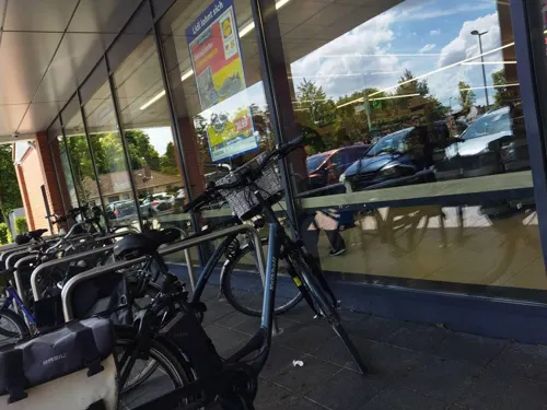
Ganseforth
Bakery · 0.6 km
22 Neuschanzer Straße, Bunde
Mo-Fr 07:00-18:00; Sa 07:00-16:00; Su 08:00-11:00
Ganseforth
Bakery · 2.0 km
25 Boenster Straße, Weener
Mo 06:00-13:00; Tu-Th 06:00-18:00; Fr 06:00-16:00; Sa 06:00-12:00;...


Poort van Groningen
Restaurant · European · 3.9 km
28A Rijksweg, Bad Nieuweschans
Mo 08:00-22:00; Tu-Fr 07:00-22:00; Sa 08:00-19:00; Su 10:00-19:00
Aloms
Restaurant · Pizza · 5.5 km
1 Bahnhofstraße, Weener
Mo 17:00-22:00; Tu-Th 11:00-22:00; Fr 11:00-22:30; Sa 12:00-22:30;...
Bäckerei Lübbers
Bakery · 4.7 km
65 Graf-Edzard-Straße, Weener
Mo 06:00-12:00; Tu-Fr 06:00-18:00; Sa 06:00-12:00; Su 08:00-11:00



Golosino
Restaurant · Pizza, Italian · 0.7 km
26 Neuschanzer Straße, Bunde
Mo-Sa 17:30-21:00; PH off
Bäckerei Lübbers
Bakery · 5.8 km
39 Süderstraße, Weener
Mo 06:00-12:30;Tu-Th 06:00-12:30,14:30-18:00;Fr 06:00-18:00;Sa 06:00-12:00

30 more on the map.
History
Bunde was first mentioned in a document in 1428. The name has been variously written as Buenda, de Bunda and Bonde.
Due to its situation on a geest, or slightly raised landform, the town was spared the great floods that inundated much of the region in the Middle Ages.
Prior to the Reformation, Bunde belonged to the Roman Catholic Diocese of Münster. Bunde became predominantly Protestant in the early 16th century, largely following the Reformed (Calvinist) faith as in the adjacent Netherlands. During the Thirty Years' War (1618–1648), Bunde, though not a battlefield, was plundered several times by Imperial (Catholic) troops.
East Frisia became part of the Kingdom of Prussia in 1744. Thereafter, crafts and cottage industries came to the fore in the region's economy. During the Seven Years' War (1756–1763), the town was twice occupied by French troops, and was subjected to tributes by the conquerors. After the war, Prussian King Frederick the Great sponsored construction of dikes to expand the region's polders.
From the History section of Bunde, Germany on Wikipedia, under CC BY-SA 4.0.
Where to stay10
Wohnmobilstellplatz am Sportboothafen Weener
Campground · 6.4 km
Am Marina-Park, Weener
Churches and places of worship25
Evangelisch-reformierte Kirche Mitling-Mark
Church · Reformed · 9.1 km
12 Mitlinger Kirchweg, Westoverledingen
Evangelisch Reformierte Kirche Landschaftspolder
Church · Reformed · 5.0 km
25 Landschaftspolder, Bunde
Evangelisch Reformierte Kirchengemeinde Wymeer
Church · Reformed · 5.9 km
Shopping17
Gas and EV charging7
Schools, colleges and libraries11
Healthcare7
Map of Bunde
250 places. The map loads OpenStreetMap tiles when you open it.
Getting there and nearby towns
Flugplatz Emden (EME) is the nearest airport with scheduled flights listed in OpenStreetMap, 23 km away.
- Weener 5 km east, about 5 min by car
- Leer 14 km northeast, about 14 min by car
- Papenburg 15 km southeast, about 15 min by car
- Veenhusen 19 km northeast, about 19 min by car
- Emden 21 km north, about 21 min by car
- Ostrhauderfehn 24 km east, about 24 min by car
- Hinte 25 km north, about 25 min by car
- Pewsum 30 km northwest, about 30 min by car
- Barßel 32 km east, about 32 min by car
- Aurich 35 km northeast, about 35 min by car
Drive times are estimates from straight-line distance, not routes.
Local news
Headlines from INDB.
Reviews, tips and questions
Loading what members have shared...
Sources and licences
- GeoNames (CC BY 4.0): population, coordinates, regions and time zone
- Mapillary (see each image): photos
- OpenStreetMap contributors (ODbL 1.0): places, airports, map data
- Wikidata (CC0 1.0): elevation, founding date, time zone, website, landmarks and historic places
- Wikimedia Commons (see each image): photos
- Wikipedia (CC BY-SA 4.0): overview and history text
Photo credits
- Sankt Martinskirche zuidzijde, Aikep, CC BY-SA 4.0
- Evangelisch-altreformierte Kirche in Bunde (2024), JoachimKohler-HB, CC BY-SA 4.0
- Höhenmarke Bunde Kirche Turm, Ulrich Kulle, CC BY-SA 4.0
- Höhenmarke Bunde, Ulrich Kulle, CC BY-SA 4.0
- Condomat, Bunde (2019) 04, Donald Trung Quoc Don (Chữ Hán: 徵國單) - Wikimedia Commons - © CC BY-SA 4.0 International . ( Want to use this image? ), CC BY-SA 4.0
- Condomat, Bunde (2019) 02, Donald Trung Quoc Don (Chữ Hán: 徵國單) - Wikimedia Commons - © CC BY-SA 4.0 International . ( Want to use this image? ), CC BY-SA 4.0
- Condomat, Bunde (2019) 03, Donald Trung Quoc Don (Chữ Hán: 徵國單) - Wikimedia Commons - © CC BY-SA 4.0 International . ( Want to use this image? ), CC BY-SA 4.0
- Condomat, Bunde (2019) 01, Donald Trung Quoc Don (Chữ Hán: 徵國單) - Wikimedia Commons - © CC BY-SA 4.0 International . ( Want to use this image? ), CC BY-SA 4.0
- Hotel Mühlenstrasse 1 in Bunde (2024), JoachimKohler-HB, CC BY-SA 4.0
- Combi Leergutbon, Bunde (2019) 04, Donald Trung Quoc Don (Chữ Hán: 徵國單) - Wikimedia Commons . ( Want to use this image? ), CC BY-SA 4.0
- Combi Leergutbon, Bunde (2019) 03, Donald Trung Quoc Don (Chữ Hán: 徵國單) - Wikimedia Commons . ( Want to use this image? ), CC BY-SA 4.0
- Wind mill Bunde 02, Dickelbers, CC BY-SA 4.0
- Wind mill Bunde 03, Dickelbers, CC BY-SA 4.0
- Wind mill Bunde 04, Dickelbers, CC BY-SA 4.0
- Wind mill Bunde 05, Dickelbers, CC BY-SA 4.0
- AXA Versicherung Hoek & Börgener GMBH & CO.KG, Bunde (2019) 01, Donald Trung Quoc Don (Chữ Hán: 徵國單) - Wikimedia Commons - © CC BY-SA 4.0 International . ( Want to use this image? ), CC BY-SA 4.0
- Weenerstraße, Bunde (2019) 07, Donald Trung Quoc Don (Chữ Hán: 徵國單) - Wikimedia Commons - © CC BY-SA 4.0 International . ( Want to use this image? ), CC BY-SA 4.0
- Moin Moin Restaurant, Bunde (2019) 02, Donald Trung Quoc Don (Chữ Hán: 徵國單) - Wikimedia Commons - © CC BY-SA 4.0 International . ( Want to use this image? ), CC BY-SA 4.0
- Weenerstraße, Bunde (2019) 06, Donald Trung Quoc Don (Chữ Hán: 徵國單) - Wikimedia Commons - © CC BY-SA 4.0 International . ( Want to use this image? ), CC BY-SA 4.0
- Beirut, Bunde (2019) 03, Donald Trung Quoc Don (Chữ Hán: 徵國單) - Wikimedia Commons - © CC BY-SA 4.0 International . ( Want to use this image? ), CC BY-SA 4.0
- Weenerstraße, Bunde (2019) 02, Donald Trung Quoc Don (Chữ Hán: 徵國單) - Wikimedia Commons - © CC BY-SA 4.0 International . ( Want to use this image? ), CC BY-SA 4.0
- Electric vehicle charging point, Bunde (2019) 03, Donald Trung Quoc Don (Chữ Hán: 徵國單) - Wikimedia Commons - © CC BY-SA 4.0 International . ( Want to use this image? ), CC BY-SA 4.0
- Weenerstraße, Bunde (2019) 03, Donald Trung Quoc Don (Chữ Hán: 徵國單) - Wikimedia Commons - © CC BY-SA 4.0 International . ( Want to use this image? ), CC BY-SA 4.0
- Weenerstraße, Bunde (2019) 05, Donald Trung Quoc Don (Chữ Hán: 徵國單) - Wikimedia Commons - © CC BY-SA 4.0 International . ( Want to use this image? ), CC BY-SA 4.0
- AXA Versicherung Hoek & Börgener GMBH & CO.KG, Bunde (2019) 02, Donald Trung Quoc Don (Chữ Hán: 徵國單) - Wikimedia Commons - © CC BY-SA 4.0 International . ( Want to use this image? ), CC BY-SA 4.0
- Moin Moin Restaurant, Bunde (2019) 01, Donald Trung Quoc Don (Chữ Hán: 徵國單) - Wikimedia Commons - © CC BY-SA 4.0 International . ( Want to use this image? ), CC BY-SA 4.0
- Electric vehicle charging point, Bunde (2019) 01, Donald Trung Quoc Don (Chữ Hán: 徵國單) - Wikimedia Commons - © CC BY-SA 4.0 International . ( Want to use this image? ), CC BY-SA 4.0
- Electric vehicle charging point, Bunde (2019) 02, Donald Trung Quoc Don (Chữ Hán: 徵國單) - Wikimedia Commons - © CC BY-SA 4.0 International . ( Want to use this image? ), CC BY-SA 4.0
- Visse Immobilen (Bernhard Vosse), Bunde (2019), Donald Trung Quoc Don (Chữ Hán: 徵國單) - Wikimedia Commons - © CC BY-SA 4.0 International . ( Want to use this image? ), CC BY-SA 4.0
- Beirut, Bunde (2019) 04, Donald Trung Quoc Don (Chữ Hán: 徵國單) - Wikimedia Commons - © CC BY-SA 4.0 International . ( Want to use this image? ), CC BY-SA 4.0
- 2013-05-03 Fotoflug Leer Papenburg DSCF7028, Martina Nolte, CC BY-SA 3.0 de
- Museum de Oude Wolden, Editør, CC BY-SA 3.0
- ChurchWeenerCathJoseph, Frisia Orientalis, CC BY-SA 3.0
- Bunde - Landschaftspolder - Friedhof + Kirche 08 ies, Frank Vincentz, CC BY-SA 3.0
- Westoverledingen - Warftweg - Kirche + Friedhof 06 ies, Frank Vincentz, CC BY-SA 3.0
- ChurchWeenerRefGeorg, Frisia Orientalis, CC BY-SA 3.0
- Bunde Kirche Nordseite, Wikiwal, CC BY-SA 3.0
- ChurchBundeOldRef, Frisia Orientalis, CC BY-SA 3.0
- Weener - Bahnhofstraße + Riverside Church 01 ies, Frank Vincentz, CC BY-SA 3.0
- Weener - Neue Straße - Baptistische Kirche 02 ies, Frank Vincentz, CC BY-SA 3.0
- Bunderhee Steinhaus Südseite, Wikiwal, CC BY 3.0
- Stapelmoor Pastorat, Wikiwal, Public domain
- Stolperstein Weener Westerstraße 41a Abraham de Vries, Gmbo 2013, CC0
- Stolperstein Weener Norderstraße 50 Abraham Gerson, Gmbo 2013, CC0
- Stolperstein Weener Westerstraße 34 Albert Arons, Gmbo 2013, CC0
- Stolperstein Weener Kreuzstraße 4 Albert de Jonge, Gmbo 2013, CC0
- Stolperstein Weener Neue Straße 2 Albert Jacobs, Gmbo 2013, CC0
- Stolperstein Weener Mühlenstraße 31 Alfred de Jonge, Gmbo 2013, CC0
- ChurchWymeer, Frisia Orientalis, CC BY-SA 3.0
- ChurchDitzumerverlaatRef, Frisia Orientalis, CC BY-SA 3.0
- Germania romana, ReMaps, CC BY-SA 4.0
- Street-level photo, sennewald63, CC BY-SA 4.0
- Street-level photo, ezinge, CC BY-SA 4.0
- Street-level photo, changchun1, CC BY-SA 4.0
- Street-level photo, robinvdlinde, CC BY-SA 4.0
- Street-level photo, ezinge, CC BY-SA 4.0
- Street-level photo, sennewald63, CC BY-SA 4.0
- Street-level photo, sennewald63, CC BY-SA 4.0
- Street-level photo, ezinge, CC BY-SA 4.0
- Street-level photo, changchun1, CC BY-SA 4.0
- Street-level photo, ramap, CC BY-SA 4.0
- Street-level photo, ramap, CC BY-SA 4.0
- Street-level photo, sennewald63, CC BY-SA 4.0
- Street-level photo, ezinge, CC BY-SA 4.0
- Street-level photo, cAble_Guy, CC BY-SA 4.0
- Street-level photo, changchun1, CC BY-SA 4.0
- Street-level photo, mfa, CC BY-SA 4.0
- Street-level photo, mfa, CC BY-SA 4.0
- Street-level photo, ezinge, CC BY-SA 4.0


Page built November 9, 2026. Spotted a mistake? Tell us or suggest a place.