
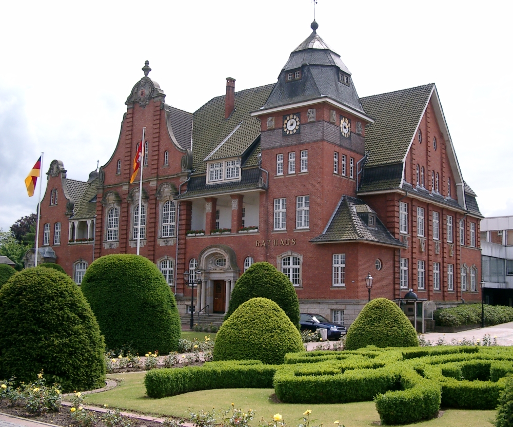


Papenburg, Germany
Papenburg is a town of 34,117 people in Lower Saxony, Germany, founded in 1631.
Why visit Papenburg
Townapedia lists 30 museums and landmarks, 40 parks and trails, 100 places to eat, 25 places to stay and 10 attractions in and around town.
Highlights include Engelnhof, Hofladen Anneken, Gut Altenkamp and Friederike von Papenburg.
Weather in Papenburg
Forecast from MET Norway (CC BY 4.0). Full forecast
About Papenburg
Papenburg (German pronunciation: [ˈpaːpm̩bʊʁk] ; East Frisian Low Saxon: Papenbörg) is a city in the district of Emsland, Lower Saxony, Germany, situated at the river Ems. It is known for its large shipyard, the Meyer-Werft, which specializes in building cruise liners.
From the Wikipedia article Papenburg (this version), under CC BY-SA 4.0.
Travel tips from other travellers: Papenburg on Wikivoyage (CC BY-SA 4.0).
Photos of Papenburg


Things to do10
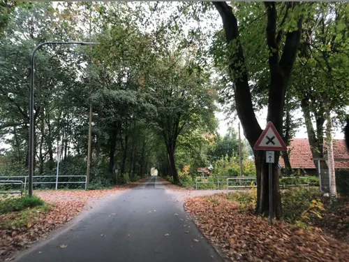
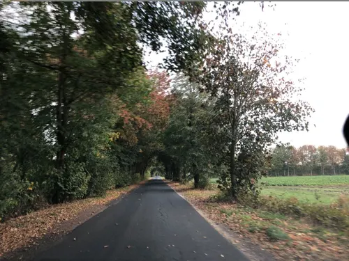
Hofladen Anneken
Farm and orchard · 2.7 km
8 Lerchenweg, Papenburg
Mo-Fr 09:00-18:00; Sa 08:00-13:00; Dec-Mar Mo off



Kino Papenburg
Cinema and theater · 1.8 km
27 Hauptkanal rechts, Papenburg
Tu-Fr 16:00+; Sa,Su 13:30+; SH Mo 16:00+
Kürbishof Sprengel
Farm and orchard · 5.3 km
Tu-Fr 09:00-18:00; Sa 09:00-16:00; Su 13:00-18:00

Museums and landmarks30


Pfarrhaus
Monument and historic site · 8.8 km
Zweigeschossiger Backsteinbau mit steilem Giebel. Nordgiebel datiert 1429 in großen Reliefbuchstaben aus Formziegeln. Kreuzstockfenster...
1 Große Stiege, Weener



18 more on the map.
Parks, trails and playgrounds40



Sternenland
Sports field and stadium · 2.5 km
30 Boschstraße, Papenburg
Mo-Fr 13:30-19:00; Sa-Su 08:30-19:00

Golfclub Gutshof e.V. Papenburg-Aschendorf
Golf course · 2.3 km
"An den Tagen Verschieden"

Ems Yacht Club Lingen
Marina and boat launch · 8.6 km
Südlich der Schleuse Herbrum, gezeitenfrei



28 more on the map.
Restaurants and cafes100
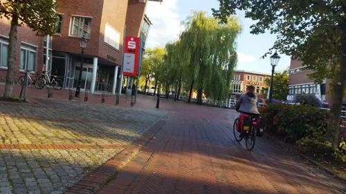
Altes Gasthaus Kuhr
Restaurant · German, Ice Cream, Fish, Cake · 1.5 km
62 Hauptkanal rechts, Papenburg
Mo-Fr 10:00-22:00; Sa,Su,PH 10:00-15:00
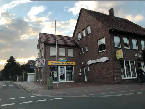
Crunchy Chicken und Burger
Restaurant · Chicken, Burger · 1.7 km
10 Splitting links, Papenburg
Mo-Th,Su 11:30-22:00; Fr,Su 11:30-23:00
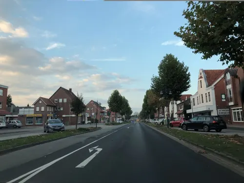
Piccola Strada Papenburg
Restaurant · Pizza, Burger, Turkish, Dessert, Pasta · 1.7 km
16 Splitting links, Papenburg
Mo-Th 11:30-22:30; Fr-Su 11:30-23:30
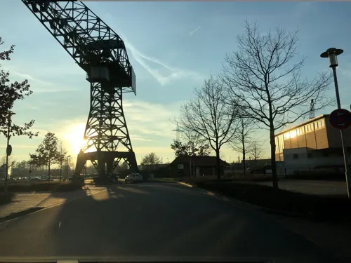
Portofino
Restaurant · International, Italian · 2.2 km
9 An der Alten Werft
Mo-Fr 10:30+, Sa-Su 09:00+
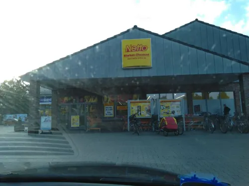
Ganseforth
Bakery · 1.0 km
26-30 Gutshofstraße, Papenburg
Mo-Fr 07:00-18:00; Sa 07:00-16:00; Su 08:00-11:00
Ganseforth Bäcker Aschendorf
Bakery · 6.8 km
2a Zu den Emsauen, Papenburg
Mo-Fr 07:00-18:00; Sa 07:00-16:00; Su 08:00-11:00

Gasthof zur alten Schule
Restaurant · Regional · 3.2 km
79 Hauptstraße, Westoverledingen
"nur bei Reservierung"
Olympia
Restaurant · Greek · 1.7 km
37 Hauptkanal rechts
May-Sep Mo,We-Sa 18:00-22:30; May-Sep PH,Su...
Roskamp´s Gasthaus
Restaurant · German · 1.8 km
30 Hauptkanal links, Papenburg
We-Su 16:00-22:00; Fr-Sa 16:00-23:00

Ganseforth
Bakery · 1.7 km
10 Karl-Hillers-Straße, Papenburg
Mo-Fr 07:00-18:00; Sa 07:00-14:00; Su 08:00-11:00
88 more on the map.
History
In the Chronicle of the Frisians, written in the 16th century by the East-Frisian council Eggerik Benninga, the Papenburg (at that time a manor) is mentioned for the first time.
In 1458, Hayo von Haren, called "von der Papenburch", confessed to be leaned with the Papenburg. The contract that was made because of this is the earliest verifiably documented mention of Papenburg.
On 2 December 1630, the district administrator Dietrich von Velen purchased the manor for 1500 Reichsthaler from Friedrich von Schwarzenberg in order to found a settlement in the fen-surrounded region.
On 4 April 1631, Bishop Ferdinand von Münster leased the then castle and manor Papenburg to Dietrich von Velen. This is considered to be the foundation of the city of Papenburg.
Matthias von Velen and his wife Margartha Anna, born von Galen, endowed the oldest church in Papenburg on 7 December 1680, dedicated to Anthony of Padua, making him its patron saint.
From 1933 to 1945 a series of 15 moorland labor, punitive and POWs-camps were active in the districts of Emsland and Bentheim. The central administration was set in Papenburg where now a memorial of these camps, the Dokumentations- und Informationszentrum (DIZ) Emslandlager, is located.
From the History section of Papenburg on Wikipedia, under CC BY-SA 4.0.
More about Papenburg
Geography
Papenburg is subdivided into 6 urban districts, Papenburg-Untenende, Papenburg-Obenende, Herbrum, Tunxdorf-Nenndorf, Aschendorf and Bokel.
From the Wikipedia article Papenburg, under CC BY-SA 4.0.
Notable people from Papenburg
- Hermann NiehoffGerman general (1897–1980)
Born in Papenburg, according to Wikidata (CC0). Each name links to its Wikipedia article.
Where to stay25
Arkadenhaus - Friedrich Freiherr von Schwarzenberg Hotel
Motel and hotel · 1.3 km
68-70 Hauptkanal links, Papenburg
Churches and places of worship27
Evangelisch-reformierte Kirche Mitling-Mark
Church · Reformed · 6.5 km
12 Mitlinger Kirchweg, Westoverledingen
Evangelisch Reformierte Gemeinde Ihrenerfeld
Church · Reformed · 8.3 km
214 Ihrener Straße, Westoverledingen
Evangelisch Reformierte Kirche Vellage
Church · Reformed · 6.6 km
35 Vellager Straße, Weener
Evangelisch-reformierte Großwolder Kirche
Church · Reformed · 7.6 km
2 Kirchstraße, Westoverledingen
Shopping42
Gas and EV charging20
wiro Tank- und Waschcenter in Papenburg
Gas station · 2.3 km
33 Deverweg, Papenburg
Raiffeisen Tankstelle Aschendorf
Gas station · 6.8 km
4 Zu den Emsauen, Papenburg
Schools, colleges and libraries26
Healthcare15
Kinder- und Jugendpsychiatrie Marien Hospital Papenburg Aschendorf
Clinic and pharmacy · 6.5 km
Map of Papenburg
250 places. The map loads OpenStreetMap tiles when you open it.
Getting there and nearby towns
Flugplatz Emden (EME) is the nearest airport with scheduled flights listed in OpenStreetMap, 37 km away.
- Weener 11 km northwest, about 11 min by car
- Ostrhauderfehn 15 km northeast, about 15 min by car
- Bunde 15 km northwest, about 15 min by car
- Leer 17 km north, about 17 min by car
- Esterwegen 17 km southeast, about 17 min by car
- Barßel 25 km northeast, about 25 min by car
- Veenhusen 24 km north, about 24 min by car
- Lathen 25 km south, about 25 min by car
- Sögel 27 km south, about 27 min by car
- Friesoythe 30 km east, about 30 min by car
Drive times are estimates from straight-line distance, not routes.
Towns near Papenburg


Keep exploring
Local news
Headlines from INDB.
Reviews, tips and questions
Loading what members have shared...
Sources and licences
- GeoNames (CC BY 4.0): population, coordinates, regions and time zone
- Mapillary (see each image): photos
- OpenStreetMap contributors (ODbL 1.0): places, airports, map data
- Wikidata (CC0 1.0): elevation, founding date, time zone, website, landmarks and historic places
- Wikimedia Commons (see each image): photos
- Wikipedia (CC BY-SA 4.0): overview and history text
Photo credits
- Papenburg Rathaus 2, The original uploader was Lencer at German Wikipedia . 23 August 2006 (original upload date), Attribution
- 2013-05-03 Fotoflug Leer Papenburg DSCF6892, Martina Nolte, CC BY-SA 3.0 de
- 2013-05-03 Fotoflug Nordholz Papenburg HP 1968, Alchemist-hp ( talk ), CC BY-SA 3.0
- 2013-05-03 Fotoflug Nordholz Papenburg HP 1967, Alchemist-hp ( talk ), CC BY-SA 3.0
- 2013-05-03 Fotoflug Nordholz Papenburg HP 2047, Alchemist-hp ( talk ), CC BY-SA 3.0
- 2013-05-03 Fotoflug Nordholz Papenburg HP 2048, Alchemist-hp ( talk ), CC BY-SA 3.0
- 2013-05-03 Fotoflug Leer Papenburg DSCF6935, Martina Nolte, CC BY-SA 3.0 de
- 2013-05-03 Fotoflug Nordholz Papenburg HP 1965, Alchemist-hp ( talk ), CC BY-SA 3.0
- 2013-05-03 Fotoflug Nordholz Papenburg HP 1966, Alchemist-hp ( talk ), CC BY-SA 3.0
- 2013-05-03 Fotoflug Leer Papenburg DSCF6891, Martina Nolte, CC BY-SA 3.0 de
- Stolperstein Mittelkanal links 15 (Papenburg) Hanny Meyer, OTFW , Berlin, CC BY-SA 3.0
- Stolperstein Mittelkanal links 15 (Papenburg) Siegfried Hayum, OTFW , Berlin, CC BY-SA 3.0
- Stolperstein Mittelkanal links 15 (Papenburg) Michel Meyer, OTFW , Berlin, CC BY-SA 3.0
- Stolperstein Mittelkanal links 15 (Papenburg) Eva Hayum, OTFW , Berlin, CC BY-SA 3.0
- Stolperstein Mittelkanal links 15 (Papenburg) Karl Hayum, OTFW , Berlin, CC BY-SA 3.0
- Stolperstein Mittelkanal links 15 (Papenburg) Juliane Hayum, OTFW , Berlin, CC BY-SA 3.0
- Bockwindmill Papenburg 03, Dickelbers, CC BY-SA 4.0
- Papenburg Bockwindmühle, Corradox, CC BY-SA 3.0
- Bockwindmill Papenburg 02, Dickelbers, CC BY-SA 4.0
- Bockwindmill Papenburg 01, Dickelbers, CC BY-SA 4.0
- Bockwindmill Papenburg 04, Dickelbers, CC BY-SA 4.0
- 2013-05-03 Fotoflug Nordholz Papenburg HP 2050, Alchemist-hp ( talk ), CC BY-SA 3.0
- 2013-05-03 Fotoflug Nordholz Papenburg HP 2049, Alchemist-hp ( talk ), CC BY-SA 3.0
- 2013-05-03 Fotoflug Nordholz Papenburg HP 1969, Alchemist-hp ( talk ), CC BY-SA 3.0
- 2013-05-03 Fotoflug Nordholz Papenburg HP 1970, Alchemist-hp ( talk ), CC BY-SA 3.0
- 2013-05-03 Fotoflug Leer Papenburg DSCF6894, Martina Nolte, CC BY-SA 3.0 de
- 2013-05-03 Fotoflug Nordholz Papenburg HP 2045, Alchemist-hp ( talk ), CC BY-SA 3.0
- 2013-05-03 Fotoflug Nordholz Papenburg HP 2046, Alchemist-hp ( talk ), CC BY-SA 3.0
- 2013-05-03 Fotoflug Nordholz Papenburg HP 1964, Alchemist-hp ( talk ), CC BY-SA 3.0
- 2013-05-03 Fotoflug Nordholz Papenburg HP 1963, Alchemist-hp ( talk ), CC BY-SA 3.0
- 2013-05-03 Fotoflug Nordholz Papenburg HP 1962, Alchemist-hp ( talk ), CC BY-SA 3.0
- 2013-05-03 Fotoflug Leer Papenburg DSCF6934, Martina Nolte, CC BY-SA 3.0 de
- 2013-05-03 Fotoflug Leer Papenburg DSCF6890, Martina Nolte, CC BY-SA 3.0 de
- 2013-05-03 Fotoflug Nordholz Papenburg HP 2044, Alchemist-hp ( talk ), CC BY-SA 3.0
- 2013-05-03 Fotoflug Nordholz Papenburg HP 2043, Alchemist-hp ( talk ), CC BY-SA 3.0
- 2013-05-03 Fotoflug Leer Papenburg DSCF6936, Martina Nolte, CC BY-SA 3.0 de
- 2013-05-03 Fotoflug Nordholz Papenburg HP 1971, Alchemist-hp ( talk ), CC BY-SA 3.0
- 2013-05-03 Fotoflug Nordholz Papenburg HP 1972, Alchemist-hp ( talk ), CC BY-SA 3.0
- 2013-05-03 Fotoflug Leer Papenburg DSCF7028, Martina Nolte, CC BY-SA 3.0 de
- Papenburg - Park Altenkamp + Gut Altenkamp 10 ies, Frank Vincentz, CC BY-SA 3.0
- 2013-05-03 Fotoflug Nordholz Papenburg HP 2069, Alchemist-hp ( talk ), CC BY-SA 3.0
- ChurchVöllenerkönigsfehn, Frisia Orientalis, CC BY-SA 3.0
- Papenburg - Hofer Kirchweg - NSG Dreiberg n 06 ies, Frank Vincentz, CC BY-SA 3.0
- Papenburg Touristen Information, Lokilech, CC BY-SA 3.0
- Zwischen Herbrum und Rhede, Hermann Schlömer, CC BY-SA 3.0
- Papenburg - Ölmühlenweg - Forum Alte Werft 06 ies, Frank Vincentz, CC BY-SA 3.0
- ChurchVöllen, Frisia Orientalis, CC BY-SA 3.0
- ChurchGrosswolde, Frisia Orientalis, CC BY-SA 3.0
- ChurchIhrenerfeldRef, Frisia Orientalis, CC BY-SA 3.0
- ChurchFlachsmeerCathStBernhard, Frisia Orientalis, CC BY-SA 3.0
- Westoverledingen - Warftweg - Kirche + Friedhof 06 ies, Frank Vincentz, CC BY-SA 3.0
- Papenburg - Nenndorfer Straße - NSG Nenndorfer Mörken 12 ies, Frank Vincentz, CC BY-SA 3.0
- Nikolaikirche Papenburg, Kuesterniko, Public domain
- Stamandusaschendorf, Inselmann, CC BY-SA 3.0
- Church Vellage, Frisia Orientalis, CC BY-SA 3.0
- Papenburg St. Antonius, Martina Nolte (cropped & brightened by Rabanus Flavus ), CC BY-SA 3.0 de
- Papenburg - Am Stadtpark - Meyers Mühle (dmt) 03 ies, Frank Vincentz, CC BY-SA 3.0
- Papenburg von-Velen-Anlage 3, Corradox, CC BY-SA 4.0
- Abgegangen Burg Nienhaus P4050265, Worldfootage, CC BY-SA 4.0
- Margaretha von Papenburg S Papenburg 07-05-2015, Wolfgang Fricke, CC BY 3.0
- 26871 Bockwindmühle Papenburg, Uwe Barghaan, CC BY-SA 4.0
- Stapelmoor Pastorat, Wikiwal, Public domain
- Papenburg - Ölmühlenweg - Hotel Alte Werft (Klappbrücke Alte Werft) 01 ies, Frank Vincentz, CC BY-SA 3.0
- Street-level photo, sennewald63, CC BY-SA 4.0
- Street-level photo, changchun1, CC BY-SA 4.0
- Street-level photo, hendel, CC BY-SA 4.0
- Street-level photo, hendel, CC BY-SA 4.0
- Street-level photo, hendel, CC BY-SA 4.0
- Street-level photo, Hightower-, CC BY-SA 4.0
- Street-level photo, hendel, CC BY-SA 4.0
- Street-level photo, hendel, CC BY-SA 4.0
- Street-level photo, camdrive2000, CC BY-SA 4.0
- Street-level photo, hendel, CC BY-SA 4.0
- Street-level photo, robinvdlinde, CC BY-SA 4.0
- Street-level photo, hendel, CC BY-SA 4.0
- Street-level photo, heetENkoel, CC BY-SA 4.0
- Street-level photo, robinvdlinde, CC BY-SA 4.0
- Street-level photo, Hightower-, CC BY-SA 4.0
- Street-level photo, hendel, CC BY-SA 4.0
- Street-level photo, hendel, CC BY-SA 4.0
- Street-level photo, hendel, CC BY-SA 4.0
- Street-level photo, Hightower-, CC BY-SA 4.0
- Street-level photo, changchun1, CC BY-SA 4.0


Page built November 9, 2026. Spotted a mistake? Tell us or suggest a place.