


Why visit Coppenbrügge
Townapedia lists 65 museums and landmarks, 25 parks and trails, 37 places to eat, 9 places to stay and 36 attractions in and around town.
Highlights include Bad Münder am Deister, Osterwaldbühne, Barenburg and Burg Hallermund.
Weather in Coppenbrügge
Forecast from MET Norway (CC BY 4.0). Full forecast
About Coppenbrügge
Coppenbrügge (German pronunciation: [kɔpn̩ˈbʁʏɡə]) is a municipality in the Hamelin-Pyrmont district, in Lower Saxony, Germany. It is situated approximatively 15 km (10 miles) east of Hamelin.
From the Wikipedia article Coppenbrügge (this version), under CC BY-SA 4.0.
Things to do36

Bad Münder am Deister
Monument and historic site · 10.6 km
Town in Hameln-Pyrmont District, in Lower Saxony, Germany




24 more on the map.
Museums and landmarks65

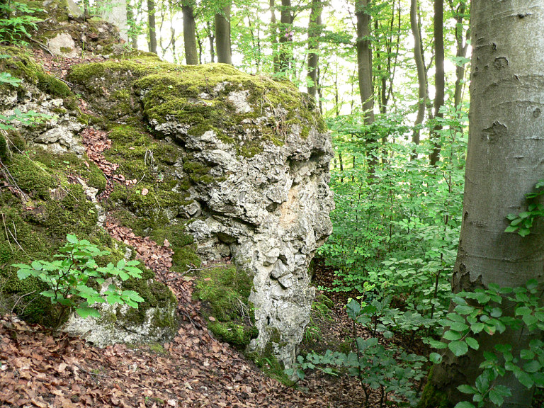




Rittergut Bisperode
Monument and historic site · 4.8 km
1 Försterbrink, Coppenbrügge
Hirschmanns Ruh
Monument and historic site · 5.6 km
Dieser Stein ist gleichzeitung ein dreieckiger Grenzstein.
53 more on the map.
Parks, trails and playgrounds25

Ith Sole Therme
Sports field and stadium · 5.8 km
5 In der Saale-Aue, Salzhemmendorf
08:00-22:00, Mo-Su,PH 09:00-22:00



Waldbad Altenhagen I
Sports field and stadium · 5.6 km
Mo-Fr 13:00-19:00; Sa 12:00-19:00; Su 11:00-19:00


Freibad Brünnighausen
Sports field and stadium · 3.6 km
May-Sep: Mo-Fr 15:00-18:00+; May-Sep: Sa,Su 14:00-18:00+
13 more on the map.
Restaurants and cafes37

Stuckis Sennhütte
Restaurant · Regional · 5.7 km
1, Salzhemmendorf
Tu,Th off; Mo,We,Fr 11:30-17:00; Sa-Su,PH 11:00-19:00
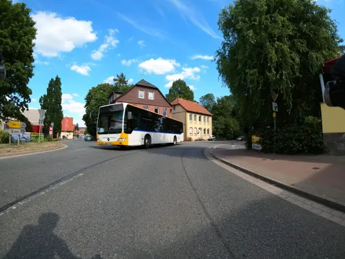
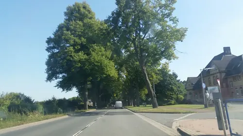
Imbiss am Bahnhof
Restaurant · Pizza, Barbecue, Fries, Gyros · 0.8 km
Pizza u. Gyros, Grill; mit Sitzplätzen und Terrasse
Tu,We,Fr,Sa 11:30-21:00; Su 16:00-21:00
Ratskeller
Restaurant · Regional · 6.5 km
43 Hauptstraße, Salzhemmendorf
We-Su 17:30-22:00; Fr-Su 11:30-14:00
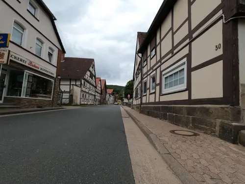


Bäckerei Bohne
Bakery · 4.6 km
21 Im Flecken, Salzhemmendorf
Mo 06:00-12:00; Tu-Fr 06:00-13:00, 15:00-18:00; Sa 06:00-12:00; Su...

Café am Waldkater
Cafe · 7.9 km
2 Waldkaterstraße, Springe
Mo off; Tu-Fr 14:00-20:00; Sa-Su 11:00-21:00

25 more on the map.
History
Coppenbrügge was first documented around 1000 in a borderline description of the Bishopric of Hildesheim as Cobbanbrug mentioned. On March 9, 1062, Emperor Henry IV granted Bishop Hezilo of Hildesheim the forest ban at Coppenbrügge. Built around 1200 Count Bernhard of Poppenburg, who sat on the castle Poppenburg, the mirror castle at Lauenstein. After that he called himself Bernhard von Poppenburg and Spiegelberg. The Spiegelburg was built in the valley between Ith and Osterwald on the old army and trade route near a swamp area. The road was Hellweg, which led from Aachen to Königsberg. After that it was the Reichsstraße 1 and today the federal highway No. 1. From 1217, Count Bernhard called himself only "von Spiegelberg".
In 1226 a feud broke out between Bernhard von Spiegelberg and Bodo von Homburg. In 1238, the Homburgs conquered the castle Spiegelberg, the Counts of Spiegelberg left the country. In 1247, the Homburgs built the castle Lauenstein. In 1260 Johann von Brünnighausen handed over his property to the bishop of Minden. This property was handed over to Count von Spiegelberg in 1281, which gave rise to the Counts of Spiegelberg and the main town of Coppenbrügge. Around 1300, the Spiegelberg donated land to the Carmelites to build their monastery in Marienau, and in 1303 Coppenbrügge Castle was rebuilt.
From the History section of Coppenbrügge on Wikipedia, under CC BY-SA 4.0.
Where to stay9
Churches and places of worship19
St. Nicolaus Kirche (Ev.-luth)
Church · Lutheran · 6.9 km
1 Kirchweg, Salzhemmendorf
Shopping8
Gas and EV charging5
Schools, colleges and libraries11
Healthcare5
Map of Coppenbrügge
220 places. The map loads OpenStreetMap tiles when you open it.
Getting there and nearby towns
Hannover Airport (HAJ) is the nearest airport with scheduled flights listed in OpenStreetMap, 39 km away.
- Salzhemmendorf 6 km southeast, about 6 min by car
- Springe 10 km north, about 10 min by car
- Bad Münder am Deister 10 km northwest, about 10 min by car
- Hameln 13 km west, about 13 min by car
- Elze 13 km east, about 13 min by car
- Nordstemmen 17 km east, about 17 min by car
- Gronau 16 km east, about 16 min by car
- Wennigsen 17 km north, about 17 min by car
- Egestorf 19 km north, about 19 min by car
- Hessisch Oldendorf 21 km west, about 21 min by car
Drive times are estimates from straight-line distance, not routes.
Local news
Headlines from INDB.
Reviews, tips and questions
Loading what members have shared...
Sources and licences
- GeoNames (CC BY 4.0): population, coordinates, regions and time zone
- Mapillary (see each image): photos
- OpenStreetMap contributors (ODbL 1.0): places, airports, map data
- Wikidata (CC0 1.0): elevation, founding date, time zone, website, landmarks and historic places
- Wikimedia Commons (see each image): photos
- Wikipedia (CC BY-SA 4.0): overview and history text
Photo credits
- Coppenbruegge Burg, No machine-readable author provided. Perry210174 assumed (based on copyright claims)., Public domain
- Plaque commémorative de la visite de Pierre le Grand au château de Coppenbrügge en 1697, Gokimines, CC0
- Coppenbrügge Burg 02, ErwinMeier, CC BY-SA 4.0
- Coppenbrügge Burg 03, ErwinMeier, CC BY-SA 4.0
- Coppenbrügge Burg 01, ErwinMeier, CC BY-SA 4.0
- Saint Nicholas Kirche Coppenbrügge 01, Clemensfranz, CC BY-SA 4.0
- Coppenbrügge St. Nicolai 01, ErwinMeier, CC BY-SA 4.0
- Coppenbrügge St. Nicolai 02, ErwinMeier, CC BY-SA 4.0
- Coppenbrügge St. Nicolai 03, ErwinMeier, CC BY-SA 4.0
- Pfarrhaus Coppenbrügge, Clemensfranz, CC BY-SA 4.0
- Saint Nicholas Kirche Coppenbrügge 05, Clemensfranz, CC BY-SA 4.0
- Saint Nicholas Kirche Coppenbrügge 04, Clemensfranz, CC BY-SA 4.0
- Saint Nicholas Kirche Coppenbrügge 03, Clemensfranz, CC BY-SA 4.0
- Saint Nicholas Kirche Coppenbrügge 02, Clemensfranz, CC BY-SA 4.0
- Leichenhalle Friedhof Coppenbrügge, Clemensfranz, CC BY-SA 4.0
- Altes Rathaus Bad Muender, Maren Kaltenbach at German Wikipedia Later version(s) were uploaded by BLueFiSH.as at de.wikipedia . ( Original text: M.Kaltenbach ), CC BY-SA 3.0
- Barenburg Berg, Axel Hindemith at German Wikipedia, Public domain
- St. Avold - Der See 1, Ragnar1904, CC BY-SA 3.0
- Burg Coppenbrügge Panorama, Axel Hindemith, CC BY 3.0
- Hallermund Fundament, Benutzer:Axel Hindemith, Public domain
- Kukesburg Wall, AxelHH at German Wikipedia, Public domain
- Luftbild 1996 Krankenhaus Lindenbrunn, Lindenbrunn, Public domain
- Steinbruch Holzmühle (3), Ragnar1904, CC BY-SA 3.0
- Hüttenstollen Osterwald Mundloch, Axel Hindemith, Public domain
- Ith Turm laubfrei Winter, Axel Hindemith, CC BY 3.0
- Naturschutzgebiet Naturwald Saubrink-Oberberg - Hangwald (2), Ragnar1904, CC BY-SA 4.0
- Naturschutzgebiet Saupark - Kleiner Deister - Durch Windbruch verpserrter Weg, Lotte76, CC BY-SA 4.0
- Coppenbrügge Kirche Altarraum, Katanga ( Diskussion ) 21:45, 21. Mai 2013 (CEST), CC BY-SA 3.0
- Kirche Bäntorf, Katanga ( Diskussion ) 17:17, 9. Mai 2013 (CEST), CC BY-SA 3.0
- Hutewald im Winter im Wisentgehege Springe, Michael Gäbler, CC BY 3.0
- Naturschutzgebiet Saupark - Kleiner Deister - Felsformation der oberen Jura (Korallenoolith) (7), Lotte76, CC BY-SA 4.0
- HemmendorfKirche, Torbenbrinker, CC BY-SA 3.0
- Kirche Salzhemmendorf, Clemensfranz, CC BY-SA 4.0
- St.Vincenz-Kirche in Altenhagen I (Springe) IMG 6393, Losch, CC BY-SA 3.0 de
- Salzhemmendorf Lauenstein Im Flecken, Clemensfranz, CC BY-SA 3.0
- Altenhagen I, Morgenruhe - Ehrenmal, Den man tau, CC BY-SA 4.0
- 11 St. Annen-Kapelle, Werner Ochs, CC BY-SA 3.0
- Ehemalige Burg Lauenstein (Niedersachsen) 1654 (Ausschnitt), Conrad Buno (Zeichnung/drawing), Caspar Merian (Stich/engraving), Public domain
- Hauptteingang Krankenhaus Lindenbrunn 2007, Lindenbrunn, Public domain
- NSG HA 097 Naturwald Saubrink und Oberberg - Wald (15), Lotte76, CC BY-SA 4.0
- Sassenburg Schecken Zugang Nordwest von aussen, Axel Hindemith, CC BY-SA 4.0
- Ith Sole Therme - panoramio, Stephan Czarnowski, CC BY-SA 3.0
- Street-level photo, Langfahrer, CC BY-SA 4.0
- Street-level photo, cageythree, CC BY-SA 4.0
- Street-level photo, elgaard, CC BY-SA 4.0
- Street-level photo, Langfahrer, CC BY-SA 4.0
- Street-level photo, hoschi, CC BY-SA 4.0
- Street-level photo, cageythree, CC BY-SA 4.0
- Street-level photo, Langfahrer, CC BY-SA 4.0
- Street-level photo, thetornado76, CC BY-SA 4.0
- Street-level photo, Hightower-, CC BY-SA 4.0
- Street-level photo, Langfahrer, CC BY-SA 4.0
- Street-level photo, fischtown, CC BY-SA 4.0
- Street-level photo, hotteliene, CC BY-SA 4.0
- Street-level photo, thetornado76, CC BY-SA 4.0
- Street-level photo, hotteliene, CC BY-SA 4.0


Page built November 9, 2026. Spotted a mistake? Tell us or suggest a place.