


Why visit Dehrn
Townapedia lists 5 museums and landmarks, 5 parks and trails, 6 places to eat, 1 place to stay and 1 attraction in and around town.
Highlights include Schloss Dehrn, Hadamar Euthanasia Centre, Bootsclub Limburg - Hafen Dehrn and Dehrner Auwald und Dehrner Teiche.
Weather in Dehrn
Forecast from MET Norway (CC BY 4.0). Full forecast
Things to do1
Museums and landmarks5

Schloss Dehrn
Monument and historic site · 0.7 km
23 Schloßstraße, Runkel

Hadamar Euthanasia Centre
Museum · 5.2 km
Nazi extermination centre in Hesse, Germany (1941-1945)

Parks, trails and playgrounds5
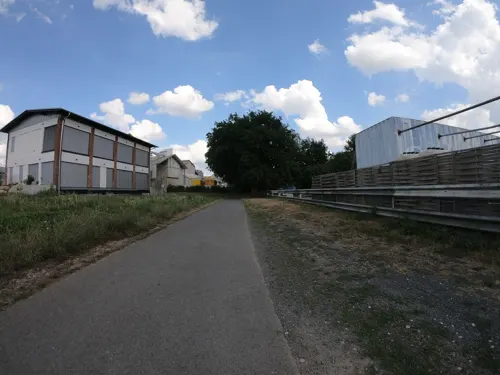

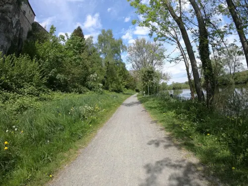
Private Stege / Lubentiushafen
Marina and boat launch · 2.0 km
Rüdiger Möller Tel.: +49[0]163 / 7691260
Restaurants and cafes6

Giuffrida Eiscafé
Cafe · Ice Cream
Das Eis-Café bietet saisonal 8 - 30 Eissorten an; der Inhaber Signore Gentile stellt das Eis selber her. Alle Eiscreationen sind seine...
45 Burgfriedenstraße, Runkel
10:30-18:00

Bäckerei Nordhofen
Bakery · 1.9 km
4 Brunnenstraße, Limburg an der Lahn
Mo-Sa 06:00-12:30; PH off
Nordhofen
Bakery
3 Schloßstraße
Mo,Sa 06:00-12:30; Tu-Fr 06:00-12:30,14:00-18:00; Su 07:30-10:30



Where to stay1
Churches and places of worship9
St. Bartholomäus
Church · Roman Catholic · 2.1 km
21 Kirchstraße, Limburg an der Lahn
St. Lubentius
Church · Catholic · 2.0 km
3 Herrenberg, Limburg an der Lahn
Shopping2
Gas and EV charging3
Schools, colleges and libraries4
Map of Dehrn
36 places. The map loads OpenStreetMap tiles when you open it.
Getting there and nearby towns
Siegerlandflughafen (SGE) is the nearest airport with scheduled flights listed in OpenStreetMap, 32 km away.
- Runkel 4 km east, about 4 min by car
- Elz 5 km west, about 5 min by car
- Hadamar 5 km northwest, about 5 min by car
- Limburg an der Lahn 5 km southwest, about 5 min by car
- Villmar 7 km southeast, about 7 min by car
- Diez 8 km southwest, about 8 min by car
- Weilburg 14 km northeast, about 14 min by car
- Langendernbach 14 km north, about 14 min by car
- Mengerskirchen 16 km north, about 16 min by car
- Selters 17 km northeast, about 17 min by car
Drive times are estimates from straight-line distance, not routes.
Local news
Headlines from INDB.
Reviews, tips and questions
Loading what members have shared...
Sources and licences
- GeoNames (CC BY 4.0): population, coordinates, regions and time zone
- Mapillary (see each image): photos
- OpenStreetMap contributors (ODbL 1.0): places, airports, map data
- Wikidata (CC0 1.0): elevation, founding date, time zone, website, landmarks and historic places
- Wikimedia Commons (see each image): photos
Photo credits
- Dehrn Sueden, Volker Thies ( Asdrubal ), CC BY-SA 3.0
- Blick auf Dehrn - geo.hlipp.de - 39279, Uwe Seibert on geo.hlipp.de, CC BY-SA 2.0
- Burg Dehrn, Turm vermutlich aus dem 3. Jh. - panoramio, qwesy qwesy, CC BY 3.0
- 2020-07-09 Eiche bei Schloss Dehrn in Runkel (Hessen), Yvonne Bentele, CC BY-SA 4.0
- 2020-07-09 Pyramideneiche bei Schloss Dehrn in Runkel (Hessen) 01, Yvonne Bentele, CC BY-SA 4.0
- 2020-07-09 Pyramideneiche bei Schloss Dehrn in Runkel (Hessen) 02, Yvonne Bentele, CC BY-SA 4.0
- 2020-07-09 Pyramideneiche bei Schloss Dehrn in Runkel (Hessen) 03, Yvonne Bentele, CC BY-SA 4.0
- Dehrn - Burg, Oliver Abels ( SBT ), CC BY 2.5
- Hadamar 012, Frank Winkelmann, CC BY 3.0
- Limburger Dom Bild 4, Phantom3Pix, CC BY-SA 4.0
- Ahlbach Kirche aussen, Volker Thies ( Asdrubal ), CC BY-SA 3.0
- Steeden Johanneskapelle, Volker Thies ( Asdrubal ), CC BY-SA 3.0
- Dehrner Teich, Jokdesign, CC BY 4.0
- Dehrn Kirche, Volker Thies ( Asdrubal ), CC BY-SA 3.0
- Dehrn Nikolauskapelle, Volker Thies ( Asdrubal ), CC BY-SA 3.0
- Burg Dehrn 2016, DIZer, CC BY-SA 4.0
- Runkel, Dehrn, Schloss 20161128-002, Tilman2007, CC BY-SA 4.0
- Limburg an der Lahn-Dietkirchen-St Lubentius von Osten-20120715, Mylius, GFDL 1.2
- Bee to be, Frank von der Lahn, CC BY-SA 4.0
- Industrieanlage bei Steeden - geo.hlipp.de - 39278, Uwe Seibert on geo.hlipp.de, CC BY-SA 2.0
- Hundsangen, St. Goar (05), Subbass1, CC BY-SA 4.0
- Kalkwerksanlage Steeden der Schaefer Kalk, Bulli17Steeden, CC BY-SA 4.0
- Taunusblick Ahlbach, Kreuzschnabel, CC BY-SA 3.0
- Limburg an der Lahn-Dietkirchen-St Lubentius-Detail von Nordosten-20120715, Mylius, GFDL 1.2
- Neuer Stammsitz in Limburg-Offheim, Annika Trappmann, CC BY-SA 4.0
- Limburg an der Lahn-Dietkirchen-St Lubentius-Inneres-Mittelschiff-Holzdecke-20120819, Mylius, GFDL 1.2
- Limburg an der Lahn-Dietkirchen-St Lubentius-Inneres-Lubentiuskapelle-Detail Buestenreliquiar-20120819, Mylius, GFDL 1.2
- Kirche in Dietkirchen - geo.hlipp.de - 39280, Uwe Seibert on geo.hlipp.de, CC BY-SA 2.0
- Limburg an der Lahn-Dietkirchen-St Lubentius-Uebergang Langhaus Querhaus und Dreifaltigkeitskapelle von Suedwesten-20120819, Mylius, GFDL 1.2
- Blick auf das Unterdorf in Steeden, Bulli17, CC BY-SA 4.0
- Lange Mail Richtung Obertiefenbach DSC 3702, Nassauer27, CC BY-SA 4.0
- Dietkirchen - Lubentiusbasilika - panoramio (1), qwesy qwesy, CC BY 3.0
- St. Lubentius Lahnbrücke, Polibil, CC BY-SA 4.0
- Street-level photo, ledersau, CC BY-SA 4.0
- Street-level photo, ledersau, CC BY-SA 4.0
- Street-level photo, kreuzschnabel, CC BY-SA 4.0
- Street-level photo, troher15, CC BY-SA 4.0
- Street-level photo, grinninghamster, CC BY-SA 4.0
- Street-level photo, grinninghamster, CC BY-SA 4.0
- Street-level photo, grinninghamster, CC BY-SA 4.0
- Street-level photo, grinninghamster, CC BY-SA 4.0
- Street-level photo, grinninghamster, CC BY-SA 4.0
- Street-level photo, troher15, CC BY-SA 4.0


Page built November 9, 2026. Spotted a mistake? Tell us or suggest a place.