


Why visit Runkel
Townapedia lists 32 museums and landmarks, 24 parks and trails, 61 places to eat, 9 places to stay and 14 attractions in and around town.
Highlights include Alte Lahnbrücke, Marmorbrücke, Lahn-Marmor-Museum and Schloss Dehrn.
Weather in Runkel
Forecast from MET Norway (CC BY 4.0). Full forecast
About Runkel
Runkel (German pronunciation: [ˈʁʊŋkl̩] ) is a town on the river Lahn in Limburg-Weilburg district in Hesse, Germany.
From the Wikipedia article Runkel (this version), under CC BY-SA 4.0.
Things to do14




2 more on the map.
Museums and landmarks32

Lahn-Marmor-Museum
Museum · 2.5 km
4 Oberau, Villmar
Mar-Oct Tu-Fr 14:00-17:00; Mar-Oct Sa,Su 10:00-17:00

Schloss Dehrn
Monument and historic site · 4.5 km
23 Schloßstraße, Runkel





20 more on the map.
Parks, trails and playgrounds24



Bootsclub Limburg - Hafen Dehrn
Marina and boat launch · 3.8 km



Private Stege / Lubentiushafen
Marina and boat launch · 4.1 km
Rüdiger Möller Tel.: +49[0]163 / 7691260
12 more on the map.
Restaurants and cafes61
L'Osteria
Restaurant · Italian · 5.2 km
14 Brüsseler Straße, Limburg an der Lahn
Mo-Th,Su,PH 11:30-22:00; Fr-Sa 11:30-23:00
Pizzeria Capri
Restaurant · Pizza · 3.6 km
47 Bahnhofstraße, Limburg an der Lahn
Mo,We,Th,Fr,Sa 10:00-14:00, 17:00-22:00; Su,PH 16:30-22:00

Ristorante Amalfi
Restaurant · Italian · 0.7 km
1 August-Gerhardt-Straße, Runkel
We-Mo 11:30-14:30,17:30-22:30; Tu off

Gaststätte "Nassauer Hof"
Restaurant · 3.2 km
56 Peter-Paul-Straße, Villmar
Fr 17:00-24:00; Sa,Su 18:00-23:30
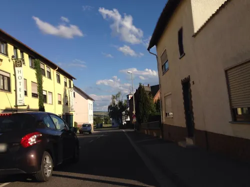
Hotel-Restaurant Landhaus Schaaf
Restaurant
15 Oberstraße, Runkel
Mo-Sa 11:30-14:00,17:30-21:30; Su 11:30-14:00,17:30-21:00; Mo off
Giuffrida Eiscafé
Cafe · Ice Cream · 4.3 km
Das Eis-Café bietet saisonal 8 - 30 Eissorten an; der Inhaber Signore Gentile stellt das Eis selber her. Alle Eiscreationen sind seine...
45 Burgfriedenstraße, Runkel
10:30-18:00
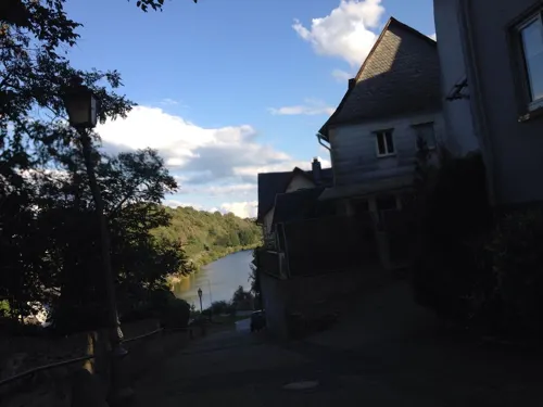
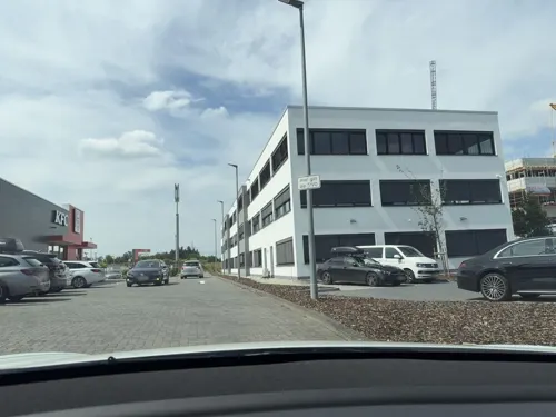


Schäfer Dein Bäcker
Bakery · 5.3 km
4 Vinzenz-Pallotti-Straße, Limburg an der Lahn
Mo-Fr 05:00-19:00; Sa 05:00-18:00; Su 07:00-18:00
49 more on the map.
History
The town's first documentary mention came in 1159 in an enfeoffment document in which a nobleman named Siegfried von Runkel had his name appear as a witness. It is believed that this Siegfried was the one who built Runkel Castle. In 1191 Siegfried married a countess of Katzenelnbogen. This high noble family forced Dietrich of Runkel to open his castles Runkel and Dehrn. No later than 1230, the castle had a chapel, thereby giving Runkel its first church building. In 1288, after years of family disputes, the Lords of Runkel and those of Westerburg sundered into two lines. In 1440, building work began on the Lahn bridge, but owing to the rift between the Runkels and the Westerburgs, the work took until 1448. In 1447 Count Philipp of Katzenelnbogen was the liege lord.
In 1543, Count Johann IV of Wied had Philipp Melanchthon as a guest at Runkel Castle. In 1568, the Reformation was introduced. In 1622, there was yet another family rift when Count Hermann II at Wied drove his younger brother Philipp Ludwig out of the leadership and indeed from the castle. In 1634, the town and the castle were largely destroyed by Count Johann Ludwig Hektor von Isolani's troops in the Thirty Years' War. In 1649, the castle's dwelling buildings were newly built as a residential castle.
From the History section of Runkel on Wikipedia, under CC BY-SA 4.0.
Where to stay9
Churches and places of worship35
Barockkirche St. Peter und Paul
Church · Catholic · 2.9 km
1 Peter-Paul-Straße
Kirche St. Marien
Church · Catholic · 4.5 km
2 Grabenstraße, Beselich
St. Lubentius
Church · Catholic · 4.1 km
3 Herrenberg, Limburg an der Lahn
Shopping16
Gas and EV charging12
Tesla Supercharger - Limburg an der Lahn
EV charging · 5.4 km
1 Vinzenz-Pallotti-Straße, Limburg an der Lahn
Schools, colleges and libraries11
Healthcare4
Apotheke im Goldener Grund
Clinic and pharmacy · 5.0 km
18 Limburger Straße, Brechen
Map of Runkel
218 places. The map loads OpenStreetMap tiles when you open it.
Getting there and nearby towns
Siegerlandflughafen (SGE) is the nearest airport with scheduled flights listed in OpenStreetMap, 34 km away.
- Villmar 3 km southeast, about 3 min by car
- Limburg an der Lahn 8 km west, about 8 min by car
- Hadamar 9 km northwest, about 9 min by car
- Diez 11 km west, about 11 min by car
- Weilburg 12 km northeast, about 12 min by car
- Bad Camberg 15 km southeast, about 15 min by car
- Selters 16 km northeast, about 16 min by car
- Weilmünster 16 km east, about 16 min by car
- Braunfels 21 km northeast, about 21 min by car
- Idstein 22 km south, about 22 min by car
Drive times are estimates from straight-line distance, not routes.
Local news
Headlines from INDB.
Reviews, tips and questions
Loading what members have shared...
Sources and licences
- GeoNames (CC BY 4.0): population, coordinates, regions and time zone
- Mapillary (see each image): photos
- OpenStreetMap contributors (ODbL 1.0): places, airports, map data
- Wikidata (CC0 1.0): elevation, founding date, time zone, website, landmarks and historic places
- Wikimedia Commons (see each image): photos
- Wikipedia (CC BY-SA 4.0): overview and history text
Photo credits
- Aerial fg064 DSC 1256 Runkel, Fritz Geller-Grimm, CC BY-SA 3.0
- Runkel an der Lahn - Burg Runkel und Lahnbrücke (2014), Bytfisch, CC BY-SA 3.0 de
- Runkel, Burgstraße 9, 2025-08 CN-01, Steffen Schmitz ( more photos ), CC BY-SA 4.0
- Runkel Burgstr 01, Christian Bickel, CC BY-SA 2.0 de
- Runkel Burgstr 02, Christian Bickel, CC BY-SA 2.0 de
- Runkel, Burg, 2025-08 CN-06, Steffen Schmitz ( more photos ), CC BY-SA 4.0
- Runkel, Burg, 2025-08 CN-07, Steffen Schmitz ( more photos ), CC BY-SA 4.0
- Runkel Castle 04, Christian Bickel, CC BY-SA 2.0 de
- Runkel, Burg, 2025-08 CN-08, Steffen Schmitz ( more photos ), CC BY-SA 4.0
- Runkel Fachwerk Obertorstr SAM 0717 20200430, Karlunun, CC BY-SA 4.0
- Runkel Burg Tor Detail 75 SAM 0719 20200430, Karlunun, CC BY-SA 4.0
- Runkel, Burg, 2025-08 CN-05, Steffen Schmitz ( more photos ), CC BY-SA 4.0
- Runkel, Evangelische Kirche, 2025-08 CN-01, Steffen Schmitz ( more photos ), CC BY-SA 4.0
- Burg Runkel - panoramio (1), qwesy qwesy, CC BY 3.0
- Runkel, Evangelische Kirche, 2025-08 CN-05, Steffen Schmitz ( more photos ), CC BY-SA 4.0
- Runkel, Evangelische Kirche, 2025-08 CN-06, Steffen Schmitz ( more photos ), CC BY-SA 4.0
- Runkel, Evangelische Kirche, 2025-08 CN-04, Steffen Schmitz ( more photos ), CC BY-SA 4.0
- Burg Runkel-02-Museum, Muck, CC BY-SA 4.0
- Burg Runkel-01-Unterburg, Muck, CC BY-SA 4.0
- Runkel, Burg, 2025-08 CN-13, Steffen Schmitz ( more photos ), CC BY-SA 4.0
- Runkel, Burg, 2025-08 CN-15, Steffen Schmitz ( more photos ), CC BY-SA 4.0
- Runkel, Evangelische Kirche, 2025-08 CN-02, Steffen Schmitz ( more photos ), CC BY-SA 4.0
- Runkel, Evangelische Kirche, 2025-08 CN-03, Steffen Schmitz ( more photos ), CC BY-SA 4.0
- Runkel, Burg, 2025-08 CN-14, Steffen Schmitz ( more photos ), CC BY-SA 4.0
- Runkel Castle 02, Christian Bickel, CC BY-SA 2.0 de
- Runkel Castle 03, Christian Bickel, CC BY-SA 2.0 de
- Runkel Castle 01, Christian Bickel, CC BY-SA 2.0 de
- Runkel, Burg, 2025-08 CN-12, Steffen Schmitz ( more photos ), CC BY-SA 4.0
- Runkel, Burg, 2025-08 CN-09, Steffen Schmitz ( more photos ), CC BY-SA 4.0
- Runkel, Burg, 2025-08 CN-10, Steffen Schmitz ( more photos ), CC BY-SA 4.0
- Runkel Burg NW 165 SAM 0713 20200430, Karlunun, CC BY-SA 4.0
- Runkel Linsenberg Lahn 120 SAM 0723 20200430, Karlunun, CC BY-SA 4.0
- Burg Runkel - geo.hlipp.de - 38318, Uwe Seibert on geo.hlipp.de, CC BY-SA 2.0
- Runkel, Burg, 2025-08 CN-11, Steffen Schmitz ( more photos ), CC BY-SA 4.0
- Burg Runkel-06-Aussicht-2, Muck, CC BY-SA 4.0
- Burg Runkel-07-Aussicht-3, Muck, CC BY-SA 4.0
- Burg Runkel-05-Aussicht-1, Muck, CC BY-SA 4.0
- Berger Kirche Seite, Volker Thies ( Asdrubal ), CC BY-SA 3.0
- Limburger Dom Bild 4, Phantom3Pix, CC BY-SA 4.0
- Limburg an der Lahn-Dietkirchen-St Lubentius von Osten-20120715, Mylius, GFDL 1.2
- Runkel01 2011-10-02, KlausFoehl, CC BY-SA 3.0
- Biurg Schadeck-1, Holger Stegemann, CC BY-SA 3.0
- Arfurt Kirchenportal, Volker Thies ( Asdrubal ), CC BY-SA 3.0
- Alte Lahnbrücke Runkel, Mr.Nutt, CC BY-SA 3.0
- Villmar - Marmorbrücke, Santiago2000, CC BY-SA 3.0
- Runkel Amtsapotheke, Volker Thies ( Asdrubal ), CC BY-SA 3.0
- Lahn-Marmor-Museum Villmar, Christof Ellger, CC BY-SA 4.0
- Ennerich Kirche, Volker Thies ( Asdrubal ), CC BY-SA 3.0
- Seelbach Kirche, Volker Thies ( Asdrubal ), CC BY-SA 3.0
- Villmar, Mattheiser Turm (1), Karsten Ratzke, CC0
- Niedertiefenbach Kirche, Volker Thies ( Asdrubal ), CC BY-SA 3.0
- Schupbach Kirche, Volker Thies ( Asdrubal ), CC BY-SA 3.0
- Runkeler Laach, Stefan Flöper, CC BY-SA 4.0
- Wehrley von Runkel, (5), Karsten Ratzke, CC0
- NSG Bleidenberg bei Niederbrechen, 3, Niederbrechen, Brechen, Landkreis Limburg-Weilburg, GeorgDerReisende, CC BY-SA 4.0
- 2021.02.28 Eich von Niederbrechen, Jurgenszablewski, CC BY-SA 4.0
- Dehrner Teich, Jokdesign, CC BY 4.0
- Dehrn Nikolauskapelle, Volker Thies ( Asdrubal ), CC BY-SA 3.0
- Burg Dehrn 2016, DIZer, CC BY-SA 4.0
- Beselich Klosterruine, Volker Thies ( Asdrubal ), CC BY-SA 3.0
- Dietkirchen Kriegsgraeber Iren, Volker Thies ( Asdrubal ), CC BY-SA 3.0
- Kirche Villmar, Mr.Nutt, CC BY-SA 3.0
- Street-level photo, miguel_andrade, CC BY-SA 4.0
- Street-level photo, miguel_andrade, CC BY-SA 4.0
- Street-level photo, kreuzschnabel, CC BY-SA 4.0
- Street-level photo, stili, CC BY-SA 4.0
- Street-level photo, grinninghamster, CC BY-SA 4.0
- Street-level photo, troher15, CC BY-SA 4.0
- Street-level photo, miguel_andrade, CC BY-SA 4.0
- Street-level photo, kreuzschnabel, CC BY-SA 4.0
- Street-level photo, miguel_andrade, CC BY-SA 4.0
- Street-level photo, troher15, CC BY-SA 4.0
- Street-level photo, troher15, CC BY-SA 4.0
- Street-level photo, grinninghamster, CC BY-SA 4.0
- Street-level photo, stili, CC BY-SA 4.0
- Street-level photo, ottor, CC BY-SA 4.0
- Street-level photo, ottor, CC BY-SA 4.0
- Street-level photo, poxonline, CC BY-SA 4.0
- Street-level photo, b166er, CC BY-SA 4.0
- Street-level photo, stili, CC BY-SA 4.0
- Street-level photo, wizonede, CC BY-SA 4.0
- Street-level photo, kreuzschnabel, CC BY-SA 4.0


Page built November 9, 2026. Spotted a mistake? Tell us or suggest a place.