


Why visit Mengerskirchen
Townapedia lists 17 museums and landmarks, 10 parks and trails, 15 places to eat, 12 places to stay and 9 attractions in and around town.
Highlights include Knoten, Ruine Maienburg, Schloß Mengerskirchen and Kallenbachtal bei Arborn und Nenderoth.
Weather in Mengerskirchen
Forecast from MET Norway (CC BY 4.0). Full forecast
About Mengerskirchen
Mengerskirchen is a municipality in Limburg-Weilburg district in Hesse, Germany.
From the Wikipedia article Mengerskirchen (this version), under CC BY-SA 4.0.
Things to do9




Museums and landmarks17


Schloß Mengerskirchen
Monument and historic site
3 Schloßstraße, Mengerskirchen



5 more on the map.
Parks, trails and playgrounds10


Stauwurzel des Seeweihers bei Mengerskirchen
Hiking and trails · 1.3 km
Steinbruch Neudorf bei Barig-Selbenhausen
Hiking and trails · 4.8 km




Restaurants and cafes15

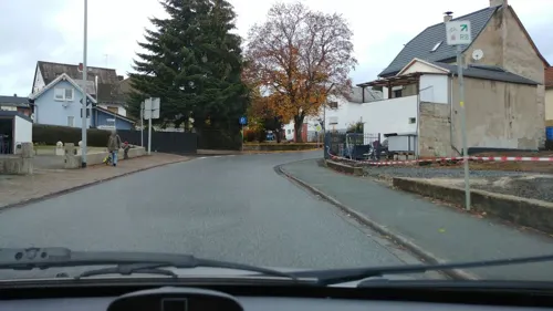
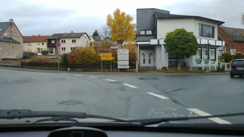

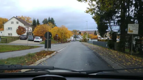


camp bernhards - Bistro am See
Restaurant · 2.0 km
1 Am Seeweiher, Mengerskirchen


3 more on the map.
History
Mengerskirchen had its first documentary mention in a document from the monastery St. Lubentius, Dietkirchen, in 1279. The outlying community of Winkels had already been mentioned in 1243, Waldernbach in 1296, Probbach in 1299 and Dillhausen in 1307. Mengerskirchen was described in 1307 as an “oppidum”. Town rights are documentarily confirmed only on 18 February 1321. In 1481 came market rights, too.
Near Mengerskirchen ran the hill fort wall Rentmauer, affording the community dwellers at that time some protection. There is proof that the community had its own priest and that it also served as the centre of the Calenberg tithing area in 1313, in which year it is believed building work began on Mengerskirchen Castle. Together with the courts of Beilstein, Haimau (today Löhnberg) and Nenderoth, a tithing court was kept on the Kalenbergskopf, a high ridge between Arborn, Mengerskirchen and Nenderoth. In 1481 Friedrich III conferred the privilege for a yearly fair to be held on 14 September near Mengerskirchen.
From 1343 to 1561, Mengerskirchen lay under Nassau-Beilstein rule, then passing along with all Nassau-Beilstein’s holdings back to Nassau-Dillenburg. Count Otto II of Nassau-Dillenburg bequeathed Mengerskirchen to his wife, Adelheid von Vianden as a widow’s seat.
From the History section of Mengerskirchen on Wikipedia, under CC BY-SA 4.0.
Where to stay12
Bundeszentrum Westernohe - Altenberg (der Deutschen Pfadfinderschaft Sankt Georg)
Campground · 4.5 km
50 Zum Weitstein, Westernohe
Churches and places of worship15
Shopping5
Gas and EV charging1
Schools, colleges and libraries2
Healthcare1
Map of Mengerskirchen
87 places. The map loads OpenStreetMap tiles when you open it.
Getting there and nearby towns
Siegerlandflughafen (SGE) is the nearest airport with scheduled flights listed in OpenStreetMap, 17 km away.
- Selters 11 km southeast, about 11 min by car
- Weilburg 12 km southeast, about 12 min by car
- Hadamar 15 km southwest, about 15 min by car
- Herborn 17 km northeast, about 17 min by car
- Sinn 16 km northeast, about 16 min by car
- Braunfels 17 km east, about 17 min by car
- Runkel 18 km south, about 18 min by car
- Solms 18 km east, about 18 min by car
- Haiger 20 km north, about 20 min by car
- Villmar 19 km south, about 19 min by car
Drive times are estimates from straight-line distance, not routes.
Local news
Headlines from INDB.
Reviews, tips and questions
Loading what members have shared...
Sources and licences
- GeoNames (CC BY 4.0): population, coordinates, regions and time zone
- Mapillary (see each image): photos
- OpenStreetMap contributors (ODbL 1.0): places, airports, map data
- Wikidata (CC0 1.0): elevation, founding date, time zone, website
- Wikimedia Commons (see each image): photos
- Wikipedia (CC BY-SA 4.0): overview and history text
Photo credits
- Probbach - Feuerwehr, Oliver Abels ( SBT ), CC BY-SA 3.0
- Mengerskirchen Schloss, Oliver Abels ( SBT ), CC BY 2.5
- Mengerskirchen Schloss 1, Oliver Abels ( SBT ), CC BY-SA 3.0 de
- Mengerskirchen Feuerwehr, Oliver Abels ( SBT ), CC BY-SA 3.0 de
- Mengerskirchen Katarina-Kasper-Haus, Oliver Abels ( SBT ), CC BY-SA 3.0 de
- Mengerskirchen Schloss 2, Oliver Abels ( SBT ), CC BY-SA 3.0 de
- Mengerskirchen Schloss 3, Oliver Abels ( SBT ), CC BY-SA 3.0 de
- Mengerskirchen Schloss 4, Oliver Abels ( SBT ), CC BY-SA 3.0 de
- Mengerskirchen St-Maria-Magdalena, Oliver Abels ( SBT ), CC BY-SA 3.0 de
- Mengerskirchen Cilli Breuers Skulptur, Oliver Abels ( SBT ), CC BY-SA 3.0 de
- Mengerskirchen Hauptstraße Ehemalige Stadtmauer, Oliver Abels ( SBT ), CC BY-SA 3.0 de
- Mengerskirchen Pfarrzentrum, Oliver Abels ( SBT ), CC BY-SA 3.0 de
- Mengerskirchen Hauptstraße Ehemalige Stadtmauer 3, Oliver Abels ( SBT ), CC BY-SA 3.0 de
- Mengerskirchen St-Maria-Magdalena 3, Oliver Abels ( SBT ), CC BY-SA 3.0 de
- Mengerskirchen Hauptstraße 75, Oliver Abels ( SBT ), CC BY-SA 3.0 de
- Mengerskirchen St-Maria-Magdalena 2, Oliver Abels ( SBT ), CC BY-SA 3.0 de
- Mengerskirchen Kirchplatz 4-6, Oliver Abels ( SBT ), CC BY-SA 3.0 de
- Kriegerdenkmal Friedhof Mengerskirchen, PSMH 1, CC BY-SA 4.0
- Mengerskirchen Hauptstraße 96a Museumsscheune, Oliver Abels ( SBT ), CC BY-SA 3.0 de
- Mengerskirchen Hauptstraße 96a Museumsscheune 2, Oliver Abels ( SBT ), CC BY-SA 3.0 de
- Mengerskirchen Franz-Leuninger-Schule, Oliver Abels ( SBT ), CC BY-SA 3.0 de
- Mengerskirchen Franz-Leuninger-Schule 2, Oliver Abels ( SBT ), CC BY-SA 3.0 de
- Knoten 1, Kurt + Else Dietrich, CC BY-SA 3.0
- Mengerskirchen Maienburg, Oliver Abels ( SBT ), CC BY 2.5
- Heiligenhaus, P.J.Schaefer, CC BY-SA 4.0
- Dillhausen - Portal St Laurentius, Oliver Abels ( SBT ), CC BY-SA 3.0
- Herz-Jesu-Kapelle, P.J.Schaefer, CC BY-SA 4.0
- Probbach - St Michaelis, Oliver Abels ( SBT ), CC BY-SA 3.0
- Mengerskirchen Waldernbach Kirche, Oliver Abels ( SBT ), CC BY 2.5
- Mengerskirchen Winkels Kirche, Oliver Abels ( SBT ), CC BY 2.5
- Kallenbachtal bei Arborn und Nenderoth 12, Otto Domes, CC BY-SA 4.0
- Elsoff - Katholische Pfarrkirche St. Peter und Paul (KD.RLP 3 07.2015), Oliver Abels, CC BY-SA 4.0
- OberrodStJoseph6, LigaDue, CC BY-SA 4.0
- Schlossstraße 1, Fachwerkhaus im Schlosshof, P.J.Schaefer, CC BY-SA 4.0
- Wohnhaus Hauptstr 68, P.J.Schaefer, CC BY-SA 4.0
- Am Funkenberg 3, P.J.Schaefer, CC BY-SA 4.0
- Kirchplatz 19, P.J.Schaefer, CC BY-SA 4.0
- Hauptstr 80+82, P.J.Schaefer, CC BY-SA 4.0
- Ringstr 8, P.J.Schaefer, CC BY-SA 4.0
- Ringstr 5, P.J.Schaefer, CC BY-SA 4.0
- Baums Kreuz, P.J.Schaefer, CC BY-SA 4.0
- Reichenborn Ereigniswald, Oliver Abels ( SBT ), CC BY-SA 3.0
- Street-level photo, kreuzschnabel, CC BY-SA 4.0
- Street-level photo, kreuzschnabel, CC BY-SA 4.0
- Street-level photo, kreuzschnabel, CC BY-SA 4.0
- Street-level photo, kreuzschnabel, CC BY-SA 4.0
- Street-level photo, marcomaus, CC BY-SA 4.0


Page built November 9, 2026. Spotted a mistake? Tell us or suggest a place.