


Limburg an der Lahn, Germany
Limburg an der Lahn is a town of 33,820 people in Hesse, Germany.
Why visit Limburg an der Lahn
Townapedia lists 56 museums and landmarks, 29 parks and trails, 234 places to eat, 28 places to stay and 16 attractions in and around town.
Highlights include Hochbunker Limburg, Alte Lahnbrücke, Diözesanmuseum and Museum im Grafenschloss.
Weather in Limburg an der Lahn
Forecast from MET Norway (CC BY 4.0). Full forecast
About Limburg an der Lahn
Limburg an der Lahn (German pronunciation: [ˈlɪmbʊʁk ʔan deːɐ̯ ˈlaːn], lit. 'Limburg on the Lahn'; officially abbreviated Limburg a. d. Lahn) is the district seat of Limburg-Weilburg in Hesse, Germany.
From the Wikipedia article Limburg an der Lahn (this version), under CC BY-SA 4.0.
Travel tips from other travellers: Limburg an der Lahn on Wikivoyage (CC BY-SA 4.0).
Photos of Limburg an der Lahn


Things to do16



Cineplex
Cinema and theater · 0.9 km
1a Dr.-Wolff-Straße, Limburg an der Lahn
Mo-Th 12:00-21:00; Fr-Su 12:00-23:15


4 more on the map.
Museums and landmarks56

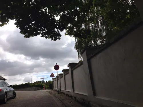
Museum im Grafenschloss
Museum · 3.3 km
8 Schloßberg, Diez
Tu-Fr 09:00-12:00,14:00-17:00; Sa,Su 14:00-17:00

Schloss Dehrn
Monument and historic site · 4.7 km
23 Schloßstraße, Runkel

Hadamar Euthanasia Centre
Museum · 7.5 km
Nazi extermination centre in Hesse, Germany (1941-1945)


Haus Byron
Monument and historic site · 1.2 km
9 Bischofsplatz, Limburg an der Lahn
Brückenturm
Monument and historic site · 1.3 km
1 Inselweg, Limburg an der Lahn



Kunstsammlungen der Stadt Limburg
Museum · 1.1 km
Tu,We 08:30-14:00; Th-Su,PH 12:30-18:00

44 more on the map.
Parks, trails and playgrounds29



Freibad Birlenbach
Sports field and stadium · 4.7 km
Mo-Su 10:00-19:00, "bei schlecher Wetterlage: 10:00-12:00, 17:00-19:00"

Bootsclub Limburg - Hafen Dehrn
Marina and boat launch · 5.4 km
Freibad Elz
Sports field and stadium · 4.4 km
30 Sandweg, Elz
May-Aug: Mo,Tu,Th,Fr 10:00-19:30; May-Aug: We 10:00-20:30;...


Private Stege / Lubentiushafen
Marina and boat launch · 3.9 km
Rüdiger Möller Tel.: +49[0]163 / 7691260

17 more on the map.
Restaurants and cafes234

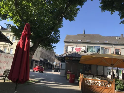
Cafe Extrablatt
Cafe · Coffee Shop · 1.0 km
14 Neumarkt, Limburg an der Lahn
Mo-Su 09:00-24:00; PH 09:00-24:00
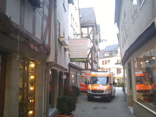
Casa Don Camillo
Restaurant · Italian, Pizza · 1.0 km
4 Plötze, Limburg an der Lahn
Mo,We-Fr 12:00-14:00,17:00-21:00; Sa,Su,PH 12:00-21:00
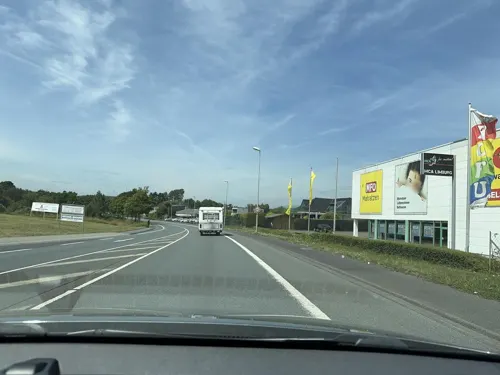
Chin Thai
Restaurant · Asian · 1.8 km
3 Dieselstraße, Limburg an der Lahn
Mo-Su 11:30-15:00, 17:00-23:30
Indian Palace
Restaurant · Indian · 0.7 km
26 Schiede, Limburg an der Lahn
Mo-Su 11:30-14:30,17:30-22:30
Kim Linh Sushi Bar
Restaurant · Asian, Sushi · 0.8 km
3 Bahnhofsplatz, Limburg an der Lahn
Mo,Tu,Th,Fr,Sa 11:00-14:30,17:00-22:00, Su 12:00-14:30,17:00-22:00

Bella Citta Vecchia
Restaurant · Italian, Pizza · 1.1 km
8 Fischmarkt, Limburg an der Lahn
Mo-Su 11:00-23:00
Burgkeller
Restaurant · Regional · 1.1 km
Regional cuisine in an ancient (1650) half-timbered house
10 Fischmarkt, Limburg an der Lahn
Mo-Su 11:00-23:00
Asia Vu
Restaurant · Thai · 3.4 km
40 Mainzer Straße, Limburg an der Lahn
Mo off; Tu-Su,PH 11:00-15:00, 17:00-22:00

Café Will
Cafe · Coffee Shop, Cake · 1.1 km
23 Salzgasse, Limburg an der Lahn
Mo-Sa 09:00-18:00; Su 10:00-18:00
Das neue Mühlchen
Restaurant · Italian · 3.0 km
47 Zum Mühlchen, Diez
Mo-Sa 11:30-14:30,17:00-24:00; Su 10:00-23:30
222 more on the map.
History
About 800 A.D., the first castle buildings arose on the Limburg crags. This was probably designed for the protection of a ford over the river Lahn. In the decades that followed, the town developed under the castle's protection. Limburg is first mentioned in documents in 910 under the name of Lintpurc when Louis the Child granted Konrad Kurzbold an estate in the community on which he was to build a church. Konrad Kurzbold laid the foundation stone for Saint George's Monastery Church, where he was also buried. The community soon increased in importance with the monastery's founding and profited from the lively goods trade on the Via Publica.
In 1150, a wooden bridge was built across the Lahn. The long-distance road from Cologne to Frankfurt am Main subsequently ran through Limburg. In the early 13th century, Limburg Castle was built in its current form. Shortly afterwards, the town passed into the ownership of the Lords of Ysenburg. In 1214, the community was granted town rights. Remains of the fortification wall from the years 1130, 1230 and 1340 with a maximum length of roughly one thousand metres indicate to this day the blossoming town's quick development in the Middle Ages. There is proof of a mint in Limburg in 1180.
Read more of the history
One line of the Lords of Ysenburg resided from 1258 to 1406 at Limburg Castle and took their name from their seat, Limburg. From this line came the House of Limburg-Stirum and also Imagina of Isenburg-Limburg, the wife of the German King Adolf.
The ruling class among the mediaeval townsfolk were rich merchant families whose houses stood right near the castle tower and were surrounded by the first town wall once it was built. The area of today's Rossmarkt ("Horse Market"), in which many simple craftsmen lived, was only brought within the fortifications once the second town wall was built. The inhabitants there, however, unlike the merchant élite, were accorded no entitlement to a voice in town affairs and were not allowed to send representatives to the town council. Nevertheless, they had to bear the main financial burden of running the town. Only in 1458 were they allowed to send two representatives to town council.
Saint George's Cathedral (Sankt-Georgs-Dom) built on the old monastery church's site, and also called Georgsdom, was consecrated in 1235. On 14 May 1289, a devastating fire wiped out great parts of the inner town, although these were subsequently rebuilt. One of the houses built at that time was the Römer 2-4-6, which is today one of Germany's oldest half-timbered houses. In 1337, Limburg's Jews were expelled from the town. Only in 1341 were they once again able to settle in the town, by royal decree. In 1344 a half share of the town was pledged to the Electorate of Trier, and in 1420, the town passed wholly into the ownership of Trier. This event, along with another town fire in 1342, the Black Death in 1349, 1356 and 1365, but above all the rise of the Territorial Princes, led to a gradual decline. In 1315 and 1346, the old stone Lahn Bridge was built (presumably in two sections).
Against the background of the German Peasants' War, unrest also arose among the townsfolk in 1525. After the Elector of Trier had demanded that the townsmen turn a Lutheran preacher out of the town, a board made up of townsmen who were ineligible for council functions handed the council a 30-point comprehensive list of demands on 24 May. It dealt mainly with financial participation and equality in taxation, trade and building issues with the merchant class. In the days that followed, these demands were reduced in negotiations between the council and the board to 16 points, which were likely also taken up with the Elector afterwards. On 5 August, however, Archbishop Richard ordered the council to overturn all concessions to the townsmen. Furthermore, a ban on assembly was decreed, and the ineligible townsmen were stripped of their right to send two representatives to council.
In 1806, Limburg came into the possession of the newly founded Duchy of Nassau. In 1818 the town wall was torn down. In 1827 the town was raised to a Catholic episcopal seat. In 1866 the Duchy and with it Limburg passed to Prussia in the wake of the Austro-Prussian War. As of 1862, Limburg became a railway hub and from 1886 a district seat. In 1892, the Pallottines settled in town, but only the men; the women came in 1895.
During World War I there was a major prisoner of war camp at Limburg an der Lahn. Many Irish members of the British Army were interned there until the end of the war and at one stage they were visited by the Irish republican leader Roger Casement in an attempt to win recruits for the forthcoming Irish rebellion.
From 1919 to 1923, Limburg was the "capital" of a short-lived state called Free State Bottleneck (or Freistaat Flaschenhals in German) because during the Allied occupation of the Rhineland it was effectively cut off from the Weimar Republic in an area the shape of a bottle's neck and subsequently separated from its administration.
In August 1939, shortly before the German invasion of Poland and start of World War II, the German Army established the Dulag G prisoner-of-war camp for Polish POWs in the town. The camp was dissolved in January 1941.
From the History section of Limburg an der Lahn on Wikipedia, under CC BY-SA 4.0.
More about Limburg an der Lahn
Geography
Limburg lies in western Hessen between the Taunus and the Westerwald on the river Lahn.
The town lies roughly centrally in a basin within the Rhenish Slate Mountains which is surrounded by the low ranges of the Taunus and Westerwald and called the Limburg Basin (Limburger Becken). Owing to the favourable soil and climate, the Limburg Basin stands as one of Hesse's richest agricultural regions and moreover, with its convenient Lahn crossing, it has been of great importance to transport since the Middle Ages. Within the basin, the Lahn's otherwise rather narrow lower valley broadens out noticeably, making Limburg's mean elevation only 117 m above sea level.
Limburg forms, together with the town of Diez, a middle centre (in terms of Central place theory) but partially functions as an upper centre to western Middle Hesse.
Limburg's residential neighbourhoods reach beyond the town limits; the neighbouring centres of Elz and Diez run seamlessly together.
Economy
Limburg is a traditional transportation hub. Already in the Middle Ages, the Via Publica crossed the navigable Lahn here. Today the A 3 (Emmerich–Oberhausen–Cologne–Frankfurt–Nuremberg–Passau) and Bundesstraße 8, which both follow the Via Publica's alignment as closely as possible, run through the town. Bundesstraße 49 links Limburg to Koblenz towards the west and Wetzlar and Gießen towards the east. The section between Limburg and Wetzlar is currently being widened to four lanes. This section as far as Obertiefenbach is also known as Die lange Meil ("The Long Mile"). Bundesstraße 54 links Limburg on the one hand with Siegen to the north and on the other by way of Diez with Wiesbaden, which may likewise be reached over Bundesstraße 417 (Hühnerstraße).
As early as 1248, a wooden bridge spanned the Lahn, but was replaced after the flooding in 1306 by a stone bridge, the Alte Lahnbrücke. Other road bridges are the Lahntalbrücke Limburg (1964) on the A 3, the Lahnbrücke near Staffel and the Neue Lahnbrücke from 1968, over which run the Bundesstraßen before they cross under the inner town through the Schiedetunnel, a bypass tunnel.
Arts and culture
The cabaret troupe "Thing", founded more than 25 years ago, moved after a short time from its initial home in the outlying centre of Staffel to the Josef-Kohlmaier-Halle, a civic event hall, where its stage can now be found in the hall's club rooms. The troupe is run by an independent acting club. On the programme are chanson, cabaret, literature and jazz as well as folk, Rock and performances by singer-songwriters. It makes a point of furthering young artists. Each month, three or four events are staged.
The dedication of "Thing" was recognized on 6 December 2003 when the Kulturpreis Mittelhessen ("Middle Hesse Culture Prize") was awarded to it.
Limburg Cathedral has a boys' choir, the Limburger Domsingknaben, which trains at Musical Boarding School in Hadamar, and a girls' choir, the Mädchenkantorei Limburg, both singing at the Limburg Cathedral and internationally.
In Limburg there are several museums. The most important are:
Staurothek, cathedral treasury and diocesan museum with the Limburger Staurothek (a cross reliquary)
Only a few towns, like Limburg, have been able to keep a full set of nearly unscathed mediaeval buildings. The formerly walled town core between St. George's Cathedral, Grabenstraße (a street marking the old town moat) and the 600-year-old Lahn Bridge thus stands today as a whole under monumental protection.
From the Wikipedia article Limburg an der Lahn, under CC BY-SA 4.0.
Notable people from Limburg an der Lahn
 Josef MengesGerman animal trader and trapper (1850-1910)Photo: M. Jung, CC BY-SA 4.0
 Hans-Jürgen IrmerGerman politicianPhoto: Martin Kraft, CC BY-SA 3.0
 Mathias BröckersGerman journalist and writerPhoto: Jean-Frédéric, CC0
 Theo GeiselGerman physicistPhoto: TheQuillAndArchive, CC BY-SA 3.0
 Stephan HartmannGerman philosopherPhoto: Stephanhartmannde, CC BY-SA 4.0
 Martin RendelGerman academicPhoto: Jafa Fass, CC0
 Peter W. MarxGerman theatre scholarPhoto: Pwmarx, CC BY-SA 4.0
 Wolfgang FinkGerman theotectical physicistPhoto: WFink, CC BY-SA 4.0
- Imagina of Isenburg-LimburgGerman Queen, countess of Nassau
- Germar RudolfGerman Holocaust denier
- Stefan SaligerGerman field hockey player
- Tamara BachGerman writer
Born in Limburg an der Lahn, according to Wikidata (CC0). Each name links to its Wikipedia article.
Where to stay28
Pension Zum Weißes Ross
Motel and hotel · Regional, Italian · 1.4 km
2 Westerwaldstraße, Limburg an der Lahn
DJH Jugendherberge Limburg an der Lahn
Motel and hotel · 1.9 km
Auf dem Guckucksberg, Limburg an der Lahn
Churches and places of worship47
Stadtkirche St. Sebastian
Church · Roman Catholic · 1.2 km
4 Bischofsplatz, Limburg an der Lahn
Annakirche, ehem. Klosterkirche St. Wilhelm
Church · Catholic · 1.0 km
2 Hospitalstraße, Limburg an der Lahn
Shopping55
Gas and EV charging29
Schools, colleges and libraries34
Adolf-Reichwein-Schule
School · 2.1 km
14 Heinrich-von-Kleist-Straße, Limburg an der Lahn
Friedrich-Dessauer-Schule
School · 1.7 km
49 Blumenröder Straße, Limburg an der Lahn
Healthcare17
Apotheke WERKStadt Limburg
Clinic and pharmacy · 0.6 km
2d Bahnhofsplatz, Limburg an der Lahn
Map of Limburg an der Lahn
250 places. The map loads OpenStreetMap tiles when you open it.
Getting there and nearby towns
Siegerlandflughafen (SGE) is the nearest airport with scheduled flights listed in OpenStreetMap, 36 km away.
- Diez 3 km west, about 3 min by car
- Elz 4 km north, about 4 min by car
- Dehrn 5 km northeast, about 5 min by car
- Hadamar 7 km north, about 7 min by car
- Runkel 8 km east, about 8 min by car
- Villmar 10 km east, about 10 min by car
- Waldbrunn 16 km north, about 16 min by car
- Montabaur 17 km west, about 17 min by car
- Bad Camberg 18 km southeast, about 18 min by car
- Weilburg 19 km northeast, about 19 min by car
Drive times are estimates from straight-line distance, not routes.
Towns near Limburg an der Lahn


Keep exploring
Local news
Headlines from INDB.
Reviews, tips and questions
Loading what members have shared...
Sources and licences
- GeoNames (CC BY 4.0): population, coordinates, regions and time zone
- Mapillary (see each image): photos
- OpenStreetMap contributors (ODbL 1.0): places, airports, map data
- Wikidata (CC0 1.0): elevation, founding date, time zone, website, landmarks and historic places
- Wikimedia Commons (see each image): photos
- Wikipedia (CC BY-SA 4.0): overview and history text
Photo credits
- DomLimburgLahn27, Danny Busch, DannyBusch at German Wikipedia, CC BY-SA 3.0
- Kastanienallee, 1, Limburg an der Lahn, Landkreis Limburg-Weilburg, GeorgDerReisende, CC BY-SA 4.0
- Parkstraße, 1, Limburg an der Lahn, Landkreis Limburg-Weilburg, GeorgDerReisende, CC BY-SA 4.0
- Parkstraße 20, 1, Limburg an der Lahn, Landkreis Limburg-Weilburg, GeorgDerReisende, CC BY-SA 4.0
- Stolperstein Dr. Adolf Friedländer, 1, Parkstraße 20, Limburg an der Lahn, Landkreis Limburg-Weilburg, GeorgDerReisende, CC BY-SA 4.0
- Stolperstein Ilse Friedländer, 1, Parkstraße 20, Limburg an der Lahn, Landkreis Limburg-Weilburg, GeorgDerReisende, CC BY-SA 4.0
- Stolperstein Babette Sternberg, 1, Parkstraße 18, Limburg an der Lahn, Landkreis Limburg-Weilburg, GeorgDerReisende, CC BY-SA 4.0
- Stolperstein Ernst Lissa, 1, Parkstraße 18, Limburg an der Lahn, Landkreis Limburg-Weilburg, GeorgDerReisende, CC BY-SA 4.0
- Stolperstein Elly Lissa, 1, Parkstraße 18, Limburg an der Lahn, Landkreis Limburg-Weilburg, GeorgDerReisende, CC BY-SA 4.0
- Hadamar 012, Frank Winkelmann, CC BY 3.0
- Berger Kirche Seite, Volker Thies ( Asdrubal ), CC BY-SA 3.0
- Limburger Dom Bild 4, Phantom3Pix, CC BY-SA 4.0
- Burg-Ardeck-Holzheim-JR-G6-3717-2009-08-04, Johannes Robalotoff, CC BY-SA 3.0 de
- Ehemaliger Friedhof Limburg 02, Cirdan, CC BY-SA 3.0
- Marienschule Limburg Altbau, Volker Thies ( Asdrubal ), CC BY-SA 3.0
- Aerial image of the Diez Castle, Carsten Steger, CC BY-SA 4.0
- Diez - Stiftskirche-1, Santiago2000, CC BY-SA 3.0
- Bunker limburg, Frank Winkelmann, CC BY 3.0
- Sophie-Hedwig-Gymnasium, Marc Crecelius, CC BY-SA 4.0
- 121013-Limburg-In der Erbach 3-St.-Johannes-Kapelle, Muns, CC BY-SA 3.0
- Haus Byron 2010, Berthold Werner, Public domain
- 00 5052 Limburg an der Lahn - Kirche, W. Bulach, CC BY-SA 4.0
- Limburg an der Lahn, St. Marien, Südseite, Jan Hubert Pinand, Elke Wetzig ( Elya ), CC BY-SA 3.0
- Evangelische Kirche Limburg an der Lahn 2, Hermann Hammer ( User:Haneburger ), CC0
- 53087 Limburg, Domstraße 12 Burgmannensitz 1, Oliver Abels ( SBT ), CC BY-SA 3.0
- Limburg, Grabenstraße 57, Karsten Ratzke, CC0
- Dehrner Teich, Jokdesign, CC BY 4.0
- Mensfelder Kopf, Blick auf vernebeltes Aar-Tal, N1f1ck, CC BY-SA 4.0
- Dehrn Nikolauskapelle, Volker Thies ( Asdrubal ), CC BY-SA 3.0
- Burg Dehrn 2016, DIZer, CC BY-SA 4.0
- Naturschutzgebiet Steinbruch Fachingen (01), Marion Halft, CC BY-SA 4.0
- Alte Lahnbruecke Limburg 2011 01, Cirdan, CC BY-SA 3.0
- MK37240 Limburger Dom, Martin Kraft, CC BY-SA 3.0
- Runkel, Dehrn, Schloss 20161128-002, Tilman2007, CC BY-SA 4.0
- Diez, Evangelische Stiftskirche (3), Karsten Ratzke, CC0
- Gravestones at Ehemaliger Friedhof Limburg 02, Cirdan, CC BY-SA 3.0
- MK37229 Stadtkirche Limburg, Martin Kraft, CC BY-SA 3.0
- Mensfelder Kopf, Volker Thies ( Asdrubal ), CC BY-SA 3.0
- Limburg - Josefstraße 7–9 (KD.HE 53179 1 08.2015), Oliver Abels, CC BY-SA 4.0
- Limburg - Ehemalige Friedhofskapelle Friedhofsweg (KD.HE 53273 2 08.2015), Oliver Abels, CC BY-SA 4.0
- Street-level photo, troher15, CC BY-SA 4.0
- Street-level photo, bct, CC BY-SA 4.0
- Street-level photo, grinninghamster, CC BY-SA 4.0
- Street-level photo, bestmedia, CC BY-SA 4.0
- Street-level photo, troher15, CC BY-SA 4.0
- Street-level photo, wizonede, CC BY-SA 4.0
- Street-level photo, miguel_andrade, CC BY-SA 4.0
- Street-level photo, changchun1, CC BY-SA 4.0
- Street-level photo, troher15, CC BY-SA 4.0
- Street-level photo, troher15, CC BY-SA 4.0
- Street-level photo, changchun1, CC BY-SA 4.0
- Street-level photo, troher15, CC BY-SA 4.0
- Street-level photo, wizonede, CC BY-SA 4.0
- Street-level photo, stili, CC BY-SA 4.0
- Street-level photo, troher15, CC BY-SA 4.0
- Street-level photo, kalcaaro, CC BY-SA 4.0
- Street-level photo, troher15, CC BY-SA 4.0
- Street-level photo, troher15, CC BY-SA 4.0
- Street-level photo, kreuzschnabel, CC BY-SA 4.0
- Street-level photo, bestmedia, CC BY-SA 4.0
- Street-level photo, bestmedia, CC BY-SA 4.0
- Street-level photo, troher15, CC BY-SA 4.0
- Street-level photo, troher15, CC BY-SA 4.0
- Street-level photo, changchun1, CC BY-SA 4.0
- Street-level photo, txllxt, CC BY-SA 4.0


Page built November 9, 2026. Spotted a mistake? Tell us or suggest a place.