


Why visit Langendernbach
Townapedia lists 8 museums and landmarks, 4 parks and trails, 8 places to eat and 5 attractions in and around town.
Highlights include Braunsberg, Hohe Hahnscheid, Schullandheim Burg Waldmannshausen and Ruine Alte Burg.
Weather in Langendernbach
Forecast from MET Norway (CC BY 4.0). Full forecast
About Langendernbach
Langendernbach is a village in the municipality Dornburg, Limburg-Weilburg district, Hesse, in western Germany.
From the Wikipedia article Langendernbach (this version), under CC BY-SA 4.0.
Things to do5

Museums and landmarks8

Schullandheim Burg Waldmannshausen
Monument and historic site · 3.0 km
39 Frickhofener Straße, Elbtal




Keltisches Opidium
Monument and historic site · 2.5 km
Ehemals riesiges keltisches Opidium...
Parks, trails and playgrounds4



Restaurants and cafes8
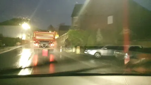
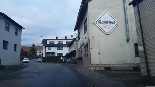
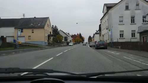
Pizza Bacco
Fast food · Pizza
37 Mainzer Straße, Dornburg
Mo-Sa 16:00-23:00; Su 11:00-23:00
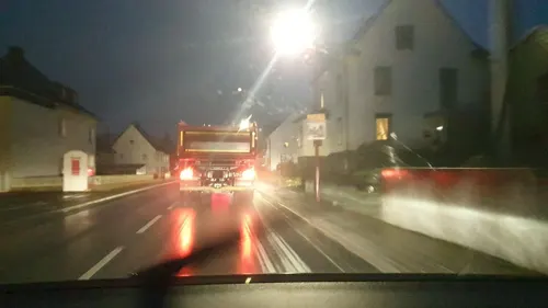
Linie 54
Fast food · Burger, Barbecue, German · 1.6 km
1a Mainzer Landstraße, Irmtraut
Mo-Su 06:00-08:00,11:30-14:00


Churches and places of worship7
Schools, colleges and libraries1
Map of Langendernbach
33 places. The map loads OpenStreetMap tiles when you open it.
Getting there and nearby towns
Siegerlandflughafen (SGE) is the nearest airport with scheduled flights listed in OpenStreetMap, 19 km away.
- Mengerskirchen 8 km east, about 8 min by car
- Hadamar 11 km south, about 11 min by car
- Weilburg 16 km east, about 16 min by car
- Runkel 17 km southeast, about 17 min by car
- Limburg an der Lahn 17 km south, about 17 min by car
- Selters 17 km east, about 17 min by car
- Diez 19 km south, about 19 min by car
- Montabaur 20 km southwest, about 20 min by car
- Villmar 19 km southeast, about 19 min by car
- Leun 22 km east, about 22 min by car
Drive times are estimates from straight-line distance, not routes.
Local news
Headlines from INDB.
Reviews, tips and questions
Loading what members have shared...
Sources and licences
- GeoNames (CC BY 4.0): population, coordinates, regions and time zone
- Mapillary (see each image): photos
- OpenStreetMap contributors (ODbL 1.0): places, airports, map data
- Wikidata (CC0 1.0): elevation, founding date, time zone, website
- Wikimedia Commons (see each image): photos
- Wikipedia (CC BY-SA 4.0): overview and history text
Photo credits
- Langendernbach Luft, Volker Thies ( Asdrubal ), GFDL
- Langendernbach - Volenhof Mainzer Straße 36 (KD.HE 50982 1 06.2015), Oliver Abels, CC BY-SA 4.0
- Langendernbach - Volenhof Mainzer Straße 36 (KD.HE 50982 2 06.2015), Oliver Abels, CC BY-SA 4.0
- Langendernbach - Fachwerkhaus Gemündener Straße 2 und 6 (KD.HE 50975 1 06.2015), Oliver Abels, CC BY-SA 4.0
- Langendernbach - Alter Schmiedeplatz (1 06.2015), Oliver Abels, CC BY-SA 4.0
- Langendernbach - Fachwerkhaus Bahnhofstraße 19 (KD.HE 50971 2 06.2015), Oliver Abels, CC BY-SA 4.0
- Langendernbach - Fachwerkhaus Bahnhofstraße 19 (KD.HE 50971 1 06.2015), Oliver Abels, CC BY-SA 4.0
- Langendernbach - Fachwerkhaus Bahnhofstraße 14 (KD.HE 50970 2 06.2015), Oliver Abels, CC BY-SA 4.0
- Langendernbach - Fachwerkhaus Bahnhofstraße 14 (KD.HE 50970 1 06.2015), Oliver Abels, CC BY-SA 4.0
- Langendernbach - Schule Bahnhofstraße 20 (KD.HE 50972 2 06.2015), Oliver Abels, CC BY-SA 4.0
- Langendernbach - Fachwerkhaus Bahnhofstraße 23 (KD.HE 50973 1 06.2015), Oliver Abels, CC BY-SA 4.0
- Langendernbach - Kulturscheune Kirchstraße 1 (KD.HE 50978 1 06.2015), Oliver Abels, CC BY-SA 4.0
- Langendernbach - Kulturscheune Kirchstraße 1 (KD.HE 50978 2 06.2015), Oliver Abels, CC BY-SA 4.0
- Langendernbach - Fachwerkhaus Bahnhofstraße 23 (KD.HE 50973 2 06.2015), Oliver Abels, CC BY-SA 4.0
- 20170424 Langendernbach St Mathias 424, Jacquesverlaeken, CC BY-SA 4.0
- Langendernbach - Schule Bahnhofstraße 20 (KD.HE 50972 1 06.2015), Oliver Abels, CC BY-SA 4.0
- Langendernbach - Katholische Pfarrkirche St. Matthias (KD.HE 50969 8 06.2015), Oliver Abels, CC BY-SA 4.0
- Langendernbach - Katholisches Pfarrhaus von St. Matthias (KD.HE 50969 3 06.2015), Oliver Abels, CC BY-SA 4.0
- Langendernbach - Katholische Pfarrkirche St. Matthias (KD.HE 50969 7 06.2015), Oliver Abels, CC BY-SA 4.0
- Langendernbach - Villa Westring 16 (KD.HE 50981 1 06.2015), Oliver Abels, CC BY-SA 4.0
- Langendernbach - Katholische Pfarrkirche St. Matthias (KD.HE 50969 5 06.2015), Oliver Abels, CC BY-SA 4.0
- Langendernbach - Katholisches Pfarrhaus von St. Matthias (KD.HE 50969 2 06.2015), Oliver Abels, CC BY-SA 4.0
- Langendernbach - Katholische Pfarrkirche St. Matthias (KD.HE 50969 4 06.2015), Oliver Abels, CC BY-SA 4.0
- Langendernbach - Katholisches Pfarrhaus von St. Matthias (KD.HE 50969 1 06.2015), Oliver Abels, CC BY-SA 4.0
- Langendernbach - Katholische Pfarrkirche St. Matthias (KD.HE 50969 2 06.2015), Oliver Abels, CC BY-SA 4.0
- Langendernbach - Katholische Pfarrkirche St. Matthias (KD.HE 50969 1 06.2015), Oliver Abels, CC BY-SA 4.0
- Langendernbach - Wohnhaus Bahnhofstraße 26 (KD.HE 50974 1 06.2015), Oliver Abels, CC BY-SA 4.0
- Langendernbach - Katholische Pfarrkirche St. Matthias (KD.HE 50969 6 06.2015), Oliver Abels, CC BY-SA 4.0
- Langendernbach - Somerlinde (ND 3533003 1 06.2015), Oliver Abels, CC BY-SA 4.0
- Langendernbach - St Matthias, Oliver Abels ( SBT ), CC BY 2.5
- Langendernbach - Somerlinde (ND 3533003 2 06.2015), Oliver Abels, CC BY-SA 4.0
- Langendernbach - Streckhof Heepengasse 5 (KD.HE 50976 2 06.2015), Oliver Abels, CC BY-SA 4.0
- Langendernbach - Katholische Pfarrkirche St. Matthias (KD.HE 50969 3 06.2015), Oliver Abels, CC BY-SA 4.0
- Langendernbach - Evangelische Kirche (KD.HE 50980 3 06.2015), Oliver Abels, CC BY-SA 4.0
- Langendernbach - Evangelische Kirche (KD.HE 50980 2 06.2015), Oliver Abels, CC BY-SA 4.0
- Langendernbach - Evangelische Kirche (KD.HE 50980 1 06.2015), Oliver Abels, CC BY-SA 4.0
- Langendernbach - Streckhof Heepengasse 5 (KD.HE 50976 1 06.2015), Oliver Abels, CC BY-SA 4.0
- Langendernbach - ev Kirche, Oliver Abels ( SBT ), CC BY 2.5
- Burg Waldmannshausen Front, Cschmitt, Public domain
- NSG Holzbachschlucht (1 06.2015), Oliver Abels, CC BY-SA 4.0
- Langendernbach Pfarrkirche, Volker Thies ( Asdrubal ), CC BY-SA 3.0
- Basaltschlucht Oppidium Dornburg, RaSlaMa at German Wikipedia, Public domain
- Ewiges Eis Dornburg, Kreuzschnabel, CC BY-SA 3.0
- Dornburg Celtic Oppidum Hildegardisfelsen 1, el_tommo, CC0
- Street-level photo, kreuzschnabel, CC BY-SA 4.0
- Street-level photo, b166er, CC BY-SA 4.0
- Street-level photo, b166er, CC BY-SA 4.0
- Street-level photo, b166er, CC BY-SA 4.0
- Street-level photo, b166er, CC BY-SA 4.0
- Street-level photo, kreuzschnabel, CC BY-SA 4.0
- Street-level photo, tobiasreg, CC BY-SA 4.0
- Street-level photo, b166er, CC BY-SA 4.0
- Street-level photo, b166er, CC BY-SA 4.0
- Street-level photo, tobiasreg, CC BY-SA 4.0
- Street-level photo, kreuzschnabel, CC BY-SA 4.0


Page built November 9, 2026. Spotted a mistake? Tell us or suggest a place.