


Why visit Delmenhorst
Townapedia lists 107 museums and landmarks, 29 parks and trails, 202 places to eat, 14 places to stay and 8 attractions in and around town.
Highlights include Maxx, Hof Wempe, Delmenhorster Wasserturm and Fabrikmuseum Nordwolle.
Weather in Delmenhorst
Forecast from MET Norway (CC BY 4.0). Full forecast
About Delmenhorst
Delmenhorst (German pronunciation: [ˈdɛlmənˌhɔʁst] ; Northern Low Saxon: Demost) is an urban district (Kreisfreie Stadt) in Lower Saxony, Germany. It has a population of 74,500 and is located 10 kilometres (6 miles) west of downtown Bremen with which it forms a contiguous urban area, whereas the city of Oldenburg is 25 kilometres (16 miles) to the northwest. The city has a total area of 62.36 square kilometres (24.08 square miles); and a population density of approx. 1200 inhabitants per km².
From the Wikipedia article Delmenhorst (this version), under CC BY-SA 4.0.
Travel tips from other travellers: Delmenhorst on Wikivoyage (CC BY-SA 4.0).
Photos of Delmenhorst


Things to do8


Hof Wempe
Farm and orchard · 5.8 km
Verkauf von Spargel, Erdbeeren, Himbeeren und Heidelbeeren
Neu-Holzkamp, Ganderkesee
Apr-Aug Mo-Fr 08:00-18:00; Apr-Aug Sa 08:00-16:00; Apr-Aug Su,PH...
Hofladen Cordes
Farm and orchard · 4.4 km
Frische Milch (24/7), Kartoffeln, Honig, Eier, Joghurt
24/7

Theater Kleines Haus
Cinema and theater · 0.9 km
4c Max-Planck-Straße, Delmenhorst

Museums and landmarks107
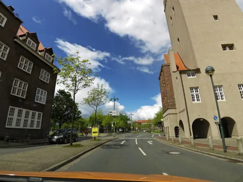
Delmenhorster Wasserturm
Monument and historic site
Wasserturm 44 Meter hoch. Wahrzeichen von Delmenhorst. 200 Stufen. Aussichtsplattform.
1 Rathausplatz, Delmenhorst
Su[1],Sa[3] 15:00-17:00 open "Erster und dritter Sonntag im Monat"




95 more on the map.
Parks, trails and playgrounds29


GraftTherme
Sports field and stadium · 0.9 km
2 Am Stadtbad, Delmenhorst
Mo-Fr 06:30-08:00,10:00-20:00; Sa,Su,PH 10:00-19:00

Bremer Abenteuerland
Playground · 5.1 km
7 Luxemburger Weg, Stuhr
Mo-Fr 14:00-19:00; Sa,Su,PH,SH 10:00-19:00
Freibad und Hallenbad Ganderkesee
Sports field and stadium · 5.5 km


17 more on the map.
Restaurants and cafes202
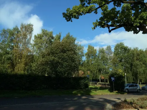
Backenköhler's Hotel und Akademie
Restaurant · German · 5.8 km
40 Dorfring, Ganderkesee
Su 12:00-21:00
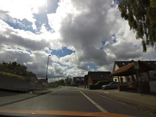
Paulini Eiscafe & Pizzeria
Restaurant · Ice Cream, Pizza · 3.2 km
Kartenzahlung ab 20€
1 Rosenweg, Ganderkesee
Th-Sa 15:00-22:00; Su 13:00-20:00
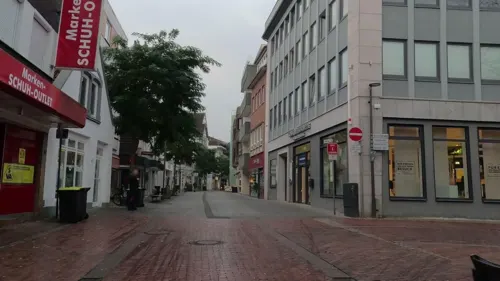
Ali Baba
Restaurant · Turkish
83 Lange Straße, Delmenhorst
Mo-Th 11:00-24:00, Fr,Sa 11:00-01:00, Su 12:00-24:00
Bäckerei Haferkamp
Cafe · Cake, Breakfast, Cafe · 2.2 km
235 Stedinger Straße, Delmenhorst
Mo-Sa 06:00-19:00; Su 07:00-11:30
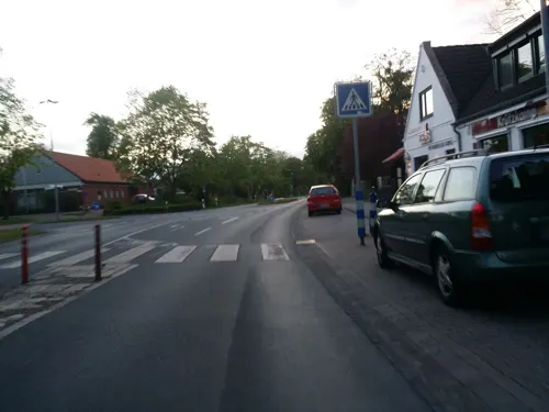
Golden India im Varreler Krug
Restaurant · Indian · 5.0 km
103 Varreler Landstraße, Stuhr
Tu 17:00-22:00; We-Sa 11:30-14:00, 17:00-22:00; Su 12:00-21:30
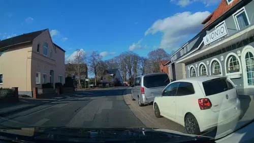
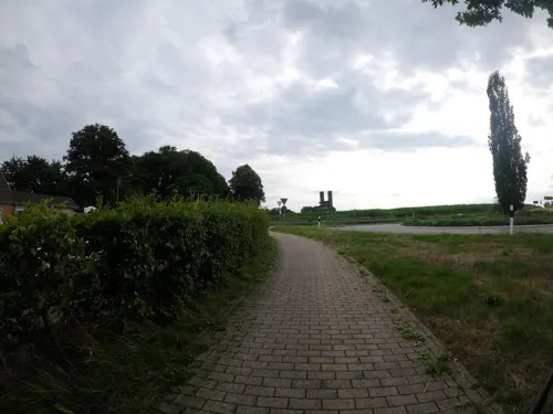
Mykonos
Restaurant · Greek · 4.1 km
22 Wildeshauser Landstraße, Ganderkesee
Mo off; Tu-Sa 07:30-23:30; Su 12:00-14:30, 17:30-23:30
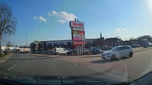
Oldenburger Hof
Restaurant · German · 6.0 km
16 Wittekindstraße, Ganderkesee
Mo-Fr 10:30-14:00, 16:00-22:00; Sa 17:00-21:30; Su, PH 09:30-14:00
Thomsen
Restaurant · Regional · 2.1 km
186 Bremer Straße, Delmenhorst
Mo-Su 11:30-14:00,18:00-21:30; Sa 18:00-21:30
190 more on the map.
History
Delmenhorst was first mentioned in a charter in 1254, after the Count of Oldenburg, Otto I, bought the place near the river Delme in 1234. A castle to protect the newly founded settlement was established in about 1247. The following count, Otto II, made the castle his residency; Delmenhorst was declared an independent town on 15 July 1371 under Bremen's law.
After a short period under the governance of the bishop of Bremen from 1421 to 1436 Delmenhorst returned under the custody of Oldenburg. Delmenhorst later was infamous for its robber-baronship under the count Gerhard VI of Oldenburg. Its reign ended in 1482 thanks to a siege laid to the castle under the leadership of the bishop of Münster. Therefore, the town now was under Münster authority until finally count Anton I won back the town as well as the castle in 1547.
When the last heir of Anton, Christian, died in 1647, Delmenhorst again fell under Oldenburg custody. As Oldenburg belonged to Danish kings and the Oldenburg regent of that time was a relative of the Danish king, Delmenhorst was thereafter under Danish control.
In 1767, Delmenhorst was bought by Tsarina Catherine II, but was given up to new Oldenburg in 1773. In 1777, Delmenhorst was declared a dukedom of Oldenburg. In 1806, a French and Dutch army occupied the territory; Delmenhorst was a part of the French empire under Napoleon from 1811 to 1813.
Read more of the history
In the industrial age, Delmenhorst experienced great economic growth, thanks to Bremen. Since Bremen was in a different duty zone, merchants who wanted to export manufactured goods outside of Bremen had to pay high customs duties. They therefore only exported the resources and produced their commodities in the surrounding villages. The industries arising were the Jute - a spinning works and weavery in 1871, the Delmenhorster Linoleumfabrik - a linoleum factory, in 1882, the Norddeutsche Wollkämmerei und Kammgarnspinnerei or Nordwolle - another, bigger spinning works, and several others. The number of inhabitants quadrupled in these years.
In 1903, Delmenhorst was declared kreisfrei, meaning it was under its own regentship, not having to obey any other county. In the 1930s, Great Depression the Nordwolle went bankrupt - nevertheless the town grew bigger, incorporating several smaller villages around it. On Kristallnacht in November 1938, the synagogue was burnt down by the Nazis, who had come to power in Germany in 1933. After the Second World War, Delmenhorst was in the British zone of occupation and had to deal with thousands of refugees from Eastern Germany, which now was occupied by the Soviet Union. The British-appointed mayor during the British Occupation was Major Jack Wolfe, an inspector of the British Constabulary. In 1950, more than 57,000 people lived in Delmenhorst.
Since the 1960s, there has been a steady decrease in employment, leaving more than 13% of the town's inhabitants unemployed and nearly 7% living on social welfare. In the year 2000, Delmenhorst was an outpost of the Hanover-based Expo 2000.
The Hanse-Wissenschaftskolleg (HWK) Institute for Advanced Study is located at Delmenhorst, in the neighborhood of Deichhorst. The HWK promotes collaboration between and among international research scientists and artists, many of whom are housed on the HWK grounds. The public is engaged through a public lecture series. The research areas of focus are energy, earth, brain, and society.
From the History section of Delmenhorst on Wikipedia, under CC BY-SA 4.0.
Notable people from Delmenhorst
 Sarah ConnorGerman singer (born 1980)Photo: Sven Mandel, CC BY-SA 4.0
 Iwan BlochGerman dermatologist and sexologist (1872-1922)Photo: Unknown author Unknown author, Public domain
 Sandra AuffarthGerman equestrianPhoto: Olaf Kosinsky, CC BY-SA 3.0 de
 Christian DürrGerman politicianPhoto: Sandro Halank, Wikimedia Commons, CC BY-SA 4.0
 Emilie of Oldenburg-DelmenhorstRegent of Schwarzburg-Rudolstadt (1614-1670)Photo: Unknown author Unknown author, CC BY-SA 3.0
 Volker WiekerGerman generalPhoto: DoD photo by Mass Communication..., Public domain
 Claudia KemfertGerman economistPhoto: Stefan Müller (climate stuff, 1 Mio..., CC BY 2.0
 Ralf LauGerman chess playerPhoto: MBIHund, CC BY 3.0
- Chris WelpGerman basketball player (1964–2015)
- Arthur FitgerGerman painter, art critic, playwright and poet (1840-1909)
- Karl FriederichsGerman classical archaeologist (1831-1871)
- Uwe ErkenbrecherGerman football manager
Born in Delmenhorst, according to Wikidata (CC0). Each name links to its Wikipedia article.
Where to stay14
Churches and places of worship36
Shopping77
Gas and EV charging26
Hoyer Turbo-Tank Delmenhorst
Gas station · 0.7 km
2 Arthur-Fitger-Straße, Delmenhorst
Schools, colleges and libraries52
Berufsbildende Schule II - Kerschensteiner-Schule
School · 1.4 km
56-58 Wiekhorner Heuweg, Delmenhorst
Healthcare29
Map of Delmenhorst
250 places. The map loads OpenStreetMap tiles when you open it.
Getting there and nearby towns
Bremen Airport (BRE) is the nearest airport with scheduled flights listed in OpenStreetMap, 10 km away.
- Ganderkesee 6 km west, about 6 min by car
- Stuhr 8 km east, about 8 min by car
- Bremen 12 km east, about 12 min by car
- Hude 13 km northwest, about 13 min by car
- Lemwerder 12 km north, about 12 min by car
- Ritterhude 16 km northeast, about 16 min by car
- Hatten 17 km west, about 17 min by car
- Schwanewede 19 km north, about 19 min by car
- Syke 20 km southeast, about 20 min by car
- Lilienthal 21 km northeast, about 21 min by car
Drive times are estimates from straight-line distance, not routes.
Towns near Delmenhorst


Keep exploring
Local news
Headlines from INDB.
Reviews, tips and questions
Loading what members have shared...
Sources and licences
- GeoNames (CC BY 4.0): population, coordinates, regions and time zone
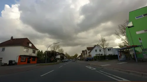
- Mapillary (see each image): photos
- OpenStreetMap contributors (ODbL 1.0): places, airports, map data
- Wikidata (CC0 1.0): elevation, founding date, time zone, website
- Wikimedia Commons (see each image): photos
- Wikipedia (CC BY-SA 4.0): overview and history text
Photo credits
- Delmenhorst Rathaus, Charlie1965nrw at German Wikipedia ( Original text: Charlie1965nrw (Karl-Heinz Meurer) ), Public domain
- Delmenhorst Maxx, Reise Reise, CC BY-SA 4.0
- Westdelme, Delmenhorst 1334, Gerd Fahrenhorst, CC BY 4.0
- Westdelme, Delmenhorst 1333, Gerd Fahrenhorst, CC BY 4.0
- Gymnasium an der Willmsstraße, Delmenhorst, Gebäude A, von Nordwesten gesehen, JürnC, CC BY-SA 4.0
- LzO Delmenhorst, Gerd Fahrenhorst, CC BY 4.0
- Bahnhof Delmenhorst, Gerd Fahrenhorst, CC BY 4.0
- Höhenmarke Delmenhorst, Ulrich Kulle, CC BY-SA 4.0
- Höhenmarke Delmenhorst Kirche Turm, Ulrich Kulle, CC BY-SA 4.0
- Kriegerdenkmal Delmenhorst Kirchplatz, Billboa, CC BY 3.0
- Ev. Stadtkirche Delmenhorst, Ulli 2mecs, CC BY-SA 4.0
- Delbus Bahnhofsvorplatz Delmenhorst, Gerd Fahrenhorst, CC BY 4.0
- Bahnhofsschild Delmenhorst 170511, Clic, CC BY-SA 4.0
- Delmenhorst - Jute-Center - geo.hlipp.de - 8405, Peter von Rueden, CC BY-SA 2.0
- Bahnhofsschild Delmenhorst, Geogast, CC BY 4.0
- Zug der Erinnerung und NWB in Delmenhorst, Billboa, CC BY 3.0
- 110 489-2 in Delmenhorst, Köf3, CC BY-SA 3.0
- Brunnen Bahnhofstraße Delmenhorst 4, Gerd Fahrenhorst, CC BY 4.0
- Brunnen Bahnhofstraße Delmenhorst, Gerd Fahrenhorst, CC BY 4.0
- Tabernakel St. Marien 2, Delmenhorst, Gerd Fahrenhorst, CC BY 4.0
- Brunnen Bahnhofstraße Delmenhorst 3, Gerd Fahrenhorst, CC BY 4.0
- Brunnen Bahnhofstraße Delmenhorst 2, Gerd Fahrenhorst, CC BY 4.0
- Kreuzwegbild St.Marien Delmenhorst, Gerd Fahrenhorst, CC BY 4.0
- Stenum (930), Ralf Krebs, CC BY 3.0
- Delmenhorst Stadtkirche 2, Delmenhorst_Stadtkirche.jpg : The original uploader was Charlie1965nrw at German Wikipedia . ( Original text: Charlie1965nrw (Karl-Heinz Meurer) ) derivative work: Rabanus Flavus ( talk ), Public domain
- Vogelschutzgehölz Sodenmatt, GrotheerR, CC BY-SA 4.0
- Hasberger-kirche, Buschi1984, CC BY-SA 3.0
- NordwolleDelmenhorst-1a, Jürgen Howaldt, CC BY-SA 2.0 de
- Josef-Hospital Delmenhorst Hauptgebäude, Jacek Rużyczka, CC BY-SA 4.0
- Gemeindebücherei Ganderkesee, Billboa, CC BY 3.0
- Ganderkesee St. Cyprian und Cornelius 02, Sir Gawain, CC BY-SA 3.0
- To de twölv Apostels in Demost 03, Slomox, CC BY-SA 4.0
- Museumsmuehle-hasbergen, Buschi1984, CC BY-SA 3.0
- Kriegerdenkmal Rathausplatz Delmenhorst 02, Gerd Fahrenhorst, CC BY 4.0
- Stolperstein Delmenhorst - Benjamin Bandel (1908), MipleDel ( Diskussion ), CC BY-SA 3.0 de
- St.-Katharinen-Kirche Schönemoor, Billboa, CC BY 3.0
- Delmenhorst Haus Coburg, Exprimidor, CC BY-SA 4.0
- St. Katharinen Kirche Schönemoor, Dbleicher at German Wikipedia, Public domain
- NordwolleDelmenhorst-2b, Jürgen Howaldt, CC BY-SA 2.0 de
- Ganderkesee St. Cyprian und Cornelius 01, Sir Gawain, CC BY-SA 3.0
- Street-level photo, moenk, CC BY-SA 4.0
- Street-level photo, sajahome, CC BY-SA 4.0
- Street-level photo, Mjas, CC BY-SA 4.0
- Street-level photo, Mjas, CC BY-SA 4.0
- Street-level photo, moenk, CC BY-SA 4.0
- Street-level photo, moenk, CC BY-SA 4.0
- Street-level photo, hubert87, CC BY-SA 4.0
- Street-level photo, thewizard, CC BY-SA 4.0
- Street-level photo, abausd, CC BY-SA 4.0
- Street-level photo, hubert87, CC BY-SA 4.0
- Street-level photo, VIA_KK, CC BY-SA 4.0
- Street-level photo, abmap, CC BY-SA 4.0
- Street-level photo, thewizard, CC BY-SA 4.0
- Street-level photo, sajahome, CC BY-SA 4.0
- Street-level photo, StefanS79, CC BY-SA 4.0
- Street-level photo, abmap, CC BY-SA 4.0
- Street-level photo, StefanS79, CC BY-SA 4.0
- Street-level photo, moenk, CC BY-SA 4.0
- Street-level photo, Mjas, CC BY-SA 4.0
- Street-level photo, Mjas, CC BY-SA 4.0
- Street-level photo, Mjas, CC BY-SA 4.0
- Street-level photo, moenk, CC BY-SA 4.0
- Street-level photo, abmap, CC BY-SA 4.0
- Street-level photo, abmap, CC BY-SA 4.0
- Street-level photo, lumbar, CC BY-SA 4.0
- Street-level photo, VIA_KK, CC BY-SA 4.0
- Street-level photo, sajahome, CC BY-SA 4.0
- Street-level photo, sajahome, CC BY-SA 4.0
- Street-level photo, changchun1, CC BY-SA 4.0


Page built November 9, 2026. Spotted a mistake? Tell us or suggest a place.