


Why visit Ganderkesee
Townapedia lists 143 museums and landmarks, 35 parks and trails, 190 places to eat, 13 places to stay and 11 attractions in and around town.
Highlights include Maxx, Hof Wempe, Delmenhorster Wasserturm and Fabrikmuseum Nordwolle.
Weather in Ganderkesee
Forecast from MET Norway (CC BY 4.0). Full forecast
About Ganderkesee
Ganderkesee (German: [ˌɡandɐkəˈzeː]; Northern Low Saxon: Gannerseer) is a municipality in Oldenburg district, in Lower Saxony, Germany.
From the Wikipedia article Ganderkesee (this version), under CC BY-SA 4.0.
Photos of Ganderkesee


Things to do11



Hof Wempe
Farm and orchard · 2.2 km
Verkauf von Spargel, Erdbeeren, Himbeeren und Heidelbeeren
Neu-Holzkamp, Ganderkesee
Apr-Aug Mo-Fr 08:00-18:00; Apr-Aug Sa 08:00-16:00; Apr-Aug Su,PH...
Hofladen Schwarting
Farm and orchard · 3.1 km
Verkauf von Kartoffeln, Eier, Honig, Fruchtaufstriche
3, Ganderkesee
Mo-Sa 08:00-18:00
Kartoffelhof Moorschlatt
Farm and orchard · 6.9 km
103 Wildeshauser Landstraße, Ganderkesee
Mo-Sa 09:00-12:00, 14:00-18:00
Wachtendorf's Hofladen
Farm and orchard · 4.8 km
Verkauf von Fleischprodukte, Kartoffeln, Gemüse, Eier, Milch, Käse, Joghurt, Eis
29 Im Fladder, Ganderkesee
Mo-Su 08:00-20:00
Dat moi nüst Lädchen
Farm and orchard · 2.9 km
Verkauf von Holtstreeker Landhonig
33 Holtstreek, Ganderkesee
Mo-Su 08:00-20:00

Theater Kleines Haus
Cinema and theater · 5.8 km
4c Max-Planck-Straße, Delmenhorst
Museums and landmarks143
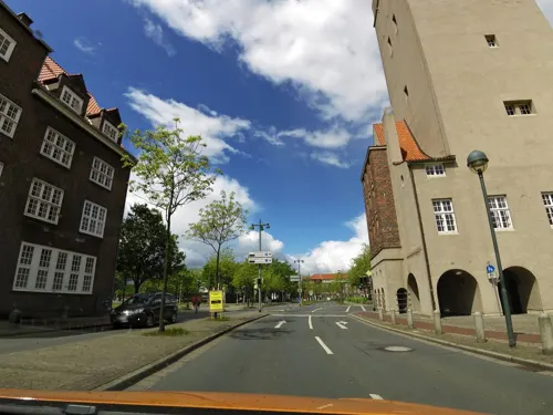
Delmenhorster Wasserturm
Monument and historic site · 5.6 km
Wasserturm 44 Meter hoch. Wahrzeichen von Delmenhorst. 200 Stufen. Aussichtsplattform.
1 Rathausplatz, Delmenhorst
Su[1],Sa[3] 15:00-17:00 open "Erster und dritter Sonntag im Monat"


Ehemalige Freilichtbühne "De Stedinge"
Monument and historic site · 7.0 km


Friederikeneiche
Monument and historic site · 5.9 km
Die Friederikeneiche, benannt nach Friederike Elisabeth Amalie von Oldenburg, ist mit einem Alter von etwa 1200 Jahren die älteste heute...

Villa Lahusen
Monument and historic site · 6.4 km
2c Fabrikhof, Delmenhorst


Friedenseiche in Bergedorf
Monument and historic site · 5.3 km
Naturdenkmal: freistehende Eiche mit schirmförmiger Krone, Höhe ca. 15 m, Stammumfang 2,90 m, Kronendurchmesser ca. 20 m


131 more on the map.
Parks, trails and playgrounds35


Schlatt beim "Anschuß"
Hiking and trails · 4.0 km
Schlatt mit offener Wasserfläche, Seggen und Binsen

Westermanns-Schlatt
Hiking and trails · 4.3 km
Artenreiches Schlatt mit Schwingrasen, Torfmoos, Wollgras, Seggen, Igelkolben etc.; umgeben von einem ca 5 m breiten Ringgraben,...

GraftTherme
Sports field and stadium · 5.2 km
2 Am Stadtbad, Delmenhorst
Mo-Fr 06:30-08:00,10:00-20:00; Sa,Su,PH 10:00-19:00
Freibad und Hallenbad Ganderkesee
Sports field and stadium · 1.2 km


23 more on the map.
Restaurants and cafes190
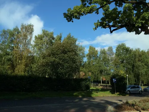
Backenköhler's Hotel und Akademie
Restaurant · German · 4.8 km
40 Dorfring, Ganderkesee
Su 12:00-21:00
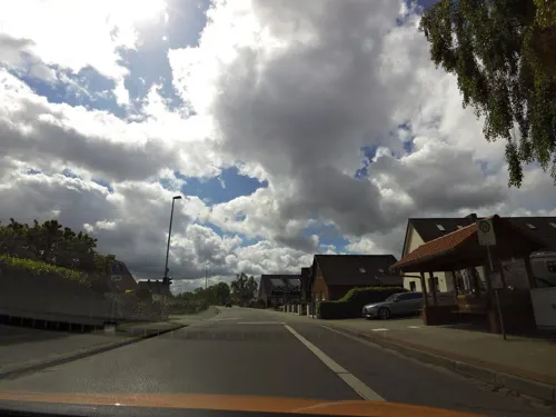
Paulini Eiscafe & Pizzeria
Restaurant · Ice Cream, Pizza · 7.0 km
Kartenzahlung ab 20€
1 Rosenweg, Ganderkesee
Th-Sa 15:00-22:00; Su 13:00-20:00
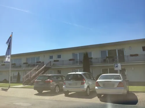
Airfield Restaurant
Restaurant · International · 2.5 km
23 Otto-Lilienthal-Straße, Ganderkesee
Mo-Su 11:30-14:00, 18:00-21:00
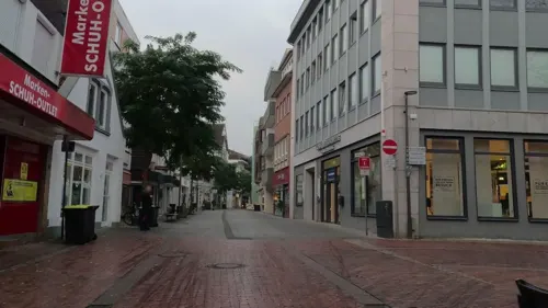
Ali Baba
Restaurant · Turkish · 6.0 km
83 Lange Straße, Delmenhorst
Mo-Th 11:00-24:00, Fr,Sa 11:00-01:00, Su 12:00-24:00
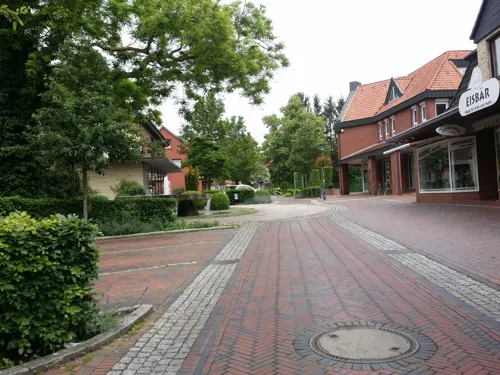
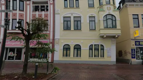
Eiscafé Zampolli
Cafe · Ice Cream · 6.0 km
82 Lange Straße, Delmenhorst
Mo-Sa 11:00-20:00; Su 12:00-20:00
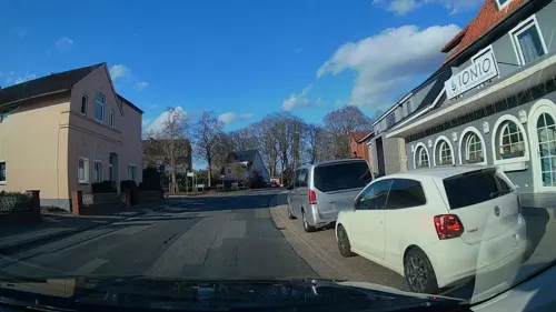
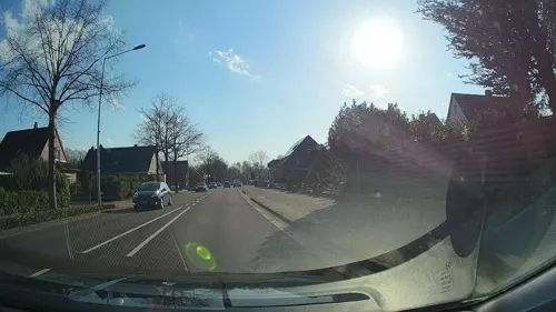
Missyou
Restaurant · Sushi, Chinese · 6.2 km
31 Stedinger Straße, Ganderkesee
Tu-Su 11:30-15:00,17:30-23:00
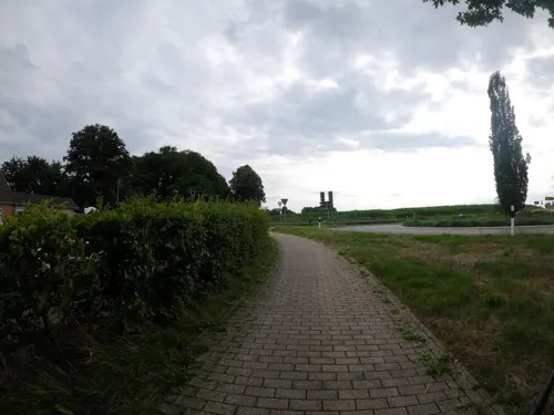
Mykonos
Restaurant · Greek · 2.4 km
22 Wildeshauser Landstraße, Ganderkesee
Mo off; Tu-Sa 07:30-23:30; Su 12:00-14:30, 17:30-23:30
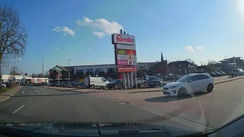
Oldenburger Hof
Restaurant · German
16 Wittekindstraße, Ganderkesee
Mo-Fr 10:30-14:00, 16:00-22:00; Sa 17:00-21:30; Su, PH 09:30-14:00

Waldschänke Steinkimmen
Restaurant · Regional · 5.8 km
53 Am Sender, Ganderkesee
We-Sa 14:00+, Su 11:00+
178 more on the map.
History
Ganderkesee was mentioned in 860 AD for the first time under the name of "Gandrikesarde".
From the History section of Ganderkesee on Wikipedia, under CC BY-SA 4.0.
More about Ganderkesee
Geography
Ganderkesee is located on the northern edge of a nature park called "Wildeshauser Geest". The northernmost part of the community is in the glacial valley of the Weser. The sandy, higher and hilly terrain of Geest joins south.
The municipality Ganderkesee bordered to the east by the city of Delmenhorst, in the north of the communities Lemwerder and Berne in the district Wesermarsch and to the municipality Hude, to the west of the town Hatten and on the south by the municipalities Dötlingen and Harpstedt.
Ganderkesee includes 25 hamlets with about 31,200 residents: Ganderkesee, Almsloh, Bergedorf, Bookholzberg, Bookhorn, Bürstel, Elmeloh, Falkenburg, Grüppenbühren, Habbrügge, Havekost, Heide, Hengsterholz, Hohenböken, Holzkamp, Hoyerswege, Hoykenkamp, Immer, Neuenlande, Rethorn, Schierbrok, Schlutter, Schönemoor, Steinkimmen and Stenum.
From the Wikipedia article Ganderkesee, under CC BY-SA 4.0.
Where to stay13
Churches and places of worship31
Shopping60
Gas and EV charging21
Hoyer Turbo-Tank Delmenhorst
Gas station · 6.1 km
2 Arthur-Fitger-Straße, Delmenhorst
Schools, colleges and libraries48
Berufsbildende Schule II - Kerschensteiner-Schule
School · 4.7 km
56-58 Wiekhorner Heuweg, Delmenhorst
Katholische öffentliche Bücherei St. Christophorus
Library · 6.1 km
122 Brendelweg, Delmenhorst
Healthcare25
Map of Ganderkesee
250 places. The map loads OpenStreetMap tiles when you open it.
Getting there and nearby towns
Bremen Airport (BRE) is the nearest airport with scheduled flights listed in OpenStreetMap, 16 km away.
- Delmenhorst 6 km east, about 6 min by car
- Hude 9 km northwest, about 9 min by car
- Hatten 11 km west, about 11 min by car
- Stuhr 14 km east, about 14 min by car
- Lemwerder 15 km north, about 15 min by car
- Dötlingen 16 km southwest, about 16 min by car
- Bremen 18 km east, about 18 min by car
- Wildeshausen 17 km southwest, about 17 min by car
- Schwanewede 21 km north, about 21 min by car
- Ritterhude 21 km northeast, about 21 min by car
Drive times are estimates from straight-line distance, not routes.
Towns near Ganderkesee


Keep exploring
Local news
Headlines from INDB.
Reviews, tips and questions
Loading what members have shared...
Sources and licences
- GeoNames (CC BY 4.0): population, coordinates, regions and time zone
- Mapillary (see each image): photos
- OpenStreetMap contributors (ODbL 1.0): places, airports, map data
- Wikidata (CC0 1.0): elevation, founding date, time zone, website
- Wikimedia Commons (see each image): photos
- Wikipedia (CC BY-SA 4.0): overview and history text
Photo credits
- GK-Elmeloh, TILMAN KLUGE at German Wikipedia, CC BY-SA 3.0
- Gemeindebücherei Ganderkesee, Billboa, CC BY 3.0
- Reisemobilstellplätze Festplatz Ganderkesee, Elgaard, CC BY 4.0
- Bahnhof Ganderkesee 2010, Billboa, CC BY 3.0
- Reisemobilstellplätze Festplatz Ganderkesee pitches, Elgaard, CC BY 4.0
- Reisemobilstellplätze Festplatz Ganderkesee 01, Elgaard, CC BY 4.0
- Reisemobilstellplätze Festplatz Ganderkesee chemical toilet dump station, Elgaard, CC BY 4.0
- Reisemobilstellplätze Festplatz Ganderkesee dump station, Elgaard, CC BY 4.0
- Bahnhof Ganderkesee, Billboa, CC BY 3.0
- Ganderkesee, St. Cyprian und Cornelius, Orgel (2), Subbass1, CC BY-SA 4.0
- Ganderkesee, St. Cyprian und Cornelius, Orgel (4), Subbass1, CC BY-SA 4.0
- Ganderkesee, St. Cyprian und Cornelius, Orgel (1), Subbass1, CC BY-SA 4.0
- Ganderkesee, St. Cyprian und Cornelius, Orgel (5), Subbass1, CC BY-SA 4.0
- Ganderkesee - AltesRathaus001, Sipalius, CC BY-SA 4.0
- Heinrich Schwarz Bronze-Skulptur bei altem Rathaus Ganderkesee, Billboa Skulptur: Heinrich Schwarz (1903-1977), CC BY 3.0
- Ganderkesee, St. Cyprian und Cornelius (42), Subbass1, CC BY-SA 4.0
- Heinrich Schwarz Bronze-Skulptur beim alten Rathaus Ganderkesee, Billboa Skulptur: Heinrich Schwarz (1903-1977), CC BY 3.0
- Ganderkesee, St. Cyprian und Cornelius, Orgel (6), Subbass1, CC BY-SA 4.0
- Ganderkesee, St. Cyprian und Cornelius, Orgel (7), Subbass1, CC BY-SA 4.0
- Ganderkesee, St. Cyprian und Cornelius, Orgel (10), Subbass1, CC BY-SA 4.0
- Ganderkesee, St. Cyprian und Cornelius, Orgel (8), Subbass1, CC BY-SA 4.0
- Ganderkesee, St. Cyprian und Cornelius, Orgel (3), Subbass1, CC BY-SA 4.0
- Ganderkesee, St. Cyprian und Cornelius (07), Subbass1, CC BY-SA 4.0
- Ganderkesee, St. Cyprian und Cornelius (12), Subbass1, CC BY-SA 4.0
- Ganderkesee, St. Cyprian und Cornelius (15), Subbass1, CC BY-SA 4.0
- Ganderkesee, St. Cyprian und Cornelius (05), Subbass1, CC BY-SA 4.0
- Ganderkesee, St. Cyprian und Cornelius (10), Subbass1, CC BY-SA 4.0
- Ganderkesee, St. Cyprian und Cornelius (02), Subbass1, CC BY-SA 4.0
- Ganderkesee, St. Cyprian und Cornelius (07) (cropped), Subbass1, CC BY-SA 4.0
- Ganderkesee, St. Cyprian und Cornelius (14), Subbass1, CC BY-SA 4.0
- Ganderkesee, St. Cyprian und Cornelius (01), Subbass1, CC BY-SA 4.0
- Ganderkesee, St. Cyprian und Cornelius (34), Subbass1, CC BY-SA 4.0
- Ganderkesee, St. Cyprian und Cornelius (32) 2, Subbass1, CC BY-SA 4.0
- Ganderkesee, St. Cyprian und Cornelius (08), Subbass1, CC BY-SA 4.0
- Ganderkesee, St. Cyprian und Cornelius (16), Subbass1, CC BY-SA 4.0
- Ganderkesee, St. Cyprian und Cornelius (13), Subbass1, CC BY-SA 4.0
- Ganderkesee, St. Cyprian und Cornelius (11), Subbass1, CC BY-SA 4.0
- Ganderkesee, St. Cyprian und Cornelius (11) (cropped), Subbass1, CC BY-SA 4.0
- Ganderkesee, St. Cyprian und Cornelius (04), Subbass1, CC BY-SA 4.0
- Hünensteine 2 (928), Ralf Krebs, CC BY 3.0
- Delmenhorst Stadtkirche 2, Delmenhorst_Stadtkirche.jpg : The original uploader was Charlie1965nrw at German Wikipedia . ( Original text: Charlie1965nrw (Karl-Heinz Meurer) ) derivative work: Rabanus Flavus ( talk ), Public domain
- NordwolleDelmenhorst-1a, Jürgen Howaldt, CC BY-SA 2.0 de
- Friederikeneiche, Billboa, CC BY 3.0
- Josef-Hospital Delmenhorst Hauptgebäude, Jacek Rużyczka, CC BY-SA 4.0
- Ganderkesee St. Cyprian und Cornelius 02, Sir Gawain, CC BY-SA 3.0
- Friderikeneiche (Hasbruch) im Juni 2015, Billboa, CC BY 3.0
- To de twölv Apostels in Demost 03, Slomox, CC BY-SA 4.0
- Ganderkesee, St. Hedwig (03), Subbass1, CC BY-SA 4.0
- Kriegerdenkmal Rathausplatz Delmenhorst 02, Gerd Fahrenhorst, CC BY 4.0
- Bookholzberg St. Bernhard kath, Sichi77, CC BY-SA 4.0
- Delmenhorst Maxx, Reise Reise, CC BY-SA 4.0
- Hasbruchturm, Billboa, CC BY 3.0
- Stedingsehre bookholzberg, Matthias Süßen, CC BY 3.0
- Stolperstein Delmenhorst - Benjamin Bandel (1908), MipleDel ( Diskussion ), CC BY-SA 3.0 de
- ND226 Friedenseiche in Bergedorf, Ralf Krebs, CC BY 3.0
- ND240 Schlatt beim Anschuß, Ralf Krebs, CC BY 3.0
- ND235 Westermanns-Schlatt, Ralf Krebs, CC BY 3.0
- Delmenhorst Haus Coburg, Exprimidor, CC BY-SA 4.0
- NordwolleDelmenhorst-2b, Jürgen Howaldt, CC BY-SA 2.0 de
- Street-level photo, moenk, CC BY-SA 4.0
- Street-level photo, sajahome, CC BY-SA 4.0
- Street-level photo, StefanS79, CC BY-SA 4.0
- Street-level photo, abmap, CC BY-SA 4.0
- Street-level photo, StefanS79, CC BY-SA 4.0
- Street-level photo, VIA_KK, CC BY-SA 4.0
- Street-level photo, sajahome, CC BY-SA 4.0
- Street-level photo, sajahome, CC BY-SA 4.0
- Street-level photo, moenk, CC BY-SA 4.0
- Street-level photo, Mjas, CC BY-SA 4.0
- Street-level photo, Mjas, CC BY-SA 4.0
- Street-level photo, StefanS79, CC BY-SA 4.0
- Street-level photo, sajahome, CC BY-SA 4.0
- Street-level photo, sajahome, CC BY-SA 4.0
- Street-level photo, sajahome, CC BY-SA 4.0
- Street-level photo, sajahome, CC BY-SA 4.0
- Street-level photo, abmap, CC BY-SA 4.0
- Street-level photo, lumbar, CC BY-SA 4.0
- Street-level photo, abmap, CC BY-SA 4.0
- Street-level photo, moenk, CC BY-SA 4.0
- Street-level photo, Mjas, CC BY-SA 4.0
- Street-level photo, moenk, CC BY-SA 4.0
- Street-level photo, moenk, CC BY-SA 4.0
- Street-level photo, abmap, CC BY-SA 4.0
- Street-level photo, moenk, CC BY-SA 4.0


Page built November 9, 2026. Spotted a mistake? Tell us or suggest a place.