


Why visit Driedorf
Townapedia lists 19 museums and landmarks, 15 parks and trails, 24 places to eat, 13 places to stay and 13 attractions in and around town.
Highlights include Bartenstein, Höllberg, Töpfermuseum and "Alter Bahnhof" Beilstein Gleis 1.
Weather in Driedorf
Forecast from MET Norway (CC BY 4.0). Full forecast
About Driedorf
Driedorf (German pronunciation: [ˈdʁiːdɔʁf]) is a municipality in the Lahn-Dill-Kreis in Hesse, Germany.
From the Wikipedia article Driedorf (this version), under CC BY-SA 4.0.
Things to do13





1 more on the map.
Museums and landmarks19

Töpfermuseum
Museum · 5.8 km
27 Kirchstraße
Mar-Nov We 10:00-12:00,14:00-17:00, Su 14:30-17:00; PH off; "und...

"Alter Bahnhof" Beilstein Gleis 1
Monument and historic site · 4.7 km
21 Schloßstraße, Greifenstein
Fr 14:30+,Sa 09:00-13:00; PH off


Zufahrt Steinbruch BAG
Monument and historic site · 5.0 km
Basaltwerk
Mo-Th 07:00-16:00; Fr 07:00-14:00
7 more on the map.
Parks, trails and playgrounds15





3 more on the map.
Restaurants and cafes24

Breitscheider Stube
Restaurant · German, Breakfast, Lunch, Diner · 5.4 km
34 Schönbacher Straße, Breitscheid
Mo-We 10:00-20:00, Th-Sa 10:00-22:00, Su 10:00-21:00, PH off
Pizzeria Milan
Restaurant · Pizza · 5.0 km
1 Auf der Hub, Breitscheid
Su,Mo 11:00-22:00; Tu off; We,Th 16:00-22:00; Fr,Sa 16:00-00:00
Zum Cockpit
Restaurant · Pizza, Pasta, Schnitzel, Fish · 5.3 km
4 Auf der Hub, Breitscheid
We-Mo 11:30-22:00


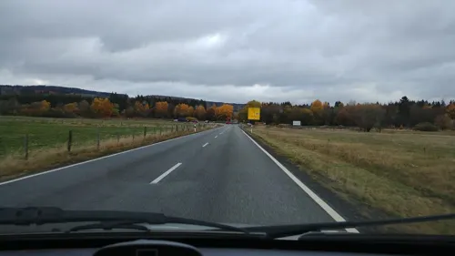
Hartmann & Luckenbach
Bakery · 1.7 km
2 Potsdamer Platz, Driedorf
Mo-Fr 05:30-18:00, Sa 07:00-14:00, Su, PH 07:00-17:00
Zweierlei
Restaurant · Breakfast, Lunch, Cake, Coffee Shop, Regional, German · 1.7 km
2 Potsdamer Platz, Driedorf
Mo-Fr 05:30-18:00, Sa 07:00-14:00, Su, PH 07:00-17:00
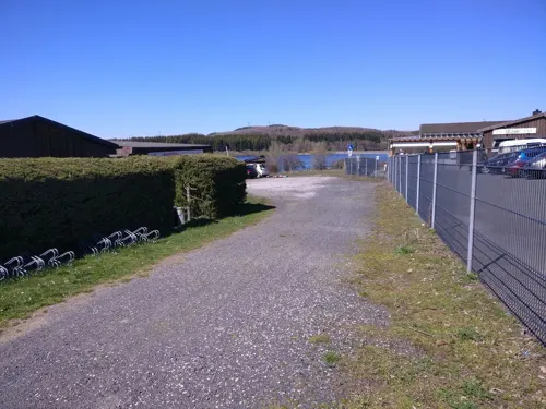


12 more on the map.
History
The greater community of Driedorf came into being in three stages as part of Hesse's municipal reforms in the 1970s. On 1 October 1971, the communities of Driedorf, Heisterberg, Hohenroth, and Heiligenborn united, and three months later, on 1 January 1972, Münchhausen followed. Five years to the day later, on 1 January 1977, Seilhofen, Waldaubach, Mademühlen and Roth were amalgamated with Driedorf by state law.
From the History section of Driedorf on Wikipedia, under CC BY-SA 4.0.
Where to stay13
Churches and places of worship15
Evangelische Kirche
Church · Protestant · 3.5 km
15 Rother Straße, Driedorf
Evangelische Kirche Münchhausen
Church · Protestant · 1.8 km
1 Bastiansweg, Driedorf
Evangeliumschristen-Baptisten Bethaus
Church · Baptist · 3.8 km
4 Hoher Weg, Breitscheid
Shopping4
Gas and EV charging7
Schools, colleges and libraries4
Healthcare2
Map of Driedorf
116 places. The map loads OpenStreetMap tiles when you open it.
Getting there and nearby towns
Siegerlandflughafen (SGE) is the nearest airport with scheduled flights listed in OpenStreetMap, 11 km away.
- Mengerskirchen 8 km south, about 8 min by car
- Greifenstein 8 km east, about 8 min by car
- Herborn 10 km northeast, about 10 min by car
- Langenaubach 9 km north, about 9 min by car
- Sinn 11 km east, about 11 min by car
- Haiger 12 km north, about 12 min by car
- Dillenburg 14 km northeast, about 14 min by car
- Burbach 15 km northwest, about 15 min by car
- Ehringshausen 15 km east, about 15 min by car
- Selters 15 km southeast, about 15 min by car
Drive times are estimates from straight-line distance, not routes.
Local news
Headlines from INDB.
Reviews, tips and questions
Loading what members have shared...
Sources and licences
- GeoNames (CC BY 4.0): population, coordinates, regions and time zone
- Mapillary (see each image): photos
- OpenStreetMap contributors (ODbL 1.0): places, airports, map data
- Wikidata (CC0 1.0): elevation, founding date, time zone, website
- Wikimedia Commons (see each image): photos
- Wikipedia (CC BY-SA 4.0): overview and history text
Photo credits
- Driedorf ev Kirche, Oliver Abels ( SBT ), CC BY 2.5
- Driedorf Junkernschloss, Oliver Abels ( SBT ), CC BY 2.5
- Driedorf - Backhaus Wilhelmstraße Teil der Gesamtanlage (KD.HE 132687 2 07.2015), Oliver Abels, CC BY-SA 4.0
- Driedorf - Backhaus Wilhelmstraße Teil der Gesamtanlage (KD.HE 132687 1 07.2015), Oliver Abels, CC BY-SA 4.0
- Rathaus in Driedorf - geo.hlipp.de - 36576, Uwe Seibert on geo.hlipp.de, CC BY-SA 2.0
- Driedorf - Rathaus (1 07.2015), Oliver Abels, CC BY-SA 4.0
- Driedorf - Oberburg Turmstraße bei Nr. 4 (KD.HE 132692 1 07.2015), Oliver Abels, CC BY-SA 4.0
- Driedorf - Unterburg Junkerwiese (KD.HE 132696 6 07.2015), Oliver Abels, CC BY-SA 4.0
- Driedorf - Fachwerkhaus Marktstraße 20 (KD.HE 132689 1 07.2015), Oliver Abels, CC BY-SA 4.0
- Driedorf - Rathausplatz (1 07.2015), Oliver Abels, CC BY-SA 4.0
- Driedorf - Oberburg Turmstraße bei Nr. 4 (KD.HE 132692 2 07.2015), Oliver Abels, CC BY-SA 4.0
- Driedorf - Evangelische Pfarrkirche Wilhelmstraße 15 (KD.HE 132694 1 07.2015), Oliver Abels, CC BY-SA 4.0
- Evangelische Kirche in Driedorf - geo.hlipp.de - 35883, Uwe Seibert on geo.hlipp.de, CC BY-SA 2.0
- Driedorf - Fachwerkhaus Schlossstraße 18 (KD.HE 132690 1 07.2015), Oliver Abels, CC BY-SA 4.0
- Driedorf - Evangelische Pfarrkirche Wilhelmstraße 15 (KD.HE 132694 4 07.2015), Oliver Abels, CC BY-SA 4.0
- Driedorf - Unterburg Junkerwiese (KD.HE 132696 4 07.2015), Oliver Abels, CC BY-SA 4.0
- Driedorf - Schalturm Turmstraße bei Nr. 14 (KD.HE 132691 2 07.2015), Oliver Abels, CC BY-SA 4.0
- Driedorf - Unterburg Junkerwiese (KD.HE 132696 5 07.2015), Oliver Abels, CC BY-SA 4.0
- Driedorf - Blick über das Zentrum der Gesamtanlage vom Schalturm (KD.HE 132687 1 07.2015), Oliver Abels, CC BY-SA 4.0
- Driedorf - Unterburg Junkerwiese (KD.HE 132696 3 07.2015), Oliver Abels, CC BY-SA 4.0
- Driedorf - Schalturm Turmstraße bei Nr. 14 (KD.HE 132691 1 07.2015), Oliver Abels, CC BY-SA 4.0
- Driedorf Oberburg, Oliver Abels ( SBT ), CC BY 2.5
- Driedorf - Ehemaliges Pfarrhaus Wilhelmstraße 14 (KD.HE 132693 1 07.2015), Oliver Abels, CC BY-SA 4.0
- Driedorf - Fachwerkhaus Marktstraße 20 (KD.HE 132689 2 07.2015), Oliver Abels, CC BY-SA 4.0
- Driedorf - Fachwerkhaus Schlossstraße 18 (KD.HE 132690 2 07.2015), Oliver Abels, CC BY-SA 4.0
- Driedorf - Evangelische Pfarrkirche Wilhelmstraße 15 (KD.HE 132694 2 07.2015), Oliver Abels, CC BY-SA 4.0
- Driedorf - Ehemaliges Pfarrhaus Wilhelmstraße 14 (KD.HE 132693 2 07.2015), Oliver Abels, CC BY-SA 4.0
- Driedorf - Unterburg Junkerwiese (KD.HE 132696 2 07.2015), Oliver Abels, CC BY-SA 4.0
- Driedorf - Evangelische Pfarrkirche Wilhelmstraße 15 (KD.HE 132694 3 07.2015), Oliver Abels, CC BY-SA 4.0
- Driedorf - Schalturm Turmstraße bei Nr. 14 (KD.HE 132691 3 07.2015), Oliver Abels, CC BY-SA 4.0
- Driedorf - Unterburg Junkerwiese (KD.HE 132696 1 07.2015), Oliver Abels, CC BY-SA 4.0
- Driedorf - Laufbrunnen in der Oranienstraße (1 07.2015), Oliver Abels, CC BY-SA 4.0
- Driedorf - Backhaus Oranienstraße 3 (KD.HE 132695 2 07.2015), Oliver Abels, CC BY-SA 4.0
- Driedorf - Backhaus Oranienstraße 3 (KD.HE 132695 1 07.2015), Oliver Abels, CC BY-SA 4.0
- Driedorf - Wasserwerk (1 07.2015), Oliver Abels, CC BY-SA 4.0
- Driedorf - Brunnen (1 07.2015), Oliver Abels, CC BY-SA 4.0
- Driedorf - Friedhof auf der Liebfrauenkirche (KD.HE 132697 2 07.2015), Oliver Abels, CC BY-SA 4.0
- Driedorf - Stausee Driedorf (6 07.2015), Oliver Abels, CC BY-SA 4.0
- Bartenstein (Berg)1, Marco.dienst, CC0
- Höllberg (Westerwald), Jörg Braukmann, CC BY-SA 4.0
- Knoten 1, Kurt + Else Dietrich, CC BY-SA 3.0
- Evangelische Kirche Rabenscheid, Useibert, CC BY-SA 4.0
- Mademühlen - Evangelische Kirche Kirchstraße 2 (KD.HE 132703 2 07.2015), Oliver Abels, CC BY-SA 4.0
- Roth-Kirche, Otto Domes, CC BY-SA 4.0
- Beilstein Kirche (01), Wikiwal, CC BY-SA 4.0
- Evangelische Kirche Schönbach, Useibert, CC BY-SA 4.0
- Führungsweg im Herbstlabyrinth 05, Zeitsprünge, CC BY-SA 3.0
- Bermershube Wald, Sayaninka, CC BY-SA 4.0
- Feuerheck bei Waldaubach 1, Otto Domes, CC BY-SA 4.0
- Mühlbachtal bei Gusternhain 6, Otto Domes, CC BY-SA 4.0
- Rückerscheid mit Aubachtal 1, Otto Domes, CC BY-SA 4.0
- Viehweide am Barstein 5, Otto Domes, CC BY-SA 4.0
- Die Heck bei Hohenroth 7, Otto Domes, CC BY-SA 4.0
- MK11118 Wacholderheide Westernohe, Martin Kraft, CC BY-SA 3.0
- Krombachtalsperre-Damm&Stausee, ProfessorX at German Wikipedia, CC BY-SA 3.0
- Toepfermuseum Breitscheid, Marco.dienst, CC0
- Erdbachquelle, Dampftrain, CC BY-SA 4.0
- Streckhof in Beilstein, Otto Domes, CC BY-SA 4.0
- Street-level photo, kreuzschnabel, CC BY-SA 4.0
- Street-level photo, kreuzschnabel, CC BY-SA 4.0
- Street-level photo, snowden, CC BY-SA 4.0
- Street-level photo, thetornado76, CC BY-SA 4.0
- Street-level photo, bitnapper, CC BY-SA 4.0


Page built November 9, 2026. Spotted a mistake? Tell us or suggest a place.