


Why visit Langenaubach
Townapedia lists 9 museums and landmarks, 11 parks and trails, 22 places to eat, 3 places to stay and 2 attractions in and around town.
Highlights include Aubachbrücke, Rabenscheider Tunnel, Stadtmuseum and Grabland.
Weather in Langenaubach
Forecast from MET Norway (CC BY 4.0). Full forecast
About Langenaubach
Langenaubach is a village and a Stadtteil of Haiger in the Lahn-Dill-Kreis district in Hesse in Germany.
From the Wikipedia article Langenaubach (this version), under CC BY-SA 4.0.
Things to do2


Museums and landmarks9




Hailo Museum
Museum · 1.6 km
6 Daimlerstraße, Haiger
Mo 10:00-18:00; Tu 13:00-18:00; We 10:00-15:00; Th 13:00-18:00; Fr...

Parks, trails and playgrounds11





Restaurants and cafes22
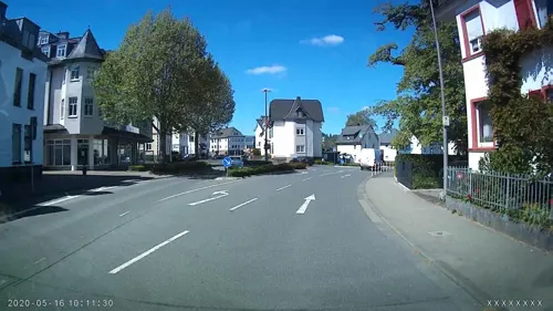
EzTenya Grillparadies
Restaurant · Steak House, Turkish · 3.2 km
61 Bahnhofstraße, Haiger
Mo,We,Th 10:00-14:00,17:00-23:00; Fr 10:00-14:00,17:00-24:00; Sa...

Hickengrundhalle
Restaurant · Greek, German · 3.3 km
80 Westerwaldstraße, Burbach
Tu-Sa 17:30-22:00+; Su 11:30-15:00,17:30-22:00+; Mo off
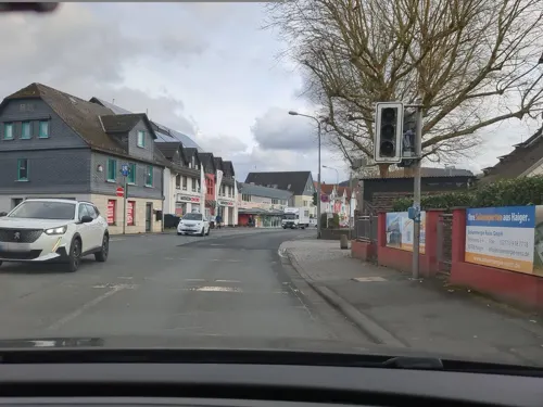
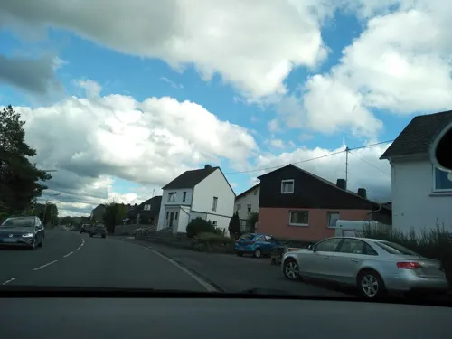
Bäckerei Rothe
Bakery · 3.3 km
4b Siegener Straße, Haiger
Mo-Fr 05:30-13:00; Sa 05:30-12:00; Su 07:30-10:30
Pizzeria Napoli
Restaurant · Italian, Pizza · 3.2 km
10 Hauptstraße, Haiger
Mo-Sa 11:00-14:00, 17:00-23:00; Su, PH 11:00-22:00


HACI Döner Pizzeria
Restaurant · Kebab, Pizza · 3.2 km
40 Hauptstraße, Haiger
Mo-Su 11:00-22:00


Raststation Zu den wilden Weibern
Cafe · 0.9 km
May-Oct: Su 11:00-17:00
10 more on the map.
Where to stay3
Churches and places of worship11
Evangelisch-Freikirchliche Gemeinde Schillerstraße
Church · Brethren · 2.9 km
23 Schillerstraße, Haiger
Freie evangelische Gemeinde Niederdresselndorf
Church · Free Evangelical · 3.1 km
3 Demmershof, Burbach
Evangelisch freikirchliche Gemeinde - Brüdergemeinde
Church · Brethren · 1.4 km
2 Am Dotz, Haiger
Königreichssaal Jehovas Zeugen
Church · Jehovahs Witness · 1.7 km
28 Sathelstraße, Haiger
Shopping6
Gas and EV charging4
Schools, colleges and libraries5
Healthcare3
Map of Langenaubach
76 places. The map loads OpenStreetMap tiles when you open it.
Getting there and nearby towns
Siegerlandflughafen (SGE) is the nearest airport with scheduled flights listed in OpenStreetMap, 7 km away.
- Haiger 3 km northeast, about 3 min by car
- Dillenburg 8 km east, about 8 min by car
- Burbach 8 km northwest, about 8 min by car
- Herborn 9 km southeast, about 9 min by car
- Wilnsdorf 13 km northwest, about 13 min by car
- Sinn 13 km southeast, about 13 min by car
- Mittenaar 14 km east, about 14 min by car
- Neunkirchen 16 km northwest, about 16 min by car
- Mengerskirchen 17 km south, about 17 min by car
- Siegen 21 km northwest, about 21 min by car
Drive times are estimates from straight-line distance, not routes.
Local news
Headlines from INDB.
Reviews, tips and questions
Loading what members have shared...
Sources and licences
- GeoNames (CC BY 4.0): population, coordinates, regions and time zone
- Mapillary (see each image): photos
- OpenStreetMap contributors (ODbL 1.0): places, airports, map data
- Wikidata (CC0 1.0): elevation, founding date, time zone, website
- Wikimedia Commons (see each image): photos
- Wikipedia (CC BY-SA 4.0): overview and history text
Photo credits
- Langenaubach von oben, NoriFotografie, CC BY-SA 4.0
- Ehemalige Evangelische Kirche Langenaubach, USeibert, CC BY-SA 3.0 de
- Evangelische Kirche in Langenaubach - geo.hlipp.de - 36659, Uwe Seibert on geo.hlipp.de, CC BY-SA 2.0
- 2022-08-Waldgebiet östlich von Langenaubach 4, Otto Domes, CC BY-SA 4.0
- 2022-08-Waldgebiet östlich von Langenaubach 5, Otto Domes, CC BY-SA 4.0
- Rotschiefergrube Feld Clara Langenaubach 3, Thariama, CC BY-SA 4.0
- Rotschiefergrube Langenaubach Stollenmundlochblick, Thariama, CC BY-SA 4.0
- Aubach bei Langenaubach - geo.hlipp.de - 36661, Uwe Seibert on geo.hlipp.de, CC BY-SA 2.0
- Rotschiefergrube Feld Clara Langenaubach 1, Thariama, CC BY-SA 4.0
- Rotschiefergrube Feld Clara Langenaubach 2, Thariama, CC BY-SA 4.0
- 2022-08-Waldgebiet östlich von Langenaubach 7, Otto Domes, CC BY-SA 4.0
- 2022-08-Waldgebiet östlich von Langenaubach 6, Otto Domes, CC BY-SA 4.0
- Baumlehrpfad bei Langenaubach - geo.hlipp.de - 36759, Uwe Seibert on geo.hlipp.de, CC BY-SA 2.0
- Langenaubach Rabenscheider Tunnel, Otto Domes, CC BY-SA 4.0
- Alte Schule Langenaubach, Thariama, CC BY-SA 4.0
- Backes Langenaubach, Thariama, CC BY-SA 4.0
- Haiger - Evangelische Pfarrkirche Kirchberg (KD.HE 132834 4 08.2015), Oliver Abels, CC BY-SA 4.0
- Aubachtal bei Langenaubach 1, Otto Domes, CC BY-SA 4.0
- Hasel bei Donsbach - 3, Otto Domes, CC BY-SA 4.0
- Naturschutzgebiet Burbach Wetterbachtal, Kludi2009, CC BY-SA 4.0
- Balkanexpress04, Marco Dienst, CC BY-SA 3.0
- Aubachbrücke, USeibert, CC BY-SA 3.0 de
- Wildweiberhäuschen 2, Otto Domes, CC BY-SA 4.0
- 2022-08-Wald-L'aubach-0129, Otto Domes, CC BY-SA 4.0
- Wildweiberhäuschen 4, Otto Domes, CC BY-SA 4.0
- Wildweiberhäuschen 1, Otto Domes, CC BY-SA 4.0
- Wildweiberhäuschen 3, Otto Domes, CC BY-SA 4.0
- Wildweiberhäuschen 8, Otto Domes, CC BY-SA 4.0
- Wildweiberhäuschen 7, Otto Domes, CC BY-SA 4.0
- Rabenscheider Tunnel Suedportal 2026, Otto Domes, CC BY-SA 4.0
- Wildweiberhäuschen 5, Otto Domes, CC BY-SA 4.0
- Wildweiberhäuschen 6, Otto Domes, CC BY-SA 4.0
- Rabenscheider Tunnel Innenansicht 2026, Otto Domes, CC BY-SA 4.0
- Kilometerstein am Rothaarsteig - geo.hlipp.de - 36070, Uwe Seibert on geo.hlipp.de, CC BY-SA 2.0
- Wegweiser auf dem Rothaarsteig - geo.hlipp.de - 35895, Uwe Seibert on geo.hlipp.de, CC BY-SA 2.0
- Eduardsturm, USeibert, CC BY-SA 3.0 de
- Naturschutzgebiet Hirzgabel, Otto Domes, CC BY-SA 4.0
- Street-level photo, akinogermany, CC BY-SA 4.0
- Street-level photo, rab, CC BY-SA 4.0
- Street-level photo, akinogermany, CC BY-SA 4.0
- Street-level photo, rab, CC BY-SA 4.0
- Street-level photo, ede875, CC BY-SA 4.0
- Street-level photo, ede875, CC BY-SA 4.0
- Street-level photo, troher15, CC BY-SA 4.0
- Street-level photo, akinogermany, CC BY-SA 4.0
- Street-level photo, akinogermany, CC BY-SA 4.0
- Street-level photo, akinogermany, CC BY-SA 4.0
- Street-level photo, rab, CC BY-SA 4.0
- Street-level photo, ede875, CC BY-SA 4.0
- Street-level photo, akinogermany, CC BY-SA 4.0
- Street-level photo, jeroenrozema74, CC BY-SA 4.0
- Street-level photo, rab, CC BY-SA 4.0
- Street-level photo, rab, CC BY-SA 4.0


Page built November 9, 2026. Spotted a mistake? Tell us or suggest a place.