


Why visit Egelsbach
Townapedia lists 173 museums and landmarks, 49 parks and trails, 131 places to eat, 6 places to stay and 3 attractions in and around town.
Highlights include Neue Stadthalle Langen, Lichtburg Filmtheater, Dorfmuseum and Petrus-Gemeindehaus.
Weather in Egelsbach
Forecast from MET Norway (CC BY 4.0). Full forecast
About Egelsbach
Egelsbach (German pronunciation: [ˈeːɡl̩sbax]) is a municipality of 11,000 in the Offenbach district in the Regierungsbezirk of Darmstadt in Hesse, Germany.
From the Wikipedia article Egelsbach (this version), under CC BY-SA 4.0.
Things to do3



Wingerthof Langen
Farm and orchard · 3.3 km
Saft und Wein aus 100% Streuobstäpfeln.
87 Frankfurter Straße, Langen
Museums and landmarks173


Wasserhochbehälter
Monument and historic site · 2.8 km
Wasserhochbehälter in Langen (Hessen)
18 An der Koberstadt, Langen (Hessen)


Heinrich-Quari-Gedenkstein
Monument and historic site · 3.3 km
Gedenktafel auf Naturstein
161 more on the map.
Parks, trails and playgrounds49

Gedenkstätte ehemalige Synagoge
Park · 2.5 km
23 Dieburger Straße, Langen (Hessen)
"auf Anfrage und zu besonderen Anlässen"




Kammereckswiesen, Herchwiesen, Schmale Wiesen und Belzbornwiesen von Langen
Hiking and trails · 1.2 km

37 more on the map.
Restaurants and cafes131
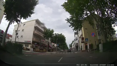
Asia-Kim
Restaurant · Asian · 2.6 km
1 Marienstraße, Langen (Hessen)
Tu-Sa 11:00-22:00; Su,PH 12:00-22:00

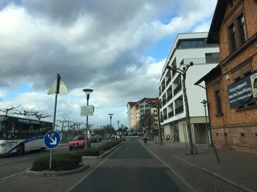
Bäumsche am Bahnhof
Restaurant · Regional · 2.9 km
3 Europaplatz, Langen (Hessen)
Mo-Sa 16:00-23:00; PH,Su 12:00-22:00
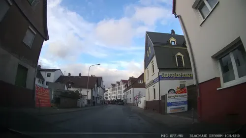

Casa del Tennis
Restaurant · Italian, Pizza, Pasta · 1.9 km
50 Heinrichstraße, Erzhausen
Tu-Su 17:00-22:00; Tu-Fr 12:00-14:30
Gute Landung
Restaurant · Regional · 1.4 km
75 Hans-Fleissner-Straße, Egelsbach
Mo-Th 15:00-22:30; Fr-Su 11:00-22:30
Haferkasten
Restaurant · German · 2.6 km
13 Wilhelm-Leuschner-Platz, Langen (Hessen)
Fr-We 11:30-14:00,18:00-22:00; Th off
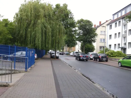
Jokers-Fried-Chicken Langen
Restaurant · Pizza, Fried Chicken · 2.9 km
25 Westendstraße, Langen (Hessen)
Mo-Su 11:00-21:00
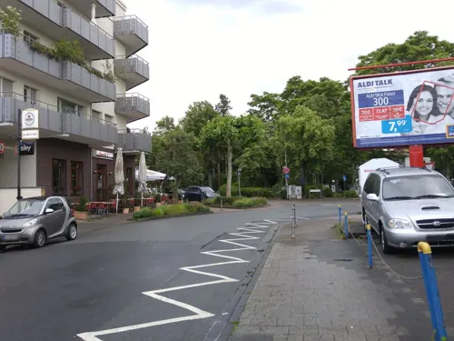
Jume's
Restaurant · International · 2.5 km
1 Walther-Rathenau-Straße, Langen (Hessen)
Tu-Sa 11:00-14:30,17:00-21:30; Su 16:00-21:30; Mo off
Little Italy
Restaurant · Pizza, Italian · 2.5 km
71 Bahnstraße, Langen (Hessen)
Apr-Sep: Su-Fr 17:30-18:00+


Matis' Waldlust
Restaurant · Regional · 2.2 km
173 Bahnstraße, Erzhausen
Tu-Sa 11:30-15:00, 17:30-23:00
119 more on the map.
History
In 1275, Egelsbach had its first documentary mention. The village then belonged to the Lords of Falkenstein, who likely inherited the place in 1255 from the Lords of Hagen-Münzenberg. After the Falkensteins’ male line died out in 1486, the Counts of Isenburg inherited Egelsbach.
In 1526, the Reformation was introduced into the village. In 1600, the Count of Isenburg sold the Amt of Kelsterbach along with Egelsbach and Langen to the Landgraves of Hesse-Darmstadt, whereupon Egelsbach became Hessian. In 1705 Egelsbach became a parish, after which it was split from the parish of Langen. With the partition of the Länger Mark (a communally owned cadastral area) in 1732, to which Egelsbach had belonged over the ages, Egelsbach got one third of the land. In 1821, the Amt of Kelsterbach was abolished and Egelsbach then belonged until 1832 to the Landratsbezirk of Langen. Since then, however, Egelsbach has been part of the Offenbach district. In 1873, the village got its own railway station on the Frankfurt am Main-Darmstadt line, and in 1955 the airport was built.
From the History section of Egelsbach on Wikipedia, under CC BY-SA 4.0.
Where to stay6
Churches and places of worship17
Martin-Luther-Kirche
Church · Lutheran · 2.7 km
31 Berliner Allee, Langen (Hessen)
Kirche Jesu Christi der Heiligen der letzten Tage
Church · Mormon · 2.3 km
22 Birkenstraße, Langen (Hessen)
Bonifatiuskapelle
Church · Orthodox · 2.1 km
4 Schloss Wolfsgarten, Langen (Hessen)
Shopping36
Gas and EV charging15
Schools, colleges and libraries18
Healthcare17
Münch'sche Apotheke zu Langen
Clinic and pharmacy · 2.4 km
1 Darmstädter Straße, Langen (Hessen)
Map of Egelsbach
250 places. The map loads OpenStreetMap tiles when you open it.
Getting there and nearby towns
Frankfurt Airport (FRA) is the nearest airport with scheduled flights listed in OpenStreetMap, 11 km away.
- Erzhausen 2 km southwest, about 2 min by car
- Langen 2 km north, about 2 min by car
- Wixhausen 4 km south, about 4 min by car
- Dreieich 6 km north, about 6 min by car
- Mörfelden-Walldorf 6 km northwest, about 6 min by car
- Gräfenhausen 6 km southwest, about 6 min by car
- Weiterstadt 9 km southwest, about 9 min by car
- Neu-Isenburg 9 km north, about 9 min by car
- Dietzenbach 9 km northeast, about 9 min by car
- Darmstadt 11 km south, about 11 min by car
Drive times are estimates from straight-line distance, not routes.
Local news
Headlines from INDB.
Reviews, tips and questions
Loading what members have shared...
Sources and licences
- GeoNames (CC BY 4.0): population, coordinates, regions and time zone
- Mapillary (see each image): photos
- OpenStreetMap contributors (ODbL 1.0): places, airports, map data
- Wikidata (CC0 1.0): elevation, founding date, time zone, website
- Wikimedia Commons (see each image): photos
- Wikipedia (CC BY-SA 4.0): overview and history text
Photo credits
- Luftaufnahme Egelsbach, Hessische Flugplatz GmbH Egelsbach ,, CC BY-SA 3.0
- Egelsbach evangelische Kirche 20110520, Rudolf Stricker, Attribution
- Egelsbach Fachwerkhaus 20110310, Rudolf Stricker, Attribution
- Stolperstein Ludwig Bacharach, 1, Ernst-Ludwig-Straße 39, Egelsbach, Landkreis Offenbach, GeorgDerReisende, CC BY-SA 4.0
- Stolperstein Emma Eisemann, 1, Ernst-Ludwig-Straße 39, Egelsbach, Landkreis Offenbach, GeorgDerReisende, CC BY-SA 4.0
- Stolperstein Daniel Katz, 1, Ernst-Ludwig-Straße 39, Egelsbach, Landkreis Offenbach, GeorgDerReisende, CC BY-SA 4.0
- Stolperstein Edith Bacharach, 1, Ernst-Ludwig-Straße 39, Egelsbach, Landkreis Offenbach, GeorgDerReisende, CC BY-SA 4.0
- Stolperstein Manfred Eisemann, 1, Ernst-Ludwig-Straße 39, Egelsbach, Landkreis Offenbach, GeorgDerReisende, CC BY-SA 4.0
- Stolperstein Gutta Bacharach, 1, Ernst-Ludwig-Straße 39, Egelsbach, Landkreis Offenbach, GeorgDerReisende, CC BY-SA 4.0
- Stolperstein Johanna Eisemann, 1, Ernst-Ludwig-Straße 39, Egelsbach, Landkreis Offenbach, GeorgDerReisende, CC BY-SA 4.0
- Stolperstein Alice Bacharach, 1, Ernst-Ludwig-Straße 39, Egelsbach, Landkreis Offenbach, GeorgDerReisende, CC BY-SA 4.0
- Stolperstein David Katz, 1, Ernst-Ludwig-Straße 39, Egelsbach, Landkreis Offenbach, GeorgDerReisende, CC BY-SA 4.0
- Stolperstein Ida Strauss, 1, Ernst-Ludwig-Straße 39, Egelsbach, Landkreis Offenbach, GeorgDerReisende, CC BY-SA 4.0
- Stolperstein Hugo Eisemann, 1, Ernst-Ludwig-Straße 39, Egelsbach, Landkreis Offenbach, GeorgDerReisende, CC BY-SA 4.0
- Stolperstein Pauline Katz, 1, Ernst-Ludwig-Straße 39, Egelsbach, Landkreis Offenbach, GeorgDerReisende, CC BY-SA 4.0
- Stolpersteinlage, 1, Ernst-Ludwig-Straße 39, Egelsbach, Landkreis Offenbach, GeorgDerReisende, CC BY-SA 4.0
- Ernst-Ludwig-Straße 39, 1, Egelsbach, Landkreis Offenbach, GeorgDerReisende, CC BY-SA 4.0
- Stolpersteinlage, 3, Ernst-Ludwig-Straße 39, Egelsbach, Landkreis Offenbach, GeorgDerReisende, CC BY-SA 4.0
- Stolpersteinlage, 1, Schulstraße 50, Egelsbach, Landkreis Offenbach, GeorgDerReisende, CC BY-SA 4.0
- Stolperstein Dina Simon, 1, Schulstraße 50, Egelsbach, Landkreis Offenbach, GeorgDerReisende, CC BY-SA 4.0
- Stolperstein Siegfried Simon, 1, Schulstraße 50, Egelsbach, Landkreis Offenbach, GeorgDerReisende, CC BY-SA 4.0
- Stolperstein Isaak Simon, 1, Schulstraße 50, Egelsbach, Landkreis Offenbach, GeorgDerReisende, CC BY-SA 4.0
- Stolpersteinlage, 2, Schulstraße 50, Egelsbach, Landkreis Offenbach, GeorgDerReisende, CC BY-SA 4.0
- Stolperstein Thekla Lehmann, 1, Schulstraße 50, Egelsbach, Landkreis Offenbach, GeorgDerReisende, CC BY-SA 4.0
- Stolperstein Erich Simon, 1, Schulstraße 50, Egelsbach, Landkreis Offenbach, GeorgDerReisende, CC BY-SA 4.0
- Egelsbach, de evangelische kerk Dm41931 IMG 1307 2024-05-23 16.23, Michielverbeek, CC BY 4.0
- Schulstraße 50, 1, Egelsbach, Landkreis Offenbach, GeorgDerReisende, CC BY-SA 4.0
- Egelsbach Evangelische Kirche 20070904, Rudolf Stricker, Public domain
- Egelsbach Rathaus 20070904, Rudolf Stricker, Public domain
- Egelsbach Rathaus 20110520, Rudolf Stricker, Attribution
- Egelsbach ehemalige Synagoge 20110310, Rudolf Stricker, Attribution
- Stolperstein Erna Reis, 1, Woogstraße 5, Egelsbach, Landkreis Offenbach, GeorgDerReisende, CC BY-SA 4.0
- Stolpersteinlage, 1, Woogstraße 5, Egelsbach, Landkreis Offenbach, GeorgDerReisende, CC BY-SA 4.0
- Stolperstein Gustav Reis, 1, Woogstraße 5, Egelsbach, Landkreis Offenbach, GeorgDerReisende, CC BY-SA 4.0
- Stolperstein Johanna Reis, 1, Woogstraße 5, Egelsbach, Landkreis Offenbach, GeorgDerReisende, CC BY-SA 4.0
- Stolperstein Theodor Reis, 1, Woogstraße 5, Egelsbach, Landkreis Offenbach, GeorgDerReisende, CC BY-SA 4.0
- Stolpersteinlage, 2, Woogstraße 5, Egelsbach, Landkreis Offenbach, GeorgDerReisende, CC BY-SA 4.0
- Woogstraße 5, 1, Egelsbach, Landkreis Offenbach, GeorgDerReisende, CC BY-SA 4.0
- Bach von der krausen Buche, 39, Egelsbach, Landkreis Offenbach, GeorgDerReisende, CC BY-SA 4.0
- Schloss Wolfsgarten Aerial fg117, Fritz Geller-Grimm supported by Rüdiger Wandke, CC BY-SA 3.0
- Erzhausen Church And Apple Trees, Ingolfson, Public domain
- Faulbruch3, Ratki, CC BY-SA 4.0
- NSG Kammereckswiesen und Herchwiesen von Langen01, KUGerhardt, CC BY-SA 4.0
- NSG Hegbachaue bei Messel, KUGerhardt, CC BY-SA 4.0
- Schillerschule Dorfmuseum Erzhausen, AndreasDelp, CC BY-SA 4.0
- Neue Stadthalle Langen, Stadt Langen, CC BY-SA 4.0
- 2020 Martin-Luther-Kirche Langen, Stefan Oemisch, CC BY-SA 4.0
- 2020 Thomas von Aquin Langen, Stefan Oemisch, CC BY-SA 4.0
- Petrusgemeindehaus Langen (Hessen) Nordansicht 2, C. M., CC BY-SA 4.0
- Maria Koenigin Erzhausen Westansicht, C. M., CC BY-SA 4.0
- "Stumpfer Turm" Langen, Hesse143, CC BY-SA 3.0
- 2020 Quari Gedenkstein, Stefan Oemisch, CC BY-SA 4.0
- 2017RestaurantWaldlust, DerNurNochAlsBilderlieferantMitmacht, CC0
- StJosefEgelsbach, Stefan Oemisch, CC BY-SA 4.0
- Langen Stadtkirche 20110310, Rudolf Stricker, Attribution
- Langen (Hessen) Aerial fg120, Fritz Geller-Grimm supported by Rüdiger Wandke, CC BY-SA 3.0
- Langen altes Rathaus 20110310, Rudolf Stricker, Attribution
- Langen Wasserhochbehälter, Oberlausitzerin64, CC BY-SA 4.0
- Street-level photo, chuck, CC BY-SA 4.0
- Street-level photo, robffm, CC BY-SA 4.0
- Street-level photo, robffm, CC BY-SA 4.0
- Street-level photo, xodes, CC BY-SA 4.0
- Street-level photo, xodes, CC BY-SA 4.0
- Street-level photo, chuck, CC BY-SA 4.0
- Street-level photo, chuck, CC BY-SA 4.0
- Street-level photo, chuck, CC BY-SA 4.0
- Street-level photo, chuck, CC BY-SA 4.0
- Street-level photo, wegavision, CC BY-SA 4.0
- Street-level photo, chuck, CC BY-SA 4.0
- Street-level photo, xodes, CC BY-SA 4.0
- Street-level photo, xodes, CC BY-SA 4.0
- Street-level photo, xodes, CC BY-SA 4.0
- Street-level photo, robffm, CC BY-SA 4.0
- Street-level photo, robffm, CC BY-SA 4.0
- Street-level photo, DCBHQQZ5662nfacw, CC BY-SA 4.0
- Street-level photo, chuck, CC BY-SA 4.0
- Street-level photo, chuck, CC BY-SA 4.0
- Street-level photo, chuck, CC BY-SA 4.0
- Street-level photo, chuck, CC BY-SA 4.0
- Street-level photo, chuck, CC BY-SA 4.0
- Street-level photo, chuck, CC BY-SA 4.0
- Street-level photo, wegavision, CC BY-SA 4.0
- Street-level photo, xodes, CC BY-SA 4.0
- Street-level photo, chuck, CC BY-SA 4.0
- Street-level photo, miguel_andrade, CC BY-SA 4.0


Page built November 9, 2026. Spotted a mistake? Tell us or suggest a place.