


Eisenhüttenstadt, Germany
Eisenhüttenstadt is a town of 32,052 people in Brandenburg, Germany, founded in 1950.
Why visit Eisenhüttenstadt
Townapedia lists 38 museums and landmarks, 20 parks and trails, 75 places to eat, 16 places to stay and 16 attractions in and around town.
Highlights include Friedrich-Wolf-Theater, Meuselberge, Feuerwehr-und Technikmuseum and Museum Utopie und Alltag – Dokumentationszentrum Alltagskultur der DDR.
Weather in Eisenhüttenstadt
Forecast from MET Norway (CC BY 4.0). Full forecast
About Eisenhüttenstadt
Eisenhüttenstadt (German pronunciation: [aɪzn̩ˈhʏtn̩ʃtat] ; lit. 'ironworks city') is a town in the Oder-Spree district of Brandenburg, Germany. It is located at the confluence of the Oder–Spree Canal and the River Oder on the border with Poland. Eisenhüttenstadt was founded as a planned city by East Germany in 1950, as a socialist model city and a state-owned steel mill complex. It was known as Stalinstadt (Lower Sorbian: Stalinměsto) between 1953 and 1961, in honor of Soviet leader Joseph Stalin, and received its current name during the de-Stalinization campaign.
From the Wikipedia article Eisenhüttenstadt (this version), under CC BY-SA 4.0.
Travel tips from other travellers: Eisenhüttenstadt on Wikivoyage (CC BY-SA 4.0).
Photos of Eisenhüttenstadt


Things to do16



4 more on the map.
Museums and landmarks38
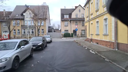
Feuerwehr-und Technikmuseum
Museum · 1.3 km
26 Heinrich-Pritzsche-Straße, Eisenhüttenstadt
Tu-Fr 12:00-16:00, Sa[1,3] 13:00-17:00; PH off

Museum Utopie und Alltag – Dokumentationszentrum Alltagskultur der DDR
Museum · 1.5 km
3 Erich-Weinert-Allee, Eisenhüttenstadt
Tu-Su,PH 11:00-17:00; Dec 24,Dec 31,Jan 01 off


Hotel Lunik
Monument and historic site · 1.5 km
35a Straße der Republik, Eisenhüttenstadt

Christussäule
Monument and historic site · 6.6 km
Die Säule aus Sandstein entstand zwischen 1736 und 1740 und zeigt einen segnenden Salvator.


Kraftwerk Vogelsang (Wernerwerk)
Monument and historic site · 3.9 km

Städtisches Museum
Museum · 1.7 km
4 Löwenstraße, Eisenhüttenstadt
Tu-Fr 12:00-16:00, Sa[1,3] 13:00-17:00; PH off

Wasserturm
Monument and historic site · 1.6 km
Wasserturm, Berliner Straße 23 Fürstenberg (Oder) Eisenhüttenstadt
26 more on the map.
Parks, trails and playgrounds20
Neuzelle Abbey
Park · 6.6 km
Monastery in Brandenburg state, Germany
Stiftsplatz, Neuzelle

Inselbad
Sports field and stadium · 1.6 km
4 Insel
Tu,Th 07:00-21:00; We,Fr 09:00-21:00; Sa-Su,PH 09:00-19:00



Spielplatz Lawitz
Playground · 4.9 km
Spielplatz mit Kletterelementen, Tischtennisplatte und Basketballkorb
8 more on the map.
Restaurants and cafes75
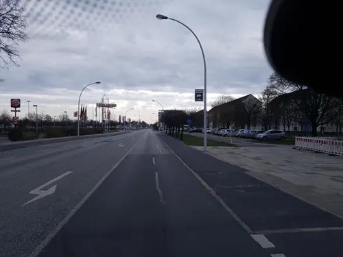
1220 Deutsche Küche
Restaurant · German · 1.2 km
54 Lindenallee, Eisenhüttenstadt
Fr-Mo 11:00-14:00, 17:00-22:00; Tu-We off; Th 17:00-22:00
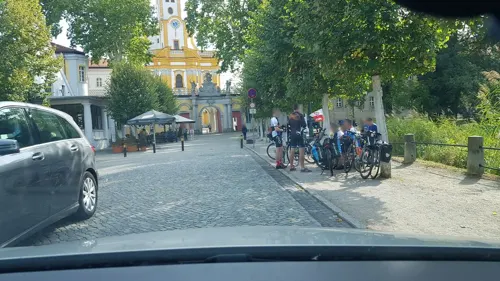
Klosterklause
Restaurant · German · 6.6 km
4 Brauhausplatz, Neuzelle
Su, We-Fr 11:30-18:00; Sa 11:30-21:00
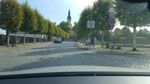
"Olea & Cafea"
Cafe · Cake, Coffee Shop · 6.6 km
Dekoration, Feinkost & Wein
1c Frankfurter Straße, Neuzelle
Tu-Fr 09:00-17:00; Sa 10:00-16:00
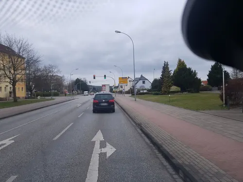
Restaurant Olympia
Restaurant · Greek · 1.5 km
114 Beeskower Straße, Eisenhüttenstadt
Mo-Su,PH 11:30-23:00
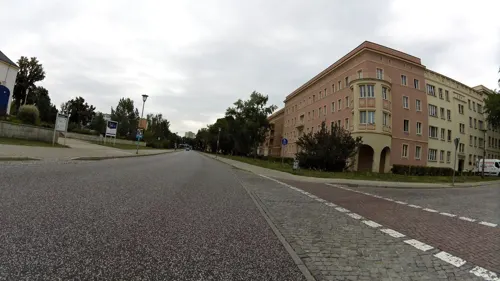
Aktivist
Restaurant · German · 1.3 km
45 Karl-Marx-Straße, Eisenhüttenstadt
Tu-Th 11:30-14:00,17:00-21:00; Fr-Sa 11:30-14:00, 17:00-22:00, Su...


Schnitzel-Wirtschaft
Restaurant · German · 1.6 km
65 Königstraße, Eisenhüttenstadt
Mo-We,Fr-Sa 16:00-22:00; Su 11:00-14:00; Su 16:00-22:00
Pizza Paradieso
Restaurant · Pizza · 1.6 km
Mo-Th 11:00-13:00,17:00-21:00; Fr,Sa 11:00-13:00,17:00-22:00; Su...
Bella Rimini Pizzeria
Restaurant · Italian · 1.0 km
81 Bahnhofstraße, Eisenhüttenstadt
11:00-14:30, 17:00-23:00
63 more on the map.
History
The town was built near the historic village of Fürstenberg (Oder) which was founded in 1251. In 1319, Fürstenberg (Polish: Przybrzeg) became part of the Duchy of Jawor within fragmented Piast-ruled Poland. Later on, it passed to the Kingdom of Bohemia, and Charles IV bought the town from the Cistercians of Neuzelle and allowed the construction of a bridge over the Oder to create a new trade route to Poland. In 1469, it passed to King Matthias Corvinus of Hungary, and, in 1490, it returned to Bohemia. After the Peace of Prague in 1635, Fürstenberg became part of the Electorate of Saxony. In 1815, it was transferred to Prussia, and, in 1871, it became part of the German Empire. In 1925, a port on the Oder was created.
During World War II, the Germans operated the Stalag III-B prisoner-of-war camp for Polish, French, Belgian, Serbian, Soviet, American, Dutch, Italian and British POWs in Fürstenberg with several forced labour subcamps in the town and region, a forced labour camp for Jewish men, and a subcamp of the Sachsenhausen concentration camp.
Read more of the history
The present-day town was founded as a socialist model city in 1950 following a decision by the East German Socialist Unity Party (SED), alongside a new steel mill combine located west of the historic town of Fürstenberg (Oder). A few years before the new town was established, a bridge over the Oder river had been constructed, the earlier one having been destroyed by retreating Wehrmacht forces in February 1945, near the end of World War II.
The population grew rapidly in the 1950s and 1960s. It was renamed Stalinstadt following the death of Joseph Stalin. In 1961, during de-Stalinization, the town was renamed Eisenhüttenstadt. After German reunification in 1990, the state-owned steel works were privatized, and most of its 12,000 employees lost their jobs. Thereafter the factory employed around 2,500 workers. The town experienced a steep decline in population, from just over 50,000 to under 30,000. Consequently, many apartment blocks have now been demolished, although some in the inner city dating from the 1950s have been renovated and restored.
From the History section of Eisenhüttenstadt on Wikipedia, under CC BY-SA 4.0.
More about Eisenhüttenstadt
Geography
The municipal area is situated on a sandy terrace in the Berlin-Warsaw glacial valley (Urstromtal). It is bounded by the Oder river and Germany–Poland border to the east. Eisenhüttenstadt is the eastern terminus of the Oder–Spree Canal. The town centre is located about 25 kilometres (16 mi) south of Frankfurt (Oder) and 110 km (68 mi) southeast of Berlin. Eisenhüttenstadt is served by the Berlin–Wrocław railway line.
The town comprises the districts of Diehlo, Fürstenberg (Oder), and Schönfließ.
From the Wikipedia article Eisenhüttenstadt, under CC BY-SA 4.0.
Notable people from Eisenhüttenstadt
 Paul van DykGerman DJ and trance music producerPhoto: Christoph Köstlin, CC BY-SA 4.0
 Roger KlugeGerman racing cyclistPhoto: Nicola, CC BY-SA 4.0
 Paul JaeckelGerman footballerPhoto: Steffen Prößdorf, CC BY-SA 4.0
 Pia KästnerGerman volleyball playerPhoto: Steffen Prößdorf, CC BY-SA 4.0
 Gisela BeyerGerman discus throwerPhoto: Benno Bartocha, CC BY-SA 3.0 de
 Sven HelbigGerman composerPhoto: Claudia Weingart, CC BY-SA 4.0
 Clemens RostockGerman politicianPhoto: Max Pfeuffer, CC BY-SA 4.0
- Udo BeyerEast German athlete
- Kathrin BoronGerman rower
- Torsten GutscheCanoe racer
- Sören LausbergGerman cyclist
- Florian Müllerassociation football player
Born in Eisenhüttenstadt, according to Wikidata (CC0). Each name links to its Wikipedia article.
Where to stay16
Churches and places of worship14
Nikolaikirche
Church · Lutheran · 1.7 km
1 Kirchplatz, Eisenhüttenstadt
Evangelische Friedensgemeinde
Church · Lutheran · 1.9 km
37 Robert-Koch-Straße, Eisenhüttenstadt
Adventhaus
Church · Seventh Day Adventist · 1.5 km
125 Gubener Straße, Eisenhüttenstadt
Apostelamt Jesu Christi
Church · New Apostolic · 2.7 km
1a Müllroser Straße, Eisenhüttenstadt
Ev. Gemeindehaus Mueller-Schlomka
Church · Lutheran · 1.5 km
9 Gubener Straße, Eisenhüttenstadt
Evangelisch-Freikirchliche-Gemeinde
Church · Baptist · 1.5 km
12 Bahnhofstraße, Eisenhüttenstadt
Shopping32
Gas and EV charging7
Schools, colleges and libraries22
Landesschule und Technische Einrichtung für Brand- und Katastrophenschutz
School · 1.4 km
1a Eisenbahnstraße, Eisenhüttenstadt
Freie Oberschule und Freies Gymnasium im Stift Neuzelle
School · 6.5 km
7 Stiftsplatz, Neuzelle
Healthcare10
MVZ Gesundheitszentrum
Clinic and pharmacy · 2.1 km
1 Neuzeller Landweg, Eisenhüttenstadt
Städtisches Krankenhaus Eisenhüttenstadt
Hospital · 2.0 km
39 Friedrich-Engels-Straße, Eisenhüttenstadt
Map of Eisenhüttenstadt
250 places. The map loads OpenStreetMap tiles when you open it.
Getting there and nearby towns
Berlin Brandenburg Airport "Willy Brandt" (BER) is the nearest airport with scheduled flights listed in OpenStreetMap, 82 km away.
- Neuzelle 7 km south, about 7 min by car
- Frankfurt (Oder) 23 km north, about 23 min by car
- Guben 23 km south, about 23 min by car
- Beeskow 28 km west, about 28 min by car
- Peitz 36 km southwest, about 36 min by car
- Fürstenwalde 46 km northwest, about 46 min by car
- Seelow 46 km northwest, about 46 min by car
- Cottbus 49 km southwest, about 49 min by car
- Kolkwitz 52 km southwest, about 52 min by car
- Müncheberg 53 km northwest, about 53 min by car
Drive times are estimates from straight-line distance, not routes.
Towns near Eisenhüttenstadt


Keep exploring
Local news
Headlines from INDB.
Reviews, tips and questions
Loading what members have shared...
Sources and licences
- GeoNames (CC BY 4.0): population, coordinates, regions and time zone
- Mapillary (see each image): photos
- OpenStreetMap contributors (ODbL 1.0): places, airports, map data
- Wikidata (CC0 1.0): elevation, founding date, time zone, website, landmarks and historic places
- Wikimedia Commons (see each image): photos
- Wikipedia (CC BY-SA 4.0): overview and history text
Photo credits
- Eisenhüttenstadt Weg zum Hochofen 2012, https://www.flickr.com/photos/ehstadtbild/, CC BY 2.0
- Oder-Spree-Kanal in Eisenhüttenstadt 2025 002, Sebastian Wallroth, CC BY 4.0
- Oder-Spree-Kanal in Eisenhüttenstadt 2025 003, Sebastian Wallroth, CC BY 4.0
- Oder-Spree-Kanal in Eisenhüttenstadt 2025 004, Sebastian Wallroth, CC BY 4.0
- Oder-Spree-Kanal in Eisenhüttenstadt 2025 005, Sebastian Wallroth, CC BY 4.0
- Oder-Spree-Kanal in Eisenhüttenstadt 2025 001, Sebastian Wallroth, CC BY 4.0
- Bahnhof Eisenhüttenstadt, CGCologne, CC BY-SA 4.0
- Bahnhof Eisenhüttenstadt 2, CGCologne, CC BY-SA 4.0
- Eisenhüttenstadt, Germany - panoramio, André Fischer, CC BY-SA 3.0
- Physiotherapie in Eisenhüttenstadt - panoramio, André Fischer, CC BY-SA 3.0
- Eisenhüttenstadt sk (09), Stefan Kühn, CC0
- Eisenhüttenstadt sk (10), Stefan Kühn, CC0
- Eisenhüttenstadt sk (08), Stefan Kühn, CC0
- Eisenhüttenstadt sk (07), Stefan Kühn, CC0
- Eisenhüttenstadt, Platz des Gedenkens (4), Hystrix, CC BY-SA 4.0
- Eisenhüttenstadt, Platz des Gedenkens (3), Hystrix, CC BY-SA 4.0
- Eisenhüttenstadt sk (04), Stefan Kühn, CC0
- Eisenhüttenstadt sk (05), Stefan Kühn, CC0
- Eisenhüttenstadt sk (06), Stefan Kühn, CC0
- Die gute Nachbarschaft. Eisenhüttenstadt, ehststadtbilder, CC BY 2.0
- Eisenhüttenstadt sk (03), Stefan Kühn, CC0
- Eisenhüttenstadt sk (02), Stefan Kühn, CC0
- Neuzelle Klosterkirche SW, PetrusSilesius, CC BY-SA 3.0
- Fürstenberg (Oder) Kirche I, Hamster 3 (M. Bechmann, Jena), CC BY-SA 3.0
- Kloster Neuzelle Pfarrkirche zum Heiligen Kreuz 01, J.-H. Janßen, CC BY-SA 4.0
- Kraftwerk Vogelsang 2007, Charlotte Nordahl , Dresden, CC BY-SA 2.0
- Kloster Neuzelle Stiftskirche St Marien 02, J.-H. Janßen, CC BY-SA 4.0
- Hotel Lunik, Peter Kaminsky, Berndroth, CC BY-SA 4.0
- Gruftbau auf dem Friedhof von außen, Peter Kaminsky, Berndroth, CC BY-SA 4.0
- Herz-Jesu-Kirche (Fürstenberg), HistorianoftheMarch, CC BY-SA 4.0
- Dreifaltigkeitskapelle Neuzelle, Vorderansicht, Angela M. Arnold (=44penguins) (changes by Rabanus Flavus ), CC BY-SA 2.5
- Neuzelle Klosterbrauerei, Unknown author, CC BY-SA 3.0
- Wohnhaus mit Gaststätte Stadtmitte, Königstraße 53, Eisenhüttenstadt, Andreas33, CC BY-SA 3.0
- Kapelle in Neuzelle 2013-03-26 ama fec, Angela M. Arnold (=44penguins), CC BY-SA 2.5
- Fürstenberg (Oder) Kirche I, Hamster 3 (M. Bechmann, Jena), CC BY-SA 3.0
- Glockenturm der kath. Heilig-Kreuz-Kirche, neben dem modernen Gebäude, Peter Kaminsky, Berndroth, CC BY-SA 4.0
- St.Marien in Neuzelle (29346208682), Bjoern Schwarz, CC BY-SA 2.0
- Kindergarten in der Erich-Weinert-Allee, Peter Kaminsky, Berndroth, CC BY-SA 4.0
- Evangelische Stadtkirche St. Nikolai, gesehen von der Alten Brückenstraße 6, Peter Kaminsky, Berndroth, CC BY-SA 4.0
- GZ Eisenhüttenstadt 2, Gemeindezentrum Eisenhüttenstadt, CC0
- Eisenhüttenstadt, Lindenallee, ehemaliger Autosalon und Friedrich-Wolf-Theater (2), Hystrix, CC BY-SA 4.0
- Street-level photo, dsmm, CC BY-SA 4.0
- Street-level photo, dsmm, CC BY-SA 4.0
- Street-level photo, dsmm, CC BY-SA 4.0
- Street-level photo, aramsamsam, CC BY-SA 4.0
- Street-level photo, dsmm, CC BY-SA 4.0
- Street-level photo, aramsamsam, CC BY-SA 4.0
- Street-level photo, aramsamsam, CC BY-SA 4.0
- Street-level photo, moenk, CC BY-SA 4.0
- Street-level photo, dsmm, CC BY-SA 4.0
- Street-level photo, aramsamsam, CC BY-SA 4.0
- Street-level photo, aramsamsam, CC BY-SA 4.0
- Street-level photo, dsmm, CC BY-SA 4.0
- Street-level photo, dsmm, CC BY-SA 4.0


Page built November 9, 2026. Spotted a mistake? Tell us or suggest a place.