


Why visit Fürstenwalde
Townapedia lists 56 museums and landmarks, 29 parks and trails, 94 places to eat, 14 places to stay and 17 attractions in and around town.
Highlights include Kulturfabrik, Dubrower Berge, Jagdschloss Fürstenwalde and Museum Fürstenwalde.
Weather in Fürstenwalde
Forecast from MET Norway (CC BY 4.0). Full forecast
About Fürstenwalde
Fürstenwalde/Spree (German pronunciation: [ˈfʏʁstn̩ˌvaldə] ; Lower Sorbian: Pśibor pśi Sprjewje [ˈpɕibɔr ˈpɕi sprʲɛwʲɛ]) is the most populous town in the Oder-Spree District of Brandenburg, in eastern Germany.
From the Wikipedia article Fürstenwalde (this version), under CC BY-SA 4.0.
Photos of Fürstenwalde


Things to do17



Heimattiergarten
Zoo and aquarium · 1.4 km
10B Doktor-Wilhelm-Külz-Straße, Fürstenwalde/Spree
09:00-18:00; Oct-Mar 09:00-16:00


Kräuterhof
Farm and orchard · 4.6 km
3 Kräuterweg, Steinhöfel
Mo,Tu 08:00-14:00; We 12:00-14:00; Th 08:00-17:00; Fr 08:00-13:00

5 more on the map.
Museums and landmarks56

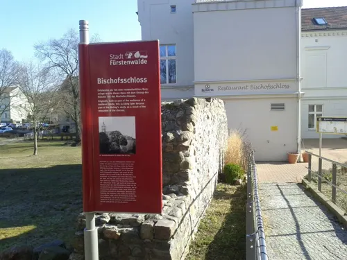
Jagdschloss Fürstenwalde
Monument and historic site · 0.6 km
13 Schloßstraße, Fürstenwalde/Spree


Memorial for the Soviet Special Camp 5
Monument and historic site · 3.3 km

Wasserturm
Monument and historic site · 3.0 km
Wasserturm der Gutsanlage in Fürstenwalde, Palmnicken - heute Oberstufenzentrum


Haus Brandenburg
Museum · 0.7 km
14 Parkallee, Fürstenwalde/Spree
Mo-Fr 09:00-13:00; Tu,Th 10:00-15:00
44 more on the map.
Parks, trails and playgrounds29

Freizeitbad Schwapp
Sports field and stadium · 1.8 km
1 Große Freizeit, Fürstenwalde/Spree
Th-Su,PH 10:00-20:00



Duellarena
Playground · 3.6 km
Nov-May Mo-Fr 13:00-18:00, Sa, Su, PH 10:00-18:00; Apr-Aug Mo-Su...
Pneumant-Sportforum
Sports field and stadium · 2.8 km
6 Siegfried-Hirschmann-Straße, Fürstenwalde/Spree
17 more on the map.
Restaurants and cafes94

Mokuryu
Restaurant · Japanese, Vietnamese · 1.1 km
66 Lindenstraße, Fürstenwalde/Spree
Mo-Su 11:00-22:00

Zunfthaus 383
Restaurant · Regional
12 Tuchmacherstraße, Fürstenwalde/Spree
Mo,Th-Sa 12:00-21:30; Su 12:00-15:00
Gao Garden
Restaurant · Asian, Sushi · 1.9 km
62 Lange Straße, Fürstenwalde/Spree
Mo-Th 11:30-22:00; Fr-Sa 11:30-23:00; Su 12:00-22:00
Bêp Bàp Ngoąi
Restaurant · Vietnamese, Japanese
23 Eisenbahnstraße, Fürstenwalde/Spree
Mo-Sa 11:00-22:00; Su 12:00-22:00

Asia Snack
Restaurant · Asian
24 Eisenbahnstraße, Fürstenwalde/Spree
Mo-Fr,Su 11:00-21:00
82 more on the map.
History
The settlement of Fürstenwalde was first mentioned in a 1272 deed, founded in the course of the German Ostsiedlung migration at a ford across the Spree river, probably near the site of a former Slavic settlement. The Lebus Land had been acquired from Poland by the Ascanian margraves of Brandenburg in 1248/1249. The town's importance rose as a staple port and terminal of the transportation of goods on the river.
In 1373 Emperor Charles IV, since 1367 also Margrave of adjacent Lower Lusatia campaigned the Brandenburg lands and enforced the renunciation of the Wittelsbach margrave Otto VII of Brandenburg by the Treaty of Fürstenwalde. From 1373 to 1415, the town was part of the Bohemian Crown. As also the collegiate church in Lebus was destroyed, Bishop Wenceslaus moved the official seat of the Bishopric of Lebus to Fürstenwalde, where the St Mary's Church was raised to a cathedral.
The last Catholic bishop was Georg von Blumenthal (1490–1550), who was besieged in his palace by Lutheran robbers led by Nickel von Minckwitz. The Bishop had to escape through a window in disguise. The bishopric was secularized during the Reformation in 1555, and was completely disbanded at the ascension of Joachim Frederick as Margrave of Brandenburg in 1598.
Read more of the history
From the 18th century, Fürstenwalde was part of the Kingdom of Prussia, and from 1815 to 1947, it was administratively located in the Province of Brandenburg. In the early 18th century, a commune of French Huguenots was established in the town. During World War II, it was the location of a subcamp of the Sachsenhausen concentration camp. From 1947 to 1952 it was part of the State of Brandenburg, from 1952 to 1990 of the Bezirk Frankfurt of East Germany and since 1990 again of Brandenburg.
From the History section of Fürstenwalde on Wikipedia, under CC BY-SA 4.0.
More about Fürstenwalde
Geography
The town is situated in the glacial valley (Urstromtal) of the Spree river north of the Rauen Hills, about 60 km (37 mi) east of Berlin and 30 km (19 mi) west of Frankfurt (Oder). The district capital Beeskow is about 25 km (16 mi) to the southeast. In the north, the municipal area comprises the village of Trebus. The town is located on the western part of historic Lubusz Land (Land Lebus).
The Fürstenwalde station is a stop on the railway line from Berlin to Frankfurt (Oder), the former Lower Silesian-Marcher Railway. It also has access to the parallel Bundesautobahn 12. The 39 MW Fürstenwalde Solar Park supplies electricity to the local grid.
From the Wikipedia article Fürstenwalde, under CC BY-SA 4.0.
Notable people from Fürstenwalde
 Wilhelm BurgdorfGerman general (1895–1945)Photo: Unknown author, Public domain
 Hans Michael RehbergGerman actor and director (1938-2017)Photo: Philipp von Ostau, CC BY-SA 3.0
 Karl RothenburgGerman General and Knight's Cross recipientPhoto: Unknown author Unknown author, CC BY-SA 3.0 de
 Helmut PankeGerman businessmanPhoto: Oliver Nanzig, CC BY 2.0
 Moritz HoffmannGerman physician (1621-1698)Photo: Hoffmann, Mauritz (1621-1698) (depicted), Public domain
 Hans von Guretzky-CornitzImperial German Army general (1855–1917)Photo: Unknown author Unknown author, CC BY-SA 3.0
 Pit KrokeGerman sculptor (1940–2016)Photo: Alexkrok, CC BY-SA 4.0
- Ernst LaasGerman philosopher (1837–1885)
- Burkhard ReichGerman footballer
- Ottomar GeschkeGerman politician and locksmith (1882-1957)
- Hans-Joachim JentschGerman judge and politician (1937-2021)
- Wolfgang GötzeGerman physicist (1937–2021)
Born in Fürstenwalde, according to Wikidata (CC0). Each name links to its Wikipedia article.
Where to stay14
Churches and places of worship14
Adventgemeinde Fürstenwalde
Church · Seventh Day Adventist · 1.2 km
5 Albert-Kleeberg-Straße, Fürstenwalde/Spree
Shopping32
Gas and EV charging8
Schools, colleges and libraries20
Healthcare8
Galenus-Apotheke
Clinic and pharmacy · 2.6 km
22A Bahnhofstraße, Fürstenwalde/Spree
Nord-Apotheke
Clinic and pharmacy · 1.2 km
25 Johann-Sebastian-Bach-Straße, Fürstenwalde/Spree
Süd-Apotheke
Clinic and pharmacy · 1.5 km
25 August-Bebel-Straße, Fürstenwalde/Spree
Map of Fürstenwalde
250 places. The map loads OpenStreetMap tiles when you open it.
Getting there and nearby towns
Berlin Brandenburg Airport "Willy Brandt" (BER) is the nearest airport with scheduled flights listed in OpenStreetMap, 38 km away.
- Müncheberg 17 km north, about 17 min by car
- Erkner 22 km west, about 22 min by car
- Woltersdorf 24 km northwest, about 24 min by car
- Beeskow 24 km southeast, about 24 min by car
- Strausberg 27 km northwest, about 27 min by car
- Seelow 29 km northeast, about 29 min by car
- Königs Wusterhausen 30 km west, about 30 min by car
- Zeuthen 30 km west, about 30 min by car
- Eichwalde 30 km west, about 30 min by car
- Frankfurt (Oder) 33 km east, about 33 min by car
Drive times are estimates from straight-line distance, not routes.
Towns near Fürstenwalde


Keep exploring
Local news
Headlines from INDB.
Reviews, tips and questions
Loading what members have shared...
Sources and licences
- GeoNames (CC BY 4.0): population, coordinates, regions and time zone
- Mapillary (see each image): photos
- OpenStreetMap contributors (ODbL 1.0): places, airports, map data
- Wikidata (CC0 1.0): elevation, founding date, time zone, website, landmarks and historic places
- Wikimedia Commons (see each image): photos
- Wikipedia (CC BY-SA 4.0): overview and history text
Photo credits
- Fuerstenwalde Spree, Clemensfranz, CC BY-SA 3.0
- Denkmal Antifaschistischer Widerstand, Fürstenwalde 3, Gerd Fahrenhorst, CC BY 4.0
- Fürstenwalde-Spree - Hotel Kaiserhof - panoramio, Roland Totzauer, CC BY 3.0
- Hotel Kaiserhof , Domstadt Fürstenwalde-Spree - panoramio, Peter Dargatz, CC BY 3.0
- Fürstenwalde Eisenbahnstraße 19, Clemensfranz, CC BY-SA 3.0
- Fürstenwalde Brandenburg Stolperstein Eisenbahnstraße, Clemensfranz, CC BY-SA 3.0
- Stolperstein Eisenbahnstr 147 (Fürstenwalde) Hilde Ruth Hirsch, OTFW , Berlin, CC BY-SA 3.0
- Stolperstein Eisenbahnstr 147 (Fürstenwalde) Rosa Storch, OTFW , Berlin, CC BY-SA 3.0
- Stolperstein Eisenbahnstr 147 (Fürstenwalde) Werner Hirsch, OTFW , Berlin, CC BY-SA 3.0
- Stolperstein Eisenbahnstr 147 (Fürstenwalde) Heimann Storch, OTFW , Berlin, CC BY-SA 3.0
- Stolperstein Eisenbahnstr 147 (Fürstenwalde) Eva Flora Prager, OTFW , Berlin, CC BY-SA 3.0
- Stolperstein Eisenbahnstr 147 (Fürstenwalde) Josef Jossel Prager, OTFW , Berlin, CC BY-SA 3.0
- Hotel Kaiserhof Fürstenwalde - panoramio, Peter Dargatz, CC BY 3.0
- Fürstenwalde Dr-Wilhelm-Külz-Straße 61, Clemensfranz, CC BY-SA 3.0
- Skulptur Frankfurter Str 4 (Fürstenwalde) Zwei Ziegen auf der Brücke&Stephan Horota&19772, OTFW , Berlin, CC BY-SA 3.0
- Skulptur Frankfurter Str 4 (Fürstenwalde) Zwei Ziegen auf der Brücke&Stephan Horota&19774, OTFW , Berlin, CC BY-SA 3.0
- Skulptur Frankfurter Str 4 (Fürstenwalde) Zwei Ziegen auf der Brücke&Stephan Horota&1977, OTFW , Berlin, CC BY-SA 3.0
- Skulptur Frankfurter Str 4 (Fürstenwalde) Zwei Ziegen auf der Brücke&Stephan Horota&19775, OTFW , Berlin, CC BY-SA 3.0
- Skulptur Frankfurter Str 4 (Fürstenwalde) Zwei Ziegen auf der Brücke&Stephan Horota&19773, OTFW , Berlin, CC BY-SA 3.0
- Brunnen Eisenbahnstr 22 (Fürstenwalde) Grasnick Brunnen&&19073, OTFW , Berlin, CC BY-SA 3.0
- Brunnen Eisenbahnstr 22 (Fürstenwalde) Grasnick Brunnen&&19076, OTFW , Berlin, CC BY-SA 3.0
- Brunnen Eisenbahnstr 22 (Fürstenwalde) Grasnick Brunnen&&1907, OTFW , Berlin, CC BY-SA 3.0
- Brunnen Eisenbahnstr 22 (Fürstenwalde) Grasnick Brunnen&&19077, OTFW , Berlin, CC BY-SA 3.0
- Brunnen Eisenbahnstr 22 (Fürstenwalde) Grasnick Brunnen&&19074, OTFW , Berlin, CC BY-SA 3.0
- Brunnen Eisenbahnstr 22 (Fürstenwalde) Grasnick Brunnen&&19075, OTFW , Berlin, CC BY-SA 3.0
- Brunnen Eisenbahnstr 22 (Fürstenwalde) Grasnick Brunnen&&19072, OTFW , Berlin, CC BY-SA 3.0
- Stolperstein Eisenbahnstr 8 (Fürstenwalde) Herbert Flatauer, OTFW , Berlin, CC BY-SA 3.0
- Büste Ottomar-Geschke-Platz (Fürstenwalde) Ottomar Geschke&Walter Kreisel&19772, OTFW , Berlin, CC BY-SA 3.0
- Büste Ottomar-Geschke-Platz (Fürstenwalde) Ottomar Geschke&Walter Kreisel&1977, OTFW , Berlin, CC BY-SA 3.0
- Opferdenkmal VVN Fürstenwalde Spree, Clemensfranz, CC BY-SA 3.0
- Denkmal OdF in Fürstenwalde Spree, Clemensfranz, CC BY-SA 4.0
- Infotafel Galgenberg Fürstenwalde, Gerd Fahrenhorst, CC BY 4.0
- Fürstenwalde Sowjetisches Ehrendenkmal, Clemensfranz, CC BY-SA 3.0
- Bullenturm u. Sparkasse Fürstenwalde - panoramio, Peter Dargatz, CC BY 3.0
- Denkmal Antifaschistischer Widerstand, Fürstenwalde 1, Gerd Fahrenhorst, CC BY 4.0
- Denkmal Antifaschistischer Widerstand, Fürstenwalde 2, Gerd Fahrenhorst, CC BY 4.0
- Sowjetische Ehrendenkmal Fürstenwalde Spree, Clemensfranz, CC BY-SA 4.0
- Rauener Steine I, Mazbln, CC BY-SA 3.0
- Fuerstenwalde St Marien, Doris Antony , Berlin, CC BY-SA 3.0
- Dubrower Berge aus SW IMG 0803, Phil Froide, Public domain
- Dorfkirche Trebus Fürstenwalde 02, Lienhard Schulz, CC BY-SA 3.0
- Lutherische Kirche Fürstenwalde Front, Matthias Krieser, CC BY-SA 3.0
- Rauener Berge, Segnilk, CC BY-SA 3.0
- Gedenkstätte Speziallager Ketschendorf, Clemensfranz, CC BY-SA 3.0
- Dorfkirche Rauen Südostansicht, Assenmacher, CC BY-SA 4.0
- Dorfkirche Berkenbrück Westturm Südwestansicht, Assenmacher, CC BY-SA 4.0
- Fürstenwalde St. Johannis Südansicht, Assenmacher, CC BY-SA 4.0
- Dorfkirche Neu Golm 1, Dreizung, CC BY-SA 4.0
- Schmalstes Haus von Fürstenwalde. Breite 3,83 m. - panoramio, Peter Dargatz, CC BY 3.0
- Bundesarchiv Bild 183-11410-0012, Blick auf ein MAS Kulturhaus, Klein, CC BY-SA 3.0 de
- Jagdschloss FUE 0017 DSC 0017, Fotograf51, CC BY 4.0
- Fuerstenwalde Palmnicken Wasserturm, Oberlausitzerin64, CC BY-SA 4.0
- Villa Strohsack, Elgaard, CC BY-SA 4.0
- Dom in Fuerstenwalde (Spree), A.Savin, CC BY-SA 3.0
- Lutherkirche in Fuerstenwalde (Spree), A.Savin, CC BY-SA 3.0
- Fürstenwalde Kulturfabrik, Clemensfranz, CC BY-SA 3.0
- Street-level photo, carlheinz, CC BY-SA 4.0
- Street-level photo, moenk, CC BY-SA 4.0
- Street-level photo, fdmap, CC BY-SA 4.0
- Street-level photo, polarmap, CC BY-SA 4.0
- Street-level photo, polarmap, CC BY-SA 4.0
- Street-level photo, dsmm, CC BY-SA 4.0
- Street-level photo, carlheinz, CC BY-SA 4.0
- Street-level photo, moenk, CC BY-SA 4.0
- Street-level photo, carlheinz, CC BY-SA 4.0
- Street-level photo, sumy, CC BY-SA 4.0
- Street-level photo, sumy, CC BY-SA 4.0
- Street-level photo, sumy, CC BY-SA 4.0
- Street-level photo, dsmm, CC BY-SA 4.0
- Street-level photo, sumy, CC BY-SA 4.0
- Street-level photo, grada, CC BY-SA 4.0
- Street-level photo, moenk, CC BY-SA 4.0
- Street-level photo, dsmm, CC BY-SA 4.0
- Street-level photo, polarmap, CC BY-SA 4.0


Page built November 9, 2026. Spotted a mistake? Tell us or suggest a place.