


Why visit Müncheberg
Townapedia lists 55 museums and landmarks, 17 parks and trails, 44 places to eat, 19 places to stay and 28 attractions in and around town.
Highlights include Wasserturm, Parklichtspiele Buckow, Brecht-Weigel-Haus and Schloß Trebnitz.
Weather in Müncheberg
Forecast from MET Norway (CC BY 4.0). Full forecast
About Müncheberg
Müncheberg (German pronunciation: [ˈmʏnçəˌbɛʁk] ) is a small town in Märkisch-Oderland, in eastern Germany approximately halfway between Berlin and the border with Poland, within the historic region of Lubusz Land.
From the Wikipedia article Müncheberg (this version), under CC BY-SA 4.0.
Photos of Müncheberg


Things to do28

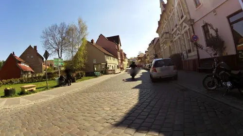
Parklichtspiele Buckow
Cinema and theater · 8.1 km
1 Wriezener Straße, Buckow (Märkische Schweiz)
Mo-Fr 16:30-22:00; Sa,Su 14:00-22:00



Hofladen Bergschäferei
Farm and orchard · 6.6 km
3 Eberswalder Chaussee, Waldsieversdorf
We-Fr 12:00-18:00



16 more on the map.
Museums and landmarks55

Brecht-Weigel-Haus
Monument and historic site · 8.4 km
30 Bertolt-Brecht-Straße, Buckow (Märkische Schweiz)


Bahnhof
Monument and historic site · 7.3 km
1 Bahnhofstraße, Buckow (Märkische Schweiz)


Steinkiste im Tempelberger Forst
Monument and historic site · 9.1 km
43 more on the map.
Parks, trails and playgrounds17


Schlosspark Trebnitz
Park · 6.4 km
"24/7 auf den Wegen. Das Areal jenseit der Wege ist derzeit gesperrt."


Kletterwand
Playground · 6.9 km
Keine klassische Kletterwand, sondern schräge Betonfläche
5 more on the map.
Restaurants and cafes44
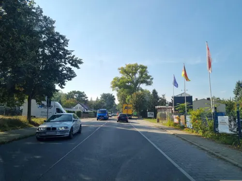
Bistorante zum Storchennest
Restaurant · German, Regional · 6.8 km
4 An der B 1, Müncheberg
Su-Th 11:00-20:00; Fr-Sa 11:00-22:00
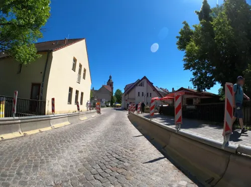
Castello Angelo
Restaurant · Italian · 8.1 km
59 Wriezener Straße, Buckow (Märkische Schweiz)
Mo,We,Th 15:00-22:00; Fr-Su 12:00-22:00; Tu off
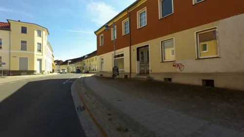
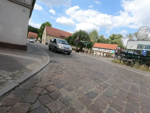
MOSES Cafe Bistro Vinothek
Restaurant · Mediterranean, Coffee Shop, Ice Cream, Cake, Juice, Salad, Pasta, Bistro · 8.0 km
5 Am Markt, Buckow (Märkische Schweiz)
Tu-Su 11:00-21:00
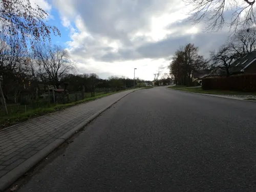
Café Landei
Cafe · Regional · 4.6 km
Selbstgebackener Kuchen, Kaffeespezialitäten, Flammkuchen, Bio-Ravioli.
8A Hermersdorfer Straße, Müncheberg
Sa, Su 11:00-18:00
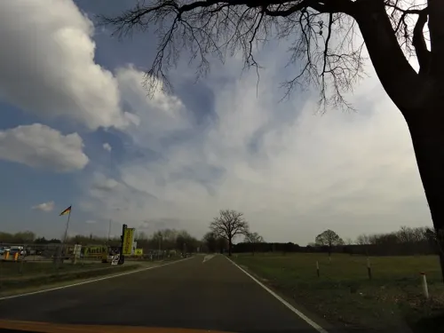
Imbiss & Gulaschkanone
Restaurant · Regional · 8.4 km
1d Berliner Straße, Müncheberg
Mo-Th 09:00-16:30; Fr-Su 09:00-17:00
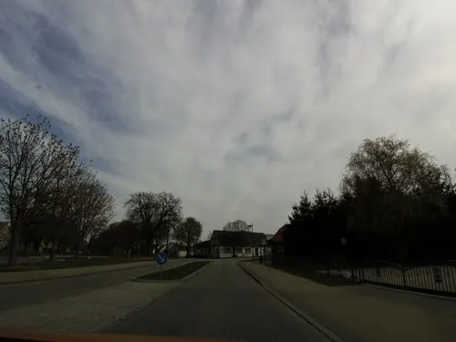

Ausflugsgaststätte Fliegende-Kiste
Restaurant · German · 4.4 km
4 Am Flugplatz, Müncheberg
Tu-Fr 07:00-14:00; Sa,Su 10:00-17:00; Mo off

Kaffee zum Glück | Kawa na szczescie
Cafe · Coffee Shop · 6.1 km
6 Trebnitzer Hauptstraße, Müncheberg
Mo-Fr off; Sa 11:30-17:00; Su 11:00-17:00 "nur in der Saison"
Losguthof
Restaurant · Regional · 9.9 km
35 Dorfstraße, Vierlinden
Sa-Su 11:00-20:00
32 more on the map.
History
The settlement was founded between 1225 and 1232 by Cistercian monks who had been given the land by the Piast Duke of Lower Silesia and soon-to-be monarch of Poland, Henry I the Bearded. A citation in a document from June 29, 1232, marks the official date of the founding. This first settlement was called Lubes (modern Polish: Lubiąż) by the monks in honor of the Lubiąż Abbey in Lower Silesia, Poland, where they originally came from. This name was not kept for long and in February 1233 the settlement was first mentioned as Munichberc (Middle High German for "Monk's Hill") in a charter by Pope Gregory IX. The settlement grew quickly and gained town privileges in 1245. The increasing prosperity led to the construction of a 7-metre-high (23 ft) city wall in 1319. After a war broke out over control of the region in 1319, the town came under the control of the Duchy of Pomerania. In 1319, Wartislaw IV granted new privileges to the town. In 1324, the town passed to Brandenburg, and between 1373 and 1415 it was part of the Bohemian (Czech) Crown.
Read more of the history
On April 17, 1432, the town was conquered by the Hussites who plundered the church and set the town on fire. In 1605 an epidemic of bubonic plague infested Müncheberg, killing 696 inhabitants. By 1624 about 1,300 people were living in the town again. Following the Thirty Year War (1618–1648) and further epidemics, the number of inhabitants dropped to less than 400 in 1655.
In 1697, a commune of French Huguenot refugees was founded in the town. Ca. 1700 the town became a permanent military base. In 1710, the French Church was consecrated. The population increased and by 1800 the town was flourishing again. The French commune was dissolved in 1806. The first school was constructed in 1852 as well as a new synagogue (1856) for the Jewish community. The Prussian Eastern Railway between Berlin and the what then eastern Germany (later independent Poland) started operating on October 1, 1867 giving Müncheberg a fast connection to the capital. The first volunteer fire brigade was formed in 1888.
During World War I, a German prisoner-of-war camp for Allies, including Americans, was operated in the town. During World War I, 129 soldiers from Müncheberg were killed in action. In 1928 the Kaiser Wilhelm Institute for Breeding Research was opened.
During World War II, a subcamp of the Sachsenhausen concentration camp was located in the present-day district of Trebnitz. The prisoners were Norwegians, Poles, Germans and Soviets. In early 1945, a death march of prisoners of various nationalities from the dissolved camp in Żabikowo to Sachsenhausen passed through the town. In the war, more than 400 inhabitants of Müncheberg died fighting on various battlefields in Europe. Combat in Müncheberg between the Wehrmacht and the Red Army took place from April 17 to April 19, 1945 and destroyed 85% of the town.
After World War II, Müncheberg was part of the Soviet occupation zone. From 1949 until the German Reunification on October 3, 1990, the town was a municipality in the Bezirk (district) Frankfurt (Oder) of the German Democratic Republic (East Germany).
From the History section of Müncheberg on Wikipedia, under CC BY-SA 4.0.
More about Müncheberg
Geography
Prior to 2003 the area today covered by Müncheberg was organized as the so-called "Amt Müncheberg". It included eight municipalities that were incorporated on March 31, 2002 to form the town of Müncheberg:
Education
Müncheberg serves as a regional center for the area. Facilities include:
Gesamtschule mit gymnasialer Oberstufe Müncheberg (grades 7-10; with Fachoberschulreife as school-leaving diploma, qualifying for vocational school; - since 2005: grades 11–13; with Abitur as school leaving exam, qualifying for university)
The Oberschule Müncheberg (grades 7-10; with MSA as school-leaving exam, qualifying for university) which was established on the foundation walls of a former military barracks in 1991—as a sign of the dawning of a new age—was closed in July 2007 in the aftermath of the 1990s decline in the birth rate. Between August 22, 1991 and July 11, 2007, up to 750 pupils per year were finishing their secondary education at this grammar school.
Müncheberg is home to the ZALF - Leibniz-Zentrum für Agrarlandschaftsforschung (Leibniz Centre for Agricultural Landscape Research). Currently there are 428 scientists and technicians employed doing research at seven different institutes including the German Entomological Institute.
From the Wikipedia article Müncheberg, under CC BY-SA 4.0.
Notable people from Müncheberg
 Gottfried Wilhelm Johannes MildbraedGerman botanist (1879-1954)Photo: Unknown author Unknown author, Public domain
- Markus MeckelGerman theologian and politician
- Hans KohlhaseGerman merchant
- Bartholomäus Gesius(1562-1613)
- Jutta StöckGerman athletics competitor
Born in Müncheberg, according to Wikidata (CC0). Each name links to its Wikipedia article.
Where to stay19
Bergschlösschen
Motel and hotel · 7.7 km
38 Königstraße, Buckow (Märkische Schweiz)
Churches and places of worship26
Dorfkirche Marxdorf
Church · Protestant · 9.8 km
11 Dorfstraße, Vierlinden
Dorfkirche Hermersdorf
Church · Protestant · 7.4 km
20 Hermersdorfer Hauptstraße, Müncheberg
Dorfkirche Pritzhagen
Church · Protestant · 9.4 km
10 Lindenstraße, Oberbarnim
Dorfkirche Trebnitz
Church · Protestant · 6.1 km
13 Trebnitzer Hauptstraße, Müncheberg
Dorfkirche Wulkow
Church · Protestant · 9.5 km
40 Hauptstraße, Neuhardenberg
Feldsteinkirche Hasenholz
Church · Protestant · 9.9 km
Dorfstraße, Buckow
Stadtpfarrkirche Buckow
Church · Protestant · 8.0 km
57 Königstraße, Buckow (Märkische Schweiz)
Dorfkirche Obersdorf
Church · Protestant · 4.4 km
20 Bahnhofstraße, Müncheberg
Shopping8
Gas and EV charging3
E-Bike-Ladestation in der Tourist-Information Märkische Schweiz in Buckow
EV charging · 8.1 km
Schools, colleges and libraries8
Kneipp®-Grundschule "Bertolt Brecht"
School · 8.9 km
17 Weinbergsweg, Buckow (Märkische Schweiz)
Healthcare3
Map of Müncheberg
211 places. The map loads OpenStreetMap tiles when you open it.
Getting there and nearby towns
Berlin Brandenburg Airport "Willy Brandt" (BER) is the nearest airport with scheduled flights listed in OpenStreetMap, 46 km away.
- Seelow 17 km east, about 17 min by car
- Fürstenwalde 17 km south, about 17 min by car
- Strausberg 19 km northwest, about 19 min by car
- Wriezen 24 km north, about 24 min by car
- Woltersdorf 27 km west, about 27 min by car
- Erkner 28 km west, about 28 min by car
- Werneuchen 31 km northwest, about 31 min by car
- Frankfurt (Oder) 33 km southeast, about 33 min by car
- Königs Wusterhausen 41 km southwest, about 41 min by car
- Berlin 49 km west, about 49 min by car
Drive times are estimates from straight-line distance, not routes.
Towns near Müncheberg


Keep exploring
Local news
Headlines from INDB.
Reviews, tips and questions
Loading what members have shared...
Sources and licences
- GeoNames (CC BY 4.0): population, coordinates, regions and time zone
- Mapillary (see each image): photos
- OpenStreetMap contributors (ODbL 1.0): places, airports, map data
- Wikidata (CC0 1.0): elevation, founding date, time zone, website
- Wikimedia Commons (see each image): photos
- Wikipedia (CC BY-SA 4.0): overview and history text
Photo credits
- Müncheberg Stadtmauer mit Berliner Torturm, Kvikk, CC BY-SA 3.0
- Denkmal für Opfer des Faschismus Müncheberg, Clemensfranz, CC BY-SA 4.0
- Berliner Tor Stadtmauer Park Müncheberg, Clemensfranz, CC BY-SA 4.0
- Berliner Tor Stadtmauer Müncheberg Grabplatte, Clemensfranz, CC BY-SA 4.0
- Eberswalder Straße 11 Wasserturm Müncheberg, Clemensfranz, CC BY-SA 4.0
- Berliner Tor Stadtmauer Müncheberg, Clemensfranz, CC BY-SA 4.0
- Eberswalder Straße 11 Landambulatorium Müncheberg, Clemensfranz, CC BY-SA 4.0
- Stadtmauer Müncheberg Kleinbahnhof, Clemensfranz, CC BY-SA 4.0
- Müncheberg - Auf dem Turm der Stadtpfarrkirche - panoramio, Roland Totzauer, CC BY 3.0
- Küstriner Tor Stadtmauer Müncheberg Keule, Clemensfranz, CC BY-SA 4.0
- Küstriner Tor Stadtmauer Müncheberg gesamt, Clemensfranz, CC BY-SA 4.0
- Kriegsgefangenenfriedhof Müncheberg Info1, Holzheizer, CC0
- Kriegsgefangenenfriedhof Müncheberg Info4, Holzheizer, CC0
- Kriegsgefangenenfriedhof Müncheberg Info3, Holzheizer, CC0
- Kriegsgefangenenfriedhof Müncheberg Info5, Holzheizer, CC0
- Kriegsgefangenenfriedhof Müncheberg Info8, Holzheizer, CC0
- Kriegsgefangenenfriedhof Müncheberg Info6, Holzheizer, CC0
- Kriegsgefangenenfriedhof Müncheberg Info2, Holzheizer, CC0
- Dorfkirche Pritzhagen 01, Lienhard Schulz, CC BY-SA 3.0
- Fledermaus-Museum, Dellex, CC BY-SA 3.0
- Brecht-Weigel-Haus Buckow 01, Lienhard Schulz, CC BY-SA 3.0
- Am Stöbber, Jörg Fuhrmann (Intermerker), CC BY-SA 4.0
- Buckow (Märkische Schweiz) Stadtpfarrkirche Mai 2014, Assenmacher, CC BY-SA 3.0
- Waldsieversdorf Wasserturm Juli 2014, Assenmacher, CC BY-SA 4.0
- Dorfkirche Obersdorf Südostansicht, Assenmacher, CC BY-SA 4.0
- Hermersdorf Kirche Chor Müncheberg, Clemensfranz, CC BY-SA 4.0
- Trebnitz Kirche, Juttrzad, CC BY-SA 3.0
- Kirche Wulkow (Neuhardenberg), J.Rzadkowski, CC BY-SA 3.0
- Kirche Heinersdorf Nord Steinhöfel, Clemensfranz, CC BY-SA 3.0
- 20200809 xl 134801-John-Heartfield-Haus-Waldsieversdorf, Molgreen, CC BY-SA 4.0
- Worin - Dorfkirche - panoramio, Roland Totzauer, CC BY 3.0
- Trebnitz Schloss, Doris Antony , Berlin, CC BY-SA 3.0
- Dorfkirche Hasenholz Buckow 01, Lienhard Schulz, CC BY-SA 3.0
- Dorfkirche Hoppegarten Südostansicht, Assenmacher, CC BY-SA 4.0
- SchlossWulkowSchuschke, SK49, CC BY 3.0
- Hoppegarten (Müncheberg) Dorfkirche, Kvikk, CC BY-SA 3.0
- Marxdorf, Kirche, Rauenstein, CC BY-SA 2.0
- Schlosspark Buckow (Märkische Schweiz), Assenmacher, CC BY-SA 3.0
- Dorfkirche Trebnitz Südwestansicht, Assenmacher, CC BY-SA 4.0
- Dorfkirche Hermersdorf Südostansicht II, Assenmacher, CC BY-SA 4.0
- Oberbarnim-Jenashöhe Blick nach Norden, Assenmacher, CC BY-SA 4.0
- Buckow-Judendicktenberg Blick nach Süden, Assenmacher, CC BY-SA 4.0
- Oberbarnim-Silberberg Blick nach Osten, Assenmacher, CC BY-SA 4.0
- 279 003 Bahnhof Bukow, Jörg Fuhrmann (Intermerker), CC BY-SA 4.0
- Street-level photo, moenk, CC BY-SA 4.0
- Street-level photo, dsmm, CC BY-SA 4.0
- Street-level photo, carlheinz, CC BY-SA 4.0
- Street-level photo, Langfahrer, CC BY-SA 4.0
- Street-level photo, carlheinz, CC BY-SA 4.0
- Street-level photo, macsico, CC BY-SA 4.0
- Street-level photo, moenk, CC BY-SA 4.0
- Street-level photo, dsmm, CC BY-SA 4.0
- Street-level photo, carlheinz, CC BY-SA 4.0
- Street-level photo, macsico, CC BY-SA 4.0
- Street-level photo, ber319, CC BY-SA 4.0
- Street-level photo, moenk, CC BY-SA 4.0
- Street-level photo, macsico, CC BY-SA 4.0
- Street-level photo, moenk, CC BY-SA 4.0
- Street-level photo, moenk, CC BY-SA 4.0
- Street-level photo, moenk, CC BY-SA 4.0
- Street-level photo, moenk, CC BY-SA 4.0
- Street-level photo, macsico, CC BY-SA 4.0
- Street-level photo, carlheinz, CC BY-SA 4.0
- Street-level photo, dsmm, CC BY-SA 4.0
- Street-level photo, ber319, CC BY-SA 4.0
- Street-level photo, Langfahrer, CC BY-SA 4.0
- Street-level photo, macsico, CC BY-SA 4.0


Page built November 9, 2026. Spotted a mistake? Tell us or suggest a place.