


Why visit Seelow
Townapedia lists 23 museums and landmarks, 5 parks and trails, 19 places to eat, 7 places to stay and 3 attractions in and around town.
Highlights include Bioland-Hof Zielke, Gedenkstätte Seelower Höhen and Battle of the Seelow Heights Memorial.
Weather in Seelow
Forecast from MET Norway (CC BY 4.0). Full forecast
About Seelow
Seelow (German pronunciation: [ˈzeːloː] ) is a German town, seat of the Märkisch-Oderland, a district of Brandenburg. As of 2013 its population was of 5,464.
From the Wikipedia article Seelow (this version), under CC BY-SA 4.0.
Photos of Seelow


Things to do3
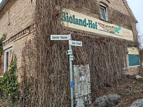
Bioland-Hof Zielke
Farm and orchard · 5.2 km
8 Am Fließ, Vierlinden
Mo 13:00+; We 13:00+; Th-Fr 13:00+

Museums and landmarks23


Battle of the Seelow Heights Memorial
Monument and historic site · 1.0 km
Memorial in Seelow, Germany

Schloss Gusow
Monument and historic site · 4.9 km
7 Schloßstraße, Gusow-Platkow


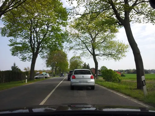
Preußischer Meilenstein
Monument and historic site · 1.6 km
Preußischer Ganzmeilenstein in Seelow

Schloss Diedersdorf
Monument and historic site · 4.6 km
51 Diedersdorf, Vierlinden
11 more on the map.
Parks, trails and playgrounds5




Restaurants and cafes19
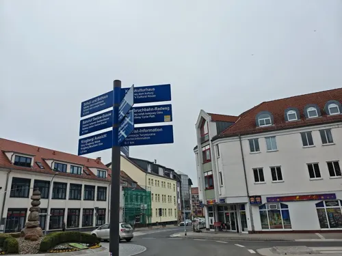

Naturkost Nußschale
Cafe · Regional
7 Puschkinplatz, Seelow
Mo 09:00-14:00, Tu,Th,Fr 09:00-16:30, We 09:00-18:00, Sa,Su,PH off

Bäckerei Klemt
Cafe
6 Frankfurter Straße, Seelow
Mo-Fr 06:00-17:30; Sa 06:00-11:30
China Bistro Wok
Restaurant · Vietnamese · 1.1 km
12A Diedersdorfer Straße, Seelow



7 more on the map.
History
The village appears in the records held in 1252 by Archbishop Wilbrand of Magdeburg. At that time, listed as Villa Zelou, it was included in the property of the formerly Polish Bishopric of Lebus (Lubusz Land), contested between the Magdeburg archbishops and the Ascanian margraves of Brandenburg.
Seelow suffered damaging town fires in 1630, 1788 and again in 1809.
From 1816 Seelow was included for administrative purposes in the Lebus district, a subdivision of the Frankfurt Region within the Prussian Province of Brandenburg. In 1863 the district council office was relocated to Seelow and in 1950 "Lebus district" was renamed "Seelow district"; following frontier changes agreed with the Soviet Union in 1945, the town of Lebus itself had lost to Poland much of the agricultural area that had traditionally supported it. Between 1952 and 1993, Seelow was the administrative centre for the eponymous district within the larger Frankfurt territory.
Seelow was the location of one of the last major pitched battles in Europe during the Second World War - the Battle of the Seelow Heights. Between 16 and 19 April 1945, Soviet troops under Marshal Zhukov broke through the last German defensive line before Berlin. The town was largely destroyed during the battle, primarily through a major air attack which took place on 17 April 1945, and which was followed by extensive burning and plunder.
From the History section of Seelow on Wikipedia, under CC BY-SA 4.0.
More about Seelow
Geography
It is situated in the extreme east of Germany, 70 km (40 miles) east of Berlin, 16 km (10 miles) west of the border with Poland.
From the Wikipedia article Seelow, under CC BY-SA 4.0.
Notable people from Seelow
- Werner OttoGerman entrepreneur (1909–2011)
- Rainer HönischGerman cyclist
- Leonhard HaskelGerman actor (1872-1923)
- Albert TschautschGerman painter (1843-1922)
- Lutz PyritzEast German jockey (1958-2018)
Born in Seelow, according to Wikidata (CC0). Each name links to its Wikipedia article.
Where to stay7
Churches and places of worship7
Dorfkirche Görlsdorf
Church · Protestant · 5.1 km
32 Am Fließ, Vierlinden
Dorfkirche Neuentempel
Church · Protestant · 5.4 km
13 Neuentempel, Vierlinden
Shopping9
Gas and EV charging3
Schools, colleges and libraries6
Healthcare4
Map of Seelow
86 places. The map loads OpenStreetMap tiles when you open it.
Getting there and nearby towns
Berlin Brandenburg Airport "Willy Brandt" (BER) is the nearest airport with scheduled flights listed in OpenStreetMap, 63 km away.
- Frankfurt (Oder) 24 km southeast, about 24 min by car
- Wriezen 27 km northwest, about 27 min by car
- Fürstenwalde 29 km southwest, about 29 min by car
- Strausberg 34 km west, about 34 min by car
- Woltersdorf 44 km west, about 44 min by car
- Erkner 44 km west, about 44 min by car
- Werneuchen 45 km west, about 45 min by car
- Eisenhüttenstadt 46 km southeast, about 46 min by car
- Eberswalde 51 km northwest, about 51 min by car
- Berlin 66 km west, about 1 h by car
Drive times are estimates from straight-line distance, not routes.
Towns near Seelow


Keep exploring
Local news
Headlines from INDB.
Reviews, tips and questions
Loading what members have shared...
Sources and licences
- GeoNames (CC BY 4.0): population, coordinates, regions and time zone
- Mapillary (see each image): photos
- OpenStreetMap contributors (ODbL 1.0): places, airports, map data
- Wikidata (CC0 1.0): elevation, founding date, time zone, website, landmarks and historic places
- Wikimedia Commons (see each image): photos
- Wikipedia (CC BY-SA 4.0): overview and history text
Photo credits
- LUB Seelow Rathaus-01, Gemiwala, CC BY-SA 4.0
- Gedenkstätte Seelower Höhen 2021-05-15 4, Z thomas, CC BY-SA 4.0
- Dorfkirche Görlsdorf (Vierlinden) 2020 SE, Hans G. Oberlack, CC BY-SA 4.0
- Gusow Schloss, Clemensfranz, CC BY-SA 3.0
- Gedenkstätte Seelower Höhen Blick ins Oderbruch, Assenmacher, CC BY-SA 3.0
- Gedenkstätte Seelower Höhen 2013 02, Marcus Cyron, CC BY-SA 3.0
- Kirche Dolgelin Südseite, Engeser, CC BY-SA 4.0
- Stadtpfarrkirche Seelow 2, Marcus Cyron, CC BY-SA 3.0
- Dorfkirche Neuentempel 3, Marcus Cyron, CC BY-SA 3.0
- Dorfkirche Gusow 2020 S, Hans G. Oberlack, CC BY-SA 4.0
- Friedersdorf Barockkirche im Herbst, Gemiwala, CC BY-SA 4.0
- Görlsdorf, Kirche, Rauenstein, CC BY-SA 2.0
- Bundesarchiv Bild 183-E0406-0022-012, Sowjetische Artillerie vor Berlin, Unknown Unknown, CC BY-SA 3.0 de
- Bahnstrecken Oderbruchbahn, Hbf878, CC BY-SA 4.0
- Friedersdorf, Kirche, Rauenstein, CC BY-SA 3.0
- Lindendorf Dolgelin Kirchenruine, Oberlausitzerin64, CC BY-SA 4.0
- Seelow Kirche, Clemensfranz, CC BY 2.5
- Street-level photo, ber319, CC BY-SA 4.0
- Street-level photo, ber319, CC BY-SA 4.0
- Street-level photo, fdmap, CC BY-SA 4.0
- Street-level photo, fdmap, CC BY-SA 4.0
- Street-level photo, fdmap, CC BY-SA 4.0
- Street-level photo, fdmap, CC BY-SA 4.0


Page built November 9, 2026. Spotted a mistake? Tell us or suggest a place.