


Frankfurt (Oder), Germany
Frankfurt (Oder) is a town of 57,107 people in Brandenburg, Germany, founded in 1201.
Why visit Frankfurt (Oder)
Townapedia lists 231 museums and landmarks, 44 parks and trails, 126 places to eat, 24 places to stay and 30 attractions in and around town.
Highlights include Wildpark Frankfurt (Oder), Theater des Lachens, Konzerthalle Carl Philipp Emanuel Bach and Kleist-Museum.
Weather in Frankfurt (Oder)
Forecast from MET Norway (CC BY 4.0). Full forecast
About Frankfurt (Oder)
Frankfurt (Oder), also known as Frankfurt an der Oder (German: [ˈfʁaŋkfʊʁt ʔan deːɐ̯ ˈʔoːdɐ], lit. 'Frankfurt on the Oder'; Central Marchian: Frankfort an de Oder) is the fourth-largest city in the German state of Brandenburg after Potsdam, Cottbus and Brandenburg an der Havel. With around 58,000 inhabitants, it is the largest German city on the Oder River, and one of the easternmost cities in modern Germany. Frankfurt sits on the western bank of the Oder, opposite the Polish town of Słubice, which was a part of Frankfurt until 1945, and called Dammvorstadt until then. The city is about 80 kilometres (50 mi) east of Berlin, in the south of the historical region Lubusz Land.
From the Wikipedia article Frankfurt (Oder) (this version), under CC BY-SA 4.0.
Travel tips from other travellers: Frankfurt (Oder) on Wikivoyage (CC BY-SA 4.0).
Photos of Frankfurt (Oder)

Things to do30





Milchtankstelle
Farm and orchard · 4.2 km
16 Lebuser Chaussee, Frankfurt (Oder)
24/7
18 more on the map.
Museums and landmarks231

Konzerthalle Carl Philipp Emanuel Bach
Museum · Roman Catholic
4 Lebuser Mauerstraße, Frankfurt (Oder)


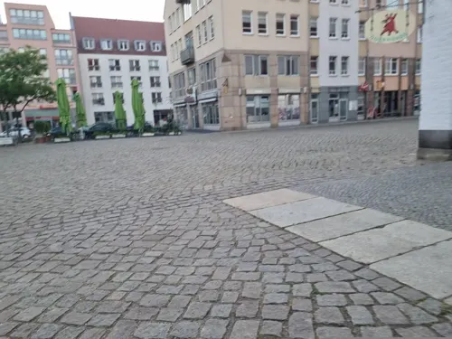

KUMA Kulturmanufaktur Gerstenberg
Museum · 0.6 km
28a Ziegelstraße, Frankfurt (Oder)
Tu-Sa 18:00-24:00


Herrenhaus Wulkow
Monument and historic site · 8.2 km
53 Wulkower Dorfstraße, Lebus


Schöpferdenkmal
Monument and historic site
Würdigung der Personen, sich um den Bau des Parks in besonderer Art und Weise verdient gemacht haben

Planetarium Frankfurt Oder
Monument and historic site · 2.4 km
Ehemaliger Wasserturm und heutiges Planetarium in Frankfurt (Oder)
48 Mühlenweg, Frankfurt (Oder)
Ehem. Hauptpostamt Frankfurt (Oder)
Monument and historic site · 0.7 km
2 Lindenstraße, Frankfurt (Oder)
219 more on the map.
Parks, trails and playgrounds44


Park an der St. Gertraudkirche
Park · 0.8 km
Einst Friedhof von St. Gertraud, gestaltet 1728–1729; umgestaltet zum Stadtpark 1801/1830


Stadion der Freundschaft
Sports field and stadium · 1.7 km
172 Buschmühlenweg, Frankfurt (Oder)




32 more on the map.
Restaurants and cafes126
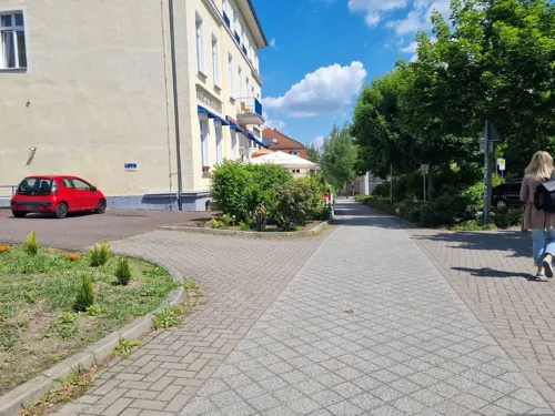
Zaroon Restaurant
Restaurant · Indian · 1.8 km
Tandoor Grill Restaurant Zaroon
38 Leipziger Straße
Mo-Su 12:00-22:00
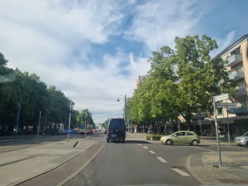
DIVINO | Café – Bistro – Frankfurt (Oder)
Cafe · Pasta, Cake, Ice Cream, Breakfast, Pastry, Sandwich, Donut, Tea, Crepe, Salad, Bistro
18 Karl-Marx-Straße, Frankfurt (Oder)
Mo-Su 10:00-18:00

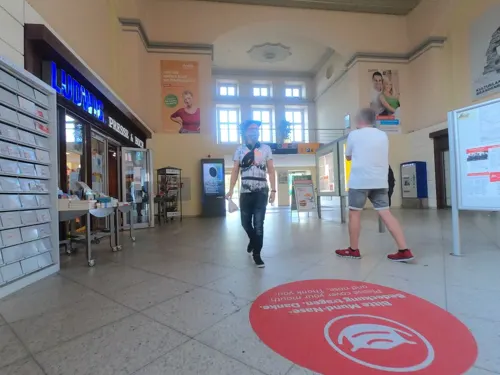
Sternenbäck
Bakery · Coffee Shop · 1.1 km
11 Bahnhofsplatz, Frankfurt (Oder)
Mo-Fr 04:45-19:00; PH 06:00-18:00; Sa-Su 06:00-19:00

Blesses royal
Restaurant · Japanese, Asian, Sushi · 1.0 km
9a Gubener Straße, Frankfurt (Oder)
Mo off; Tu-Su 11:00-15:00,17:00-22:00; PH 11:00-15:00,17:00-22:00

Eiscafé Bellini
Cafe · Coffee, Ice Cream, Waffle, Cake, Pastry
7 Karl-Marx-Straße, Frankfurt (Oder)
09:00-19:00
Frankfurter Kartoffelhaus
Restaurant · German, Regional, European, Salad
7 Holzmarkt, Frankfurt (Oder)
Mo-Fr 16:30-22:00; Sa 11:30-22:00; Su 11:30-20:00; PH 11:30-20:00

Bäcker Dreißig
Bakery · 8.0 km
1c Gewerbepark Kirschallee, Lebus
Mo-Fr 06:00-17:00; Sa 06:30-12:00; Su 06:30-10:00
114 more on the map.
History
Prior to 1249, a West Slavic settlement named Zliwitz along with the Lubusz Land was part of the Kingdom of Poland. The Piast duke Henry the Bearded granted Zliwitz staple rights in 1225. In 1226, construction of the St. Nicholas Church (today's Friedenskirche) began. In 1249, the settlement became part of the Margraviate of Brandenburg.
The town of Frankfurt received its charter in 1253 at the Brandendamm. The early settlers lived on the western banks of the Oder; later the town was extended to the eastern bank. After a war broke out over control of the region in 1319, the town came under the control of the Duchy of Pomerania. In 1319, Wartislaw IV, Duke of Pomerania, granted new privileges to the town. The town fell again to Brandenburg in 1324. In the Late Middle Ages, the town dominated the river trade between Wrocław and Szczecin. In 1430, Frankfurt joined the Hanseatic League. In 1432, the Czech Hussites captured the town.
In the 16th century, many Polish exports, including grain, wood, ash, tar and hemp, were floated from western Poland via Frankfurt to the port of Szczecin, with the high Brandenburgian customs duties on Polish goods lowered in the early 17th century.
Read more of the history
In April 1631, during the Thirty Years' War, Frankfurt was the site of the Battle of Frankfurt an der Oder between the Swedish Empire and the Holy Roman Empire. After a two-day siege, Swedish forces, supported by Scottish auxiliaries, stormed the town and destroyed many buildings, e.g. the Georgen Hospital. The result was a Swedish victory. By the end of the Thirty Years' War, the town's population had decreased from 12,000 inhabitants to 2,366 inhabitants.
In the 16th century the oldest church of the town (today's Friedenskirche) was secularized and was even used as a granary, and from the 17th century it served as the church of the French Huguenots.
The city was briefly occupied by the Russian Imperial Army during the Seven Years' War, in August 1759, in the prelude to the battle of Kunersdorf.
With the dissolution of the Margraviate of Brandenburg during the Napoleonic Wars, Frankfurt became part of the Province of Brandenburg in 1815. In the 19th century, Frankfurt played an important role in trade. Centrally positioned in the Kingdom of Prussia between Berlin and Posen (Poznań), on the river Oder with its heavy traffic, the town housed the second-largest annual trade fair (Messe) of the German Reich, surpassed only by that in Leipzig. One of the main escape routes for insurgents of the unsuccessful Polish November Uprising from partitioned Poland to the Great Emigration led through the city. In 1842, the Berlin–Frankfurt (Oder) railway was opened.
The SS Einsatzgruppe VI was formed in the town before it entered several Polish cities, including Poznań, Kalisz and Leszno, to commit various crimes against Poles during the German invasion of Poland, which started World War II. During World War II the Germans brought numerous forced laborers, both men and women, from Poland and the Soviet Union to the town. In early 1945, death marches of prisoners of various nationalities from the dissolved camps in Żabikowo and Świecko to the Sachsenhausen concentration camp passed through the city. There was no fighting for the town in 1945 during World War II even though the town was declared a fortress (Festung) in an attempt to block the Red Army's route to Berlin. The nearly empty town was burned down by the Red Army. The postwar East German–Polish border ran along the Oder, separating the Dammvorstadt on the eastern bank – which became the Polish town of Słubice – from the rest of Frankfurt. While part of communist East Germany, Frankfurt was administered within Bezirk Frankfurt (Oder). It became part of the reconstituted state of Brandenburg with German reunification in 1990.
In the post-communist era, following the collapse of its main employer VEB Halbleiterwerk, Frankfurt has suffered from high unemployment and low economic growth. Its population has fallen significantly from around 87,000 at the time of German reunification in 1990. The only remnant of semiconductor technology industries in Frankfurt by 2003 was the Innovations for High Performance Microelectronics (IHPM) institute.
Today, the towns of Frankfurt and Słubice have friendly relations and run several common projects and facilities. Poland joined the European Union on 1 May 2004, and implemented the Schengen Agreement on 21 December 2007 leading to the removal of permanent border controls.
In March 2008, the Jewish community of Frankfurt celebrated its first Torah dedication since the Holocaust. The procession of the new Torah scroll began from the spot where the town's Frankfurter Synagogue stood prior to World War II, 500 meters from Germany's current border with Poland. Celebrants marched with the scroll into the town's Chabad-Lubavitch centre, where they danced with the Torah, which had been donated by members of the Chabad-Lubavitch community in Berlin.
From the History section of Frankfurt (Oder) on Wikipedia, under CC BY-SA 4.0.
Notable people from Frankfurt (Oder)
 Heinrich von KleistGerman poet, dramatist, novelist and short story writer (1777–1811)Photo: Anton Graff, Public domain
 Manuela SchwesigGerman politician (SPD), Minister President of Mecklenburg-VorpommernPhoto: Agência Senado from Brasilia, Brazil, CC BY 2.0
 Anton von WernerGerman painter (1843-1915)Photo: Anton von Werner, Public domain
 Hermann WeingärtnerGerman gymnast (1864–1919)Photo: Meyer Albert (1857 - 1924) Details..., Public domain
 Franziska GiffeyGerman politician, former Mayor of BerlinPhoto: Martin Kraft, CC BY-SA 4.0
 Friedrich LoefflerGerman bacteriologist (1852–1915)Photo: Unknown author Unknown author, CC BY 4.0
 Rudolf BrandtGerman civil servant and SS officer, convicted war criminal (1909–1948)Photo: Unknown author Unknown author, Public domain
 Hermann WissmannGerman explorer and colonial administrator in Africa (1853–1905)Photo: Unknown author Unknown author, Public domain
 Joachim HansenGerman actor (1930–2007)Photo: Harry Pot for Anefo ]], CC0
 Andrii TaranUkrainian military officer and politicianPhoto: Посольство України в Словенії, CC BY 4.0
- Erich HoepnerGerman general (1886–1944)
- Georg Hermann QuinckeGerman physicist (1834–1924)
Born in Frankfurt (Oder), according to Wikidata (CC0). Each name links to its Wikipedia article.
Where to stay24
Churches and places of worship23
Heilandskapelle
Church · Protestant · 3.0 km
41 Eichenweg, Frankfurt (Oder)
Church of the Holy Virgin Mary The Queen of Poland in Słubice
Church · 1.6 km
Shopping48
Gas and EV charging8
Schools, colleges and libraries31
Kleist-Museum (Bibliothek & Archiv)
Library · 0.6 km
6,7 Faberstraße, Frankfurt (Oder)
Competence Network Interdisciplinary Ukrainian Studies
School
23a Große Scharrnstraße, Frankfurt (Oder)
Healthcare22
Map of Frankfurt (Oder)
250 places. The map loads OpenStreetMap tiles when you open it.
Getting there and nearby towns
Berlin Brandenburg Airport "Willy Brandt" (BER) is the nearest airport with scheduled flights listed in OpenStreetMap, 72 km away.
- Eisenhüttenstadt 23 km south, about 23 min by car
- Seelow 24 km northwest, about 24 min by car
- Neuzelle 29 km south, about 29 min by car
- Fürstenwalde 33 km west, about 33 min by car
- Müncheberg 33 km northwest, about 33 min by car
- Guben 45 km south, about 45 min by car
- Wriezen 50 km northwest, about 50 min by car
- Strausberg 52 km northwest, about 52 min by car
- Erkner 55 km west, about 55 min by car
- Woltersdorf 56 km west, about 56 min by car
Drive times are estimates from straight-line distance, not routes.
Towns near Frankfurt (Oder)


![Photo: Harry Pot for Anefo ]], CC0](https://commons.wikimedia.org/wiki/File:Joachim_Hansen_1960b.jpg)

Keep exploring
Local news
Headlines from INDB.
Reviews, tips and questions
Loading what members have shared...
Sources and licences
- GeoNames (CC BY 4.0): population, coordinates, regions and time zone
- Mapillary (see each image): photos
- OpenStreetMap contributors (ODbL 1.0): places, airports, map data
- Wikidata (CC0 1.0): elevation, founding date, time zone, website, landmarks and historic places
- Wikimedia Commons (see each image): photos
- Wikipedia (CC BY-SA 4.0): overview and history text
Photo credits
- Frankfurt (Oder) - Slubicer Straße - panoramio, Roland Totzauer, CC BY 3.0
- 2006-03 Frankfurt (Oder) 16, photographer: Sicherlich, CC BY-SA 3.0
- 2006-03 Frankfurt (Oder) 15, Sicherlich, CC BY-SA 3.0
- 2006-03 Frankfurt (Oder) 17, Sicherlich, CC BY-SA 3.0
- Friedenskirche Frankfurt (Oder) 03, Sebastian Wallroth, CC BY 3.0
- Friedenskirche Frankfurt (Oder) 02, Sebastian Wallroth, CC BY 3.0
- Gewerbe- und Bürgerschule Frankfurt (Oder) 2023 003, Sebastian Wallroth, CC BY 4.0
- Słubice Virgin Mary Queen of Poland church, Fridolin freudenfett, CC BY-SA 4.0
- Universitas Viadrina Frankfurt (Oder), RudolfSimon, CC BY 3.0
- FFO 04-13 Oderturm, A.Savin, CC BY-SA 3.0
- D Ffo SMC, Daag, CC BY-SA 3.0
- Frankfurt Oder Gauss Gymnasium, Sebastian Wallroth, Public domain
- 2006-03 Frankfurt (Oder) 28, Ralf Lotys (Sicherlich), CC BY 3.0
- Oderlandhalle2012, Coradoline, CC BY-SA 3.0
- FFO 04-13 Gertraudenkirche, A.Savin, CC BY-SA 3.0
- Kleistpark Frankfurt Oder 008, Sebastian Wallroth, Public domain
- 07-2008Frankfurt (Oder)03, Coradoline, CC BY-SA 3.0
- 2006-03 Frankfurt (Oder) 43, Ralf Lotys (Sicherlich), CC BY 3.0
- Wildpark Frankfurt Oder Entrance, Sebastian Wallroth, Public domain
- Anger Frankfurt Oder 2016-04 010, Sebastian Wallroth, CC BY 4.0
- Ziegenwerder Island Frankfurt Oder, MOs810, CC BY-SA 4.0
- Park an der St. Gertraudkirche Frankfurt Oder 2016-04 011, Sebastian Wallroth, CC BY 4.0
- Heilandskapelle Frankfurt (Oder) 003, Sebastian Wallroth, Public domain
- Słubice, Frankfurter Brauhaus - fotopolska.eu (340162), Danuta B., CC BY-SA 3.0
- Botanischer Garten Frankfurt (Oder) 01, Sebastian Wallroth, CC BY 4.0
- Boossen - Dorfkirche - panoramio, Roland Totzauer, CC BY 3.0
- 6105 Frankfurt-oder, Spyrosdrakopoulos, CC BY-SA 4.0
- Frankfurt Oder Slubice 2013-02 14, Sebastian Wallroth, CC BY 3.0
- Lienaudenkmal Frankfurt Oder 24.08.2014 09-44-36, Sebastian Wallroth, CC BY 3.0
- WulkowDorfkirche, Klabauter2, CC BY-SA 3.0
- Schloss Wulkow, Wulkow bei Booßen, Stadt Lebus, Deutschland, Scanned by Sebastian Wallroth, Public domain
- BoossenBergstrasse14, Klabauter2, CC BY-SA 3.0
- Schoepferdenkmal Frankfurt Oder 24.08.2014 09-41-51, Sebastian Wallroth, CC BY 3.0
- Leipziger Garten - Polonia (Frankfurt (Oder)) 20230 001, Sebastian Wallroth, CC BY 4.0
- Volkshochschule Frankfurt (Oder) 2018 001 18 03 31 034000, Sebastian Wallroth, CC0
- Park Grüne Lunge in Frankfurt (Oder) 2023 001, Sebastian Wallroth, CC BY 4.0
- Konrad-Wachsmann-Oberstufenzentrum 2024, Sebastian Wallroth, CC BY 4.0
- Kulturmanufaktur Gerstenberg 2024 002, Sebastian Wallroth, CC BY 4.0
- Frankfurt (Oder) Konzerthalle, Coradoline, CC BY-SA 3.0
- Innenraum mit Haupttribüne Stadion der Freundschaft FFO, RuFi7, CC0
- Marienkirche FFO, The original uploader was Oge68 at German Wikipedia ., CC BY-SA 3.0
- Kliestow Kirche 001, Sebastian Wallroth, Public domain
- Lennepark Frankfurt Oder 002, Sebastian Wallroth, Public domain
- Theater des Lachens, Lukas Beck, CC BY-SA 4.0
- Kleist Museum Frankfurt (Oder), Lukas Beck, CC BY-SA 4.0
- Musikschule Frankfurt (Oder), Lukas Beck, CC BY-SA 4.0
- Street-level photo, dsmm, CC BY-SA 4.0
- Street-level photo, dsmm, CC BY-SA 4.0
- Street-level photo, dsmm, CC BY-SA 4.0
- Street-level photo, AR88, CC BY-SA 4.0
- Street-level photo, carlheinz, CC BY-SA 4.0
- Street-level photo, moenk, CC BY-SA 4.0
- Street-level photo, dsmm, CC BY-SA 4.0
- Street-level photo, dsmm, CC BY-SA 4.0
- Street-level photo, dsmm, CC BY-SA 4.0
- Street-level photo, AR88, CC BY-SA 4.0
- Street-level photo, dsmm, CC BY-SA 4.0
- Street-level photo, dsmm, CC BY-SA 4.0
- Street-level photo, dsmm, CC BY-SA 4.0
- Street-level photo, dsmm, CC BY-SA 4.0
- Street-level photo, carlheinz, CC BY-SA 4.0
- Street-level photo, dsmm, CC BY-SA 4.0
- Street-level photo, dsmm, CC BY-SA 4.0
- Street-level photo, ber319, CC BY-SA 4.0


)_20230_001.jpg)


Page built November 9, 2026. Spotted a mistake? Tell us or suggest a place.