


Why visit Hürth
Townapedia lists 99 museums and landmarks, 43 parks and trails, 220 places to eat, 18 places to stay and 20 attractions in and around town.
Highlights include Gloria-Theater, Phantasialand, Keramion and Feierabendhaus.
Weather in Hürth
Forecast from MET Norway (CC BY 4.0). Full forecast
About Hürth
Hürth (German pronunciation: [hʏʁt] ) is a town in the Rhein-Erft-Kreis, North Rhine-Westphalia, Germany. Hürth shares borders with the city of Cologne and is about 6 km to the southwest of Cologne city centre, at the northeastern slope of the natural preserve Kottenforst-Ville. The town consists of thirteen districts, once independent villages, and is distributed over a relatively large area. The municipal area is interspersed with lakes and stretches of forest.
From the Wikipedia article Hürth (this version), under CC BY-SA 4.0.
Photos of Hürth


Things to do20

Gloria-Theater
Cinema and theater · 9.2 km
Theatre in Cologne, Germany


Studiobühne Köln
Cinema and theater · 7.4 km
Theatre in Cologne, Germany



Berli
Cinema and theater · 3.7 km
Kann auch als Veranstaltungsort gemietet werden (amenity=event_location)
45-49 Wendelinusstraße, Hürth
Gertrudenhof Bauernmarkt
Farm and orchard · 2.1 km
Mo-Fr 09:30-18:30; Sa 08:00-19:00; Su,PH 11:00-16:00
8 more on the map.
Museums and landmarks99

Keramion
Museum · 5.1 km
12 Bonnstraße, Frechen
Mo off; Tu-Fr 10:00-17:00; Sa 14:00-17:00; Su 10:00-17:00


Burg Efferen
Monument and historic site · 3.4 km
8 Ritterstraße, Hürth

Museum für Alltagsgeschichte
Museum · 5.2 km
15 Kempishofstraße, Brühl
We,Sa 15:00-17:00; Su 14:00-18:00
87 more on the map.
Parks, trails and playgrounds43


Schlosspark Augustusburg
Park · 6.0 km
Park of Augustusburg Palace in Brühl, Rhineland, Germany

Teilfläche des Nordhangs im Restfeld Vereinigte Ville
Hiking and trails · 2.0 km



Erlebnisbauernhof Gertrudenhof
Sports field and stadium · 2.3 km
open "Je nach Saison und Veranstaltung"
KarlsBad
Sports field and stadium · 4.6 km
40 Kurfürstenstraße, Brühl
Mo 06:30-22:00; Tu-Fr 09:00-22:00; Sa 08:00-20:00; Su 10:00-20:00
Familienbad De Bütt
Sports field and stadium · 1.5 km
91 Sudetenstraße, Hürth
Tu-Fr 06:30-21:00; Sa-Su 09:00-21:00; PH Mo off


Strandbad Heider Bergsee
Sports field and stadium · 4.6 km
"saisonale unterschiedliche Öffnungszeiten"
31 more on the map.
Restaurants and cafes220
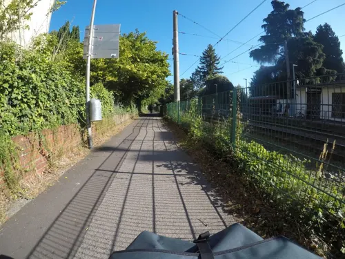
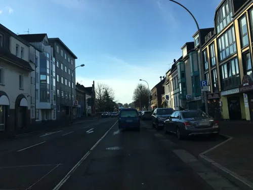
Chick in Bucket
Restaurant · Chicken, American, Burger · 1.9 km
330 Luxemburger Straße, Hürth
Mo-Th 11:30-22:00; Fr 15:00-23:30; Sa 12:00-23:30; Su 12:00-22:00
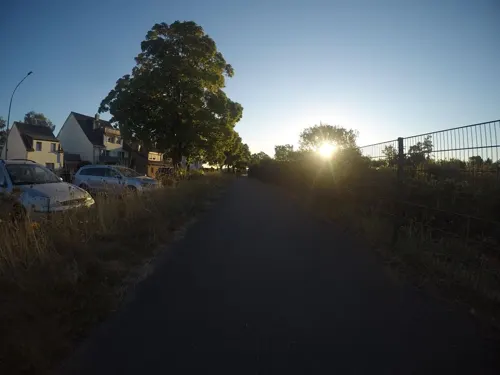
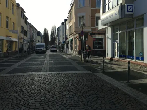

Cafe Del Sol
Restaurant · International · 3.0 km
227 Luxemburger Straße, Hürth
Mo-Fr 00:00-01:00,09:00-24:00; Sa,Su 00:00-02:00,09:00-24:00
Clubhaus am Geißbockheim
Restaurant · German · 4.8 km
1-3 Franz-Kremer-Allee
Su, We-Th 11:30-18:30; Fr-Sa 11:30-21:00
El Patio
Restaurant · Spanish · 5.2 km
9 Kempishofstraße, Brühl
Mo-Su 12:00-15:00,18:00-24:00; Sa 18:00-24:00
Haus Kreisch
Restaurant · Regional · 5.1 km
38 Rodderweg, Brühl
Mo, Tu, We, Fr 17:00-01:00; Sa 11:00-15:00, 17:00-01:00; Su...
L'Osteria
Restaurant · Italian · 3.0 km
146 Luxemburger Straße, Hürth
Mo-Th 11:00-23:00; Fr,Sa 12:00-24:00; Su,PH 12:00-23:00
Machu
Restaurant · Asian · 5.4 km
15 Bahnhofstraße, Brühl
Tu-Th 11:30-15:00,16:30-22:00; Fr,Sa 11:30-15:00,16:30-22:30;...
208 more on the map.
History
On 1 April 1930 the rural communities of Hürth (with Alstädten and Knapsack), Berrenrath, Fischenich, Gleuel (with Sielsdorf and Burbach), Hermülheim and Kendenich (with Kalscheuren) were united into a new country community called Hürth. After the same year's failed attempt by the city of Cologne, with its then-mayor Konrad Adenauer, to incorporate Efferen, Efferen was associated to Hürth in 1933, in tandem with Stotzheim. This made Hürth the largest rural community of Germany until 1978, when Hürth ceased being a rural community and became a suburb of Cologne as new developments in Efferen closed the gap between the city of Cologne and Hürth.
The country administration of the rural district Cologne was seated in Hürth on 22 November 1963. From 1816, it had been seated in the city of Cologne itself. The administration moved to Bergheim on 3 September 1993.
Hürth is home to the Bundessprachenamt, which was founded on 4 July 1969.
Burbach was first mentioned documentarily in 1233. Nowadays, Alstädten and Burbach are one district named Alstädten-Burbach.
Berrenrath was first mentioned documentarily in 922. The resettlement of Berrenrath onto a now-abandoned brown coal mine was decided on 27 February 1952. This was necessary due to mining plans of the Roddergrube AG. The resettlement was completed in September 1995.
Read more of the history
The Efferen district had its first documentary mention as a pastoral town in 1189. The Catholics first humbled themselves with a plain wooden church. On 6 June 1869 this church was replaced with a solid building, consecrated by auxiliary bishop Baudri.
On 31 October 1944 large parts of Efferen, including the church and the hospital, were destroyed in an air raid; thirty-six people died.
On 20 December 1953 Boue, a member of the church assembly, consecrated the newly built Evangelic church, designed by architect Jürgen Körber. Two years later, on 25 November 1956, a new Roman Catholic church, which was designed by the Cologne architects Wolfram Borgard and Fritz Volmer, was consecrated by auxiliary bishop Wilhem Cleven.
In Hermülheim the town's two grammar schools are located: the Ernst-Mach-Gymnasium and the Albert-Schweizer-Gymnasium.
The building of the residential area Hürth-Mitte, that was begun in 1964 according to a decision by the municipal council in 1960, had the aim of establishing a "city centre" in the approximate geographic centre of Hürth. The decision was evidently benefitted by the constantly raising population in those times. This was partially completed by 1985, with the new town hall and community centre having been erected. Hürth-Mitte is also the site of the Hürth Park, a shopping mall, which serves as the town's economic and social centre. Hürth-Mitte is not a district for itself, but officially belongs to Hermülheim.
Knapsack, its first documentary mention in 1566, started to emerge into a notable town after 1900 due to establishment and development of industry (1906 the Knapsack-Griesheim AG, later known as the Hoechst AG; 1913 construction of the brown coal power plant Goldenberg-Werk).
Due to environmental constraints, 4,000 citizens had to be resettled between the years 1969 and 1979.
From the History section of Hürth on Wikipedia, under CC BY-SA 4.0.
More about Hürth
Geography
Hürth is situated about 6 km to the southwest of Cologne city centre, at the northeastern slope of the Kottenforst-Ville nature reserve.
The town, consisting of thirteen formerly independent villages, is essentially made up of numerous subdivisions and commercial centres distributed over a relatively large area. The municipal area is interspersed with lakes and stretches of forest.
From the Wikipedia article Hürth, under CC BY-SA 4.0.
Notable people from Hürth
 Michael SchumacherGerman racing driver (born 1969)Photo: Original: Aécio Neves – Wellington..., CC BY 2.0
 Ralf SchumacherGerman racing driverPhoto: 9EkieraM1, CC BY-SA 4.0
 Jean BreuerGerman track cyclistPhoto: Nicola, CC BY-SA 3.0
 Reinhard KleistGerman graphic designer and cartoonist (b. 1970)Photo: Martin Kraft, CC BY-SA 3.0
- Paul Henckelsactor (1885–1967)
- Karl-Josef AssenmacherGerman football referee
- Dieter PrestinGerman footballer
Born in Hürth, according to Wikidata (CC0). Each name links to its Wikipedia article.
Where to stay18
Churches and places of worship39
St. Maria von den Engeln
Church · Roman Catholic · 5.5 km
1a Schloßstraße, Brühl
Shopping56
Gas and EV charging26
Schools, colleges and libraries55
Healthcare21
Augenarzt Brühl | MVZ AR Augenblick Rheinland GmbH
Clinic and pharmacy · 5.2 km
41-43 Kölnstraße, Brühl
Balthasar Apotheke
Clinic and pharmacy · 5.2 km
28-30 Balthasar-Neumann-Platz, Brühl
Map of Hürth
250 places. The map loads OpenStreetMap tiles when you open it.
Getting there and nearby towns
Cologne Bonn Airport (CGN) is the nearest airport with scheduled flights listed in OpenStreetMap, 19 km away.
- Brühl 5 km southeast, about 5 min by car
- Frechen 6 km northwest, about 6 min by car
- Erftstadt 8 km southwest, about 8 min by car
- Türnich 8 km west, about 8 min by car
- Köln 9 km northeast, about 9 min by car
- Wesseling 9 km southeast, about 9 min by car
- Kerpen 12 km west, about 12 min by car
- Sechtem 11 km southeast, about 11 min by car
- Niederkassel 13 km southeast, about 13 min by car
- Zündorf 13 km east, about 13 min by car
Drive times are estimates from straight-line distance, not routes.
Towns near Hürth


Keep exploring
Local news
Headlines from INDB.
Reviews, tips and questions
Loading what members have shared...
Sources and licences
- GeoNames (CC BY 4.0): population, coordinates, regions and time zone
- Mapillary (see each image): photos
- OpenStreetMap contributors (ODbL 1.0): places, airports, map data
- Wikidata (CC0 1.0): elevation, founding date, time zone, website, landmarks and historic places
- Wikimedia Commons (see each image): photos
- Wikipedia (CC BY-SA 4.0): overview and history text
Photo credits
- Otto-Maigler-See Strandbad, Tohma ( talk ), CC BY-SA 4.0
- Bodelschwingh-Schule Hürth, Pflasterschelm, CC0
- 26-01 Bücherschrank Alt-Hürth 02, Achim Raschka, CC0
- 26-01 Bücherschrank Alt-Hürth 01, Achim Raschka, CC0
- Hürth, Nordrand - panoramio, rucksackkruemel, CC BY 3.0
- Die Moschee in Hürth - panoramio, rucksackkruemel, CC BY 3.0
- Wasserstofftankstelle 350 bar bei ST@RT Hürth HyCologne a, Dr. Artur Braun (Arturbraun), CC BY-SA 4.0
- Wasserstofftankstelle 350 bar bei ST@RT Hürth HyCologne b, Dr. Artur Braun (Arturbraun), CC BY-SA 4.0
- Wasserstofftankstelle 350 bar bei ST@RT Hürth HyCologne c, Dr. Artur Braun (Arturbraun), CC BY-SA 4.0
- Wasserstofftankstelle 350 bar bei ST@RT Hürth HyCologne d, Dr. Artur Braun (Arturbraun), CC BY-SA 4.0
- Stadtbücherei im Bürgerhaus Hürth-7606, Raimond Spekking, CC BY-SA 4.0
- Stadtbücherei im Bürgerhaus Hürth-7605, Raimond Spekking, CC BY-SA 4.0
- Carbidofen-Elektrode, System Söderberg, Hürth-7608, Raimond Spekking, CC BY-SA 4.0
- Carbidofen-Elektrode, System Söderberg, Hürth-7609, Raimond Spekking, CC BY-SA 4.0
- Stadtbücherei im Bürgerhaus Hürth-7610, Raimond Spekking, CC BY-SA 4.0
- Rathaus Hürth-7613, Raimond Spekking, CC BY-SA 4.0
- Rathaus Hürth-7615, Raimond Spekking, CC BY-SA 4.0
- Stadtbücherei im Bürgerhaus Hürth-7611, Raimond Spekking, CC BY-SA 4.0
- Relief am Bürgerhaus Hürth-7616, Raimond Spekking, CC BY-SA 4.0
- Rathaus Hürth-7614, Raimond Spekking, CC BY-SA 4.0
- Stadtbücherei im Bürgerhaus Hürth-7612, Raimond Spekking, CC BY-SA 4.0
- Gloria-Theater-Koeln-Aussenansicht, Gloria-Theater, Köln, CC BY-SA 3.0 de
- Phantasialand Brühl, Wolkenkratzer, CC BY-SA 3.0
- Köln südbrücke, Hans Peter Schaefer --> Hps-poll, CC BY-SA 3.0
- Studiobühne Köln - Aussen-7864, Raimond Spekking, CC BY-SA 4.0
- Millowitsch-Theater, Superbass, CC BY-SA 3.0
- Käthe-Kollwitz-Museum Köln, Raimond Spekking, CC BY-SA 4.0
- Museum für ostasiatische Kunst (0480-82), Raimond Spekking, CC BY-SA 4.0
- Kulturquartier Köln - Rautenstrauch-Joest-Museum - Vorderseite (6904-06), Raimond Spekking, CC BY-SA 4.0
- Aerial image of the Augustusburg Palace gardens (view from the south), Carsten Steger, CC BY-SA 4.0
- Köln-Volksgarten Weiher, Schweinepeterle, Public domain
- Severeinskirche aus Severinstorburg 2009, Elke Wetzig ( Elya ), CC BY-SA 3.0
- St. Aposteln Köln - Ostseite (4539), Raimond Spekking, CC BY-SA 4.0
- Christus auferstehung 2009, Elke Wetzig ( Elya ), CC BY-SA 3.0
- Main entrance at CBS, Babbelbabbel, CC BY-SA 3.0
- Deutsche Sporthochschule Köln, Haupteingang, Duhon, CC BY 3.0
- Hauptgebäude der Universität zu Köln-5634, Raimond Spekking, CC BY-SA 4.0
- Burg-Efferen-Zugang-1078, Horsch, Willy - HOWI, CC BY 3.0
- Friedenskirche-Efferen-1051, Horsch, Willy - HOWI, CC BY 3.0
- Hürth-Knapsack Germany Feierabendhaus-03, CEphoto, Uwe Aranas, CC BY-SA 3.0
- Ernst-Mach-Gymnasium-Huerth-Innenhof, Willy Horsch, CC BY 2.5
- Erzbischöfliches Sankt Ursula-Gymnasium Brühl, HOWI - Horsch, Willy, CC BY 3.0
- FH-Bund, Wo st 01 (There are 682 Pictures in my Category ) See also Toolserver, CC BY-SA 3.0 de
- Martin-Luther-King-Kirchenzentrum-Hürth, HOWI - Horsch, Willy, CC BY 3.0
- Martin-Luther-Kirche Gleuel, Achim Raschka, CC BY-SA 3.0
- Max Ernst Museum Brühl des LVR-0901, Raimond Spekking, CC BY-SA 4.0
- Keramion, Tohma, CC BY-SA 4.0
- Albert-Schweitzer-Gymnasium Hürth Haupteingang, HOWI - Horsch, Willy, CC BY 3.0
- Christuskirche Brühl (Rheinland), HOWI - Horsch, Willy, CC BY 3.0
- Dietrich-Bonhoeffer-Kirche (Köln-Lindenthal) (2), Chris06, CC BY-SA 4.0
- Brühl Andreaskirche 05, Achim Raschka, CC BY-SA 4.0
- Hl. Johannes der Täufer in Brühl, Michael Wittwer, CC BY-SA 4.0
- Feierabendhaus Knapsack, bodoklecksel, CC BY-SA 3.0
- Köln-Lindenthal Fort VI erbaut 1873-1876, HOWI - Horsch, Willy, CC BY 3.0
- Huerther Waldsee 02, Achim Raschka ( talk ), CC BY-SA 4.0
- Nordfeldweiher Vogelperspektive, Antisyntagmatarchos, CC0
- Deutschland Köln Museumsgebäude Toyota, Buch-t, CC BY-SA 3.0 de
- Nordhangs im Restfeld Vereinigte Ville, Gelli63, CC BY-SA 4.0
- Street-level photo, raymond, CC BY-SA 4.0
- Street-level photo, raymond, CC BY-SA 4.0
- Street-level photo, mfa, CC BY-SA 4.0
- Street-level photo, Feuerundwasser, CC BY-SA 4.0
- Street-level photo, masterofnoroad, CC BY-SA 4.0
- Street-level photo, mfa, CC BY-SA 4.0
- Street-level photo, mfa, CC BY-SA 4.0
- Street-level photo, raymond, CC BY-SA 4.0
- Street-level photo, raymond, CC BY-SA 4.0
- Street-level photo, Feuerundwasser, CC BY-SA 4.0
- Street-level photo, walldi222, CC BY-SA 4.0
- Street-level photo, walldi222, CC BY-SA 4.0
- Street-level photo, Feuerundwasser, CC BY-SA 4.0
- Street-level photo, marccologne, CC BY-SA 4.0
- Street-level photo, raymond, CC BY-SA 4.0
- Street-level photo, raymond, CC BY-SA 4.0
- Street-level photo, walldi222, CC BY-SA 4.0
- Street-level photo, noel, CC BY-SA 4.0


Page built November 9, 2026. Spotted a mistake? Tell us or suggest a place.