


Gemünden am Main, Germany
Gemünden am Main is a town of 11,375 people in Bavaria, Germany.
Why visit Gemünden am Main
Townapedia lists 140 museums and landmarks, 21 parks and trails, 53 places to eat, 16 places to stay and 40 attractions in and around town.
Highlights include Laden, Main Viaduct, Nantenbach, Kloster Schönau and Burgruine und Klosterruine Schönrain.
Weather in Gemünden am Main
Forecast from MET Norway (CC BY 4.0). Full forecast
About Gemünden am Main
Gemünden am Main (German pronunciation: [ɡəˈmʏndn̩ ʔam ˈmaɪn]; officially Gemünden a.Main) is a town in the Main-Spessart district in the Regierungsbezirk of Lower Franconia (Unterfranken) in Bavaria, Germany and lies roughly 40 km down the Main from Würzburg. Gemünden has around 10,000 inhabitants.
From the Wikipedia article Gemünden am Main (this version), under CC BY-SA 4.0.
Things to do40

Laden
Farm and orchard · 5.2 km
Hohenroth, Gemünden am Main
We-Fr 09:00-17:00; Sa 10:00-17:00; Su 13:00-17:00



28 more on the map.
Museums and landmarks140

Kloster Schönau
Monument and historic site · Catholic · 3.2 km
Franziskaner-Minoriten-Kloster
28, Gemünden am Main

Burgruine und Klosterruine Schönrain
Monument and historic site · 4.1 km
Ehemaliges Kloster mit Hirsauer Priorat 1525 Verkauf an die Grafen von Rieneck und Umbau zum Schloss, nach 1601 Würzburger Amtssitz,...

Eulenturm
Monument and historic site · 1.3 km
Südlicher Eckturm, Rundturm mit leicht vorkragendem Obergeschoss und Spitzhelm
Fahrzeug- und Technikmuseum Neuendorf
Museum · 5.2 km
1 Nantenbacher Straße, Neuendorf
"Mai - Ende Oktober, jeden 1. Sonntag von 11.00 - 16.00 Uhr"

Schönrain am Main
Monument and historic site · 4.1 km
Cultural heritage monument D-6-77-131-71 (0) in Gemünden am Main, Bavaria





128 more on the map.
Parks, trails and playgrounds21

Brückenrelikt Reichsautobahn Strecke 46, Fulda-Würzburg (Kletterpfeiler E46)
Sports field and stadium · 6.9 km




Yachtclub Wernfeld / Main e.V.
Marina and boat launch · 2.9 km
Main-km 216,2 LU; Strom/Wasser, Dusche/WC, Waschmaschine, Slipanlage



9 more on the map.
Restaurants and cafes53
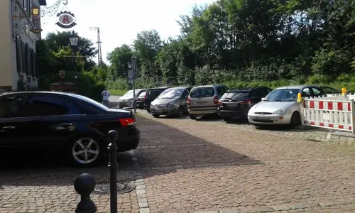
Fränkischer Gasthof Hotel "Zum Koppen"
Restaurant · Regional, German · 1.3 km
22 Obertorstraße, Gemünden am Main
closed "temporarily closed"

Al Leone
Restaurant · Italian · 1.2 km
30 Obertorstraße, Gemünden am Main
Su-Fr 11:30-14:00,17:30-22:00; We off; Sa 17:30-22:00
Asia Haus
Restaurant · Asian · 1.2 km
34 Obertorstraße, Gemünden am Main
Tu-Su,PH 11:30-14:30, 17:30-22:30

Café Klein & Fein
Cafe · Coffee Shop · 6.4 km
7 Hauptstraße, Rieneck
Th 13:00-17:00; Fr 13:00-18:00; Sa-Su 08:00-18:00
Gasthof "Zur Linde"
Restaurant · Regional · 1.7 km
1 Hafenstraße, Gemünden am Main
Mo-Sa 17:00-22:00; Th off; Su,PH 11:30-14:00, 17:00-22:00
Goldener Anker
Restaurant · Regional · 4.1 km
1 Fabrikgasse, Gemünden am Main
Mo 17:00-21:30; Tu-Su 11:00-21:30
Rieneck's Schnitzelhaus
Restaurant · Burger, Italian, German, Ice Cream · 5.7 km
77 Hauptstraße, Rieneck
We-Su 17:00-22:00

Schonderfelder Brotzeitstube
Bar and pub · German, Regional · 6.5 km
17 Schonderfeld
May-Oct: Tu 16:00-20:00; Fr 17:00-22:00; Sa 15:00-20:00; Su...


Dorfladen am Gutshof
Cafe · 6.6 km
15 Kirchberg, Karlstadt
Sa-Mo 07:00-13:00; Tu-Fr 07:00-13:00, 14:30-18:00
41 more on the map.
History
The local Schönau monastery (Kloster Schönau) was founded in 1189 by Philipp von Thüngen. A Conventual Franciscan monastery since 1699, the monks' main job was to take care of the monastery and pilgrimage church.
The town, which likely had grown out of an early fishing village at the confluence of the three rivers, had its first documentary mention in 1243 in an agreement between Prince-Bishop of Würzburg Hermann I of Lobdeburg and Countess Adelheid of Rieneck. According to the agreement, two thirds of the castle and half of the settlement were subject to the Hochstift (or secular authority) of the Prince-Bishops of Würzburg. This followed attempts by the Counts of Rieneck to expand their territory to the south. At that point, Gemünden had already been awarded the status of town by the Rieneck counts.
The castle above the town, the Scherenburg, had been built by the Rienecks to control the shipping on the Main and the eastern terminus of the Birkenhainer Strasse, an important trade route in the Middle Ages.
From the History section of Gemünden am Main on Wikipedia, under CC BY-SA 4.0.
Where to stay16
4 Elemente
Motel and hotel · Regional · 1.4 km
15 Mühltorstraße, Gemünden am Main
Churches and places of worship31
St. Gertrud
Church · Roman Catholic · 5.8 km
11 Hauptstraße, Karsbach
Kloster der Barmherzigen Schwestern vom hl. Kreuz
Church · Catholic · 1.1 km
2 Kreuzstraße, Gemünden am Main
Pfarrkirche St. Johannes der Täufer
Church · Roman Catholic · 6.4 km
7 Hauptstraße, Rieneck
Shopping10
Gas and EV charging8
Schools, colleges and libraries10
Healthcare5
Map of Gemünden am Main
250 places. The map loads OpenStreetMap tiles when you open it.
Getting there and nearby towns
Verkehrslandeplatz Giebelstadt (GHF) is the nearest airport with scheduled flights listed in OpenStreetMap, 48 km away.
- Karlstadt 11 km southeast, about 11 min by car
- Lohr am Main 12 km southwest, about 12 min by car
- Hammelburg 15 km northeast, about 15 min by car
- Marktheidenfeld 24 km south, about 24 min by car
- Veitshöchheim 27 km southeast, about 27 min by car
- Werneck 29 km east, about 29 min by car
- Würzburg 33 km southeast, about 33 min by car
- Steinau an der Straße 34 km northwest, about 34 min by car
- Wertheim 35 km southwest, about 35 min by car
- Schweinfurt 37 km east, about 37 min by car
Drive times are estimates from straight-line distance, not routes.
Local news
Headlines from INDB.
Reviews, tips and questions
Loading what members have shared...
Sources and licences
- GeoNames (CC BY 4.0): population, coordinates, regions and time zone
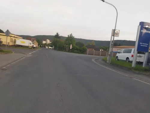
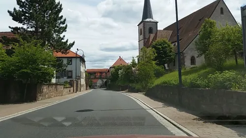
- Mapillary (see each image): photos
- OpenStreetMap contributors (ODbL 1.0): places, airports, map data
- Wikidata (CC0 1.0): elevation, founding date, time zone, website, landmarks and historic places
- Wikimedia Commons (see each image): photos
- Wikipedia (CC BY-SA 4.0): overview and history text
Photo credits
- Scherenburg Gemünden am Main, Julien Christ, CC BY-SA 3.0
- Bushaltestelle Bahnhof, 2, Gemünden am Main, Landkreis Main-Spessart, GeorgDerReisende, CC BY-SA 4.0
- Linie 640, 1, Gemünden am Main, Landkreis Main-Spessart, GeorgDerReisende, CC BY-SA 4.0
- Bushaltestelle Bahnhof, 1, Gemünden am Main, Landkreis Main-Spessart, GeorgDerReisende, CC BY-SA 4.0
- Flug -Nordholz-Hammelburg 2015 by-RaBoe 1232 - Gemünden am Main, © Ra Boe / Wikipedia, CC BY-SA 3.0 de
- Bahnhof, 5, Gemünden am Main, Landkreis Main-Spessart, GeorgDerReisende, CC BY-SA 4.0
- Bahnhof, 2, Gemünden am Main, Landkreis Main-Spessart, GeorgDerReisende, CC BY-SA 4.0
- Bahnhofstraße 32-36, 1, Gemünden am Main, Landkreis Main-Spessart, GeorgDerReisende, CC BY-SA 4.0
- Bahnhofstraße 31, 1, Gemünden am Main, Landkreis Main-Spessart, GeorgDerReisende, CC BY-SA 4.0
- Bahnhof, 1, Gemünden am Main, Landkreis Main-Spessart, GeorgDerReisende, CC BY-SA 4.0
- Bahnhofstraße 27, 1, Gemünden am Main, Landkreis Main-Spessart, GeorgDerReisende, CC BY-SA 4.0
- Bahnhofstraße 27, 4, Gemünden am Main, Landkreis Main-Spessart, GeorgDerReisende, CC BY-SA 4.0
- Linie 650, 1, Gemünden am Main, Landkreis Main-Spessart, GeorgDerReisende, CC BY-SA 4.0
- Bahnhofstraße 27, 2, Gemünden am Main, Landkreis Main-Spessart, GeorgDerReisende, CC BY-SA 4.0
- Nantenbach Mainbrücke Schönrain-Tunnel 2006-01-29-b, Unknown author, CC BY 2.5
- RuineSchoenrainSO, Fjellfross at German Wikipedia, CC BY-SA 3.0
- Aerial image of the Rieneck Castle, Carsten Steger, CC BY-SA 4.0
- Gemünden Slorburg, Reise-Line, CC BY-SA 3.0
- RuHomburg1, Bonnlander, CC BY-SA 3.0
- Gemünden, Kloster Schönau-002, Tilman2007, CC BY-SA 3.0
- Gemünden, Mainstraße 6-001, Tilman2007, CC BY-SA 3.0
- Gemünden Christuskirche 002, Tilman2007, CC BY-SA 3.0
- Heßdorf Evangelische Kirche 001, Tilman2007, CC BY 3.0
- Gössenheim, Katholische Pfarrkirche St. Radegundis, 002, Tilman2007, CC BY-SA 3.0
- Rieneck, St. Johannes d. T-002, Tilman2007, CC BY-SA 3.0
- Adonissuche (7), Keltenhuegel, CC BY-SA 4.0
- Pfeiler Strecke 46 Gräfendorf 20190417 002, Tilman2007, CC BY-SA 4.0
- Stolperstein für Heinrich Grünbaum (Gemünden am Main), Christian Michelides, CC BY-SA 4.0
- Stolperstein für Arthur Kahn (Gemünden am Main), Christian Michelides, CC BY-SA 4.0
- Stolperstein für Fanny Weinberg (Gemünden am Main), Christian Michelides, CC BY-SA 4.0
- Stolperstein für Heinemann Grünbaum (Gemünden am Main), Christian Michelides, CC BY-SA 4.0
- NSG Mäusberg-Rammersberg-Ständelberg 2006 04, Bonnlander, CC BY-SA 4.0
- Gemünden am Main, Seifriedsburg, Katholische Filialkirche St. Jakob d. Ä., 001, Tilman2007, CC BY-SA 3.0
- Hauptstraße 11 Karsbach 20200614 001, Tilman2007, CC BY-SA 4.0
- Kloster-Schoenau-1, Rosemarie Knechtel, Public domain
- Landschaft mit Adonisröschen im NSG Mäusberg-Rammersberg-Ständelberg im Abendlicht, Christine Meinecke, CC BY-SA 4.0
- Rieneck, St. Johannes d. T-001, Tilman2007, CC BY-SA 3.0
- Кохання врятує цей світ, Galyna29, CC BY-SA 4.0
- Gemünden, Bahnhof - panoramio, hartmut_bach, CC BY 3.0
- Gemünden, Bahnhof - panoramio (1), hartmut_bach, CC BY 3.0
- Street-level photo, bernd_niemann, CC BY-SA 4.0
- Street-level photo, ramap, CC BY-SA 4.0
- Street-level photo, changchun1, CC BY-SA 4.0
- Street-level photo, ramap, CC BY-SA 4.0
- Street-level photo, tian, CC BY-SA 4.0
- Street-level photo, tian, CC BY-SA 4.0
- Street-level photo, changchun1, CC BY-SA 4.0
- Street-level photo, tian, CC BY-SA 4.0
- Street-level photo, changchun1, CC BY-SA 4.0
- Street-level photo, tian, CC BY-SA 4.0
- Street-level photo, ramap, CC BY-SA 4.0
- Street-level photo, tian, CC BY-SA 4.0
- Street-level photo, ramap, CC BY-SA 4.0
- Street-level photo, tian, CC BY-SA 4.0
- Street-level photo, tian, CC BY-SA 4.0
- Street-level photo, tian, CC BY-SA 4.0
- Street-level photo, bernd_niemann, CC BY-SA 4.0
- Street-level photo, bernd_niemann, CC BY-SA 4.0


Page built November 8, 2026. Spotted a mistake? Tell us or suggest a place.