


Hildburghausen, Germany
Hildburghausen is a town of 11,632 people in Thuringia, Germany.
Why visit Hildburghausen
Townapedia lists 21 museums and landmarks, 6 parks and trails, 33 places to eat, 3 places to stay and 36 attractions in and around town.
Highlights include Stadttheater Hildburghausen, Bismarckturm Hildburghausen, Schloss Bedheim and Stadtmuseum.
Weather in Hildburghausen
Forecast from MET Norway (CC BY 4.0). Full forecast
About Hildburghausen
Hildburghausen (German pronunciation: [hɪltbʊʁkˈhaʊ̯zn̩] ) is a town in Thuringia in central Germany, capital of the Hildburghausen district.
From the Wikipedia article Hildburghausen (this version), under CC BY-SA 4.0.
Things to do36



24 more on the map.
Museums and landmarks21


Oppidum Steinsburg
Monument and historic site · 10.0 km
Archaeological site in Germany





9 more on the map.
Parks, trails and playgrounds6

Werra Sport- und Freizeitbad Hildburghausen
Sports field and stadium · 0.7 km
16 Oberes Kleinodsfeld, Hildburghausen

Parkgelände der Helios Fachklinik
Park · 0.7 km
Die Helios Fachkliniken Hildburghausen liegen eingebettet in einer wunderschöne und großzügigen Parkanlage. Hier finden unsere Patienten...

Restaurants and cafes33
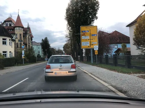
Burghof
Restaurant · International · 0.6 km
8 Friedrich-Rückert-Straße, Hildburghausen
Mo 17:00-22:00; Tu-Fr 11:00-14:00,17:00-22:00; Sa 17:00-22:00; Su...

Café & Backshop Drei Ähren
Bakery · 0.9 km
1 Am Friedhof, Hildburghausen
Mo-Fr 07:00-19:00; Sa 07:00-15:00; Su,PH off
Drei Ähren Bäckerei
Bakery · 1.4 km
9 Häselriether Straße, Hildburghausen
Mo-Fr 08:30-18:00, Sa 08:30-16:00


Asia Restaurant
Restaurant · Asian
7 Markt, Hildburghausen
Tu-Su,PH 11:00-14:00,17:00-22:00; Mo off


21 more on the map.
History
The settlement of Hilteburgehusin was first mentioned in a 1234 deed, when the Counts of Henneberg sold it to the Prince-Bishops of Würzburg. Repurchased in 1316, the Henneberg lords vested the citizens with town privileges in 1324 and had city walls erected. In 1353, the estates of Hildburghausen were inherited by the Wettin landgrave Frederick III of Thuringia and upon the 1485 Treaty of Leipzig became part of the Ernestine duchies.
In 1528, the Hildburghausen citizens turned Protestant. The town fell to the newly established Duchy of Saxe-Coburg in 1572 and upon the extinction of the line in 1638 passed to the Duchy of Saxe-Altenburg. In 1680, it became the residence of the Ernestine dukes of Saxe-Hildburghausen until its dissolution in 1826, after which it passed to the Duchy of Saxe-Meiningen. The town became part of the new state of Thuringia in 1920.
From the History section of Hildburghausen on Wikipedia, under CC BY-SA 4.0.
Where to stay3
Churches and places of worship18
St. Bartholomäus
Church · Lutheran · 5.2 km
113 Lange Gasse, Straufhain
St. Nikolaus
Church · Lutheran · 4.4 km
20 Schulstraße, Hildburghausen
St. Marien
Church · Lutheran · 5.7 km
84 Eishäuser Hauptstraße, Straufhain
St. Marien
Church · Lutheran · 6.8 km
26 Adelhäuser Kirchgasse, Straufhain
St. Peter und Paul
Church · Lutheran · 5.2 km
An der Kirche, Gerhardtsgereuth
St. Valentin
Church · Lutheran · 3.8 km
43 Leimriether Hauptstraße, Hildburghausen
Shopping15
Gas and EV charging4
Schools, colleges and libraries6
Healthcare9
Map of Hildburghausen
151 places. The map loads OpenStreetMap tiles when you open it.
Getting there and nearby towns
Erfurt-Weimar Airport (ERF) is the nearest airport with scheduled flights listed in OpenStreetMap, 64 km away.
- Suhl 21 km north, about 21 min by car
- Coburg 25 km southeast, about 25 min by car
- Rödental 26 km southeast, about 26 min by car
- Zella-Mehlis 26 km north, about 26 min by car
- Meiningen 27 km northwest, about 27 min by car
- Neustadt bei Coburg 30 km east, about 30 min by car
- Sonneberg 32 km east, about 32 min by car
- Lichtenfels 39 km southeast, about 39 min by car
- Schmalkalden 39 km northwest, about 39 min by car
- Bad Neustadt an der Saale 39 km west, about 39 min by car
Drive times are estimates from straight-line distance, not routes.
Local news
Headlines from INDB.
Reviews, tips and questions
Loading what members have shared...
Sources and licences
- GeoNames (CC BY 4.0): population, coordinates, regions and time zone
- Mapillary (see each image): photos
- OpenStreetMap contributors (ODbL 1.0): places, airports, map data
- Wikidata (CC0 1.0): elevation, founding date, time zone, website, landmarks and historic places
- Wikimedia Commons (see each image): photos
- Wikipedia (CC BY-SA 4.0): overview and history text
Photo credits
- Hildburghausen Historisches Rathaus, Bernd Hutschenreuther, CC BY-SA 3.0
- Hildburghausen-Gymnasium-Georgianum, Störfix, CC BY-SA 3.0 de
- Hildburghausen-Stadttheater, Störfix, CC BY-SA 3.0 de
- Hildburghausen-Christuskirche, Störfix, CC BY-SA 3.0 de
- Hildburghausen-Apostelkirche, Störfix, CC BY-SA 3.0 de
- Hildburghausen-Kath-Kirche-St-Leopold, Störfix, CC BY-SA 3.0 de
- Hildburghausen - Altstadt - Christuskirche - Kronleuchter und Kuppel senkrecht, Roman Eisele, CC BY-SA 4.0
- Hildburghausen - Altstadt - Christuskirche - Kronleuchter unter der Kuppel, Roman Eisele, CC BY-SA 4.0
- Hildburghausen-Christuskirche1, Störfix, CC BY-SA 3.0 de
- Hildburghausen-Knappengasse-18-02, Störfix, CC BY-SA 3.0 de
- Hildburghausen-Knappengasse-18-01, Störfix, CC BY-SA 3.0 de
- Stolpersteine Hildburghausen, Aschroet, CC0
- Rathaus Hildburghausen 7, Aschroet, CC0
- Rathaus Hildburghausen 5, Aschroet, CC0
- Rathaus Hildburghausen 8, Aschroet, CC0
- Rathaus Hildburghausen 9, Aschroet, CC0
- Chirotherium Hildburghausen 1, Aschroet, CC0
- Rathaus Hildburghausen 4, Aschroet, CC0
- Rathaus Hildburghausen 6, Aschroet, CC0
- Chirotherium Hildburghausen 3, Aschroet, CC0
- Chirotherium Hildburghausen 2, Aschroet, CC0
- Hildburghausen-Christuskirche2, Störfix, CC BY-SA 3.0 de
- Hildburghausen-Berthot-Villa, Störfix, CC BY-SA 3.0 de
- Erwin Spindler Ansichtskarte Hildburghausen, Erwin Spindler, Public domain
- Hildburghausen-Apostelkirche-02, Störfix, CC BY-SA 3.0 de
- Hildburghausen-Apostelkirche-01, Störfix, CC BY-SA 3.0 de
- Hildburghausen-Apostelkirche-03, Störfix, CC BY-SA 3.0 de
- Hildburghausen-Toilettenhäuschen, Störfix, CC BY-SA 3.0 de
- Hildburghausen-Puschkinplatz 12, Störfix, CC BY-SA 3.0 de
- Hildburghausen-Postamt, Störfix, CC BY-SA 3.0 de
- Hildburghausen-Gymnasium, Störfix, CC BY-SA 3.0 de
- Theresienfest Hildburghausen03102019, Zavijava2, CC BY-SA 3.0
- Cemetery Birkenfeld, Hildburghausen 3, Aschroet, CC0
- Cemetery Birkenfeld, Hildburghausen 1, Aschroet, CC0
- Cemetery Birkenfeld, Hildburghausen 5, Aschroet, CC0
- Cemetery Birkenfeld, Hildburghausen 4, Aschroet, CC0
- Cemetery Birkenfeld, Hildburghausen 2, Aschroet, CC0
- Hildburghausen Wasserturm Bahnhof, Oberlausitzerin64, CC BY-SA 4.0
- Cemetery Birkenfeld, Hildburghausen 6, Aschroet, CC0
- Steinsburg-022, DKrieger, CC BY-SA 3.0
- Weitersroda-Schloss, Störfix, CC BY-SA 3.0 de
- Eishausen-Ev-Kirche, Störfix, CC BY-SA 3.0 de
- Häselrieth-Ev-Kirche-St-Wigbert, Störfix, CC BY-SA 3.0 de
- Stressenhausen-Ev-Kirche, Störfix, CC BY-SA 3.0 de
- Adelshausen St.Marien-20211007-RM-173029, Ermell, CC BY-SA 4.0
- St. Marien, Ebenhards 1, Aschroet, CC0
- Pfersdorf-Ev-Kirche-St-Nikolas, Störfix, CC BY-SA 3.0 de
- Leimrieth-Ev-Kirche-St-Valentin, Störfix, CC BY-SA 3.0 de
- Bedheim-St-Kiliankirche, Störfix, CC BY-SA 3.0 de
- Gerhardtsgereuth-Ev-Kirche, Störfix, CC BY-SA 3.0 de
- Hildburghausen Stadtmuseum, Bernd Hutschenreuther, CC BY-SA 3.0
- HIBU Meyer Dkm01, Metilsteiner, CC BY-SA 3.0
- Gerhardtsgereuth-Kriegerdenkmal-01, Störfix, CC BY-SA 3.0 de
- Hildburghausen - Bismarckturm, Mazbln, CC BY-SA 2.5
- Bedheim-Schloss, Störfix, CC BY-SA 3.0 de
- Burg, Nordturm, Uwe-Chico, CC BY-SA 4.0
- Bildnisbüste der Dunkelgräfin, MarcelBuehner, CC BY-SA 4.0
- Street-level photo, bejotel, CC BY-SA 4.0
- Street-level photo, ramap, CC BY-SA 4.0
- Street-level photo, changchun1, CC BY-SA 4.0
- Street-level photo, nakaner, CC BY-SA 4.0
- Street-level photo, ramap, CC BY-SA 4.0
- Street-level photo, ramap, CC BY-SA 4.0
- Street-level photo, changchun1, CC BY-SA 4.0
- Street-level photo, ramap, CC BY-SA 4.0
- Street-level photo, changchun1, CC BY-SA 4.0
- Street-level photo, bejotel, CC BY-SA 4.0
- Street-level photo, atze02, CC BY-SA 4.0
- Street-level photo, bejotel, CC BY-SA 4.0
- Street-level photo, ramap, CC BY-SA 4.0
- Street-level photo, bejotel, CC BY-SA 4.0
- Street-level photo, ramap, CC BY-SA 4.0
- Street-level photo, bejotel, CC BY-SA 4.0


Page built November 8, 2026. Spotted a mistake? Tell us or suggest a place.