


Hövelhof, Germany
Hövelhof is a town of 15,962 people in North Rhine-Westphalia, Germany.
Why visit Hövelhof
Townapedia lists 36 museums and landmarks, 26 parks and trails, 76 places to eat, 21 places to stay and 9 attractions in and around town.
Highlights include Hofladen Westkämper, Graf-Bülow-Höhe, Heimatzentrum Senne and Skulpturengarten Wilfried Hagebölling.
Weather in Hövelhof
Forecast from MET Norway (CC BY 4.0). Full forecast
About Hövelhof
Hövelhof (German pronunciation: [ˈhøːvl̩ˌhoːf] ) is a municipality in the district Paderborn, in North Rhine-Westphalia, Germany. Since 14 March 2012, Hövelhof can use the official prefix Sennegemeinde (English: "Senne municipality").
From the Wikipedia article Hövelhof (this version), under CC BY-SA 4.0.
Things to do9

Hofladen Westkämper
Farm and orchard · 5.8 km
69 Sennelagerstraße, Paderborn
Mo-Fr 08:00-12:00, 14:00-18:00; Sa 08:00-12:00; Su off

Museums and landmarks36
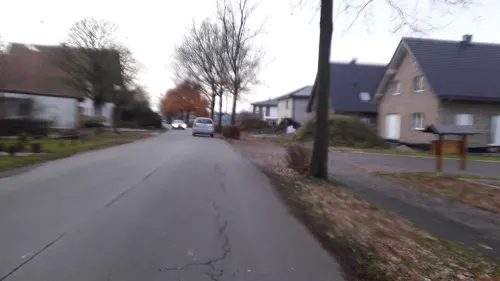


Ehemalige Rangierlok der "Geha-Möbelwerke"
Monument and historic site · 1.1 km
Kleine grüne Werkslok
Henken Mühle
Monument and historic site · 4.6 km
242 Gütersloher Straße, Hövelhof
Pyramiden-Pappel Charles Napoléon
Monument and historic site · 4.9 km
Mit Blumen gestaltetes Wappen der Gemeinde Hövelhof
24 more on the map.
Parks, trails and playgrounds26

Skulpturengarten Wilfried Hagebölling
Park · 5.2 km
120 Bielefelder Straße, Paderborn
May-Oct Su[1] 15:00-18:00




14 more on the map.
Restaurants and cafes76
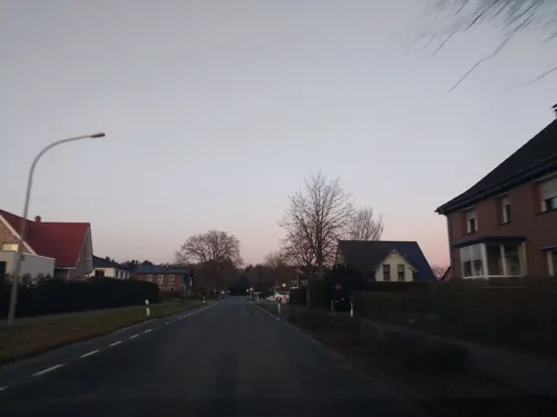
Gasthaus Spieker
Restaurant · Regional · 4.1 km
86 Detmolder Straße, Hövelhof
Mo,Tu off; We-Sa 17:00-22:00; PH,Su 11:30-14:30,17:30-21:30

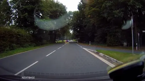
Hahnenkrug
Restaurant · German · 4.1 km
164 Detmolder Straße, Hövelhof
We-Fr 16:00-22:00; Sa-Su 11:00-22:00
Hotel-Restaurant Piärdestall
Restaurant · German, French · 4.7 km
245 Gütersloher Straße, Hövelhof
Tu off; Mo,We-Sa 17:30-23:00; Su 11:30-14:30,17:30-23:00
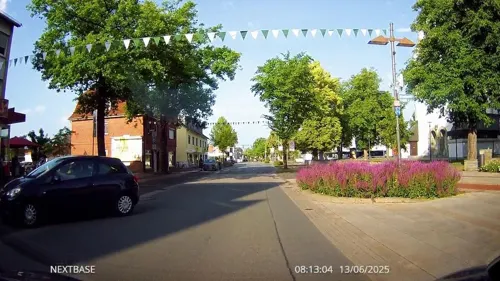
Pizza Avanti
Restaurant · Italian, Pizza · 6.7 km
129 Bielefelder Straße, Paderborn
Su-Th 16:00-23:00; Fr-Sa 16:00-00:00
Taverna Zorbas
Restaurant · Greek · 2.7 km
139 Sennestraße, Hövelhof
Mo,Tu,Th-Sa 17:00-23:00; PH,Su 11:30-14:30,17:00-23:00; We off
Viet Nam plus 2
Restaurant · Vietnamese · 1.2 km
40 Bielefelder Straße, Hövelhof
Mo-Su,PH 11:30-15:00,17:00-22:00; We off
Forellenhof Wüseke
Restaurant · German · 5.0 km
205 Bielefelder Straße, Paderborn
We-Su 11:45-14:30, 17:30-21:30; Mo, Tu off


Gasthaus Mohrenschänke
Restaurant · 1.7 km
40 Bauernweg, Delbrück
Mo-Fr 18:00+; Tu off; Sa 17:00+; Su 10:00+

Goeken backen
Cafe · 6.6 km
1-3 Rosmarinstraße, Paderborn
Mo-Fr 07:00-18:30; Sa 07:00-18:00; Su 07:30-18:00
64 more on the map.
History
The name of the municipality is derived from the name of the Hövelhof, a grange that was founded around the year 1000. The first official documentation of its name was in 1446. About 200 years later, in 1645, the last owner died childless. Thus, the Hövelhof fell into the ownership of the local sovereign, the prince-bishop of Paderborn. Close to the farm, the hunting lodge was built in 1661; at the beginning of the 18th century, the first church was erect.
From the History section of Hövelhof on Wikipedia, under CC BY-SA 4.0.
Where to stay21
Churches and places of worship17
St. Johannes Nepomuk
Church · Roman Catholic · 0.8 km
32 Allee, Hövelhof
Shopping19
Gas and EV charging12
Schloss-Handel Gastankst...
Gas station · 6.8 km
340 Kaunitzer Straße, Schloß Holte-Stukenbrock
Schools, colleges and libraries13
Bildungszentrum "Erich Klausener" Schloß Holte-Stukenbrock der Polizei NRW
School · 5.5 km
26 Lippstädter Weg, Schloß Holte-Stukenbrock
Healthcare7
Map of Hövelhof
236 places. The map loads OpenStreetMap tiles when you open it.
Getting there and nearby towns
Flugplatz Bielefeld (BFE) is the nearest airport with scheduled flights listed in OpenStreetMap, 18 km away.
- Verl 12 km northwest, about 12 min by car
- Paderborn 13 km southeast, about 13 min by car
- Rietberg 15 km west, about 15 min by car
- Oerlinghausen 15 km north, about 15 min by car
- Salzkotten 16 km south, about 16 min by car
- Lage 22 km northeast, about 22 min by car
- Leopoldshöhe 22 km north, about 22 min by car
- Rheda-Wiedenbrück 24 km west, about 24 min by car
- Bielefeld 25 km north, about 25 min by car
- Lippstadt 26 km southwest, about 26 min by car
Drive times are estimates from straight-line distance, not routes.
Local news
Headlines from INDB.
Reviews, tips and questions
Loading what members have shared...
Sources and licences
- GeoNames (CC BY 4.0): population, coordinates, regions and time zone
- Mapillary (see each image): photos
- OpenStreetMap contributors (ODbL 1.0): places, airports, map data
- Wikidata (CC0 1.0): elevation, founding date, time zone, website
- Wikimedia Commons (see each image): photos
- Wikipedia (CC BY-SA 4.0): overview and history text
Photo credits
- Hoevelhof ehem.fuerstb.Jagdschloss, ludger1961, CC BY-SA 3.0
- Hövelhof geothermische Karte, Hagar66, CC BY-SA 3.0
- Hövelhof - 2026-03-07 - 5-Bäche-Weg (IMG 20260307 141651), Tsungam, CC BY-SA 4.0
- Hövelhof - 2026-03-07 - 5-Bäche-Weg, Bildstock Bruchweg 19 (IMG 20260307 141201), Tsungam, CC BY-SA 4.0
- Hövelhof - 2026-03-07 - 5-Bäche-Weg, Bildstock Dullwallsweg-Bruchweg (IMG 20260307 140752), Tsungam, CC BY-SA 4.0
- Hövelhof - 2026-03-07 - 5-Bäche-Weg, Schwarzwasserbach (IMG 20260307 142316), Tsungam, CC BY-SA 4.0
- Hövelhof - 2026-03-07 - 5-Bäche-Weg, Schwarzwasserbach (IMG 20260307 142334), Tsungam, CC BY-SA 4.0
- Hövelhof's Kirche 'St. Johannes Nepomuk' mit Pfarrheim - panoramio, INDALOMANIA, CC BY-SA 3.0
- Hövelhof's Denkmal für die Kriegsopfer - panoramio, INDALOMANIA, CC BY-SA 3.0
- Rathaus Hövelhof - panoramio, INDALOMANIA, CC BY-SA 3.0
- Eine typische Hövelhofer Verkehrsinsel - panoramio, INDALOMANIA, CC BY-SA 3.0
- Hövelhof - 2026-03-07 - 5-Bäche-Weg, Bildstock Grüner Weg 20a (IMG 20260307 143133), Tsungam, CC BY-SA 4.0
- Hövelhof - 2026-03-07 - 5-Bäche-Weg, Bildstock Grüner Weg 20a (IMG 20260307 143145850 HDR), Tsungam, CC BY-SA 4.0
- Hövelhof - 2026-03-07 - 5-Bäche-Weg, Bildstock Kirchstraße 63 (IMG 20260307 143610), Tsungam, CC BY-SA 4.0
- Hövelhof - 2026-03-07 - 5-Bäche-Weg, Bildstock Kirchstraße-Nordstraße (IMG 20260307 143737), Tsungam, CC BY-SA 4.0
- Hövelhof - 2026-03-07 - 5-Bäche-Weg, Krollbach (IMG 20260307 140111), Tsungam, CC BY-SA 4.0
- Senne-Bahn Zug der NWB im Bahnhof Hövelhof, ludger1961 ( talk · contribs ), CC BY-SA 3.0
- Rinderkraftbrühe mit feiner Einlage Zum Grünen Baum in Hövelhof, Benreis, CC BY-SA 4.0
- Hövelhof - 2026-03-07 - 5-Bäche-Weg, Bildstock Mergelweg 14 (IMG 20260307 135818), Tsungam, CC BY-SA 4.0
- Hövelhof - 2026-03-07 - 5-Bäche-Weg (IMG 20260307 125406), Tsungam, CC BY-SA 4.0
- Hövelhof - 2026-03-07 - 5-Bäche-Weg, LSG Obere Senne (IMG 20260307 125417), Tsungam, CC BY-SA 4.0
- Lauerwiesen08, Heinzhg, CC BY-SA 3.0
- Lippling - Kirche - 4, Ath, CC0
- Ramselbruch-4, Athde, CC0
- Hoevelhof-rixelbruch01, Erdkröte, CC BY-SA 3.0
- St. Achatius Stukenbrock-Senne-2, Athde, CC0
- Hoevelhof-Kirche-4, Athde, CC0
- Ostenland Kath.Kirche St.Joseph, ludger1961, CC BY-SA 3.0
- Sande St. Marien, Daniel Brockpähler, CC BY-SA 3.0
- Peter und Paul Kapelle, bez. 1869 02, Sven Kückmann, CC BY-SA 4.0
- Hövelhof Ev.Johanneskirche, ludger1961, CC BY-SA 3.0
- Sennelager ev.Paul-Gerhardt-Gemeindezentrum, ludger1961, CC BY-SA 3.0
- Klausheide-Apels Teich-3, Athde, CC0
- Erdgarten-Lauerwiesen - 2, Ath, CC0
- Sennelager - Langenbergteich - 2, Ath, CC0
- Paderborn - 2016-06-26 - PB-031 Lippeniederung bei Sande (025), Tsungam, CC BY-SA 4.0
- Hövelhof - 2016-05-01 - Moosheide (PB) (003), Tsungam, CC BY-SA 4.0
- Stukenbrock - 2016-05-01 - Senner Pferde Moosheide (017), Tsungam, CC BY-SA 4.0
- Delbrück - Rixel - 16, Ath, CC0
- Delbrück - Rellerkapelle - 2, Ath, CC0
- Street-level photo, thetornado76, CC BY-SA 4.0
- Street-level photo, thetornado76, CC BY-SA 4.0
- Street-level photo, thetornado76, CC BY-SA 4.0
- Street-level photo, thetornado76, CC BY-SA 4.0
- Street-level photo, derlipper, CC BY-SA 4.0
- Street-level photo, derlipper, CC BY-SA 4.0
- Street-level photo, thetornado76, CC BY-SA 4.0
- Street-level photo, derlipper, CC BY-SA 4.0
- Street-level photo, derlipper, CC BY-SA 4.0
- Street-level photo, live, CC BY-SA 4.0
- Street-level photo, rotespferd, CC BY-SA 4.0
- Street-level photo, thetornado76, CC BY-SA 4.0
- Street-level photo, thetornado76, CC BY-SA 4.0
- Street-level photo, Schmarvis, CC BY-SA 4.0
- Street-level photo, nrailuj, CC BY-SA 4.0
- Street-level photo, thetornado76, CC BY-SA 4.0
- Street-level photo, thetornado76, CC BY-SA 4.0
- Street-level photo, thetornado76, CC BY-SA 4.0
- Street-level photo, Coemgen84, CC BY-SA 4.0
- Street-level photo, thetornado76, CC BY-SA 4.0
- Street-level photo, baldur80, CC BY-SA 4.0
- Street-level photo, bielebog, CC BY-SA 4.0
- Street-level photo, bielebog, CC BY-SA 4.0
- Street-level photo, bielebog, CC BY-SA 4.0
- Street-level photo, zuse, CC BY-SA 4.0
- Street-level photo, thetornado76, CC BY-SA 4.0


Page built November 8, 2026. Spotted a mistake? Tell us or suggest a place.