
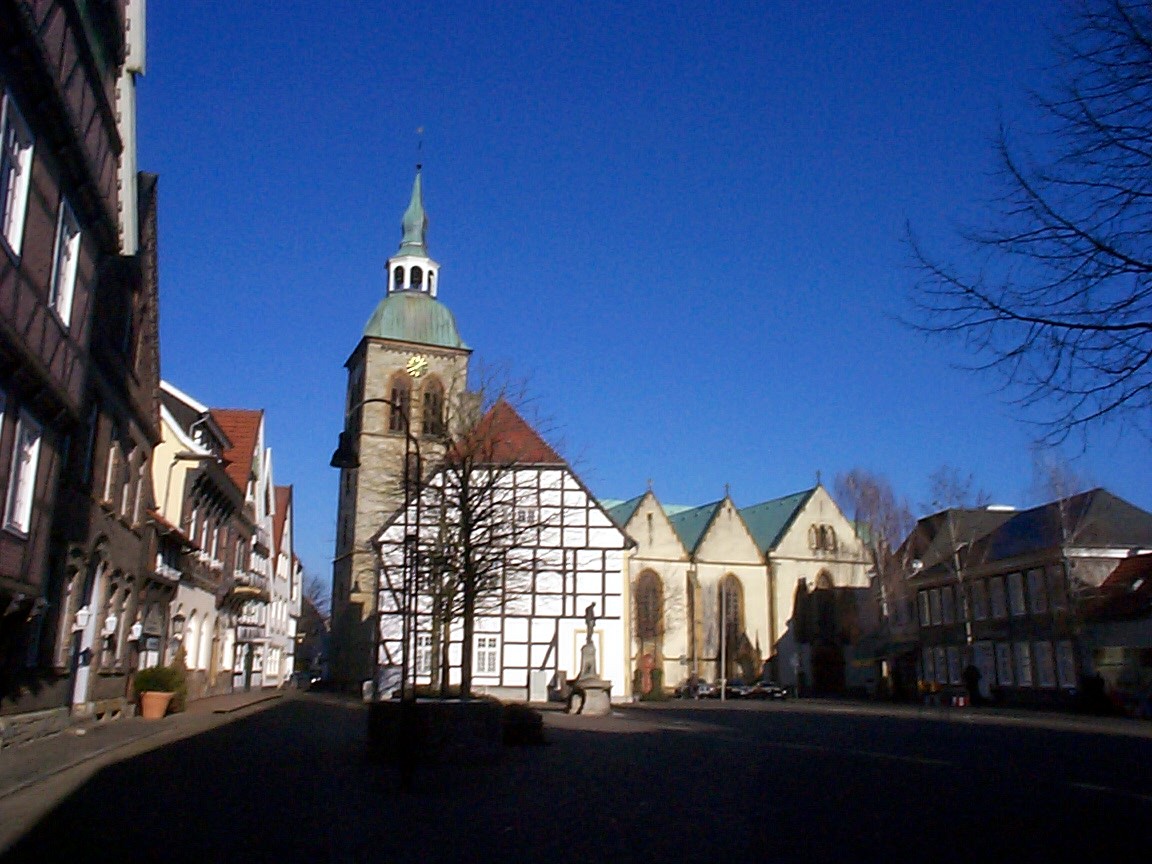


Rheda-Wiedenbrück, Germany
Rheda-Wiedenbrück is a town of 46,123 people in North Rhine-Westphalia, Germany.
Why visit Rheda-Wiedenbrück
Townapedia lists 30 museums and landmarks, 37 parks and trails, 169 places to eat, 14 places to stay and 4 attractions in and around town.
Highlights include Theater Gütersloh, Biolandhof Vollmer, Museum für westfälische Literatur (Haus Nottbeck) and Schloss Rheda.
Weather in Rheda-Wiedenbrück
Forecast from MET Norway (CC BY 4.0). Full forecast
About Rheda-Wiedenbrück
Rheda-Wiedenbrück (German pronunciation: [ˈʁeːda viːdn̩ˈbʁʏk] ; Westphalian: Raie-Wienbrügge) is a city in the district of Gütersloh, in North Rhine-Westphalia, Germany.
From the Wikipedia article Rheda-Wiedenbrück (this version), under CC BY-SA 4.0.
Photos of Rheda-Wiedenbrück


Things to do4


Biolandhof Vollmer
Farm and orchard · 3.8 km
Bioland Betrieb mit Hofladen & Lieferservice. Sortiment: Rohmilch von Weidekühen, Obst und Gemüse, Kartoffeln, Getreide, Fleisch, Eier,...
4 Schildstraße, Rheda-Wiedenbrück
Tu 16:00-18:00; We 10:00-12:00; Fr 10:00-12:00,16:00-18:00; Sa 10:00-12:00
Hofladen Schröder
Farm and orchard · 5.1 km
15 Kiebitzstraße, Gütersloh
Mo-Fr 09:00-18:00; Sa 09:00-14:00
Museums and landmarks30

Museum für westfälische Literatur (Haus Nottbeck)
Museum · 5.9 km
Museum für westfälische Literatur
1 Landrat-Predeick-Allee, Oelde


Haus Bosfeld
Monument and historic site · 3.5 km
36, Rheda-Wiedenbrück




Pulverturm
Monument and historic site · 1.8 km
Stadtmauer mit Kasematten
Bronzezeitlicher Grabfund von Rheda
Monument and historic site · 2.3 km
1911 entdecktes Grab aus der jungen Bronzezeit mit reichen Grabbeigaben, unter anderem ein reich verziertes Bronzebecken
18 more on the map.
Parks, trails and playgrounds37


Stadtpark und Botanischer Garten Gütersloh
Park · 8.2 km
Park and botanical garden in Gütersloh, Germany




Seilzirkus
Playground · 0.7 km
Ergänzung von inklusiven Elementen 2025-07
Mo-Su,PH 09:00-20:00
25 more on the map.
Restaurants and cafes169
Pizzeria Da Vito
Restaurant · Italian · 1.5 km
90-98 Bielefelder Straße, Rheda-Wiedenbrück
Tu, Th, Sa 17:30-22:00; Fr 11:30-14:00, 17:30-22:00; Su 17:00-21:00
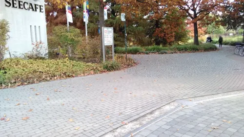
Seecafe - Restaurant
Cafe · Cake, Coffee Shop · 1.6 km
22 Paul-Schmitz-Straße, Rheda-Wiedenbrück
We-Su 09:00-18:00
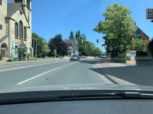
The Little Hanky
Restaurant · Burger · 0.7 km
63 Berliner Straße, Rheda-Wiedenbrück
Tu-Fr 11:30-14:30, 17:00-20:00; Sa-Su 17:00-20:00
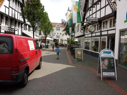
Wiedenbrücker Kaffeekontor
Cafe · Coffee Shop · 1.9 km
14 Klingelbrink, Rheda-Wiedenbrück
Su, Mo off; Tu-Th 10:00-13:30, 15:30-18:00; Fr 10:00-18:00; Sa 10:00-15:00
Bäckerei Liening
Bakery · 7.4 km
1 Kirchstraße, Rietberg
Mo-Fr 06:00-19:00; Sa 06:00-14:00; Su 08:00-11:00
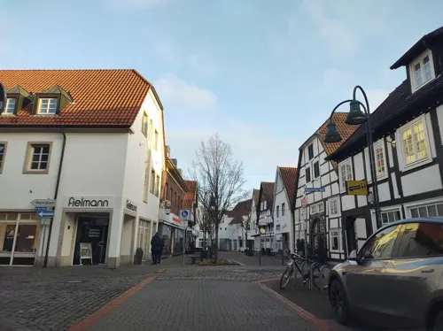
CLAPPERTONs speisekammer
Restaurant · Regional · 1.9 km
26 Lange Straße, Rheda-Wiedenbrück
Mo-Sa 17:00-23:00; Su off
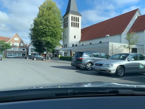
Drostenkeller
Restaurant · Breakfast, Lunch · 2.1 km
14 Wasserstraße, Rheda-Wiedenbrück
Mo-Th 09:00-14:30, Fr 09:00-14:00
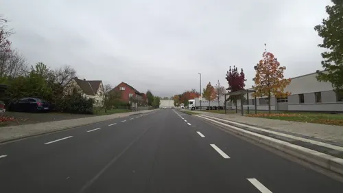

Bäckerei Vorbohle GmbH Co. KG
Cafe · Cake · 2.0 km
11 Klingelbrink, Rheda-Wiedenbrück
Mo-Fr 06:30-18:30; Sa 06:00-13:00; Su 08:00-11:00

Birkholz
Bakery · 1.6 km
139 Bielefelder Straße, Rheda-Wiedenbrück
Mo-Fr 06:00-18:00; Sa 06:00-14:00; Su 08:00-16:00
157 more on the map.
History
It is suspected that in 785 a first small church was built in Wiedenbrück. Excavations show the emergence of a transept basilica built after 900. The dendrochronological analysis of two tree coffins found north of the Saint Aegidius church resulted in a dating to the years 907/923 and 926/42. Rheda was documented at the latest in 1088 and earliest in 1085. Since its first mentioning in 1170 until 1807/1815, the castle or the later Rheda Castle was the center of the Rheda ruling region (the County of Bentheim-Tecklenburg-Rheda).
Wiedenbrück was the seat of the Office Reckenberg and thus an exclave of the Bishopric of Osnabrück.
Emperor Otto granted the rights of market, coin and customs law for Wiedenbrück to the bishop of Osnabrück in the year 952. Several certificates issued by Otto III (HRE) in Wiedenbrück in 985 are known. It is therefore assumed that a royal court existed in Wiedenbrück at that time.
Read more of the history
In 1225 bishop Engelbert of Osnabrück took over the ancient legal court responsibility for Wiedenbrück and other cities. This is one of the starting points of the development of the Bishopric of Osnabrück to a territorial state of the Bishop of Osnabrück. The oldest surviving coins from Wiedenbrück are dated 1230. In 1231 Wiedenbrück was proclaimed civitas. Aldermen were elected to the Court and a seal was announced. In 1249 the new town was founded and a year later castle Reckenberg was mentioned for the first time.
Around 1462 a first constitution was drafted, based on the constitution of Osnabrück. In 1543 Wiedenbrück was reformed by Hermann Bonnus, a representative of the Bishop Franz of Waldeck. By 1565 Wiedenbrück was predominantly Lutheran. In the same year the boundaries between the Office Reckenberg to which Wiedenbrück counted, and the adjacent Rheda were established in the so-called Bielefeld recess, as two independent sovereign areas were first recognized.
After first steps for a Counter-Reformation were taken in 1624/1625, Wiedenbrück was occupied in 1626 during the Thirty Years' War by the Danes . When the Bishop Franz Wilhelm von Wartenberg assumed office in 1628, he continued the Counter-Reformation.
In 1637 Wiedenbrück established one of the oldest high schools in the region, the Gymnasium Marianum, a Latin School and forerunner of the current Ratsgymnasium high school in Wiedenbrück. The Franciscan monastery was founded in 1644 by Bishop Franz Wilhelm. Three years later, in July 1647 Wiedenbrück was taken by the Swedes, but cleared after dismantling of the fortress within two months. When in 1648 in Münster and Osnabrück the Peace of Westphalia was negotiated, this did require the alternation of a Catholic and a Lutheran bishop in the House of Brunswick-Lüneburg for the Bishopric of Osnabrück.
In 1664, prompted by Ernst August I., the refortification of the city began. In 1716 the last urban copper coins were minted. In 1726, a new office building was constructed on the Reckenberg.
As a result of the conversion of bishopric Osnabrück into a principality, Wiedenbrück was attached to the house of Hanover in 1802. In 1807 the city became part of the Kingdom of Westphalia. The chapter of fellows of collegiate was disbanded in 1810, and the Office Reckenberg with Wiedenbrück were ceded to Prussia at the Congress of Vienna in 1816 and assigned to the new province of Westphalia. Wiedenbrück thus separated from the Diocese of Osnabrück, the Catholic communities of the former Office Reckenberg came to the Archdiocese of Paderborn.
In the early morning hours of 10 November 1938 members of the SA, who had previously gathered in the adjacent restaurant Neuhaus, set the Rheda synagogue on fire. The remains were demolished and the property subsequently sold. In
1938 the federal highway A2 was opened to traffic. The highway was not, as is sometimes falsely claimed built almost exactly on the border between Rheda Wiedenbrück, but crosses it several times in different city areas.
In 1940, Field Marshal Hermann Goering ordered the confiscation of all bronze church bells, which were to be used for arms manufacturing. From 1816 until the local government reform in 1970, the city was the seat of the district named after the city of Wiedenbrück.
From the History section of Rheda-Wiedenbrück on Wikipedia, under CC BY-SA 4.0.
More about Rheda-Wiedenbrück
Geography
The twin community lies within the valley of the river Ems in the Westphalian Lowland south of the Teutoburg Forest, which is about 30 km away. The formerly independent towns of Rheda and Wiedenbrück are separated by the Federal Highway 2 which does not, however, form the historic border between the two districts. The Ems river runs through the city. The nearest major cities are Gütersloh (about 11 km), Bielefeld and Paderborn around 35 km away, and Hamm about 55 km away.
From the Wikipedia article Rheda-Wiedenbrück, under CC BY-SA 4.0.
Notable people from Rheda-Wiedenbrück
 Liz MohnGerman businesswoman and philanthropistPhoto: Jan Voth / Bertelsmann Stiftung, CC BY-SA 3.0 de
 Ingo PohlmannGerman pop singerPhoto: ©pitpony.photography, CC BY-SA 3.0
 Jens TeutrineGerman politician (FDP)Photo: David.renz, CC BY-SA 4.0
 Nicole KortlükeGerman film editorPhoto: UlrikeZimmermann, CC BY-SA 4.0
- Carl Heinrich EbermaierGerman botanist (1802-1870)
- Hanne WolharnGerman actress
Born in Rheda-Wiedenbrück, according to Wikidata (CC0). Each name links to its Wikipedia article.
Where to stay14
Hotel am Doktorplatz
Motel and hotel · 0.7 km
19 Berliner Straße, Rheda-Wiedenbrück
Churches and places of worship30
Herz-Jesu-Kirche
Church · Catholic · 7.4 km
171 Druffeler Straße, Rietberg
Shopping50
Pro Arbeit e.V. Secondhand-Verkauf - Herzebrock-Clarholz
Shop · 6.2 km
44 Otto-Hahn-Straße, Herzebrock-Clarholz
Gas and EV charging26
Schools, colleges and libraries37
Healthcare19
Map of Rheda-Wiedenbrück
250 places. The map loads OpenStreetMap tiles when you open it.
Getting there and nearby towns
Flugplatz Bielefeld (BFE) is the nearest airport with scheduled flights listed in OpenStreetMap, 21 km away.
- Gütersloh 8 km northeast, about 8 min by car
- Rietberg 10 km southeast, about 10 min by car
- Oelde 11 km west, about 11 min by car
- Harsewinkel 13 km north, about 13 min by car
- Wadersloh 13 km south, about 13 min by car
- Verl 15 km east, about 15 min by car
- Beelen 16 km northwest, about 16 min by car
- Friedrichsdorf 16 km northeast, about 16 min by car
- Steinhagen 18 km north, about 18 min by car
- Lippstadt 20 km south, about 20 min by car
Drive times are estimates from straight-line distance, not routes.
Towns near Rheda-Wiedenbrück


Keep exploring
Local news
Headlines from INDB.
Reviews, tips and questions
Loading what members have shared...
Sources and licences
- GeoNames (CC BY 4.0): population, coordinates, regions and time zone
- Mapillary (see each image): photos
- OpenStreetMap contributors (ODbL 1.0): places, airports, map data
- Wikidata (CC0 1.0): elevation, founding date, time zone, website, landmarks and historic places
- Wikimedia Commons (see each image): photos
- Wikipedia (CC BY-SA 4.0): overview and history text
Photo credits
- Wiedenbrueck Marktplatz 4, Unknown author, CC BY-SA 3.0
- Sonnenuhr auf der Burg in Rheda-Wiedenbrück - panoramio, biniu79, CC BY-SA 3.0
- Schloss in Rheda-Wiedenbrück - panoramio, biniu79, CC BY-SA 3.0
- Schloss Rheda, 1, Rheda, Rheda-Wiedenbrück, Landkreis Gütersloh, GeorgDerReisende, CC BY-SA 4.0
- Steinweg 8 + 6, 1, Rheda, Rheda-Wiedenbrück, Landkreis Gütersloh, GeorgDerReisende, CC BY-SA 4.0
- Steinweg 13, 1, Rheda, Rheda-Wiedenbrück, Landkreis Gütersloh, GeorgDerReisende, CC BY-SA 4.0
- Schloss Rheda, 3, Rheda, Rheda-Wiedenbrück, Landkreis Gütersloh, GeorgDerReisende, CC BY-SA 4.0
- Schloss Rheda, 2, Rheda, Rheda-Wiedenbrück, Landkreis Gütersloh, GeorgDerReisende, CC BY-SA 4.0
- Rheda-Wiedenbrück, Schloss Rheda, Schloss und Kapellenturm, Dguendel, CC BY 4.0
- Steinweg 14 + 12, 1, Rheda, Rheda-Wiedenbrück, Landkreis Gütersloh, GeorgDerReisende, CC BY-SA 4.0
- Schloss Rheda, 4, Rheda, Rheda-Wiedenbrück, Landkreis Gütersloh, GeorgDerReisende, CC BY-SA 4.0
- Rheda-Wiedenbrück, Schloss Rheda, die Häuser Steinweg 6 und 13, Dguendel, CC BY 4.0
- Rheda-Wiedenbrück, Schloss Rheda, die Kornmühle, Dguendel, CC BY 4.0
- Steinweg, 1, Rheda, Rheda-Wiedenbrück, Landkreis Gütersloh, GeorgDerReisende, CC BY-SA 4.0
- Rheda-Wiedenbrück, der Steinweg, Dguendel, CC BY 4.0
- Rheda-Wiedenbrück, am Mühlgraben, Dguendel, CC BY 4.0
- Rheda-Wiedenbrück, Schloss Rheda, die Schlossmühle, Dguendel, CC BY 4.0
- Rheda-Wiedenbrück, Schloss Rheda, die Schlossmühle,Mühlgraben, Dguendel, CC BY 4.0
- Ems, 6, Rheda, Rheda-Wiedenbrück, Landkreis Gütersloh, GeorgDerReisende, CC BY-SA 4.0
- Rheda-Wiedenbrück, Schloss Rheda, der Marstall, Dguendel, CC BY 4.0
- Rheda-Wiedenbrück, Schloss Rheda, der Marstall, Portal, Dguendel, CC BY 4.0
- Steinweg 9, 1, Rheda, Rheda-Wiedenbrück, Landkreis Gütersloh, GeorgDerReisende, CC BY-SA 4.0
- Steinweg 9, 3, Rheda, Rheda-Wiedenbrück, Landkreis Gütersloh, GeorgDerReisende, CC BY-SA 4.0
- Steinweg 11, 1, Rheda, Rheda-Wiedenbrück, Landkreis Gütersloh, GeorgDerReisende, CC BY-SA 4.0
- 2007-07-30,06, Rheda-Wiedenbrück, Ems, Mündung der Umflut, JKL-Foto, CC BY-SA 3.0
- Orangerie am Schloss in Rheda-Wiedenbrück - panoramio, biniu79, CC BY-SA 3.0
- Schlosspark, 2, Rheda, Rheda-Wiedenbrück, Landkreis Gütersloh, GeorgDerReisende, CC BY-SA 4.0
- Theater GT Südost, Steffan Sturm, CC BY-SA 3.0 de
- Botanischer-guetersloh, Hewa, CC0
- Apostelkirche (Gütersloh) (01), Chris06, CC BY-SA 4.0
- Jahnstadion wiedenbruck03, Oliver Freier // www.rheingeschwader.de, CC BY-SA 3.0 de
- Evangelische Stadtkirche (Rheda) (3), Chris06, CC BY-SA 4.0
- Gütersloh - Spexard (Naturschutzgebiet), Hagar66, CC BY-SA 3.0
- Rheda Schlosspark 2011, Hrz29vv, CC BY-SA 3.0
- Heidewald-fsv-guetersloh, Hewa, CC BY 3.0
- Gütersloh - Mitte West-Heilig Geist Kirche 1, Hagar66, CC BY-SA 3.0
- Herz-Jesu-Kirche Druffel, Druffeler at German Wikipedia ( Original text: Druffeler ), Public domain
- Herzebrock Kreuzkirche, Daniel Brockpähler, CC BY-SA 3.0
- Rheda-Wiedenbrück, Kreuzkirche, Joachim K. Löckener, CC BY 3.0
- Liebfrauen-Guetersloh, Hewa, CC BY 3.0
- 23Haus Nottbeck 2, Varus111, Public domain
- Schloss Möhler 2014 1, Eurext, CC BY-SA 3.0
- Rheda-Wiedenbrück - St. Johannes Baptist, Joachim K. Löckener, CC BY-SA 3.0
- Tönnies-Arena Rheda-Wiedenbrück, Bielibob, CC BY-SA 3.0
- Lukaskirche-Guetersloh, Hewa, CC BY 3.0
- Rheda - Haus Bosfeld - 1, Ath, CC0
- NSG Am Merschgraben, Druffeler, CC BY-SA 3.0
- Emssee001, Druffeler, CC BY-SA 3.0
- Naturschutzgebiet Im Binner0001, Druffeler, CC BY-SA 3.0
- Spexard - NSG Spexard - 2, Ath, CC0
- Guetersloh-Riegerpark-Skulp, Hewa, CC0
- 15-12-31 Am Kamphof 05, Achim Raschka, CC BY-SA 4.0
- Anne-Frank-Gesamtschule, CfB Gütersloh / Originally uploaded by Wolf1974, GFDL
- 2007-09-30,01b, Schloss Rheda,Schlosswiesen überflutet, Jkl-foto, CC BY-SA 3.0
- Street-level photo, mofte105, CC BY-SA 4.0
- Street-level photo, zuse, CC BY-SA 4.0
- Street-level photo, zuse, CC BY-SA 4.0
- Street-level photo, zuse, CC BY-SA 4.0
- Street-level photo, mofte105, CC BY-SA 4.0
- Street-level photo, flohoff, CC BY-SA 4.0
- Street-level photo, descilla, CC BY-SA 4.0
- Street-level photo, baldur80, CC BY-SA 4.0
- Street-level photo, flohoff, CC BY-SA 4.0
- Street-level photo, flohoff, CC BY-SA 4.0
- Street-level photo, mofte105, CC BY-SA 4.0
- Street-level photo, flohoff, CC BY-SA 4.0
- Street-level photo, zuse, CC BY-SA 4.0
- Street-level photo, VIA_KK, CC BY-SA 4.0
- Street-level photo, flohoff, CC BY-SA 4.0
- Street-level photo, zuse, CC BY-SA 4.0
- Street-level photo, zuse, CC BY-SA 4.0
- Street-level photo, thetornado76, CC BY-SA 4.0
- Street-level photo, flohoff, CC BY-SA 4.0
- Street-level photo, mofte105, CC BY-SA 4.0
- Street-level photo, zuse, CC BY-SA 4.0
- Street-level photo, zuse, CC BY-SA 4.0
- Street-level photo, zuse, CC BY-SA 4.0
- Street-level photo, zuse, CC BY-SA 4.0
- Street-level photo, derlipper, CC BY-SA 4.0
- Street-level photo, stefanro74, CC BY-SA 4.0
- Street-level photo, flohoff, CC BY-SA 4.0
- Street-level photo, flohoff, CC BY-SA 4.0
- Street-level photo, nrailuj, CC BY-SA 4.0
- Street-level photo, flohoff, CC BY-SA 4.0


Page built November 9, 2026. Spotted a mistake? Tell us or suggest a place.