


Why visit Issum
Townapedia lists 63 museums and landmarks, 41 parks and trails, 36 places to eat, 13 places to stay and 12 attractions in and around town.
Highlights include Hofladen Biolandhof Frohnenbruch, Petra Kühne, Wegekreuz and Altes Pfarrhaus.
Weather in Issum
Forecast from MET Norway (CC BY 4.0). Full forecast
About Issum
Issum (German pronunciation: [ˈɪsʊm]) is a municipality in the district of Kleve, in North Rhine-Westphalia, Germany. It is located approximately 5 kilometres (3.1 mi) east of Geldern.
From the Wikipedia article Issum (this version), under CC BY-SA 4.0.
Things to do12

Hofladen Biolandhof Frohnenbruch
Farm and orchard · 3.3 km
Hofeigenen BIO-Fleisch vom Limousin-Rind oder Freilandschwein, Geflügel und Eier
81 Schloßallee, Kamp-Lintfort
We-Fr 09:00-18:00; Sa 09:00-14:00
Petra Kühne
Farm and orchard · 6.3 km
Obst der Saison, Gemüse der Saison, Kartoffeln, Honig, Marmelade, Eier, eigenes Rindfleisch, Nudeln aus eigenen Eiern, Eierlikör, regionales Bier
63 Xantener Straße, Kamp-Lintfort
Mo,We-Fr 09:00-12:00,15:00-18:30; Tu 15:00-18:30; Sa 09:00-14:00
Bornheim Rübenkraut & Apfelkraut seit 1760
Farm and orchard · 5.4 km
94 Kirchhoffstraße, Kamp-Lintfort
Sa 09:00-12:00
Kleineschay
Farm and orchard · 2.5 km
24 Braustraße, Issum
Mo-We "nach Vereinbarung", Tu-Sa 09:00-19:00, Su 09:00-14:00

Bio-Hofladen Pauwen
Farm and orchard · 1.3 km
68 Pauenweg, Issum
Spargelhof Kawaters
Farm and orchard · 4.3 km
78 Vorster Straße, Issum

Museums and landmarks63

Wegekreuz
Monument and historic site · Roman Catholic · 4.0 km
Einfaches hohes Holzkreuz ohne Christusfigur, Backsteineinfriedung
Altes Pfarrhaus
Monument and historic site · 3.8 km
Freistehender, zweigeschossiger Backsteinbau mit Walmdach und eingeschossigem Anbau; Traufseiten dreiachsig, Giebelseiten zweiachsig,...
Baerlaghof
Monument and historic site · 3.2 km
Große dreiflügelige Hofanlage; Mittelhaus Rest eines Hallenhauses C18, T-Haus C19; Stall C19, Ergänzungen C20; Backstein, Sockel verputzt
Düne bei Haus Beerendonk
Monument and historic site · 4.1 km
Bronzezeitliches und Römisches Gräberfeld; Urnenfund aus der Hallstattzeit; römische Funde 1. bis 3, Jhdt

Ehrenmal
Monument and historic site · 3.8 km
Schlichtes, steinernes Kreuz mit gusseisernem Korpus auf massivem Sockel; Namen der Gefallenen WW1 und WW2; einzige, reich gestaltete...
Festes Haus Loewshof
Monument and historic site · 5.4 km
Podest 29x27m; Reste einer Grabenanlage, Vorgängerbau des Loewshofes
Forsthaus
Monument and historic site · 3.8 km
Kleines, über hohem unterkellertem Sockel eingeschossiges Backsteinhaus mit Satteldach, in der Art eines T-Hauses; ehemaliges Forsthaus...
Gildenkampkate
Monument and historic site · 4.2 km
Eingeschossige Backsteinkate mit hohem Walmdach, zum Teil originale Deckung, im Inneren ist die Holzkonstruktion noch erhalten
Hacksteinhof
Monument and historic site · 5.1 km
Offene Backsteinhofanläge mit eingeschossigem traufständigem Wohnhaus mit Krüppelwalmdach; Regionaltypisches Beispiel eines T-Hauses mit...
Haus Beerenbrouck
Monument and historic site · 4.2 km
Zweigeschossiges, siebenachsige Herrenhaus um 1800 neu erbaut; urkundlich seit 1139 erwähnte Wasserburg
51 more on the map.
Parks, trails and playgrounds41






29 more on the map.
Restaurants and cafes36

Bauerncafé & Restaurant Baerlaghof
Restaurant · Regional, Cake, Pancake · 3.2 km
38 Hochwald, Issum
We-Fr 14:00+; Sa 12:00+; Su,PH 10:00+; Mo,Tu off

Café am Weiher
Cafe · Regional · 3.3 km
81 Schloßallee, Kamp-Lintfort
We-Fr 09:00-18:00; Sa 09:00-14:00
Trattoria Da Sandro
Restaurant · Italian, Pizza · 0.7 km
2-4 Rosenstraße, Issum
Mo off; Tu-Fr 12:00-14:00,17:00-22:30; Sa 17:00-22:00 ; Su 17:00-22:00
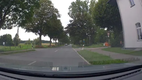


Ristaurante Pizzaria Italia
Restaurant · Italian · 0.7 km
32 Gelderner Straße, Issum
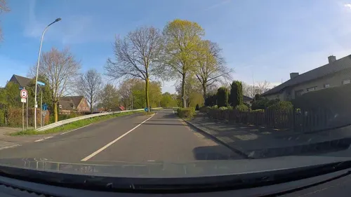


Zur Dorfschmiede
Restaurant · Balkan · 5.9 km
Mo,Tu,Th,Sa 17:00-23:00; PH,Su 11:00-15:00,17:00-23:00; We off
24 more on the map.
Where to stay13
Privatzimmer "Oppolzer/Schmitz"
Motel and hotel · 5.6 km
33 Hartefelder Dorfstraße, Geldern
Churches and places of worship23
Wallfahrtskirche "Zur Schmerzensmutter"
Church · Roman Catholic · 3.6 km
Shopping8
Gas and EV charging8
Schools, colleges and libraries9
St. Antonius-Schule, katholische Grundschule Hartefeld
School · Catholic · 5.6 km
71 a Hartefelder Dorfstraße, Geldern
Healthcare2
Map of Issum
215 places. The map loads OpenStreetMap tiles when you open it.
Getting there and nearby towns
Airport Weeze (NRN) is the nearest airport with scheduled flights listed in OpenStreetMap, 22 km away.
- Kapellen 6 km northwest, about 6 min by car
- Geldern 8 km west, about 8 min by car
- Kamp-Lintfort 8 km east, about 8 min by car
- Alpen 8 km northeast, about 8 min by car
- Rheurdt 8 km south, about 8 min by car
- Sonsbeck 9 km northwest, about 9 min by car
- Rheinberg 11 km east, about 11 min by car
- Neukirchen-Vluyn 13 km southeast, about 13 min by car
- Kevelaer 14 km northwest, about 14 min by car
- Xanten 14 km north, about 14 min by car
Drive times are estimates from straight-line distance, not routes.
Local news
Headlines from INDB.
Reviews, tips and questions
Loading what members have shared...
Sources and licences
- GeoNames (CC BY 4.0): population, coordinates, regions and time zone
- Mapillary (see each image): photos
- OpenStreetMap contributors (ODbL 1.0): places, airports, map data
- Wikidata (CC0 1.0): elevation, founding date, time zone, website, landmarks and historic places
- Wikimedia Commons (see each image): photos
- Wikipedia (CC BY-SA 4.0): overview and history text
Photo credits
- Brewery Diebels, Sven Tombers, CC BY 2.5
- Issum Haus Steeg, HenkvD, CC BY-SA 4.0
- Issum Neustr 45, HenkvD, CC BY-SA 3.0 de
- Issum Weseler Str 25, HenkvD, CC BY-SA 3.0 de
- Issum Weseler Str 23, HenkvD, CC BY-SA 3.0 de
- Issum Neustr 28, HenkvD, CC BY-SA 3.0 de
- Issum Neustr 20, HenkvD, CC BY-SA 3.0 de
- Issum Markt 5, HenkvD, CC BY-SA 3.0 de
- Issum Neustr 16, HenkvD, CC BY-SA 3.0 de
- Issum Markt 4, HenkvD, CC BY-SA 3.0 de
- Issum Neustr 22, HenkvD, CC BY-SA 3.0 de
- Stolperstein Issum Neustraße 2 Regina Moses, Gmbo 2013, CC0
- Stolpersteine Issum Neustraße 2, Gmbo 2013, CC0
- Stolpersteinlage Issum Neustraße 2, Gmbo 2013, CC0
- Stolperstein Issum Neustraße 2 Sigmund Moses, Gmbo 2013, CC0
- Issum St Nikolaus Kirche, HenkvD, CC BY-SA 3.0 de
- Issum Kapellener Str 2, HenkvD, CC BY-SA 3.0 de
- Issum Dän Ütruper, HenkvD, CC BY-SA 4.0
- Stolpersteinlage Issum Kapellener Straße 5, Gmbo 2013, CC0
- Stolperstein Issum Kapellener Straße 5 Recha Lebenstein, Gmbo 2013, CC0
- Stolperstein Issum Kapellener Straße 5 Ernst Cohen, Gmbo 2013, CC0
- Stolpersteine Issum Kapellener Straße 5, Gmbo 2013, CC0
- Stolperstein Issum Kapellener Straße 5 Else Lebenstein, Gmbo 2013, CC0
- Stolperstein Issum Kapellener Straße 5 Martha Falkenstein, Gmbo 2013, CC0
- Issum Gelderner Str 10, HenkvD, CC BY-SA 3.0 de
- Issum Kapellener Str 14, HenkvD, CC BY-SA 3.0 de
- Issum Kapellener Str 16, HenkvD, CC BY-SA 3.0 de
- Issum Gelderner Str 17, HenkvD, CC BY-SA 3.0 de
- Issum Kapellener Str 15, HenkvD, CC BY-SA 3.0 de
- Issum 07 ies, Frank Vincentz, CC BY-SA 3.0
- Issum Kapellener Str 24, HenkvD, CC BY-SA 3.0 de
- Issum Kapellener Str 28, HenkvD, CC BY-SA 3.0 de
- Issum Der Sijwäwer, HenkvD, CC BY-SA 4.0
- Issum Evangl Pfarrkirche, HenkvD, CC BY-SA 3.0 de
- Issum Kapellener Str 30, HenkvD, CC BY-SA 3.0 de
- Issum Kapellener Str 27, HenkvD, CC BY-SA 3.0 de
- Kloster Kamp - Abteikirche - 2010, Avda, CC BY-SA 3.0
- HausOermterberg, Sven Tombers, CC BY 2.5
- Sevelen Kirche (1), HenkvD, CC BY-SA 4.0
- Sonnenstrahlen durch die Baumkronen, Leah Goßens, CC BY-SA 4.0
- Bönninghardt, die katholische Pfarrkirche Sankt Vincenz Dm15 foto3 2016-05-05 14.25, Michielverbeek, CC BY-SA 4.0
- Blink (KLE) 2, Risch photography, CC BY-SA 4.0
- Fleuthkulen, GPunktCPunkt, CC BY-SA 4.0
- NRW NSG Leucht Buchenwald am Stappweg im Mai IMG 7094, Smitfotos, CC BY-SA 4.0
- KapelleAengenesch, Sven Tombers, CC BY 2.5
- Street-level photo, poxonline, CC BY-SA 4.0
- Street-level photo, poxonline, CC BY-SA 4.0
- Street-level photo, poxonline, CC BY-SA 4.0
- Street-level photo, poxonline, CC BY-SA 4.0
- Street-level photo, poxonline, CC BY-SA 4.0
- Street-level photo, poxonline, CC BY-SA 4.0
- Street-level photo, poxonline, CC BY-SA 4.0
- Street-level photo, poxonline, CC BY-SA 4.0
- Street-level photo, poxonline, CC BY-SA 4.0


Page built November 9, 2026. Spotted a mistake? Tell us or suggest a place.