


Why visit Geldern
Townapedia lists 157 museums and landmarks, 76 parks and trails, 113 places to eat, 30 places to stay and 21 attractions in and around town.
Highlights include Erdbeerhof Menne, Orchideen-Bremkens, Jüdischer Friedhof and Altes Pastorat.
Weather in Geldern
Forecast from MET Norway (CC BY 4.0). Full forecast
About Geldern
Geldern (German pronunciation: [ˈɡɛldɐn] ; Dutch: Gelre, Gelder, Gelderen; archaic English: Guelder(s)) is a city in the federal German state of North Rhine-Westphalia. It is part of the district of Kleve, which is part of the Düsseldorf
From the Wikipedia article Geldern (this version), under CC BY-SA 4.0.
Photos of Geldern


Things to do21
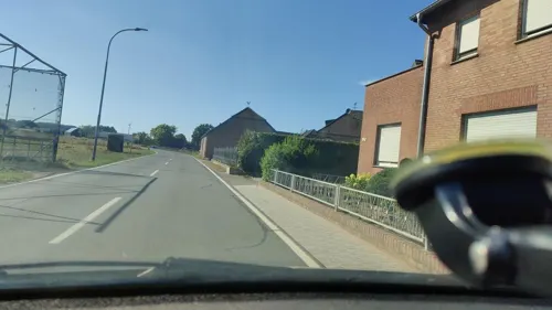
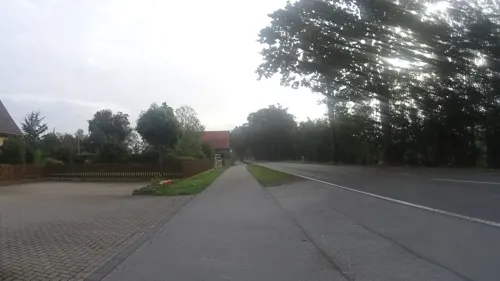
Orchideen-Bremkens
Farm and orchard · 3.9 km
119 Walbecker Straße, Geldern
Fr 09:00-18:00; Sa 09:00-13:00

Gartenbau Hoffmann
Farm and orchard · 7.6 km
Fruchtautomaten 24/7 geöffnet
4 Am Kingshof, Straelen
Th,Fr 08:00-12:00, 14:00-18:00, Sa 08:00-12:00

Kevelaerer Landmomente
Farm and orchard · 7.9 km
6 Binnenheide, Kevelaer
Mo. - Sa.: 08:00 - 20:00 Uhr, So.: 10:00 - 18:00 Uhr, Winter...
Naturhof Berendsen GmbH
Farm and orchard · 7.2 km
12 Altwettener-Weg, Kevelaer
Th,Fr 15:30-18:30; Sa 10:00-14:00
Pellens Hortensien
Farm and orchard · 1.7 km
9 St.-Adelheid-Weg, Geldern
We-Fr 10:00-17:00; Sa 10:00-14:00
Rosen Kretz
Farm and orchard · 7.0 km
13 Passerweg, Straelen
Mo-Fr 08:00-12:00,13:00-18:00; Sa 08:00-13:00
9 more on the map.
Museums and landmarks157


Altes Pastorat
Monument and historic site · 6.1 km
Ältestes Walbecker Haus. Dreigeschossiges Backsteinhaus mit Satteldach, Erd- und 1. Obergeschoss dicht übereinander, 2.Obergeschoss...
4 Boursstraße, Geldern


Herrenhaus Eyll
Monument and historic site · 7.3 km
Zweigeschossiges Herrenhaus mit Walmdach; erwähnt C15

Singendonksche Windmühle
Monument and historic site · 6.7 km
Galerieholländer, über Backsteinunterbau ein Gefüge aus Ständern, die mit Andreaskreuzen verstrebt sind. Die Außenhaut besteht aus auf...


Haus Diesdonk
Monument and historic site · 2.5 km
61 Venloer Straße, Geldern

Haus Ingenray
Monument and historic site · 3.8 km
22 Möhlendyck, Geldern

Haus Steprath
Monument and historic site · 7.2 km
37 Am Bröckelken, Geldern

Haus Bellinghoven
Monument and historic site · 4.6 km
Eingeschossige Herrenhaus, Mauerwerk aus Backstein hell verputzt mit barocken Schweifgiebeln; Festes Haus 1247. geldrisches Lehen
Haus Wankum
Monument and historic site · 6.1 km
1405 urkundlich erwähnter Rittersitz; eingeschossiges Backsteinhaus mit Walmdach; zweiflügeliges Wirtschaftsgebäude; ehem. Wassergraben...
24 Am Mühlenwasser
145 more on the map.
Parks, trails and playgrounds76




64 more on the map.
Restaurants and cafes113
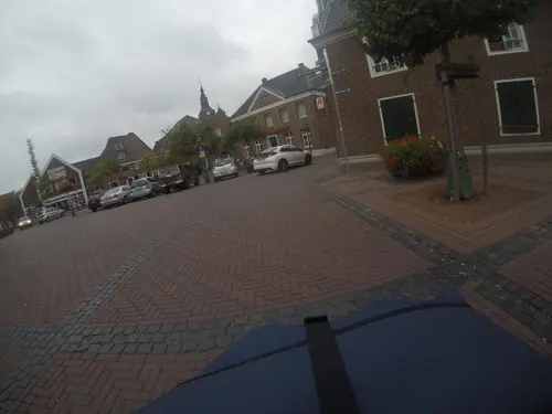
Zwiebelturm
Restaurant · International · 7.9 km
4 Webermarkt, Kerken
Tu-Su 17:00-23:00; Th off;PH 12:00+
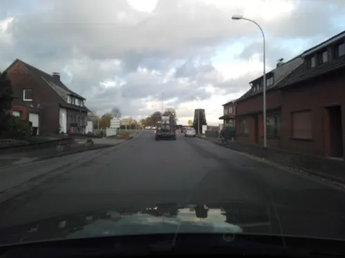
Bäckerei Hoenen
Cafe · 7.7 km
23 Sevelener Straße, Kerken
Mo-Fr 06:00-18:30; Sa 06:00-13:00; Su 08:00-12:00


Indisches Restaurant Sagar
Restaurant · Indian
42 Markt, Geldern
Mo 17:00-22:30; Tu-Su,PH 11:00-14:00,17:00-23:00
KEIO Gourmet
Restaurant · Chinese, Japanese, Mongolian · 3.4 km
110 Klever Straße, Kerken
Mo,We-Sa 11:30-15:00,17:30-22:30; Su,PH 11:30-22:30; Tu off
Trattoria Da Sandro
Restaurant · Italian, Pizza · 7.1 km
2-4 Rosenstraße, Issum
Mo off; Tu-Fr 12:00-14:00,17:00-22:30; Sa 17:00-22:00 ; Su 17:00-22:00

101 more on the map.
History
According to folk legend, local noblemen Wichard and Lupold of Pont fought a fire-breathing dragon around 878. They found it under a medlar tree, and one of them stabbed it with his spear. The dying dragon rattled two or three times: Gelre! Gelre! In commemoration of this heroic feat, the Lords of Pont founded the city of Geldern at the confluence of the Niers and the Fleuth.
The city of Geldern was first documented around 900. Several versions of the name have been used: Gelre, Gielra, Gellero, Gelera and similar. The probable ancestor of the Counts of Guelders was Gerhard Flamens, who received Wassenberg as a fief from Emperor Henry II in 1020. His great-grandson Gerhard IV of Wassenberg was the first to call himself Count of Guelders (as Gerhard I), from 1096. The title "count" came from other properties, probably in Teisterbant. From 1125 only the title of Guelders was used. Wassenberg itself was given to the Duke of Limburg (and later to Jülich) as a wedding gift in 1107. The counts of Guelders moved their residence to the castle in Geldern, that was built probably around this date at the crossing of the Niers. The castle and the accompanying medieval settlement were the origin of the present city, and also gave its name to the county and later duchy of Guelders.
Read more of the history
The settlement was fortified in the 13th century with earth and stone walls and moats. The walls were named after the four cardinal directions and had three gates. Geldern received city rights in 1229. It was the residence of the counts and dukes of Guelders until 1343, and capital of the Upper Quarter of Guelders until 1347. The monastery of the Carmelites was built in the early 14th century. The Late Gothic parish church of Mary Magdalene was built between 1400 and 1418.
Often in its history, Geldern lay in the battlefield of territorial disputes. It was subordinate to Spanish rule from 1543 until 1578, when it was occupied by the Dutch. Geldern returned to Spanish control in 1587, which lasted until 1703. During this period (more exactly between 1662 and 1664) Schloss Haag (first documented in 1337, located 1 km north of Geldern) was expanded. (Since World War II only the outer castle has remained.)
From 1701 until 1714 the War of the Spanish Succession took place. The city was under Prussian siege beginning February 1703, but only surrendered on 21 December. At the end of the war, at the 1713 Treaty of Utrecht, the previously Spanish Upper Quarter of Guelders was divided between four powers: Austria, the United Provinces, Prussia and the Duchy of Jülich. With the larger part of the former Upper Quarter, Geldern fell to Prussia and became the seat of administration of Prussian Guelders. King Frederick II of Prussia visited Geldern in August 1740. He ordered the demolition of the city fortifications in 1764.
Between 1794 and 1814 Geldern was occupied by the French. They disbanded the old structures and created a new, more strict administration. The canton of Geldern was part of the arrondissement of Cleves, which was a part of the département of the Roer. In 1802 the monastery of the Carmelites was secularized.
In the course of the Prussian reorganization of administration, the district of Geldern was formed on 23 April 1816. It was one of over 40 rural districts of the Province of Jülich-Cleves-Berg, the northern half of the later Rhine Province. In 1863 the railway line Cologne – Krefeld – Geldern – Cleves was opened, and a narrow-gauge local line in 1902 (closed in 1932).
In World War II Geldern was bombed several times, at the end of 1944 and on 14 February 1945, which led to devastation in the city centre. Only a few houses were saved, about 82% was destroyed. The parish church was also severely damaged, and the main building of Schloss Haag was completely destroyed. The parish church of Mary Magdalene was rebuilt in 1952, and redecorated in 2003/2004.
From the History section of Geldern on Wikipedia, under CC BY-SA 4.0.
More about Geldern
Geography
Geldern lies in the plains of the lower, northern Rhineland, west of the Rhine. Its average elevation is 27 m AMSL. The river Niers, a tributary of the Meuse (Maas), flows through Geldern. The stream Gelderner Fleuth flows into the Niers in Geldern.
It is close to both Düsseldorf Airport and Airport Weeze, also called Airport Niederrhein (referring to the Lower Rhine region).
Geldern shares borders with Kevelaer and Sonsbeck to the north, Issum to the east, Kerken and Straelen to the south, and the Dutch municipalities Venlo and Bergen to the west.
Arts and culture
There is an approx. 60 km long cycle path along the Fossa Eugeniana, a never completed canal from the Rhine near Rheinberg to the Meuse near Venlo. Hiking is possible around the former Schloss Haag, part of which still remains, and is home to Golfclub Schloss Haag e.V. There is a mill tower and the refectory of the 16th century former monastery of Augustinian nuns. There are some wind mills in the vicinity, including one within 1 km of Geldern-Kapellen.
Every summer Geldern hosts a street painting contest, which attracts international artists. Geldern has the largest Whitsun(Pentecost) funfair of the lower Rhine, a street party in summer, and a Christmas Market. Several other events are organized in summer.
From the Wikipedia article Geldern, under CC BY-SA 4.0.
Notable people from Geldern
 Thomas StruthGerman photographer (born 1954)Photo: Hpschaefer www.reserv-art.de, CC BY-SA 4.0
 Adelaide, Abbess of VilichAbbess of Vilich and Christian saint (c.970-c.1015)Photo: Unbezeichneter Kupferstich gedruckt..., Public domain
 Max PfefferGerman General and Knight's Cross recipientPhoto: Daphne mesereum, CC BY-SA 4.0
 Benedictus BunsDutch musician and composerPhoto: mr. Wim Goossens Original uploader..., Public domain
 Anne van BonnGerman association football playerPhoto: xtranews.de, CC BY 2.0
 Björn BöhningGerman politicianPhoto: re:publica from Germany, CC BY-SA 2.0
 Lydia HüskensGerman politicianPhoto: FDP-Landtagsfraktion Sachsen-Anhalt, CC BY-SA 4.0
- Xenia SeebergGerman actress
- Cristoval Royas de SpinolaSpanish bishop and diplomat
- Sven ThomsGerman biochemist
- Wilhelm DiekampGerman historian
- Suzie KerstgensGerman singer
Born in Geldern, according to Wikidata (CC0). Each name links to its Wikipedia article.
Where to stay30
Churches and places of worship44
Wallfahrtskirche "Zur Schmerzensmutter"
Church · Roman Catholic · 4.2 km
Shopping33
Gas and EV charging27
Schools, colleges and libraries35
St. Antonius-Schule, katholische Grundschule Hartefeld
School · Catholic · 4.5 km
71 a Hartefelder Dorfstraße, Geldern
Healthcare23
Map of Geldern
250 places. The map loads OpenStreetMap tiles when you open it.
Getting there and nearby towns
Airport Weeze (NRN) is the nearest airport with scheduled flights listed in OpenStreetMap, 16 km away.
- Kapellen 7 km northeast, about 7 min by car
- Issum 8 km east, about 8 min by car
- Kevelaer 9 km northwest, about 9 min by car
- Straelen 9 km southwest, about 9 min by car
- Sonsbeck 11 km north, about 11 min by car
- Rheurdt 11 km southeast, about 11 min by car
- Wachtendonk 12 km south, about 12 min by car
- Weeze 15 km northwest, about 15 min by car
- Alpen 15 km northeast, about 15 min by car
- Kamp-Lintfort 15 km east, about 15 min by car
Drive times are estimates from straight-line distance, not routes.
Towns near Geldern


Keep exploring
Local news
Headlines from INDB.
Reviews, tips and questions
Loading what members have shared...
Sources and licences
- GeoNames (CC BY 4.0): population, coordinates, regions and time zone
- Mapillary (see each image): photos
- OpenStreetMap contributors (ODbL 1.0): places, airports, map data
- Wikidata (CC0 1.0): elevation, founding date, time zone, website
- Wikimedia Commons (see each image): photos
- Wikipedia (CC BY-SA 4.0): overview and history text
Photo credits
- Geldern, Johannes1024, CC BY-SA 3.0
- Stolpersteinlage Geldern Nordwall 39, Gmbo 2013, CC0
- Stolperstein Geldern Nordwall 39 Synagoge, Gmbo 2013, CC0
- Stolperstein Geldern Issumer Straße 42 Moritz Gompertz, Gmbo 2013, CC0
- Stolpersteinlage Geldern Issumer Straße 42, Gmbo 2013, CC0
- Stolperstein Geldern Issumer Straße 53 Rosalie Cain, Gmbo 2013, CC0
- Stolpersteine Geldern Nordwall 49, Gmbo 2013, CC0
- Stolperstein Geldern Nordwall 49 Clara Plaut, Gmbo 2013, CC0
- Stolperstein Geldern Nordwall 49 Hilda Heymann, Gmbo 2013, CC0
- Stolpersteinlage Geldern Issumer Straße 64, Gmbo 2013, CC0
- Stolperstein Geldern Issumer Straße 64 Maria Hertz, Gmbo 2013, CC0
- Stolpersteinlage Geldern Nordwall 49, Gmbo 2013, CC0
- Geldern Issumer Strasse 4 Denkmal GE10151, Matthias Nonnenmacher, CC BY-SA 4.0
- Stolpersteine Geldern Issumer Straße 01, Gmbo 2013, CC0
- Stolperstein Geldern Issumer Straße 01 Emil Francken, Gmbo 2013, CC0
- Stolperstein Geldern Issumer Straße 01 Martha Francken, Gmbo 2013, CC0
- Stolpersteine Geldern Hartstraße 02, Gmbo 2013, CC0
- Stolperstein Geldern Hartstraße 02 Henriette Kaufmann, Gmbo 2013, CC0
- Stolperstein Geldern Hartstraße 02 Karl Israel Kaufmann, Gmbo 2013, CC0
- Stolperstein Geldern Hartstraße 02 Claus Kaufmann, Gmbo 2013, CC0
- Stolperstein Geldern Hartstraße 02 Ella Kaufmann, Gmbo 2013, CC0
- Stolperstein Geldern Hartstraße 02 Hedwig Kaufmann, Gmbo 2013, CC0
- Stolperstein Geldern Hartstraße 02 Alfred Kaufmann, Gmbo 2013, CC0
- Geldern – Brunnenanlage in der Glockengasse – Walbeck – Pont – Vernum – Kapellen – Veert - panoramio, giggel, CC BY 3.0
- Geldern-KircheMariaMagdalena-1-Asio, Asio otus, CC BY-SA 3.0
- Geldern – Drachenbrunnen am Markt - panoramio, giggel, CC BY 3.0
- Stolperstein Geldern Markt 07 Fritz Elias, Gmbo 2013, CC0
- Geldern – Marktplatz - Aaskrähe - panoramio, Edgar El, CC BY 3.0
- Geldern – kath. Kirche St. Maria Magdalena - panoramio (1), Edgar El, CC BY 3.0
- Geldern – kath. Kirche St. Maria Magdalena - panoramio, giggel, CC BY 3.0
- Geldern - Glockengasse - panoramio, Edgar El, CC BY 3.0
- Geldern – Glockenspiel am Markt - panoramio, giggel, CC BY 3.0
- Geldern – Wasserlauf am Marktplatz - panoramio, giggel, CC BY 3.0
- Geldern – Wasserspiel am Marktplatz - panoramio, giggel, CC BY 3.0
- Geldern – Bronzestatue – „Dä Geldersche Wend“ - panoramio (1), Edgar El, CC BY 3.0
- Geldern – Bronzestatue – „Dä Geldersche Wend“ - panoramio, giggel, CC BY 3.0
- Stolperstein Geldern Westwall 67 Hans Passmann, Gmbo 2013, CC0
- Het begin van de aanleg van de Fossa Eugeniana, 1626 Delineatio & descriptio novi canalis, qui non ita pridem derivari cepit circa Rhenum in Mosam quod opus ceptum 21. die Septembris, anni 1626..., Rijksmuseum, CC0
- Diesdonk-Sammlung Duncker (5413568), Alexander Duncker, Public domain
- Sevelen Kirche (1), HenkvD, CC BY-SA 4.0
- Geldern Baudenkmal GE10062 Schloss Walbeck 02, Rudolfo42, CC BY-SA 4.0
- Geldern Walbeck - Steprather Mühle 01 ies, Frank Vincentz, CC BY-SA 3.0
- Wetten St. Petrus 2010-05-05 16.14, Michielverbeek, CC BY-SA 3.0
- Geldern Baudenkmal GE10029 Pfarrkirche Nikolaus, Rudolfo42, CC BY-SA 4.0
- Kath. Kirche St. Georg in Holt - panoramio, Edgar El, CC BY 3.0
- Kapellen Kirche, HenkvD, CC BY-SA 4.0
- Geldern alter jüdischer Friedhof 2, Gmbo 2013, CC0
- Geldern Baudenkmal GE10129 Altes Pastorat, Rudolfo42, CC BY-SA 4.0
- Straelen 2016 0052, Klaus Graf, CC BY-SA 3.0
- Kevelaer-Achterhoek Singendonksche Mühle 1797, Willemjans, CC BY-SA 4.0
- Fleuthkulen, GPunktCPunkt, CC BY-SA 4.0
- Geldern - Geldern – ev. Heilig-Geist-Kirche – erbaut 1703 - panoramio, giggel, CC BY 3.0
- Veert, Sankt Martin Kirche DmGE10026 foto9 2016-08-24 15.29, Michielverbeek, CC BY-SA 4.0
- KapelleAengenesch, Sven Tombers, CC BY 2.5
- Haus Steprath Tranchot, Jean Joseph Tranchot or Karl von Müffling, Public domain
- Haus Ingenray, Geldern-Pont, Chirograph, CC BY-SA 4.0
- Street-level photo, poxonline, CC BY-SA 4.0
- Street-level photo, mfa, CC BY-SA 4.0
- Street-level photo, jenz, CC BY-SA 4.0
- Street-level photo, ramap, CC BY-SA 4.0
- Street-level photo, poxonline, CC BY-SA 4.0
- Street-level photo, poxonline, CC BY-SA 4.0
- Street-level photo, poxonline, CC BY-SA 4.0
- Street-level photo, poxonline, CC BY-SA 4.0
- Street-level photo, poxonline, CC BY-SA 4.0
- Street-level photo, saschahaberkorn, CC BY-SA 4.0
- Street-level photo, jenz, CC BY-SA 4.0
- Street-level photo, saschahaberkorn, CC BY-SA 4.0
- Street-level photo, poxonline, CC BY-SA 4.0
- Street-level photo, poxonline, CC BY-SA 4.0
- Street-level photo, poxonline, CC BY-SA 4.0
- Street-level photo, poxonline, CC BY-SA 4.0
- Street-level photo, poxonline, CC BY-SA 4.0
- Street-level photo, zoegglmeyr, CC BY-SA 4.0
- Street-level photo, poxonline, CC BY-SA 4.0
- Street-level photo, poxonline, CC BY-SA 4.0


Page built November 9, 2026. Spotted a mistake? Tell us or suggest a place.