


Kevelaer, Germany
Kevelaer is a town of 28,064 people in North Rhine-Westphalia, Germany.
Why visit Kevelaer
Townapedia lists 160 museums and landmarks, 77 parks and trails, 113 places to eat, 38 places to stay and 16 attractions in and around town.
Highlights include Biohof Büsch, Biohof Etzold, Niederrheinisches Museum für Volkskunde und Kulturgeschichte and Traktorenmuseum Pauenhof.
Weather in Kevelaer
Forecast from MET Norway (CC BY 4.0). Full forecast
About Kevelaer
Kevelaer (German pronunciation: [ˈkeːvəlaːɐ̯] ; Low Rhenish: Käwela) is a town in the district of Kleve, in North Rhine-Westphalia in Germany. It is the largest Catholic pilgrimage location within north-western Europe. Over one million Marian devotees, mostly from Germany and the Netherlands, visit the Basilica of Kevelaer every year to honour the Blessed Virgin Mary. The population in 2025 was 28,215.
From the Wikipedia article Kevelaer (this version), under CC BY-SA 4.0.
Travel tips from other travellers: Kevelaer on Wikivoyage (CC BY-SA 4.0).
Things to do16

Biohof Etzold
Farm and orchard · 4.2 km
10 Hestert, Kevelaer
Tu,Th 14:00-19:00; Fr 09:00-19:00; Sa 09:00-14:00
Heeser Spargelhof
Farm and orchard · 8.2 km
18 Hees, Weeze
Tu-Sa 09:00-18:00; Su 09:00-16:00 "(Bitte aktuelle Öffnungszeiten...
Hüdderather Hofladen
Farm and orchard · 2.0 km
11 Hüdderath, Kevelaer
Mo,Tu off; We-Fr 09:00-18:00; Sa 09:00-14:00
Kevelaerer Landmomente
Farm and orchard · 4.4 km
6 Binnenheide, Kevelaer
Mo. - Sa.: 08:00 - 20:00 Uhr, So.: 10:00 - 18:00 Uhr, Winter...
Naturhof Berendsen GmbH
Farm and orchard · 3.7 km
12 Altwettener-Weg, Kevelaer
Th,Fr 15:30-18:30; Sa 10:00-14:00
Spargel- und Erdbeerhof Baumanns
Farm and orchard · 1.5 km
56 Keylaer, Kevelaer
Apr-Jun Mo-Fr 09:00-18:00; Apr-Jun Sa,Su 09:00-13:00; Jul Mo-Sa...

Gartenbau Lenzen
Farm and orchard · 6.1 km
59 Wettener Straße, Geldern
Mo-Fr 08:30-18:00, Sa 08:30-12:30
Obsthof Hetjens
Farm and orchard · 6.3 km
171 Klever Straße, Geldern
Mo-Fr 09:00-18:00, Sa 09:00-13:30
4 more on the map.
Museums and landmarks160


Royal Air Force Museum Laarbruch-Weeze
Museum · 5.9 km
6 Flughafen-Ring, Weeze
We, Sa, Su 14:00-17:00 || "Gruppen nach Vereinbarung"

Singendonksche Windmühle
Monument and historic site · 7.4 km
Galerieholländer, über Backsteinunterbau ein Gefüge aus Ständern, die mit Andreaskreuzen verstrebt sind. Die Außenhaut besteht aus auf...

Haus Steprath
Monument and historic site · 7.8 km
37 Am Bröckelken, Geldern

Haus Wankum
Monument and historic site · 7.6 km
1405 urkundlich erwähnter Rittersitz; eingeschossiges Backsteinhaus mit Walmdach; zweiflügeliges Wirtschaftsgebäude; ehem. Wassergraben...
24 Am Mühlenwasser
Kölner Heiligenhäuschen
Monument and historic site · Roman Catholic · 5.6 km
Bildstock aus Backstein, Natursteinnische mit Statue der "Maria Kevelaer" ( 1984 erneuert); aufwendiges Sandsteinrelief, Wappen der...

Schloss Wissen
Monument and historic site · 3.9 km
26 Schloßallee, Weeze
Alter Bentheimshof
Monument and historic site · 5.6 km
Ehemaliges T-Gehöft; Wohnhaus eingeschossig mit Krüppelwalmdach; Traufseite mit Putzquadergliederung vierachsig, die Giebelseiten weisen...
Altes Pastorat
Monument and historic site · 7.2 km
Staatliches eingeschossiges traufständiges Backsteingebäude mit Krüppelwalmdach; weitgehend originalen Erhaltungszustand (Blausteinboden...
Büchelhof
Monument and historic site · 4.4 km
Große Backsteinhofanlage, das Wohnhaus der T-Anlage ist zweigeschossig mit Walmdach, traufständige Eingangsseite in sechs Achsen,...
148 more on the map.
Parks, trails and playgrounds77



De Maasduinen National Park
Park · 10.9 km
National park in the Netherlands

Niersseitenarme und Niersmoräste bei Hüdderath
Hiking and trails · 3.3 km
65 more on the map.
Restaurants and cafes113
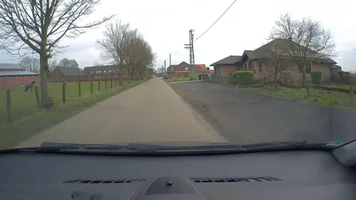

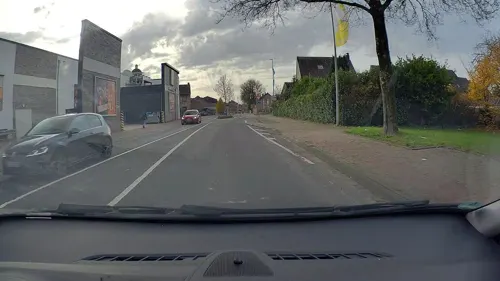


Büsch
Cafe · German, Coffee Shop, Sandwich, Cake
1 Antwerpener Platz, Kevelaer
Mo-Sa 07:00-22:00; Su,PH 07:00-12:00

Michelone
Restaurant · Pizza · 6.0 km
2 Alter Markt, Weeze
Tu-Th 11:30-14:00,17:00-22:30; Fr,Sa 11:30-14:00,17:00-23:00; Su...
Steakhaus Argentina
Restaurant · Argentinian
4 Johannes-Stalenus-Platz, Kevelaer
We-Su,PH 11:30-15:00,17:30-22:00


Cumsalis
Restaurant
20 Hauptstraße, Kevelaer
Mo 17:00-22:00; We, Th 17:00-22:00; Fr 17:00-23:00; Sa...
Die gläserne Hostienbäckerei
Bakery
28 Neustraße, Kevelaer
Mo-Th 09:00-12:00,15:00-17:00; We,Fr 09:00-12:00
101 more on the map.
History
The chapel was consecrated and on 1 June 1642, the Sunday after Assumption of Mary, the print was displayed in it, and the chapel became such a popular destination for pilgrims that a church was built for them between 1643 and 1645. The little chapel was replaced in 1654 with a larger one, the Gnadenkapelle, which still houses the print.
It is one of the most visited Catholic pilgrimage sites in north-western Europe. The Gnadenkapelle (English: Chapel of Mercy) has drawn pilgrims to the Lower Rhine Region from all over the world for more than 360 years.
From the History section of Kevelaer on Wikipedia, under CC BY-SA 4.0.
Where to stay38
Churches and places of worship42
Shopping36
Gas and EV charging18
Schools, colleges and libraries20
Katholische öffentliche Bücherei St. Petrus Wetten
Library · 3.7 km
17 Pastoratsweg, Kevelaer
Healthcare18
Augenarztpraxis Fackeldey und Simon
Clinic and pharmacy
64 Busmannstraße, Kevelaer
Map of Kevelaer
250 places. The map loads OpenStreetMap tiles when you open it.
Getting there and nearby towns
Airport Weeze (NRN) is the nearest airport with scheduled flights listed in OpenStreetMap, 7 km away.
- Weeze 6 km northwest, about 6 min by car
- Straelen 16 km south, about 16 min by car
- Xanten 17 km northeast, about 17 min by car
- Rees 23 km northeast, about 23 min by car
- Kleve 24 km north, about 24 min by car
- Rheinberg 24 km east, about 24 min by car
- Wesel 27 km east, about 27 min by car
- Nettetal 30 km south, about 30 min by car
- Moers 30 km southeast, about 30 min by car
- Voerde 30 km east, about 30 min by car
Drive times are estimates from straight-line distance, not routes.
Local news
Headlines from INDB.
Reviews, tips and questions
Loading what members have shared...
Sources and licences
- GeoNames (CC BY 4.0): population, coordinates, regions and time zone
- Mapillary (see each image): photos
- OpenStreetMap contributors (ODbL 1.0): places, airports, map data
- Wikidata (CC0 1.0): elevation, founding date, time zone, website, landmarks and historic places
- Wikimedia Commons (see each image): photos
- Wikipedia (CC BY-SA 4.0): overview and history text
Photo credits
- Kevelaer-StAntonius-1-Asio, Asio otus, CC BY-SA 3.0
- Kevelaer, Germany - panoramio (58), Ben Bender, CC BY-SA 3.0
- Kevelaer, Germany - panoramio (49), Ben Bender, CC BY-SA 3.0
- Kevelaer, Germany - panoramio (55), Ben Bender, CC BY-SA 3.0
- Kevelaer, Germany - panoramio (61), Ben Bender, CC BY-SA 3.0
- Kevelaer, Germany - panoramio (1), Ben Bender, CC BY-SA 3.0
- Kevelaer, Germany - panoramio (28), Ben Bender, CC BY-SA 3.0
- Kevelaer, Germany - panoramio (54), Ben Bender, CC BY-SA 3.0
- Kevelaer-Annastr21-1-Asio, Asio otus, CC BY-SA 3.0
- Kevelaer, Germany - panoramio (13), Ben Bender, CC BY-SA 3.0
- Kevelaer, Germany - panoramio (2), Ben Bender, CC BY-SA 3.0
- Kevelaer, Germany - panoramio (11), Ben Bender, CC BY-SA 3.0
- Kevelaer, Germany - panoramio (47), Ben Bender, CC BY-SA 3.0
- Kevelaer, Germany - panoramio (57), Ben Bender, CC BY-SA 3.0
- Kevelaer, Germany - panoramio (22), Ben Bender, CC BY-SA 3.0
- Kevelaer, Germany - panoramio (3), Ben Bender, CC BY-SA 3.0
- Kevelaer, Germany - panoramio (46), Ben Bender, CC BY-SA 3.0
- Kevelaer, Germany - panoramio (52), Ben Bender, CC BY-SA 3.0
- Kevelaer, Germany - panoramio (48), Ben Bender, CC BY-SA 3.0
- Kevelaer-StAntonius-Orgel-1-Asio, Asio otus, CC BY-SA 3.0
- Kevelaer, Germany - panoramio (50), Ben Bender, CC BY-SA 3.0
- Kevelaer, Germany - panoramio (53), Ben Bender, CC BY-SA 3.0
- 2023 Kevelaer, byld fan de keapman Hendrick Busman, RomkeHoekstra, CC BY-SA 4.0
- Kevelaer-Busmannstr21-1-Asio, Asio otus, CC BY-SA 3.0
- Kevelaer, Germany - panoramio (4), Ben Bender, CC BY-SA 3.0
- Kevelaer, Germany - panoramio (118), Ben Bender, CC BY-SA 3.0
- Kevelaer, Germany - panoramio (112), Ben Bender, CC BY-SA 3.0
- Kevelaer-Busmannstr30a-1-Asio, Asio otus, CC BY-SA 3.0
- Kevelaer-StAntonius-4-Asio, Asio otus, CC BY-SA 3.0
- Kevelaer, Germany - panoramio (51), Ben Bender, CC BY-SA 3.0
- Kevelaer, Germany - panoramio (8), Ben Bender, CC BY-SA 3.0
- Kevelaer, Germany - panoramio (35), Ben Bender, CC BY-SA 3.0
- Kevelaer, Germany - panoramio (7), Ben Bender, CC BY-SA 3.0
- Kevelaer-StAntonius-Orgel-2-Asio, Asio otus, CC BY-SA 3.0
- Kevelaer, Germany - panoramio (65), Ben Bender, CC BY-SA 3.0
- Kevelaer, Germany - panoramio (21), Ben Bender, CC BY-SA 3.0
- Kevelaer-Busmannstr7-1-Asio, Asio otus, CC BY-SA 3.0
- Kevelaer-Busmannstr28-1-Asio, Asio otus, CC BY-SA 3.0
- Kevelaer-Busmannstr30-1-Asio, Asio otus, CC BY-SA 3.0
- Kevelaer, Germany - panoramio (59), Ben Bender, CC BY-SA 3.0
- Tussen Wellerlooi en Twisteden, meer in Maasduinen 2009-08-16 18.30, Michielverbeek, CC BY-SA 3.0
- Basilika, Gnadenkapelle in Kevelaer, Pkw98, CC BY-SA 3.0
- Schloss Wissen, Rainer Lippert, CC0
- Irrland Kevelaer-Twisteden - Blick vom Tower (2), Tetris L, CC BY-SA 4.0
- Weeze - Sankt Cyriakus 02 ies, Frank Vincentz, CC BY-SA 3.0
- Eingang NMK, NiederrheinMuseumKevelaer, CC BY-SA 4.0
- Wetten St. Petrus 2010-05-05 16.14, Michielverbeek, CC BY-SA 3.0
- Twisteden, kerk bij begraafplaats foto2 2009-08-16 18.01, Michielverbeek, CC BY-SA 3.0
- Weeze, de evangelische kerk Dm12 foto2 2013-04-30 13.35, Michielverbeek, CC BY-SA 3.0
- Kapellen Kirche, HenkvD, CC BY-SA 4.0
- Kevelaer-Achterhoek Singendonksche Mühle 1797, Willemjans, CC BY-SA 4.0
- Kevelaer-Winnekendonk NSG Fleuthbenden PM18-13, Pieter Delicaat, CC BY-SA 4.0
- Kevelaer, Germany - panoramio (9), Ben Bender, CC BY-SA 3.0
- Veert, Sankt Martin Kirche DmGE10026 foto9 2016-08-24 15.29, Michielverbeek, CC BY-SA 4.0
- Haus Steprath Tranchot, Jean Joseph Tranchot or Karl von Müffling, Public domain
- Street-level photo, poxonline, CC BY-SA 4.0
- Street-level photo, poxonline, CC BY-SA 4.0
- Street-level photo, poxonline, CC BY-SA 4.0
- Street-level photo, poxonline, CC BY-SA 4.0
- Street-level photo, poxonline, CC BY-SA 4.0
- Street-level photo, poxonline, CC BY-SA 4.0
- Street-level photo, poxonline, CC BY-SA 4.0
- Street-level photo, poxonline, CC BY-SA 4.0
- Street-level photo, poxonline, CC BY-SA 4.0
- Street-level photo, poxonline, CC BY-SA 4.0


Page built November 8, 2026. Spotted a mistake? Tell us or suggest a place.