


Kamp-Lintfort, Germany
Kamp-Lintfort is a town of 39,490 people in North Rhine-Westphalia, Germany.
Why visit Kamp-Lintfort
Townapedia lists 79 museums and landmarks, 84 parks and trails, 148 places to eat, 11 places to stay and 23 attractions in and around town.
Highlights include TerraZoo Rheinberg, Obstplantagen Monterkampshof, Kamp Abbey and Alte Kellnerei.
Weather in Kamp-Lintfort
Forecast from MET Norway (CC BY 4.0). Full forecast
About Kamp-Lintfort
Kamp-Lintfort (German: [kampˈlɪntˌfɔʁt] ) is a town in Wesel District, in North Rhine-Westphalia, Germany. It is located 8 kilometres (5 miles) north-west of Moers.
From the Wikipedia article Kamp-Lintfort (this version), under CC BY-SA 4.0.
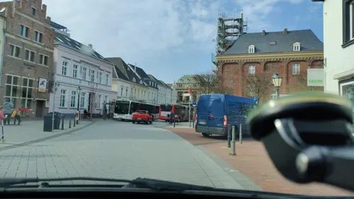
Photos of Kamp-Lintfort


Things to do23

TerraZoo Rheinberg
Zoo and aquarium · 6.0 km
Mo off; Tu-Su, PH 10:00-18:00; Dec 24-25 off, Dec 31 off; Jan 01 off
Obstplantagen Monterkampshof
Farm and orchard · 4.9 km
Obst
33 Vluyner Straße, Neukirchen-Vluyn
Mo-Th 09:00-13:00,15:00-18:30, Fr 09:00-18:30, Sa 09:00-13:00


Die Schaf-Gabe
Farm and orchard · 5.8 km
Kardierte Wolle zum Filzen, als Kissen- oder Deckenfüllung. Strickwolle natur- und pflanzengefärbt, Socken, Pullover, Westen,...
77 Littardweg, Neukirchen-Vluyn
We 15:00-17:00, Sa 10:00-14:00
Geflügelhof Göntgen
Farm and orchard · 6.4 km
Ein großes und sorgfältig ausgewähltes Sortiment, Saisonalität und Regionalität sind sehr wichtig.
51 Baggerstraße, Moers
Tu,We,Fr 15:00-18:00; Th 10:00-18:00; Sa 08:00-13:00
Hofladen Biolandhof Frohnenbruch
Farm and orchard · 6.1 km
Hofeigenen BIO-Fleisch vom Limousin-Rind oder Freilandschwein, Geflügel und Eier
81 Schloßallee, Kamp-Lintfort
We-Fr 09:00-18:00; Sa 09:00-14:00
Hücklekemkes
Farm and orchard · 5.3 km
Eier , Gänseeier (saisonbedingt) Damwild, Geflügel
7 Winterswicker Feld, Rheinberg
"nach Vereinbarung"
Paschenhof
Farm and orchard · 5.7 km
Milch und viele Produkte von Erzeugern aus der Region kaufen an den Verkaufsautomaten
52 Paschenweg, Neukirchen-Vluyn
24/7
Petra Kühne
Farm and orchard · 2.8 km
Obst der Saison, Gemüse der Saison, Kartoffeln, Honig, Marmelade, Eier, eigenes Rindfleisch, Nudeln aus eigenen Eiern, Eierlikör, regionales Bier
63 Xantener Straße, Kamp-Lintfort
Mo,We-Fr 09:00-12:00,15:00-18:30; Tu 15:00-18:30; Sa 09:00-14:00

Bornheim Rübenkraut & Apfelkraut seit 1760
Farm and orchard · 3.6 km
94 Kirchhoffstraße, Kamp-Lintfort
Sa 09:00-12:00
11 more on the map.
Museums and landmarks79


Alte Kellnerei
Monument and historic site · 6.3 km
104 Innenwall, Rheinberg



Landwehr
Monument and historic site · 6.4 km
6m breiter Wall, vorgelagert 3m breiter Graben;
Baerlaghof
Monument and historic site · 5.4 km
Große dreiflügelige Hofanlage; Mittelhaus Rest eines Hallenhauses C18, T-Haus C19; Stall C19, Ergänzungen C20; Backstein, Sockel verputzt
Mühlengraben
Monument and historic site · 5.1 km
600m langer, heute trockener Mühlengraben der Wassermühle Sassenrath; Fallhöhe durch Abschneiden einer Flußschlinge des Nieper Altrheins
Einheitspersonenwagen ("Donnerbüchse") BI 29
Monument and historic site · 6.4 km
67 more on the map.
Parks, trails and playgrounds84


Erlenbruchwald und Landwehr in der Leucht
Hiking and trails · 6.0 km



Solvay Hallenbad
Sports field and stadium · 5.9 km
4 Friedrich-Stender-Weg, Rheinberg
Mo-Fr 06:00-08:00, Tu,Th 13:30-21:00, We 13:30-15:30

Bruch- und Auenwald und angrenzender Eichenwald am Ostrand der Leucht
Hiking and trails · 5.2 km
Fossa Eugeniana nördlich vom Kamperbrucher Feld
Hiking and trails · 1.8 km
Panoramabad Pappelsee
Sports field and stadium · 0.9 km
74 Bertastraße, Kamp-Lintfort
Sa,Su 10:00-14:30; Mo 14:30-15:30; Tu 06:00-07:45,16:00-21:30; We...
72 more on the map.
Restaurants and cafes148
Bäckerei Holland
Bakery · 1.2 km
Bäckerei und Cafe
398 Moerser Straße
Mo-Fr 06:00-17:00; Sa 06:00-14:00; Su 08:00-12:00
Il Grato
Restaurant · Italian · 1.9 km
81 Rheinberger Straße, Kamp-Lintfort
Mo,We-Sa 16:00-22:00; Su,PH 12:00-22:00; Tu off

AlBawadi
Restaurant · Mediterranean · 1.8 km
27a Rundstraße, Kamp-Lintfort
Mo-Th 11:00-21:00; Fr-Su 17:00-22:00
Bauerncafé & Restaurant Baerlaghof
Restaurant · Regional, Cake, Pancake · 5.4 km
38 Hochwald, Issum
We-Fr 14:00+; Sa 12:00+; Su,PH 10:00+; Mo,Tu off
Brummitreff Imbiss & Food Trucks
Restaurant · Regional, German · 2.1 km
159 Friedrich-Heinrich-Allee, Kamp-Lintfort
Mo 06:00-15:30, Su-Fr 06:00-22:00, Sa 15:00-22:00

Cafe Extrablatt
Cafe · Coffee Shop
225 Moerser Straße, Kamp-Lintfort
Mo-Sa 08:00-24:00; Su,PH 09:30-24:00
Café am Weiher
Cafe · Regional · 6.1 km
81 Schloßallee, Kamp-Lintfort
We-Fr 09:00-18:00; Sa 09:00-14:00
Palm im Samannshof
Restaurant · International · 6.3 km
55 Littardweg, Neukirchen-Vluyn
We-Sa 17:00-21:00; Su, PH 12:00-20:00
136 more on the map.
Notable people from Kamp-Lintfort
- Brigitte AsdonkGerman member of the Red Army Faction
- Wilhelm Ernst BarkhoffGerman solicitor, banker, social reformer and Anthroposophist (1916-1994)
Born in Kamp-Lintfort, according to Wikidata (CC0). Each name links to its Wikipedia article.
Where to stay11
Casino im Park
Motel and hotel · 1.0 km
54 Friedrich-Heinrich-Allee, Kamp-Lintfort
Churches and places of worship37
Christusgemeinde - Ev. Freie Gemeinde
Church · Evangelisch-Freikirchlich · 6.0 km
13 Gartenstraße, Neukirchen-Vluyn
Evangelisch-Freikirchliche Gemeinde - Friedenskirche
Church · Baptist · 0.9 km
87 Königstraße, Kamp-Lintfort
Shopping48
Gas and EV charging21
KFZ-Meisterbetrieb Gerd Schwabe GmbH
Gas station · 1.7 km
4 Bahnhofstraße, Kamp-Lintfort
Schools, colleges and libraries44
Hochschule Rhein-Waal, Zweigbibliothek Kamp-Lintfort
Library
25 Friedrich-Heinrich-Allee, Kamp-Lintfort
Rhine-Waal University of Applied Sciences, Kamp-Lintfort campus
School
25 Friedrich-Heinrich-Allee, Kamp-Lintfort
Healthcare20
Map of Kamp-Lintfort
250 places. The map loads OpenStreetMap tiles when you open it.
Getting there and nearby towns
Düsseldorf Airport (DUS) is the nearest airport with scheduled flights listed in OpenStreetMap, 29 km away.
- Rheinberg 6 km northeast, about 6 min by car
- Neukirchen-Vluyn 6 km south, about 6 min by car
- Rheurdt 7 km southwest, about 7 min by car
- Moers 8 km southeast, about 8 min by car
- Issum 8 km west, about 8 min by car
- Alpen 9 km north, about 9 min by car
- Voerde 14 km northeast, about 14 min by car
- Dinslaken 15 km northeast, about 15 min by car
- Kapellen 14 km northwest, about 14 min by car
- Duisburg 17 km southeast, about 17 min by car
Drive times are estimates from straight-line distance, not routes.
Towns near Kamp-Lintfort


Keep exploring
Local news
Headlines from INDB.
Reviews, tips and questions
Loading what members have shared...
Sources and licences
- GeoNames (CC BY 4.0): population, coordinates, regions and time zone
- Mapillary (see each image): photos
- OpenStreetMap contributors (ODbL 1.0): places, airports, map data
- Wikidata (CC0 1.0): elevation, founding date, time zone, website, landmarks and historic places
- Wikimedia Commons (see each image): photos
- Wikipedia (CC BY-SA 4.0): overview and history text
Photo credits
- Kloster Kamp 02, Yorg, CC BY-SA 2.0 de
- Kamp-Lintfort, Christuskirche, 2024-10 CN-02, Steffen Schmitz ( more photos ), CC BY-SA 4.0
- Kirmes Kamp-Lintfort, KnoppiNRW, CC BY-SA 4.0
- Kamp-Lintfort-Aquamobil-Gottfried Gruner, Dat doris, CC BY-SA 4.0
- Kamp-Lintfort-100 Jahre Bergbau, Dat doris, CC BY-SA 4.0
- Kamp-Lintfort, St. Josef, 2024-10 CN-02, Steffen Schmitz ( more photos ), CC BY-SA 4.0
- Kamp-Lintfort, St. Josef, 2024-10 CN-03, Steffen Schmitz ( more photos ), CC BY-SA 4.0
- Kamp-Lintfort, Christuskirche, 2024-10 CN-01, Steffen Schmitz ( more photos ), CC BY-SA 4.0
- Kamp-Lintfort, St. Josef, 2024-10 CN-01, Steffen Schmitz ( more photos ), CC BY-SA 4.0
- Kamp-Lintfort, St. Josef, 2024-10 CN-01 (bearb Sp 2), Steffen Schmitz ( more photos ), CC BY-SA 4.0
- Kamp-Lintfort, ABC-Gebäude, 2017-09 CN-03, Steffen Schmitz ( more photos ), CC BY-SA 4.0
- Kamp-Lintfort, ABC-Gebäude, 2017-09 CN-02, Steffen Schmitz ( more photos ), CC BY-SA 4.0
- Kamp-Lintfort, Friedrichstraße 2, 2017-09 CN-02, Steffen Schmitz ( more photos ), CC BY-SA 4.0
- Kamp-Lintfort, Friedrichstraße 2, 2017-09 CN-01, Steffen Schmitz ( more photos ), CC BY-SA 4.0
- Kamp-Lintfort, ABC-Gebäude, 2017-09 CN-01, Steffen Schmitz ( more photos ), CC BY-SA 4.0
- Kamp-Lintfort-Stephanswäldchen 02, Dat doris, CC BY-SA 4.0
- Kamp-Lintfort-Stephanswäldchen 01, Dat doris, CC BY-SA 4.0
- Altes Rathaus Kamp-Lintfort, KnoppiNRW, CC BY-SA 4.0
- Kamp-Lintfort-Beamtensiedlung Bertastraße 02, Dat doris, CC BY-SA 4.0
- Beamtensiedlung Kamp-Lintfort, KnoppiNRW, CC BY-SA 4.0
- Kamp-Lintfort-Beamtensiedlung Bertastraße 01, Dat doris, CC BY-SA 4.0
- Kamp-Lintfort-Pappelsee 01, Dat doris, CC BY-SA 4.0
- Kamp-Lintfort-Große Goorley 02, Dat doris, CC BY-SA 4.0
- Kamp-Lintfort-Pappelsee 02, Dat doris, CC BY-SA 4.0
- Haus-Knipp-Eisenbahnbrücke, Raimond Spekking, CC BY-SA 4.0
- Kloster Kamp - Abteikirche - 2010, Avda, CC BY-SA 3.0
- Rheinberg, Zollturm, 2012-04 CN-01, Steffen Schmitz ( more photos ), CC BY-SA 3.0 de
- Rheinberg, Alte Kellnerei, 2012-04 CN-02, kaʁstn Disk / Cat, CC BY-SA 3.0 de
- Rheinberg Amplonius, A.Savin, CC BY-SA 3.0
- WRC Grabsteine mit Kreuz mk, Michael Kramer, CC BY-SA 3.0
- Rheinberg, Evangelische Pfarrkirche, 2012-04 CN-02, kaʁstn Disk / Cat, CC BY-SA 3.0 de
- Georg-Forster-GymnasiumSeitenansichtPausenhof, Stefan Magerstedt, CC BY-SA 4.0
- Rheinberg TerraZoo Gebäude, A.Savin, CC BY-SA 3.0
- Sonnenstrahlen durch die Baumkronen, Leah Goßens, CC BY-SA 4.0
- NRW NSG Leucht Wintermaerchen 2 P1210176, Smitfotos, CC BY-SA 4.0
- Neukirchen-Vluyn, Neukirchen, Dorfkirche, 2015-05 CN-04, kaʁstn – Steffen Schmitz, CC BY-SA 4.0
- Kamp-Lintfort, St. Barbara, 2024-10 CN-03, Steffen Schmitz ( more photos ), CC BY-SA 4.0
- Kamp-Lintfort, Kreuzkirche, 2024-10 CN-05, Steffen Schmitz ( more photos ), CC BY-SA 4.0
- Blink (KLE) 2, Risch photography, CC BY-SA 4.0
- Rheinberg, Altrhein, 2020-06 CN-01, Steffen Schmitz ( more photos ), CC BY-SA 4.0
- NRW NSG Leucht Buchenwald am Stappweg im Mai IMG 7094, Smitfotos, CC BY-SA 4.0
- Street-level photo, poxonline, CC BY-SA 4.0
- Street-level photo, poxonline, CC BY-SA 4.0
- Street-level photo, poxonline, CC BY-SA 4.0
- Street-level photo, poxonline, CC BY-SA 4.0
- Street-level photo, poxonline, CC BY-SA 4.0
- Street-level photo, poxonline, CC BY-SA 4.0
- Street-level photo, poxonline, CC BY-SA 4.0
- Street-level photo, poxonline, CC BY-SA 4.0
- Street-level photo, poxonline, CC BY-SA 4.0
- Street-level photo, poxonline, CC BY-SA 4.0
- Street-level photo, enqueue, CC BY-SA 4.0
- Street-level photo, poxonline, CC BY-SA 4.0
- Street-level photo, poxonline, CC BY-SA 4.0
- Street-level photo, poxonline, CC BY-SA 4.0
- Street-level photo, poxonline, CC BY-SA 4.0
- Street-level photo, SteppHahn, CC BY-SA 4.0
- Street-level photo, poxonline, CC BY-SA 4.0
- Street-level photo, poxonline, CC BY-SA 4.0


Page built November 9, 2026. Spotted a mistake? Tell us or suggest a place.