


Enkenbach-Alsenborn, Germany
Enkenbach-Alsenborn is a town of 7,189 people in Rheinland-Pfalz, Germany.
Why visit Enkenbach-Alsenborn
Townapedia lists 55 museums and landmarks, 11 parks and trails, 44 places to eat, 7 places to stay and 9 attractions in and around town.
Highlights include Hofladen Klug, Klostergut Hahnerhof, Ritterstein 166 "Hundsbrunnen" and Ritterstein 167 "Weidsohl".
Weather in Enkenbach-Alsenborn
Forecast from MET Norway (CC BY 4.0). Full forecast
About Enkenbach-Alsenborn
Enkenbach-Alsenborn (German pronunciation: [ˈɛŋkn̩bax ˈʔalzn̩bɔʁn]) is a municipality in the district of Kaiserslautern, in Rhineland-Palatinate, Germany. It is situated on the northern edge of the Palatinate Forest, approx. 10 km north-east of Kaiserslautern. Enkenbach-Alsenborn is also the seat of the Verbandsgemeinde ("collective municipality"), also named Enkenbach-Alsenborn.
From the Wikipedia article Enkenbach-Alsenborn (this version), under CC BY-SA 4.0.
Photos of Enkenbach-Alsenborn


Things to do9

Hofladen Klug
Farm and orchard · 1.7 km
1 Neuwoog, Enkenbach-Alsenborn
Mo-Fr 08:00-12:30,14:00-18:00; We 08:00-12:30; Sa 08:00-12:00


Museums and landmarks55

Ritterstein 166 "Hundsbrunnen"
Monument and historic site · 4.0 km
Nordwestlich von Hochspeyer im Hundsbrunner Tal, zwischen Mitteleck, Hundsbrunnerkopf und Mehlweiler Kopf. Wahrscheinlich benannt nach...

Ritterstein 167 "Weidsohl"
Monument and historic site · 4.7 km
Nördlich der Straße von Hochspeyer nach Kaiserslautern, auf der Hochfläche im Sattel zwischen Queitersberg und Mitteleck. Die Suhle war...

Ritterstein 168 "An der dicken Eiche"
Monument and historic site · 2.9 km
Nordwestlich von Hochspeyer an der alten Hochstraße am Nordwesthang des Harzkopfes. Hier stand eine mächtige uralte Eiche, die 1921 vom...

Ritterstein 169 "Müllerstisch"
Monument and historic site · 2.5 km
Am Höhenweg von Kleinen Kieneck über den Großen Hetzelkopf zum Steinkopf. Sitzgruppe mit Bänken und steinerner Tischplatte am...

Ritterstein 170 "Schanze 1"
Monument and historic site · 3.9 km
Westlich des Weges im Langenthal, zwischen dem Großen Kieneck und dem Krummen Eck. Preußische Schanze aus der Zeit der Revolutionskriege...
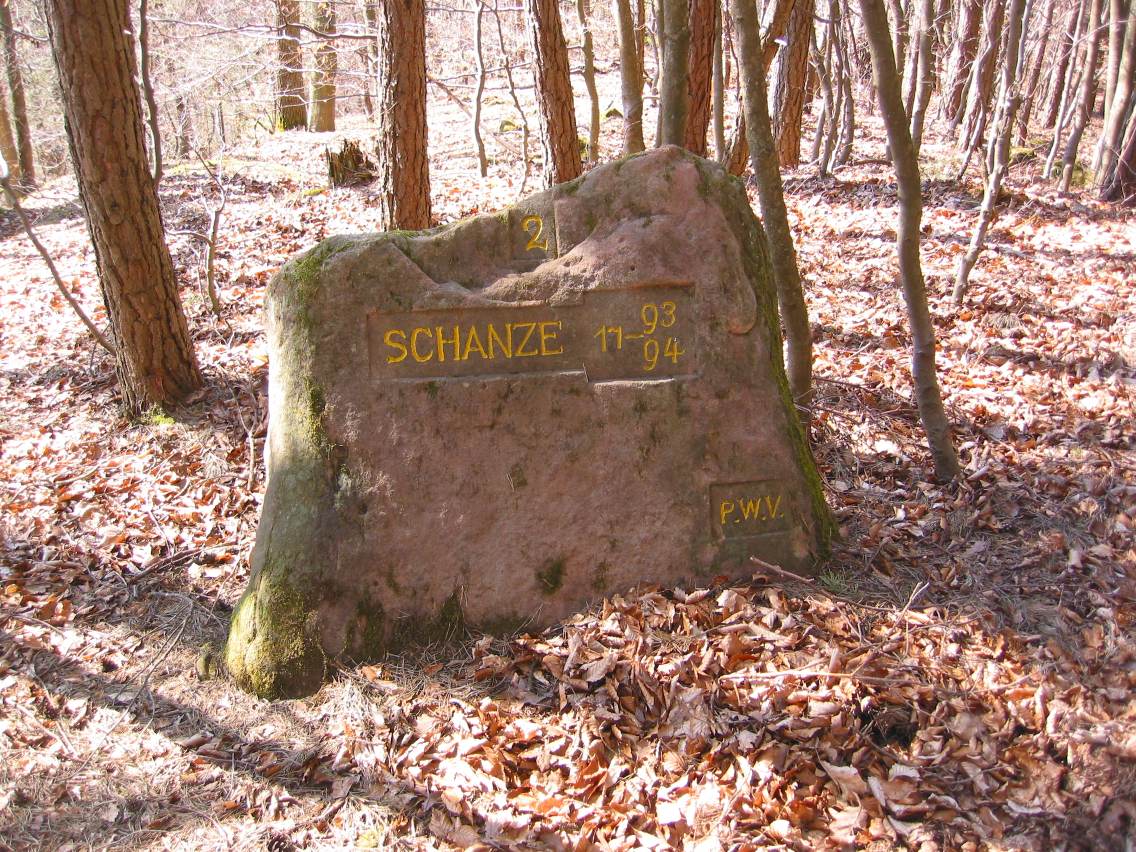
Ritterstein 171 "Schanze 2"
Monument and historic site · 4.2 km
Auf dem südlichen Berggipfel des Großen Kienecks. Preußische Schanze aus der Zeit der Revolutionskriege (1793–1794).

Ritterstein 172 "Schanze 3"
Monument and historic site · 3.0 km
Am westlichen Berghang vom Großen Kieneck zu den Buchelköpfen. Preußische Schanze aus der Zeit der Revolutionskriege (1793–1794).

Ritterstein 173 "Schanze 4"
Monument and historic site · 2.9 km
Auf dem Kleinen Kieneck. Preußische Schanze aus der Zeit der Revolutionskriege (1793–1794).

Ritterstein 174 "Schanze 5"
Monument and historic site · 2.4 km
Auf dem Großen Hetzelkopf, westlich vom Höhenweg von Kleinen Kieneck über den Großen Hetzelkopf zum Steinkopf. Preußische Schanze aus...

Ritterstein 175 "Schanze 6"
Monument and historic site · 1.7 km
Auf dem südwestlichen Bergvorsprung des Kleinen Hetzelkopfs, oberhalb dem Altenhof. Preußische Schanze aus der Zeit der...

Ritterstein 176 "Schorlenberger Sohl"
Monument and historic site · 2.6 km
Etwa 1 km südwestlich vom Forsthaus Schorlenberg, auf der Hochfläche zwischen Nußknick und Kleinem Kieneck, Suhle auf der Hochfläche des...

Ritterstein 177 "Schmugglersdell"
Monument and historic site · 3.8 km
Am mittleren Osthang des Großen Kienecks, am Weg vom Langenthal zum Schorlenberg. Bezeichnung des Schmugglergebiets in der Nähe des...
43 more on the map.
Parks, trails and playgrounds11





Restaurants and cafes44
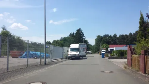
Flammkuchenhütte
Restaurant · German · 4.0 km
3 An der Heide, Mehlingen
Mo,Tu off; We-Fr 12:00-14:00,18:00-23:00; Sa 18:00-23:00; Su 12:00-22:00
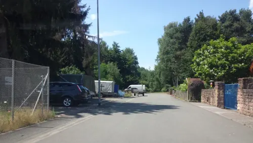
Pfälzer Dampfnudelhof
Restaurant · 4.1 km
15 An der Heide, Mehlingen
We,Fr,Sa 12:00-22:00; Th,Su 12:00-18:00
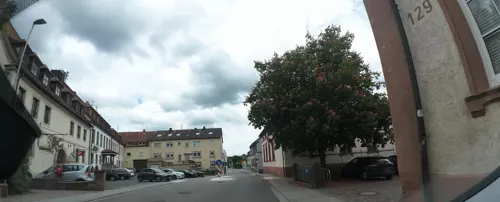
Pfungstädter Brauereigaststube "Kirsche"
Restaurant · German · 4.3 km
132 Hauptstraße, Hochspeyer
Tu-Sa 17:00-23:00; Su 11:00-22:00

Hotel-Restaurant Pfälzer Hof
Restaurant · German, Regional
19 Hauptstraße
Mo-Tu,Th,Su 11:00-14:30,17:00-22:00; We off; Fr,Sa 17:00-22:00


Bäckerei Krauß - De Obberschde Krausse Bäcker
Bakery
37 Hauptstraße, Enkenbach-Alsenborn
Tu-Fr 05:30-13:00,14:00-18:00; Sa 05:30-12:00
32 more on the map.
History
The area immediately surrounding Enkenbach-Alsenborn contains a high number of Celtic burial mounds from prehistoric times.
With favorable traffic levels and the connection to the railway in the year 1871 with the opening of Enkenbach station on the Alsenz Valley Railway, as well as the establishment of industry in the Kaiserslautern area, led to the total population of the municipality increasing despite strong emigration out of present-day Germany. Due to this population increase, Enkenbach-Alsenborn evolved from a farming community to the municipality it is today.
From the History section of Enkenbach-Alsenborn on Wikipedia, under CC BY-SA 4.0.
More about Enkenbach-Alsenborn
Geography
The municipality consists of the local villages of Enkenbach and Alsenborn. Before officially combining on 7 June 1969, the two villages worked very closely throughout their history to include a common coat of arms until 1795, a common mayor until 1825 and a common forest area until 1832.
Neighbouring municipalities are - in a clockwise direction - Neuhemsbach, Sippersfeld, Kerzenheim, Ramsen (Pfalz), Wattenheim, Fischbach (Kaiserslautern district), Kaiserslautern and Mehlingen.
From the Wikipedia article Enkenbach-Alsenborn, under CC BY-SA 4.0.
Where to stay7
Churches and places of worship9
Klosterkirche
Church · Catholic
10 Klosterstraße, Enkenbach-Alsenborn
Protestantische Kirche
Church · Protestant · 1.7 km
95 Rosenhofstraße, Enkenbach-Alsenborn
Schlosskirche
Church · Protestant · 4.7 km
3 Schlossberg, Neuhemsbach
Evangelische Kirche
Church · Protestant · 0.6 km
15 Kirchenstraße, Enkenbach-Alsenborn
Protestantische Kirche Mehlingen
Church · Protestant · 3.5 km
25 Spelzenhofstraße, Mehlingen
Shopping9
Gas and EV charging4
Tankstelle Schuster & Sohn
Gas station · 1.6 km
1 Haselheckerstraße, Enkenbach-Alsenborn
Schools, colleges and libraries5
Integrierte Gesamtschule Enkenbach-Alsenborn
School · 1.3 km
23 Am Mühlberg, Enkenbach-Alsenborn
Münchhofschule Grundschule Hochspeyer
School · 4.7 km
2 Kreuzhohlstraße, Hochspeyer
Healthcare6
Abele Gesundheitszentrum
Clinic and pharmacy · 0.8 km
22 Kaiserslauterer Straße, Enkenbach-Alsenborn
Map of Enkenbach-Alsenborn
159 places. The map loads OpenStreetMap tiles when you open it.
Getting there and nearby towns
Ramstein Air Base (RMS) is the nearest airport with scheduled flights listed in OpenStreetMap, 22 km away.
- Kaiserslautern 10 km southwest, about 10 min by car
- Otterberg 10 km west, about 10 min by car
- Winnweiler 10 km north, about 10 min by car
- Eisenberg 15 km northeast, about 15 min by car
- Rockenhausen 17 km north, about 17 min by car
- Bad Dürkheim 20 km east, about 20 min by car
- Herxheim am Berg 20 km east, about 20 min by car
- Grünstadt 21 km northeast, about 21 min by car
- Kirchheimbolanden 22 km northeast, about 22 min by car
- Neustadt an der Weinstraße 23 km southeast, about 23 min by car
Drive times are estimates from straight-line distance, not routes.
Towns near Enkenbach-Alsenborn


Keep exploring
Local news
Headlines from INDB.
Reviews, tips and questions
Loading what members have shared...
Sources and licences
- GeoNames (CC BY 4.0): population, coordinates, regions and time zone
- Mapillary (see each image): photos
- OpenStreetMap contributors (ODbL 1.0): places, airports, map data
- Wikidata (CC0 1.0): elevation, founding date, time zone, website
- Wikimedia Commons (see each image): photos
- Wikipedia (CC BY-SA 4.0): overview and history text
Photo credits
- Pfluegender Elefant von Hans Buch, Immanuel Giel, Public domain
- Enkenbach-Alsenborn, Germany - panoramio (2), Immanuel Giel, CC BY 3.0
- Enkenbach-Alsenborn, Germany - panoramio, Immanuel Giel, CC BY 3.0
- Klosterkirche Enkenbach Westseite von Hans Buch-2, Immanuel Giel derivative work: AnRo0002, Public domain
- Prot Kirche Alsenborn mit Umgebung Hans Buch, Immanuel Giel, Public domain
- Schloßkirche Neuhemsbach, Nordseite, Hans Buch, Public domain
- Ritterstein 166 Hundsbrunnen, pfalz39, CC BY-SA 3.0
- Ritterstein 167 Weidsohl, pfalz39, CC BY-SA 3.0
- Ritterstein 168 An der dicken Eiche 1925, pfalz39, CC BY-SA 3.0
- Ritterstein169 Müllerstisch, Awilms, CC BY 3.0
- Ritterstein 170 Schanze 1 1793-94, Pfalz39, CC BY-SA 3.0
- Ritterstein 171 Schanze 2 1793-94, Pfalz39, CC BY-SA 3.0
- Ritterstein 172 Schanze 3 1793-94, Pfalz39, CC BY-SA 3.0
- Ritterstein173 Schanze4, Awilms, CC BY 3.0
- Ritterstein174 Schanze5, Awilms, CC BY 3.0
- Ritterstein175 Schanze6, Awilms, CC BY 3.0
- Ritterstein176 SchorlenbergerSohl1, Awilms, CC BY 3.0
- Ritterstein177 Schmugglersdell, Awilms, CC BY 3.0
- Mehlinger Heide 3 (Hans Buch), -- Immanuel Giel 08:03, 4 May 2007 (UTC), Public domain
- Mehlinger Heide 2 (Hans Buch), -- Immanuel Giel 08:03, 4 May 2007 (UTC), Public domain
- EnkenbachKlosterkircheH0a, Helge Klaus Rieder, CC0
- Wäschebrunnen - panoramio, Immanuel Giel, CC BY 3.0
- Wäschbrunnen - panoramio, Immanuel Giel, CC BY 3.0
- Wäschbrunnen - panoramio (1), Immanuel Giel, CC BY 3.0
- Klosterkirche - panoramio (1), Immanuel Giel, CC BY 3.0
- Klosterkirche - panoramio (2), Immanuel Giel, CC BY 3.0
- Café Willenbacher - panoramio, Immanuel Giel, CC BY 3.0
- Rathausbrunnen - panoramio (1), Immanuel Giel, CC BY 3.0
- Enkenbacher Kuckuck, Alsenborner Bajass, Sembacher Wind - panoramio, Immanuel Giel, CC BY 3.0
- Baalborner Stier, Mehlinger Hohlwampe, Neukircher Besenbinder, Enkenbacher Kuckuck, Alsenborner Bajass - panoramio, Immanuel Giel, CC BY 3.0
- Rathausbrunnen mit Darstellung der Uznamen der Teilgemeinden - panoramio, Immanuel Giel, CC BY 3.0
- Sembacher Wind, Neuhemsbacher Windmacher Baalborner Stier - panoramio, Immanuel Giel, CC BY 3.0
- Wappen der Teilgemeinden am Rathaus der Verbandsgemeinde - panoramio, Immanuel Giel, CC BY 3.0
- Protestantische Kirche - panoramio (13), Immanuel Giel, CC BY 3.0
- Elefant - panoramio (4), Immanuel Giel, CC BY 3.0
- Pflügender Elefant - panoramio (1), Immanuel Giel, CC BY 3.0
- Pflügender Elefant (nach einer alten Postkarte) - panoramio, Immanuel Giel, CC BY 3.0
- Shanghaier Elefant für Alsenborn - panoramio, Immanuel Giel, CC BY 3.0
- Pflügender Elefant - panoramio, Immanuel Giel, CC BY 3.0
- Pflügender Elefant - panoramio (2), Immanuel Giel, CC BY 3.0
- Street-level photo, wegavision, CC BY-SA 4.0
- Street-level photo, wegavision, CC BY-SA 4.0
- Street-level photo, wegavision, CC BY-SA 4.0
- Street-level photo, b166er, CC BY-SA 4.0
- Street-level photo, teddy73, CC BY-SA 4.0
- Street-level photo, teddy73, CC BY-SA 4.0
- Street-level photo, ledermann, CC BY-SA 4.0
- Street-level photo, teddy73, CC BY-SA 4.0
- Street-level photo, teddy73, CC BY-SA 4.0
- Street-level photo, b166er, CC BY-SA 4.0
- Street-level photo, mfa, CC BY-SA 4.0
- Street-level photo, teddy73, CC BY-SA 4.0
- Street-level photo, wegavision, CC BY-SA 4.0
- Street-level photo, Bulld0z3r, CC BY-SA 4.0
- Street-level photo, b166er, CC BY-SA 4.0
- Street-level photo, wegavision, CC BY-SA 4.0
- Street-level photo, b166er, CC BY-SA 4.0
- Street-level photo, edddy, CC BY-SA 4.0


Page built November 9, 2026. Spotted a mistake? Tell us or suggest a place.