


Why visit Karben
Townapedia lists 105 museums and landmarks, 37 parks and trails, 135 places to eat, 10 places to stay and 12 attractions in and around town.
Highlights include Bioland MagerHof, Dottenfelderhof Laden, Bunker Ilbenstadt and Burg Vilbel.
Weather in Karben
Forecast from MET Norway (CC BY 4.0). Full forecast
About Karben
Karben (German pronunciation: [ˈkaʁbn̩] ) is a town in the Wetteraukreis, in Hessen, Germany. It is situated on the banks of the river Nidda in the Rhein-Main-Gebiet (Rhine-Main area), approximately 18 kilometres (11 miles) north of Frankfurt.
From the Wikipedia article Karben (this version), under CC BY-SA 4.0.
Things to do12

Dottenfelderhof Laden
Farm and orchard · 4.3 km
Dottenfelder Hof, Bad Vilbel
Mo-Sa 08:00-19:00; PH off
Margarethenhof
Farm and orchard · 1.9 km
16 Frankfurter Straße, Karben
Mo-Fr 08:00-19:00; Sa 08:00-15:00
Obsthof Schneider
Farm and orchard · 4.8 km
24 Am Steinberg, Frankfurt am Main
Apr-Oct: Mo-Su 09:00-19:00; Nov-Apr: Mo-Fr 11:00-18:00; Nov-Apr:...
Altstadt Markt
Farm and orchard · 5.5 km
6 Marktplatz, Bad Vilbel
Mo-Fr 07:30-18:30; Sa 07:30-14:30
Hofladen Jahn
Farm and orchard · 4.6 km
23 Südliche Hauptstraße, Schöneck
Tu-Fr 08:00-18:30; Sa 08:00-14:00


Museums and landmarks105


Burg Vilbel
Monument and historic site · 5.4 km
2 Klaus-Havenstein-Weg, Bad Vilbel

Leonhardisches Schloß
Monument and historic site · 0.8 km
2 Burg-Gräfenröder-Straße, Karben

Lersnersches Schloss
Monument and historic site · 5.4 km
3 Zur Charlottenburg, Frankfurt am Main



Barockes Herrenhaus der Familie von Glauburg
Monument and historic site · 5.2 km
1 Untere Burggasse, Frankfurt am Main

93 more on the map.
Parks, trails and playgrounds37





25 more on the map.
Restaurants and cafes135
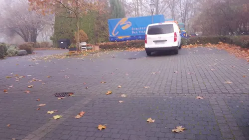
Alte Mühle
Restaurant · German, International · 5.4 km
13 Lohstraße, Bad Vilbel
Mo off; Tu-Fr 11:00-24:00; Sa-Su,PH 10:00-24:00
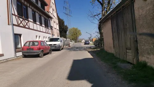
Hofcafe
Cafe · Bistro · 4.2 km
Geschlossen vom 24. bis 26.12. und 31.12.2025 und am 1.1.2026. Betriebsferien vom 12.-19.1.2026.
1 Dottenfelder Hof, Bad Vilbel
Mo-Sa 09:00-18:00; PH off
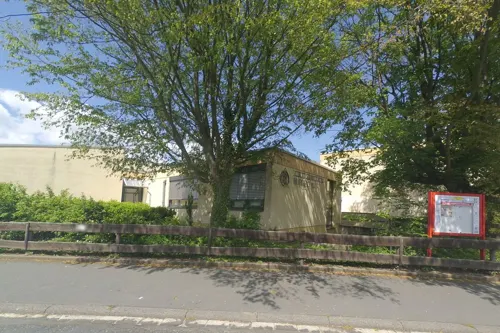
Petterweiler Plaudertässchen
Cafe · Regional, Cake, Waffeln, Frühstück, Suppen · 4.0 km
Inhabergeführtes Mehrgenerationencafé für Menschen mit und ohne Gluten- und Laktoseunverträglichkeit sowie Zöliakie.
12 Sauerbornstraße, Karben
Mo-Th 09:00-13:30; Su 14:00-18:00

Ristorante Pizzeria Bella Italia
Restaurant · Italian, Pizza · 5.5 km
Außenbereich: 3 Tische, bequem am Parkplatz
4 Mühlstraße, Bad Vilbel
Mo-Fr 11:00-14:00,17:00-23:00; Sa,Su 17:00-23:00
Bürgerhaus-Restaurant
Restaurant · Italian, German · 4.6 km
3 Burgstraße, Niederdorfelden
Mo,Tu,Th,Fr,Su 11:30-14:00,17:30+; Sa 17:30+; We off
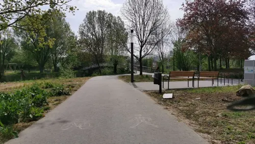
Deftig & Fein Restaurant
Restaurant · Regional · 0.7 km
1 Rathausplatz, Karben
We-Fr,Su,Mo,PH 11:00-14:00,17:00-22:00; Sa 17:00-22:00

Der Bäcker Eifler
Bakery · 5.3 km
15 Rodheimer Straße, Bad Vilbel
Mo-Fr 07:00-22:00; Sa 07:00-22:00; Su 07:00-18:00
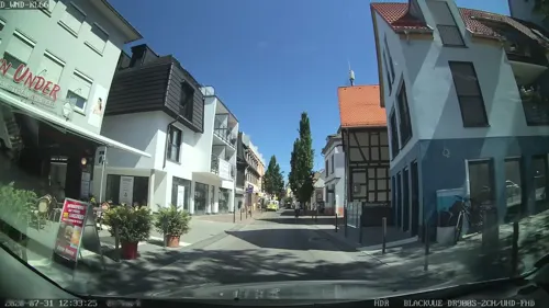


Down Under
Restaurant · Australian, American · 5.8 km
34 Frankfurter Straße, Bad Vilbel
Mo-Sa 12:00-01:00, Su 12:00-00:00

Gaststätte zur Ludwigshöhe
Restaurant · German · 0.6 km
26 Rendeler Straße, Karben
Mo-We 17:00-24:00; Fr,Sa 17:00-24:00; Su 11:00-14:30,17:00-24:00; Th off
123 more on the map.
History
military castellum, forming a part of the limes, the Roman imperial border defence network and Karben’s mineral springs have been used by the Romans some 2000 years ago. Rendel, Karben’s oldest borough, was mentioned first in 774 in a deed of donation to the monastery of Lorch. Kloppenheim once belonged to an installation of the “Deutschen Orden” (Teutonic Knights Order), who maintained a small palace there. Gross-Karben hosts two more manors which were inhabited by local landlords. The “Degenfeld’sche Schloss” contains today Karben’s Museum on agriculture and local history. Gross-Karben, Klein-Karben, Okarben, Burg-Graefenrode and Rendel still have churches dating back from the Baroque period.
Okarben experienced a face-change in the 19th century, when it started hosting workers for the newly established Main-Weser Railroad between Frankfurt and Kassel. The city has transformed itself from a bundle of independent villages living mostly of farming the rich soils of the Wetterau to a slowly integrating city providing housing for a growing population of commuters and space for several small and mid-sized enterprises, while maintaining much of its original rural charm.
From the History section of Karben on Wikipedia, under CC BY-SA 4.0.
Where to stay10
Churches and places of worship31
Ev. Kirche Massenheim (Friedenskirche)
Church · Protestant · 5.6 km
7 An der Kirche, Bad Vilbel
Evangelische Kirche
Church · Protestant · 4.0 km
5 Hauptstraße, Bad Vilbel
Evangelische Kirche Rendel
Church · Protestant · 2.1 km
5 Klein-Karbener-Straße, Karben
Ev. Kirche Niedererlenbach
Church · Protestant · 5.3 km
1 Zur Charlottenburg, Frankfurt am Main
Evangelische Kirche
Church · Protestant · 5.0 km
4 Kirchgasse, Schöneck
Shopping39
Gas and EV charging18
Schools, colleges and libraries29
Healthcare14
Praxis für Allgemeinmedizin Sportmedizin und Naturheilverfahren
Clinic and pharmacy · 2.6 km
2 Karbener Weg, Bad Vilbel
Map of Karben
250 places. The map loads OpenStreetMap tiles when you open it.
Getting there and nearby towns
Frankfurt Airport (FRA) is the nearest airport with scheduled flights listed in OpenStreetMap, 28 km away.
- Nidderau 7 km east, about 7 min by car
- Maintal 10 km southeast, about 10 min by car
- Rosbach vor der Höhe 10 km northwest, about 10 min by car
- Mühlheim am Main 13 km south, about 13 min by car
- Frankfurt am Main 14 km southwest, about 14 min by car
- Offenbach 14 km south, about 14 min by car
- Oberursel 14 km west, about 14 min by car
- Altenstadt 14 km northeast, about 14 min by car
- Steinbach am Taunus 16 km southwest, about 16 min by car
- Erlensee 16 km southeast, about 16 min by car
Drive times are estimates from straight-line distance, not routes.
Local news
Headlines from INDB.
Reviews, tips and questions
Loading what members have shared...
Sources and licences
- GeoNames (CC BY 4.0): population, coordinates, regions and time zone
- Mapillary (see each image): photos
- OpenStreetMap contributors (ODbL 1.0): places, airports, map data
- Wikidata (CC0 1.0): elevation, founding date, time zone, website
- Wikimedia Commons (see each image): photos
- Wikipedia (CC BY-SA 4.0): overview and history text
Photo credits
- Karben Degenfeldschloss01, Haselburg-müller, CC BY-SA 3.0
- Karben Leonhardischloss02, Haselburg-müller, CC BY-SA 3.0
- Karben Leonhardischloss01, Haselburg-müller, CC BY-SA 3.0
- Christinenstraße, Karben, Schwester Christine Jordan, Pandabear de, CC BY-SA 4.0
- Skulptur 'Werte' im Karbener Skulpturpark von Peter Mayer, Pandabear de, CC BY-SA 4.0
- Skulptur Karben Wetterau - 1 (1), Pandabear de, CC BY-SA 4.0
- Skulptur 'Solidarité' in Karben Wetterau, Pandabear de, CC BY-SA 4.0
- Stolperstein Karben Bahnhofstrasse 51, Jt wob ( Diskussion ) 14:55, 3. Mai 2020 (CEST), CC BY-SA 4.0
- Skulptur 'Strauß' im Karbener Skulpturpark von Joachim Holz, Pandabear de, CC BY-SA 4.0
- Skulptur 'Shri Ganapati' im Karbener Skulpturpark von Christof Paul, Pandabear de, CC BY-SA 4.0
- Skulptur 'Lebensrad' im Karbener Skulpturpark von Michaela Hagen, Pandabear de, CC BY-SA 4.0
- Skulptur 'Baum des Lebens' im Karbener Skulpturpark von Heidemarie Khan, Pandabear de, CC BY-SA 4.0
- Nidda in Karben, Freak-Line-Community, CC BY-SA 4.0
- Karben Leonhardischloss04, Haselburg-müller, CC BY-SA 3.0
- Karben Leonhardischloss03, Haselburg-müller, CC BY-SA 3.0
- Klein-Karben, jüdischer Friedhof, Tor, Karsten Ratzke, CC0
- Klein-Karben, jüdischer Friedhof, Karsten Ratzke, CC0
- Klein-Karben, jüdischer Friedhof, Gedenkstein, Karsten Ratzke, CC0
- Pfarrhaus Groß-Karben, Chrikrue, CC0
- Wasserburg Bad Vilbel 869-vd, Pedelecs, CC BY-SA 3.0
- Schöneck-Büdesheim Schloss 20130424, Rudolf Stricker, Attribution
- Anna schmidt schule niedererlenbach p 016, Peng ( talk ) 12:08, 4 May 2011 (UTC), CC BY 3.0
- Burgruine Dorfelden, Haselburg-müller, CC BY-SA 3.0
- Lersnersches Schloss Hofseite, Haselburg-müller, CC BY-SA 3.0
- Kurt-Schumacher-Schule(1), Gittini61, CC BY-SA 4.0
- Ludwigsquelle, Prolingheuer, CC BY-SA 4.0
- Alteberg02, Klaus Stahlke, CC BY-SA 4.0
- Naturschutzgebiet "Im alten See bei Gronau" 01, Klaus Stahlke, CC BY-SA 4.0
- Pfingstweide und Kloppenheimer Wäldchen, Prolingheuer, CC BY-SA 4.0
- Dortelweil, evangelische Kirche, Karsten11, Public domain
- Gronau, Kirche, Karsten Ratzke, CC0
- Msh An der Kirche 7 ev Kirche Ost, Massemer, CC BY-SA 4.0
- Schöneck-Büdesheim evangelische Kirche 20101101, Rudolf Stricker, Attribution
- Klein-Karben, St. Michaelis Kirche, Karsten Ratzke, CC0
- Kirche Rendel, Jt wob, CC BY-SA 4.0
- Niederdorfelden, die evangelische Kirche foto2 2016-08-11 10.50, Michielverbeek, CC BY-SA 4.0
- Steinerner-Tisch, Unknown author, CC BY-SA 3.0
- Schöneck-Büdesheim Schloss 20101101, Rudolf Stricker, Attribution
- Klein-Karben, St. Michaelis Kirche (1), Karsten Ratzke, CC0
- Tellerrückschlagventil-Beispiel, HopuWiki, CC BY-SA 4.0
- Street-level photo, wegavision, CC BY-SA 4.0
- Street-level photo, vilby, CC BY-SA 4.0
- Street-level photo, chuck, CC BY-SA 4.0
- Street-level photo, jurgenweighardt, CC BY-SA 4.0
- Street-level photo, jaybe, CC BY-SA 4.0
- Street-level photo, troher15, CC BY-SA 4.0
- Street-level photo, jaybe, CC BY-SA 4.0
- Street-level photo, vilby, CC BY-SA 4.0
- Street-level photo, troher15, CC BY-SA 4.0
- Street-level photo, troher15, CC BY-SA 4.0
- Street-level photo, troher15, CC BY-SA 4.0
- Street-level photo, troher15, CC BY-SA 4.0
- Street-level photo, wegavision, CC BY-SA 4.0
- Street-level photo, robffm, CC BY-SA 4.0
- Street-level photo, flidolin, CC BY-SA 4.0
- Street-level photo, wegavision, CC BY-SA 4.0
- Street-level photo, wegavision, CC BY-SA 4.0
- Street-level photo, robffm, CC BY-SA 4.0
- Street-level photo, 7eter, CC BY-SA 4.0
- Street-level photo, jurgenweighardt, CC BY-SA 4.0
- Street-level photo, mapcreator, CC BY-SA 4.0
- Street-level photo, mapcreator, CC BY-SA 4.0
- Street-level photo, mapcreator, CC BY-SA 4.0
- Street-level photo, robffm, CC BY-SA 4.0
- Street-level photo, jurgenweighardt, CC BY-SA 4.0
- Street-level photo, tmka, CC BY-SA 4.0


Page built November 8, 2026. Spotted a mistake? Tell us or suggest a place.