


Why visit Oberursel
Townapedia lists 70 museums and landmarks, 44 parks and trails, 232 places to eat, 34 places to stay and 10 attractions in and around town.
Highlights include Hildmanns Hofladen, Kinopolis Bad Homburg, Central Garage and Heidetränk-Oppidum.
Weather in Oberursel
Forecast from MET Norway (CC BY 4.0). Full forecast
About Oberursel
Oberursel (Taunus) (German pronunciation: [oːbɐˈʔʊʁzl̩] , lit. 'Upper Ursel', in contrast to "Lower Ursel") is a town in Germany and part of the Frankfurt Rhein-Main urban area. It is located to the north west of Frankfurt, in the Hochtaunuskreis county. It is the 13th largest town in Hesse. In 2011, the town hosted the 51st Hessentag state festival.
From the Wikipedia article Oberursel (Taunus) (this version), under CC BY-SA 4.0.
Travel tips from other travellers: Oberursel on Wikivoyage (CC BY-SA 4.0).
Photos of Oberursel


Things to do10

Hildmanns Hofladen
Farm and orchard · 3.8 km
10 Sodener Straße, Kronberg im Taunus
Tu 09:00-13:00,15:00-18:00; Fr 09:00-17:00; Sa 09:00-13:00

Kinopolis Bad Homburg
Cinema and theater · 3.5 km
1 Basler Straße, Bad Homburg v.d. Höhe
Mo-Fr 15:00-21:00; Sa,Su 13:00-21:00
An'nettes Hoflädchen
Farm and orchard · 1.9 km
Gemüseverkauf mit Vertrauenskasse; Nudeln, Marmelade, Soße, Wurst/Fleisch aus dem Automaten
Hofladen Hofgut Hohenwald
Farm and orchard · 3.3 km
69 Oberurseler Straße, Kronberg im Taunus

Museums and landmarks70

Central Garage
Museum · 2.0 km
5 Niederstedter Weg, Bad Homburg v.d. Höhe
We-Su 12:00-16:30; Mo,Tu,PH off


Vortaunusmuseum
Museum · 0.6 km
1 Marktplatz, Oberursel (Taunus)
closed "Wegen Sanierungsarbeiten bis auf Weiteres geschlossen."

Heidetrank Oppidum
Monument and historic site · 4.2 km
Celtic oppidum near Oberursel in the Taunus in Germany


Nida
Monument and historic site · 7.3 km
Ancient Roman town in the northwestern suburbs of Frankfurt, Germany


Saalburg Roman Fort
Monument and historic site · 7.2 km
Cohort castrum, part of the Limes Germanicus, and is the most completely reconstructed Roman fort in Germany


Galerie Artlantis
Museum · 3.7 km
6 Tannenwaldweg, Bad Homburg v.d. Höhe
Fr 15:00-18:00; Sa,Su,PH 11:00-18:00 "nur während der Ausstellungszeiten"
58 more on the map.
Parks, trails and playgrounds44




32 more on the map.
Restaurants and cafes232
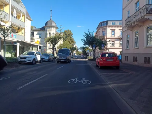
Luna y Sol
Restaurant · Spanish · 3.8 km
Tapasbar y Cerveceria
114 Louisenstraße, Bad Homburg v. d. Höhe
Mo-Fr 12:00-14:30, Mo-Fr 17:00-23:00, Sa 12:00-24:00, Su 12:00-22:00
Heidekrug
Restaurant · Korean · 1.4 km
30 Königsteiner Straße, Oberursel (Taunus)
Tu-Su 11:30-14:30,17:30-22:00, Mo off

Hirschgarten
Restaurant · German · 3.7 km
1 Elisabethenschneise, Bad Homburg v. d. Höhe
Mo-Tu off; We-Su 12:00-21:30
Pizza Lui
Restaurant · Italian, Indian · 3.9 km
No hot drinks, no alcoholic drinks
128 Louisenstraße, Bad Homburg v. d. Höhe
Mo-Fr 11:00-14:30,17:00-23:00; Sa,Su 12:00-23:00
Zum Schwanen
Restaurant · Regional · 0.6 km
Am Wochenende durchgehend geöffnet
7 Hollerberg, Oberursel (Taunus)
We-Sa 17:00-22:00; Su 12:00-20:00
Barg
Restaurant · Persian · 3.4 km
2 Am Bahnhof, Bad Homburg v.d. Höhe
Mo-We 17:00-24:00, Th 17:00-01:00, Fr 17:00-02:00, Sa 15:00-02:00,...

Forellengut Herzberger
Restaurant · Fish · 3.6 km
Durchgehend warme Küche. Biergarten.
1, Oberursel (Taunus)
Sa,Su,PH 11:00-18:00
Villa Fantastica
Restaurant · Italian · 3.7 km
Osteria Villa Fantastica
45 Kaiser-Friedrich-Promenade, Bad Homburg v. d. Höhe
Tu-Sa 12:00-15:00,18:00-23:30
Zum Rühl
Restaurant · German, Regional · 3.1 km
50 Kurmainzer Straße, Oberursel (Taunus)
Mo-Fr 11:30-22:30; Tu off; Sa,Su 11:00-22:30
Alt-Oberurseler Brauhaus
Restaurant · Regional
13 Ackergasse, Oberursel (Taunus)
Mo-Th 11:00-24:00, Fr,Sa 11:00-01:00, Su 11:00-22:00
Bangkok Streetfood
Restaurant · Thai · 1.9 km
12 Industriestraße, Oberursel (Taunus)
Mo-Su,PH 11:00-22:00; Dec 24-25 off; Dec 31-Jan 01 off
Bei Dani & Mario
Restaurant · German · 0.7 km
2 Rathausplatz, Oberursel (Taunus)
Tu-Sa 11:30-14:30,17:30-22:00; Su 12:00-15:00,17:30-21:00; Mo off
220 more on the map.
History
The town was first mentioned as "Ursella" in 791 in a deed recording a donation to the monastery Lorsch. In the year 880 the first church in the area, called "monasterium ad ursellam", was mentioned. In 1317 the first trading activities were documented.
In 1444 Oberursel was officially sanctioned as a town. Two years later, the town wall was finished. Since the town was growing so fast in the 15th century the town walls had to be expanded in 1481 towards the east. In the early 16th century a school for Latin language was established next to the church.
1535 Oberursel become property of Earl Ludwig von Stolberg-Königstein and becomes a Protestant town.
1557 Nicolaus Henricus built the first printing plant in Oberursel.
1605 due to the Counter-Reformation Oberursel becomes Catholic again.
The most important industry in the late Middle Ages and in the early modern times was the clothier business.
During the Thirty Years' War the town was destroyed three times, in 1622 and 1645, and the number of inhabitants decreased from 1,600 to 600. During the 1645 razing, most buildings were destroyed by fire; the three surviving buildings were the old town hall, the bakery, and one apartment house near the marketplace. This is the reason why nearly all houses in the old town of Oberursel are from the 17th century.
Read more of the history
As the town was rebuilt and grew, many mills and forges were founded along the "Urselbachtal".
By 1858, industrialisation had begun in Oberursel, with several cotton-spinning mills being built.
In 1860 Oberursel was linked to the railway between Bad Homburg and Frankfurt.
In 1899 a subway was opened privately in the direction of Hohemark (currently Line U3).
During the Second World War, many captured American and British airmen passed through Oberursel as they were interrogated and processed into the German POW camp system at the "Durchgangslager der Luftwaffe" or "Transit Camp of the Luftwaffe" located in the town. The camp name was commonly shortened to "Dulag Luft", or simply "Dulag". Almost all allied airmen who were shot down and captured spent some time at that camp before being moved to their permanent assigned "Stalag".
After the occupation of Oberursel by the U.S. in April 1945, the "Dulag" area was taken over by the US Army.
The existing buildings were transformed into Camp King, which began as an intelligence post, then later a transportation post until its de-activation in 1993. Today the former Camp King is a residential area, still populated by several former US soldiers.
In 1929 Bommersheim was annexed; in 1972 Oberstedten, Stierstadt and Weißkirchen followed.
From the History section of Oberursel (Taunus) on Wikipedia, under CC BY-SA 4.0.
More about Oberursel
Geography
The maximum distance from the northern town border to the southern border is 7.2 km (4 mi) the maximum distance from east to west is 13.0 km (8 mi).
The nearly Grosse Feldberg is the highest spot in the Taunus: 820 m above sea level
To the north Oberursel borders with Schmitten, to the east with Bad Homburg vor der Höhe, to the south-east with Frankfurt, to the southwest with Steinbach and to the west with Kronberg.
Besides the town centre (including Bommersheim), Oberursel is divided into the districts Oberstedten (population 6,118), Stierstadt (5,541) and Weißkirchen (Oberursel) (5,151). Bommersheim was annexed before the municipal reform of 1972 and therefore is not an independent district.
Economy
There are many well known companies located in Oberursel, predominantly in the IT and tourism industries.
Prior to its dissolution, Aero Lloyd was headquartered in Oberursel. When Aero Flight existed, it had its head office in Oberursel.
Arts and culture
The "Vortaunusmuseum" is located in the central marketplace. Its exhibits illustrate the town's history and the history of soap box derbies. Soap box derbies were invented in Oberursel, and the world championship is held in Oberursel every year.
Another popular event occurring in Oberursel is the Brunnenfest, an annual village fair held in the early summer, which attracts visitors from surrounding areas and around the world.
Education
Oberursel is the educational centre of "Hochtaunuskreis" county. As well as six primary schools, one in each of the town districts, there is a grammar school, a secondary school, a secondary modern school (junior high) and a comprehensive school.
There are also two private schools, "Helen-Keller-Schule" and "Hans-Thoma-Schule", a commercial high school named "Feldbergschule", and the [1] Frankfurt International School.
The following vocational institutions, training centres, and speciality schools are also located in Oberursel:
[3] Ketteler-la-Roche-Schule (Fachschule für Sozialpädagogik)
[4] Lutherische Theologische Hochschule (Selbständige Evangelisch-Lutherische Kirche)
Bildungszentrum (seither: Verwaltungsschule) der Bundesanstalt für Arbeit
From the Wikipedia article Oberursel (Taunus), under CC BY-SA 4.0.
Notable people from Oberursel
 Joseph Franz MolitorGerman philosopher (1779-1860)Photo: Herbert Rusche, CC BY-SA 3.0
- Christian CalmesLuxembourgian lawyer and historian (1913-1995)
- Monika BerberichGerman terrorist and member of the Red Army Faction
- Johann SpiesGerman printer
- Melchior AcontiusGerman poet (ca. 1515-1569)
- Florian HommGerman businessman
Born in Oberursel, according to Wikidata (CC0). Each name links to its Wikipedia article.
Where to stay34
Steigenberger Bad Homburg
Motel and hotel · 3.8 km
69-75 Kaiser-Friedrich-Promenade, Bad Homburg v. d. Höhe
Dorint Hotel Frankfurt - Oberursel
Motel and hotel · 1.3 km
29 Königsteiner Straße, Oberursel (Taunus)
Churches and places of worship38
Evangelisch-Freikirchliche Gemeinde Bad Homburg
Church · Baptist · 3.5 km
18 Sodener Straße, Bad Homburg v.d. Höhe
Christuskirche
Church · Protestant · 0.9 km
18a Oberhöchstadter Straße, Oberursel (Taunus)
Christuskirche
Church · Protestant · 2.4 km
25 Kolberger Weg, Bad Homburg v.d. Höhe
Herz-Jesu-Kirche
Church · Roman Catholic · 3.1 km
92a Heuchelheimer Straße, Bad Homburg v.d. Höhe
Liebfrauenkirche
Church · Catholic
32 Herzbergstraße, Oberursel (Taunus)
Evangelische Kirche St. Nikolaus
Church · Lutheran · 2.3 km
28 Kirchstraße, Oberursel (Taunus)
Shopping71
Gas and EV charging17
Schools, colleges and libraries34
Healthcare27
Hochtaunus Apotheke Bad Homburg
Clinic and pharmacy · 2.9 km
24 Zeppelinstraße, Bad Homburg v.d. Höhe
Medicus-Apotheke im Fachartztzentrum Oberursel
Clinic and pharmacy · 1.1 km
10 Nassauer Straße, Oberursel (Taunus)
Map of Oberursel
250 places. The map loads OpenStreetMap tiles when you open it.
Getting there and nearby towns
Frankfurt Airport (FRA) is the nearest airport with scheduled flights listed in OpenStreetMap, 20 km away.
- Bad Homburg vor der Höhe 4 km northeast, about 4 min by car
- Steinbach am Taunus 4 km south, about 4 min by car
- Friedrichsdorf 7 km northeast, about 7 min by car
- Eschborn 7 km south, about 7 min by car
- Schwalbach am Taunus 7 km southwest, about 7 min by car
- Königstein im Taunus 8 km west, about 8 min by car
- Bad Soden am Taunus 9 km southwest, about 9 min by car
- Wehrheim 10 km north, about 10 min by car
- Bad Vilbel 12 km east, about 12 min by car
- Frankfurt am Main 13 km southeast, about 13 min by car
Drive times are estimates from straight-line distance, not routes.
Towns near Oberursel


Keep exploring
Local news
Headlines from INDB.
Reviews, tips and questions
Loading what members have shared...
Sources and licences
- GeoNames (CC BY 4.0): population, coordinates, regions and time zone
- Mapillary (see each image): photos
- OpenStreetMap contributors (ODbL 1.0): places, airports, map data
- Wikidata (CC0 1.0): elevation, founding date, time zone, website, landmarks and historic places
- Wikimedia Commons (see each image): photos
- Wikipedia (CC BY-SA 4.0): overview and history text
Photo credits
- Ou-marktplatz001, dontworry, CC BY-SA 3.0
- Bleibeskopf 76, Leipold, Marc, Public domain
- Hessenpark-weinberg+rhein-main-001, Dontworry, CC BY-SA 3.0
- Nida Heddernheim Toepferoefen1, Haselburg-müller, CC BY-SA 3.0
- Saalburg Main Gate (Porta Praetoria), en:User:Ekem, Public domain
- Opel-Zoo Kronberg Afrikasavanne 26-09-2008 002, Tragopan, CC BY-SA 3.0
- Wehrheim Obernhain, MdE, CC BY-SA 3.0
- Bad Homburg, Englische Kirche 01, 4spring, CC0
- Frankfurt Tempel mit Turm 2005 08 26, Donny Wöllauer, CC BY-SA 3.0
- Heidetränk Oppidum old Celtic oppidum, Leonhard Lenz, CC BY-SA 4.0
- Bad-homburg-erloeserkirche-038, Dontworry, CC BY-SA 3.0
- Oberursel, Feldbergschule, Karsten Ratzke, CC0
- Bad Homburg Hirschgarten, Karsten11, Public domain
- BHvdH Sinclair-Haus 20110320 Pano, Eva K., GFDL 1.2
- Oberursel, Klinik Hohemark, Eingang, Karsten Ratzke, CC0
- Aerial image of Schlosspark Bad Homburg (view from the southwest), Carsten Steger, CC BY-SA 4.0
- View of FIS main campus, Shuffle2, CC BY-SA 3.0
- Bad Homburg, St. Marienkirche, Karsten Ratzke, CC0
- Oberhöchstadt, NSG Waldwiesental, Karsten Ratzke, CC0
- Oberursel, Liebfrauenkirche, Karsten11, CC0
- Christuskirche, Bad Homburg 02, 4spring, CC0
- Oberursel, Christuskirche, Front, Karsten11, Public domain
- Bad Homburg Gartenfeld, Herz Jesu Kirche, Karsten11, CC0
- Tower - panoramio (13), Roman SUZUKI, CC BY 3.0
- Evangelisch-Freikirchliche Gemeinde Bad Homburg, 02, 4spring, CC0
- St. Johannes, Oberursel (Taunus) (LRM 20240128 134437), Matti Blume, CC BY-SA 4.0
- Heidetränk-Oppidum Digitales Geländemodell, Geodaten online Hessen, CC0
- Gymnasium Oberursel, Karsten11, Public domain
- SELKD Hochschule Oberursel - Schild, Taurus65, CC0
- Schlosspark-Bad-Homburg-JR-G6-1773-2007-08-06, Johannes Robalotoff, CC BY-SA 3.0 de
- BHvdH Erloeserkircher Frontansicht EVA 8493, Eva K., GFDL 1.2
- Oberursel, Vortaunusmuseum, Karsten Ratzke, CC0
- Oberursel, Klinik Hohemark, Hauptgebäude, Karsten Ratzke, CC0
- Bad Homburg, St. Marien Seitenansicht, Karsten11, CC0
- Opelit Mopetta Bad Homburg, Buch-t, CC BY-SA 3.0 de
- View of FIS main campus 2, Shuffle2, CC BY-SA 3.0
- Street-level photo, sungedoul, CC BY-SA 4.0
- Street-level photo, schmitzjochen, CC BY-SA 4.0
- Street-level photo, sungedoul, CC BY-SA 4.0
- Street-level photo, ramap, CC BY-SA 4.0
- Street-level photo, schmitzjochen, CC BY-SA 4.0
- Street-level photo, schmitzjochen, CC BY-SA 4.0
- Street-level photo, schmitzjochen, CC BY-SA 4.0
- Street-level photo, bente24, CC BY-SA 4.0
- Street-level photo, miguel_andrade, CC BY-SA 4.0
- Street-level photo, miguel_andrade, CC BY-SA 4.0
- Street-level photo, tmka, CC BY-SA 4.0
- Street-level photo, tmka, CC BY-SA 4.0
- Street-level photo, scg1176, CC BY-SA 4.0
- Street-level photo, tmka, CC BY-SA 4.0
- Street-level photo, miguel_andrade, CC BY-SA 4.0
- Street-level photo, tmka, CC BY-SA 4.0
- Street-level photo, jose1711, CC BY-SA 4.0
- Street-level photo, tmka, CC BY-SA 4.0


Page built November 9, 2026. Spotted a mistake? Tell us or suggest a place.