


Kirchheimbolanden, Germany
Kirchheimbolanden is a town of 8,006 people in Rheinland-Pfalz, Germany.
Why visit Kirchheimbolanden
Townapedia lists 34 museums and landmarks, 9 parks and trails, 47 places to eat, 5 places to stay and 17 attractions in and around town.
Highlights include Hofladen „Biohof am Hollerberg“, Wartturm, Bahnhof Marnheim and Heimatmuseum.
Weather in Kirchheimbolanden
Forecast from MET Norway (CC BY 4.0). Full forecast
About Kirchheimbolanden
Kirchheimbolanden is the capital and the second largest city of the Donnersbergkreis, in Rhineland-Palatinate. Situated in south-western Germany, it is approximately 25 km west of Worms, and 30 km north-east of Kaiserslautern.
From the Wikipedia article Kirchheimbolanden (this version), under CC BY-SA 4.0.
Photos of Kirchheimbolanden


Things to do17
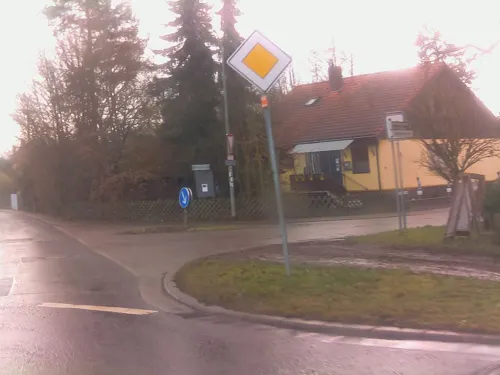
Hofladen „Biohof am Hollerberg“
Farm and orchard · 3.4 km
4 Crayenbühlstraße, Bolanden
Mo-Su 08:00-20:00

Wartturm
Scenic view · 0.9 km
Ehemaliger Wartturm, spätmittelalterlicher Bruchsteinbau, vor 1431


Schneckentürmchen
Scenic view · 0.9 km
Kleines gründerzeitliches Belvedere, 1880–84


5 more on the map.
Museums and landmarks34

Bahnhof Marnheim
Monument and historic site · 4.7 km
23 Bahnhofstraße, Marnheim


Wasserturm
Monument and historic site · 1.0 km
Ehemaliger Wasserturm, spätgründerzeitlicher Backsteinbau, um 1900

Schloss Kirchheimbolanden
Monument and historic site · 0.6 km
3 Schloßplatz, Kirchheimbolanden

Grauer Turm
Monument and historic site
In der Mitte des Westabschnitts der mittelalterlichen Stadtbefestigung gelegener rechteckiger Mauerturm
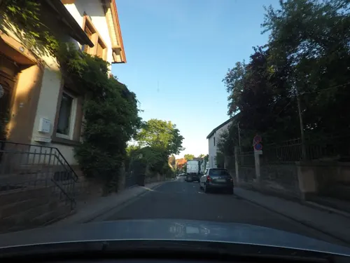
Karl-Ritter-Schule
Monument and historic site
17 Schillerstraße, Kirchheimbolanden

Roter Turm
Monument and historic site
Südwestlicher, runder Mauereckturm der mittelalterlichen Stadtbefestigung

Ehrenmal 1914-1918
Monument and historic site · 0.6 km
Kriegerdenkmal 1914/18 und 1939/45, reliefierter Muschelkalkblock, 1933 von Heinrich Schuler, Kirchheimbolanden, nach 1956 erweitert
Grauer Turm
Monument and historic site · 3.7 km
Spätgotischer Rundturm, 15. oder 16. Jahrhundert.
22 more on the map.
Parks, trails and playgrounds9





Restaurants and cafes47
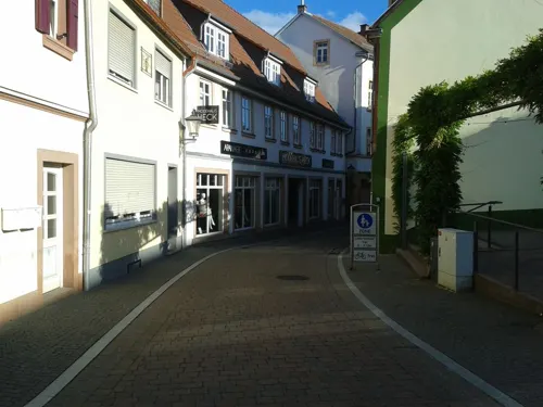
Ariatello Pizzeria
Restaurant · Italian, Italian Pizza
22 Schloßstraße
Tu-Fr 11:30-14:00, 16:00-21:45; Sa-Su 16:00-22:00
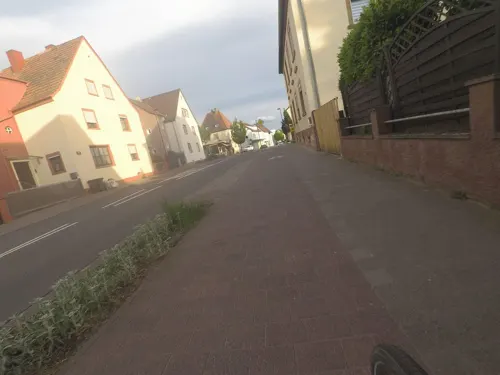
Piemont Restaurant
Restaurant · Italian
74 Marnheimer Straße, Kirchheimbolanden
Mo-Sa 17:45-22:30; Tu-Fr 11:45-14:30,17:45-22:30; Su...
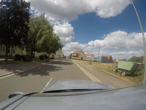
Pizzeria Arina
Restaurant · Pizza · 3.6 km
16 Morschheimer Straße, Orbis
Mo-Sa 16:30-22:00; PH 11:00-22:00; Su 11:00-22:00
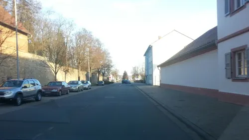
Restaurant Orangerie - Von der Heide kreativ mit Herz
Restaurant · German
4 Dr.-Edeltraud-Sießl-Allee
Mo 17:30-23:00; Th-Su 11:30-15:00, 17:30-23:00
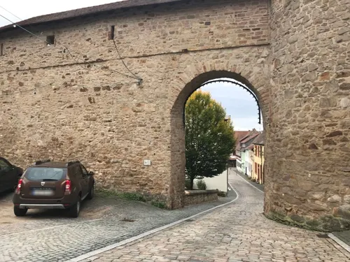
Vinoteca Dai Romani
Restaurant · Italian
11 Am Wehrgang, Kirchheimbolanden
Tu-Sa 11:00-14:00, 17:30-22:00; Su 11:00-22:00
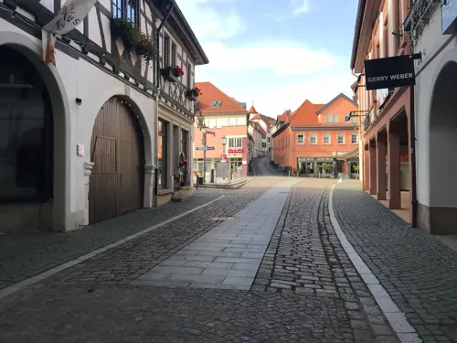
Restaurant Zur Mälzerei
Restaurant
2 Dr.-Edeltraud-Sießl-Allee
Mo, Th-Sa 17:30-22:00; Tu, We off; Su 11:30-15:00, 17:00-22:00
BistroITALY
Restaurant · Italian
1a Gartenstrasse
Mo, Tu, Th-Su 17:00-22:00; Sa, Su 11:00-14:00

Akropolis
Restaurant · Greek
9 Edenbornerstraße, Kirchheimbolanden
Tu-Th 11:30-14:30, 17:30-23:00; Fr-Sa 17:30-23:00; Su 11:30-14:30,...
35 more on the map.
History
The place Kirchheim was first mentioned in 774, later it belonged to the Lords of Bolanden.
It is mentioned in the Wormser wall-building ordinance from around 900 as one of the places that shared responsibility for maintaining the city wall of Worms. At the end of the 13th century, Kirchheim was inherited by the Sponheim branch line Bolanden-Dannenfels. Count Heinrich II. Von Sponheim-Bolanden raised the village to a town in 1368 and made it his residence. Via his granddaughter Anna von Hohenlohe († 1410) and her husband Philipp I, Count of Nassau-Weilburg, Kirchheimbolanden and the entire Sponheim-Bolander family property finally fell to the Nassau House, which owned it until the end of the feudal period.
Charles August, Prince of Nassau-Weilburg moved his residence from Weilburg to Kirchheim in 1737. Charles Christian, Prince of Nassau-Weilburg temporarily owned his own infantry regiment (1755–1759) in Mannheim with the Elector of the Electoral Palatinate and was temporarily general of the Netherlands, where he was governor. Frederick William, Prince of Nassau-Weilburg (1788–1816) left the city in 1793 because of the French Revolution and went to Bayreuth. This ended the time as the royal seat for Kirchheimbolanden, then only called Kirchheim.
Read more of the history
It experienced its greatest heyday under Prince Charles August (1719–1753) and especially under Carl Christian (1753–1788) of the House of Nassau-Weilburg and his wife Princess Carolina of Orange-Nassau.
After 1792, French revolutionary troops occupied the region and after the Treaty of Campo Formio (1797), annexed the left bank of the Rhine. From 1798 to 1814, Kirchheim belonged to the French department of Donnersberg and was the main town (chef-lieu) of the canton of the same name.
Due to the agreements made at the Congress of Vienna (1815) and an exchange contract with Austria, the region became part of the Kingdom of Bavaria in 1816. From 1818, Kirchheim was the seat of a land commissioner in the Bavarian Rhine circle.
When the Rhenish Hessian Legion hurriedly evacuated Kirchheim from a Prussian overwhelming power during the Palatinate uprising on 14 June 1849, Palatine militants remained in the palace garden without notification. In the battle of Kirchheimbolanden in the presence of the Prince of Prussia, 17 militants were killed.
From 1939, the place was part of and administrative seat of the district of the same name. After the Second World War, Kirchheimbolanden became part of the then newly formed state of Rhineland-Palatinate, within the French occupation zone. In the course of the first Rhineland-Palatinate administrative reform, the city moved in 1969 to the newly formed Donnersbergkreis and its seat; three years later, Kirchheimbolanden was incorporated into the also newly created community of the same name.
From the History section of Kirchheimbolanden on Wikipedia, under CC BY-SA 4.0.
More about Kirchheimbolanden
Geography
Kirchheimbolanden lies in the Palatinate at the transition point of the Nordpfälzer Bergland to the Alzeyer Hügelland bordering to the east. The city centre is located about four kilometres (as the crow flies) northeast of Donnersberg on the slope of Wartberg, also known as Schillerhain. The Leiselsbach, a left tributary of the Pfrimm, rises in the urban area. The lowest point lies at 229 m above sea level, the highest at 496 m above sea level.
The highest point of the district is the summit of the 502 meter high Eichelberg in the far west, further east the 430.7 meter high Kuhkopf extends. The development is on the slope of the Wartberg, alternatively called Schillerhain. In the northwest of the district rises the 399.7 meter high Albertskreuz and northwest of the settlement area the 354.1 meter high Steinkopf. The Hungerberg range of hills, up to 302 meters high, is located in the southeast.
Kirchheimbolanden is divided into the city centre with the district Haide and the districts Ambach, Bolanderhof, Edenbornerhof, Hessenhütte, Neuhof, Rothenkircherhof and Schillerhain Further places of residence are railway station 2262, Brunnenberg, brickworks Ebert, Kohlhütte and Ziegelhütte.
From the Wikipedia article Kirchheimbolanden, under CC BY-SA 4.0.
Where to stay5
Churches and places of worship17
Protestantische Pfarrkirche
Church · Protestant · 4.1 km
32 Hauptstraße, Gauersheim
Protestantische Pfarrkirche
Church · Protestant · 3.8 km
12 Kirchstraße, Marnheim
Shopping9
Gas and EV charging5
Schools, colleges and libraries11
Georg-von-Neumayer-Schule Realschuleplus
School · 0.9 km
47 Dr.-Heinrich-von-Brunck-Straße, Kirchheimbolanden
Healthcare5
Map of Kirchheimbolanden
159 places. The map loads OpenStreetMap tiles when you open it.
Getting there and nearby towns
Ramstein Air Base (RMS) is the nearest airport with scheduled flights listed in OpenStreetMap, 39 km away.
- Alzey 12 km northeast, about 12 min by car
- Eisenberg 12 km south, about 12 min by car
- Rockenhausen 14 km west, about 14 min by car
- Grünstadt 15 km southeast, about 15 min by car
- Winnweiler 16 km southwest, about 16 min by car
- Herxheim am Berg 21 km southeast, about 21 min by car
- Bad Kreuznach 23 km northwest, about 23 min by car
- Wörrstadt 22 km north, about 22 min by car
- Osthofen 23 km east, about 23 min by car
- Worms 25 km east, about 25 min by car
Drive times are estimates from straight-line distance, not routes.
Towns near Kirchheimbolanden


Local news
Headlines from INDB.
Reviews, tips and questions
Loading what members have shared...
Sources and licences
- GeoNames (CC BY 4.0): population, coordinates, regions and time zone
- Mapillary (see each image): photos
- OpenStreetMap contributors (ODbL 1.0): places, airports, map data
- Wikidata (CC0 1.0): elevation, founding date, time zone, website, landmarks and historic places
- Wikimedia Commons (see each image): photos
- Wikipedia (CC BY-SA 4.0): overview and history text
Photo credits
- KirchheimbolandenGrauerTurm, Mussklprozz, CC BY-SA 3.0
- Kirchheimbolanden, die Straße Vorstadt, Dguendel, CC BY 3.0
- Kirchheimbolanden – Vorstadt - Mozartbrunnen - panoramio, giggel, CC BY 3.0
- Kirchheimbolanden, die Neue Allee, Dguendel, CC BY 3.0
- Kirchheimbolanden, die Straße Vorstadt (Norwestende), der Vorstadtturm, Dguendel, CC BY 3.0
- Kirchheimbolanden BW 2012-10-23 14-10-01, Berthold Werner, CC BY-SA 3.0
- Kirchheimbolanden - Vorstadtturm - panoramio, Edgar El, CC BY 3.0
- Kirchheimbolanden, die Turmschänke, Dguendel, CC BY 3.0
- Kirchheimbolanden – Vorstadtturm – Unteres Stadttor - panoramio, giggel, CC BY 3.0
- Kirchheimbolanden BW 2012-10-23 14-11-16, Berthold Werner, CC BY-SA 3.0
- Kirchheimbolanden, die Straße Am Wehrgang, Roter Turm, Dguendel, CC BY 3.0
- Kirchheimbolanden – Keiler als Wappentier - panoramio, Edgar El, CC BY 3.0
- Kirchheimbolanden - Drey Kronen-Brauhaus am Turm - panoramio, giggel, CC BY 3.0
- Kirchheimbolanden, der Römerplatz-2, Dguendel, CC BY 3.0
- Kirchheimbolanden – der Keiler ist das Wappentier – Bronzeplastik von Martin Mayer - panoramio (1), giggel, CC BY 3.0
- Kirchheimbolanden – der Keiler ist das Wappentier – Bronzeplastik von Martin Mayer - panoramio, giggel, CC BY 3.0
- Kirchheimbolanden, die Häuser Am Wehrgang 11 und 13, Roter Turm, Dguendel, CC BY 3.0
- Kirchheimbolanden BW 2012-10-23 14-09-02, Berthold Werner, CC BY-SA 3.0
- Kirchheimbolanden, die Hofschänke, Dguendel, CC BY 3.0
- Kirchheimbolanden BW 2012-10-23 14-16-34, Berthold Werner, CC BY-SA 3.0
- Vorstadtturm Kirchheimbolanden, Alberto, CC BY 2.0
- Kirchheimbolanden – Hofschänke, Am Wehrgang 11 - panoramio, giggel, CC BY 3.0
- Kirchheimbolanden – Römerplatz und Vorstadtturm - panoramio, Edgar El, CC BY 3.0
- Roter Turm (Kirchheimbolanden)-02-Tafel, Muck, CC BY-SA 4.0
- Stadtmauer (Kirchheimbolanden)-01, Muck, CC BY-SA 4.0
- Roter Turm (Kirchheimbolanden)-01, Muck, CC BY-SA 4.0
- Stadtmauer (Kirchheimbolanden)-04-Tafel, Muck, CC BY-SA 4.0
- Kirchheimbolanden, die Schlossstraße (Südteil), Dguendel, CC BY 3.0
- Kirchheimbolanden - Stadtmauer - Wehrgang - panoramio, Edgar El, CC BY 3.0
- Kirchheimbolanden, die Langstraße, Dguendel, CC BY 3.0
- Kirchheimbolanden BW 2012-10-23 14-13-04 1, Berthold Werner, CC BY-SA 3.0
- Kirchheimbolanden BW 2012-10-23 14-17-28, Berthold Werner, CC BY-SA 3.0
- Kirchheimbolanden, der Rote Turm, Dguendel, CC BY 3.0
- Pfrimmtalviadukt01, User:Kandschwar, CC BY-SA 3.0
- KirchheimbolandenPaulskirche, Mussklprozz, CC BY-SA 3.0
- Mennonitenkirche Weierhof 01, Sokkok, CC BY-SA 3.0
- 2009.08.14.122052 Peterskirche Kirchheimbolanden, Hermann Luyken, CC BY-SA 3.0
- 2009.08.14.103405 Schloss Kirchheimbolanden, Hermann Luyken, CC BY-SA 3.0
- Schwarzfels am Donnersberg, F835, CC0
- Katholische Kirche Bolanden, Hyperboreas1, CC BY-SA 3.0
- Ehemaliges Stadtpalais - Detailansicht, Dguendel, CC BY-SA 3.0
- Gauersheim Protestantische Kirche, Altera levatur, CC BY-SA 4.0
- Evangelische Kirche Bolanden, Hyperboreas1, CC BY-SA 3.0
- Bischheim+Protestantische+Kirche, PhilEOS, CC BY-SA 4.0
- Wartturm (Kirchheimbolanden) 1, Muck, CC BY-SA 4.0
- Schneckenturm 1, Muck, CC BY-SA 4.0
- Marnheim, Unknown author Unknown author, Public domain
- Wasserturm (Kirchheimbolanden) 1, Muck, CC BY-SA 4.0
- Grauer-Turm-Kirchheim-Bolanden-01, Immanuel Giel, CC BY-SA 3.0
- Kirchheimbolanden BW 2012-10-23 14-18-06, Berthold Werner, CC BY-SA 3.0
- NSG-Kibo-1, PhilEOS, CC BY-SA 4.0
- Kirchheimbolanden BW 2012-10-23 14-31-50, Berthold Werner, CC BY-SA 3.0
- Protestantische Kirche Rittersheim, Marco Merz 94, CC BY-SA 4.0
- Gymnasium Weierhof, Hyperboreas1, CC BY-SA 3.0
- Street-level photo, miguel_andrade, CC BY-SA 4.0
- Street-level photo, VIA_CH, CC BY-SA 4.0
- Street-level photo, cello, CC BY-SA 4.0
- Street-level photo, wegavision, CC BY-SA 4.0
- Street-level photo, VIA_CH, CC BY-SA 4.0
- Street-level photo, NorMan61, CC BY-SA 4.0
- Street-level photo, mrdonut261, CC BY-SA 4.0
- Street-level photo, VIA_CH, CC BY-SA 4.0
- Street-level photo, miguel_andrade, CC BY-SA 4.0
- Street-level photo, wegavision, CC BY-SA 4.0
- Street-level photo, ramap, CC BY-SA 4.0
- Street-level photo, VIA_CH, CC BY-SA 4.0
- Street-level photo, mrdonut261, CC BY-SA 4.0
- Street-level photo, VIA_CH, CC BY-SA 4.0
- Street-level photo, mrdonut261, CC BY-SA 4.0
- Street-level photo, VIA_CH, CC BY-SA 4.0
- Street-level photo, mrdonut261, CC BY-SA 4.0
- Street-level photo, wegavision, CC BY-SA 4.0
- Street-level photo, VIA_CH, CC BY-SA 4.0
- Street-level photo, VIA_CH, CC BY-SA 4.0
- Street-level photo, VIA_CH, CC BY-SA 4.0
- Street-level photo, VIA_CH, CC BY-SA 4.0
- Street-level photo, mrdonut261, CC BY-SA 4.0
- Street-level photo, VIA_CH, CC BY-SA 4.0
- Street-level photo, VIA_CH, CC BY-SA 4.0
- Street-level photo, mrdonut261, CC BY-SA 4.0
- Street-level photo, mrdonut261, CC BY-SA 4.0
- Street-level photo, wegavision, CC BY-SA 4.0
- Street-level photo, VIA_CH, CC BY-SA 4.0
- Street-level photo, NorMan61, CC BY-SA 4.0
- Street-level photo, mrdonut261, CC BY-SA 4.0


Page built November 9, 2026. Spotted a mistake? Tell us or suggest a place.