


Why visit Osthofen
Townapedia lists 25 museums and landmarks, 19 parks and trails, 66 places to eat, 9 places to stay and 6 attractions in and around town.
Highlights include Rhine Bridge (Worms), Heimatmuseum Osthofen, KZ Lager Osthofen and Der Spieß - An der Spießbrücke.
Weather in Osthofen
Forecast from MET Norway (CC BY 4.0). Full forecast
About Osthofen
Osthofen (German: [ˈɔstˌhoːfn̩] ) is a town in the middle of the Wonnegau in the Alzey-Worms district in Rhineland-Palatinate, Germany. Since 1 July 2014 it is part of the Verbandsgemeinde (a kind of collective municipality) Wonnegau. Osthofen was raised to town on 24 October 1970.
From the Wikipedia article Osthofen (this version), under CC BY-SA 4.0.
Photos of Osthofen


Things to do6


Leckzapfen
Scenic view
Weinbergshaus, neugotischer burgartiger Klinkerbau, Rundturm, zweite Hälfte des 19. Jahrhunderts
1 Bechtheimer Hohl, Osthofen


Museums and landmarks25
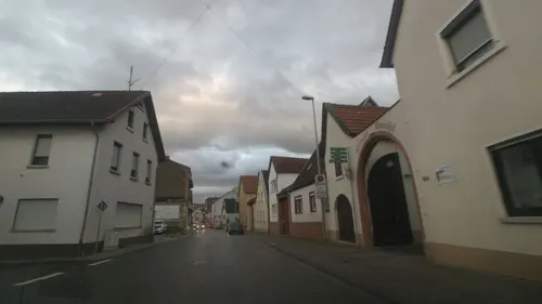

KZ Lager Osthofen
Monument and historic site
Bronzetafel an der Außenwand in der Nähe der Straße. Größe ca. 50 x 50 cm. Die Tafel wurde von der Lagergeeinschaft 1978 aufgehängt,...




XIV
Monument and historic site · 3.6 km
Kreuzweg zum Klausenberg||14 Granitstelen mit Bronzebildern nach|Entwürfen von Walther Mellmann|Errichtet im Oktober 2007||Heimatverein...
13 more on the map.
Parks, trails and playgrounds19





7 more on the map.
Restaurants and cafes66
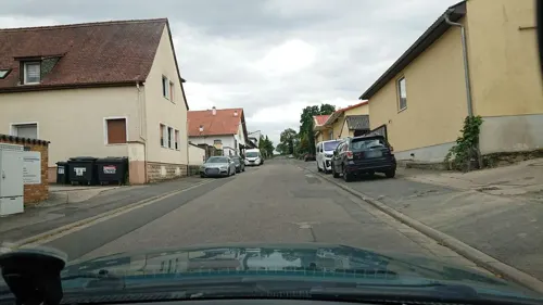
Bechtheimer Hof
Restaurant · German · 3.1 km
16 Kuhpfortenstraße, Bechtheim
Mo,Th,Fr,Sa 17:00-22:00; Su 11:00-21:00
Ristorante Amalfi
Restaurant · Italian
1 Bahnhofstraße, Osthofen
Tu-Su 12:00-14:00,17:30-22:00; Mo off
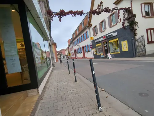
Weingasthof Zum weißen Roß
Restaurant · German
50 Friedrich-Ebert-Straße
We-Sa 18:00+; Su 12:00-14:30,18:00-21:30
Vis à Vis Weinbar und Restaurant
Restaurant
53 Friedrich-Ebert-Straße
We-Sa 18:00-22:00,Su 17:00-22:00

Dogan Grillhaus & Pizzeria
Restaurant · Kebab
2 Friedrich-Ebert-Straße
Mo-Sa 11:00-22:00; Su 12:00-22:00

Weingut Grittmann
Brewery and winery · 1.2 km
32 Alter Westhofer Weg
Mo-Fr 08:00-12:00,14:00-18:00; Sa 08:00-12:00
Weingut Spiess
Brewery and winery · 3.5 km
2 Gaustraße, Bechtheim
Mo-Fr 08:00-12:00,13:00-18:00; Sa 08:00-12:00,13:00-16:30
54 more on the map.
History
Archaeological finds have established that the Osthofen municipal area was already settled at least four thousand years ago. The town had its first documentary mention in the Lorsch codex as Ostowa in a document dated to 784. It is believed that Osthofen was founded by people from either the now amalgamated village of Mühlheim or the Merovingian royal palace that once stood in Worms-Neuhausen.
On Osthofen's Goldberg (mountain), a chapel to Saint Remigius might have been built as early as the 6th century. This is where the first major estate was, which by 1195 had grown into an Imperial castle. In Mühlheim, the Knights Templar likewise built a castle in 12/15.
From 1933 to 1934, the city was home to a concentration camp which provides the subject for the novel The Seventh Cross by Anna Seghers.
From the History section of Osthofen on Wikipedia, under CC BY-SA 4.0.
More about Osthofen
Geography
The town lies in Rhenish Hesse where the river Seebach, a very short river that rises in neighbouring Westhofen and flows for only 9 km, empties into the Rhine.
Economy
Osthofen is a state-recognized tourism centre, and under state planning also identified as a lower centre.
Osthofen has at its disposal a railway station with a connection to the Mainz–Ludwigshafen line. Formerly there were connections to the Osthofen–Rheindürkheim–Guntersblum line (on which there is still goods traffic as far as Worms-Rheindürkheim), the Osthofen–Westhofen line (locally known as the Gickelche) and the Osthofen–Gau-Odernheim line. The last two have since been torn up.
Nearby is also an Autobahn interchange onto the A 61, and towards the Rhine lies Bundesstraße 9.
Osthofen belongs to the Wonnegau winegrowing zone in Rhenish Hesse. Within the town, 35 winegrowing businesses are active, and the planted vineyard area amounts to 465 ha. Some 68% of the wine made here is from white wine varieties (as at 2007). In 1979, there were still 116 such active businesses, but the planted vineyard area amounted to only 429 ha.
The town is the location of the former Osthofen concentration camp, and a memorial site is found there today.
Arts and culture
The Evangelical Bergkirche (“Mountain Church”) is believed to have stemmed from a chapel to Saint Remigius built in the 6th century beside which grew into an estate fortified with a castle over the course of the ages. Today's church grew out of the castle and the chapel, with the churchtower, it is further believed, standing on the old keep’s foundations. The castle was converted many times, acquiring its current shape after a fire in the 19th century.
Saint John’s Catholic Church (Johanniskirche) had its beginnings in a temple of the Order of Saint John, and in 1713 it was transferred to the Catholic parish (the Order is Protestant), which radically converted the building in 1792. The church’s altar was originally to be found in the Carmelite church in Worms.
The Town Hall (Rathaus) was built in 1902 as a financial office.
The Old Town Hall (Altes Rathaus) was built in 1739 as the town’s second town hall.
Into the so-called “Little Church” (Kleine Kirche), which directly neighbours the Old Town Hall, parts of the first town hall from 1581 have been incorporated.
The Waterworks (Wasserwerk) from 1906 has a striking façade with Art Nouveau and Baroque Revival elements.
The Jewish graveyard on Mettenheimer Chaussee was laid out in 1832 and is a memorial to the town's Jewish community.
From the Wikipedia article Osthofen, under CC BY-SA 4.0.
Where to stay9
Churches and places of worship17
St.-Michaels-Kapelle (Klausenbergkapelle)
Church · Roman Catholic · 3.6 km
33 Klausenbergstraße, Worms
St. Lambertus
Church · Roman Catholic · 3.4 km
5 Kirchgasse, Bechtheim
Budhistisches Retreatzentrum Altmühle der Karma Kagyü Linie
Place of worship · Tibetan · 2.4 km
8 Schleifgasse, Osthofen
Shopping7
Gas and EV charging4
Schools, colleges and libraries9
Healthcare2
Map of Osthofen
164 places. The map loads OpenStreetMap tiles when you open it.
Getting there and nearby towns
City-Airport Mannheim (MHG) is the nearest airport with scheduled flights listed in OpenStreetMap, 29 km away.
- Worms 8 km south, about 8 min by car
- Biblis 10 km east, about 10 min by car
- Bürstadt 12 km southeast, about 12 min by car
- Gernsheim 13 km northeast, about 13 min by car
- Bobenheim-Roxheim 13 km south, about 13 min by car
- Lampertheim 16 km southeast, about 16 min by car
- Alzey 16 km west, about 16 min by car
- Stockstadt am Rhein 16 km northeast, about 16 min by car
- Einhausen 16 km east, about 16 min by car
- Frankenthal 19 km south, about 19 min by car
Drive times are estimates from straight-line distance, not routes.
Towns near Osthofen


Local news
Headlines from INDB.
Reviews, tips and questions
Loading what members have shared...
Sources and licences
- GeoNames (CC BY 4.0): population, coordinates, regions and time zone
- Mapillary (see each image): photos
- OpenStreetMap contributors (ODbL 1.0): places, airports, map data
- Wikidata (CC0 1.0): elevation, founding date, time zone, website, landmarks and historic places
- Wikimedia Commons (see each image): photos
- Wikipedia (CC BY-SA 4.0): overview and history text
Photo credits
- Osthofen-altesrathaus, p.schmelzle, CC BY-SA 3.0
- Osthofen Wohnhauslage Schwerdstraße 13, Alfons Tewes, CC BY-SA 4.0
- Osthofen Stolperstein Schwerdstraße 13 Ludwig Ebert, Alfons Tewes, CC BY-SA 4.0
- Ansicht der Hofeinfahrt mit Kastanie am Ziegelhüttenweg, Osthofen, Naturdenkmal, Grauth, CC BY-SA 4.0
- Schnapp-Türmchen Osthofen, Muck, CC BY-SA 4.0
- Rotes Häuschen Osthofen, Muck, CC BY-SA 4.0
- Wasserbehälter Osthofen, Muck, CC BY-SA 4.0
- Wasserbehälter Osthofen-2, Muck, CC BY-SA 4.0
- 2014.06.22.121051 Lacerta agilis (dead) Zauneidechse Sand Lizard Osthofen, Hermann Luyken, CC0
- 2014.06.22.120750 Melanargia galathea Osthofen, Hermann Luyken, CC0
- 2014.06.22.120800 Melanargia galathea Osthofen, Hermann Luyken, CC0
- 2014.06.22.120510 Melanargia galathea Osthofen, Hermann Luyken, CC0
- 2014.06.22.120536 Melanargia galathea Osthofen, Hermann Luyken, CC0
- 2014.06.22.120534 Melanargia galathea Osthofen, Hermann Luyken, CC0
- 2014.06.22.120617 Unidentified butterfly Osthofen, Hermann Luyken, CC BY-SA 3.0
- 2014.06.22.120627 Unidentified butterfly Osthofen, Hermann Luyken, CC0
- 2014.06.22.120348 Melanargia galathea Osthofen, Hermann Luyken, CC0
- 2014.06.22.120353 Melanargia galathea Osthofen, Hermann Luyken, CC0
- 2014.06.22.120400 Unidentified butterfly Osthofen, Hermann Luyken, CC0
- 2014.06.22.120136 Pararge aegeria Osthofen, Hermann Luyken, CC0
- 2014.06.22.120015 Pararge aegeria Osthofen, Hermann Luyken, CC0
- 2014.06.22.120004 Pararge aegeria Osthofen, Hermann Luyken, CC0
- Weißes Häuschen Osthofen, Muck, CC BY-SA 4.0
- 2014.06.22.112304 Wheat field Osthofen, Hermann Luyken, CC0
- Worms Bruecke 02, Armin Kübelbeck -- Kuebi 16:55, 27 May 2007 (UTC), CC BY-SA 3.0
- Basilika St. Lambert, Symposiarch, CC BY-SA 3.0
- Osthofen-bergkirche, p.schmelzle, CC BY-SA 3.0
- Worms-Abenheim, Klausenbergkapelle, von Osten, Pratz53, CC BY-SA 4.0
- Hungerstein Elbe-bei-Pirna, Sastognuti, Public domain
- Entrance of a concentration camp memorial, Mahabalaindia, CC BY-SA 4.0
- Osthofen-10, Immanuel Giel, CC BY-SA 3.0
- Goldbach Mettenheim 3, Immanuel Giel, CC BY-SA 4.0
- Evangelische Kirche Bechtheim 01, Immanuel Giel, CC BY-SA 4.0
- Osthofen 02, Immanuel Giel, CC BY-SA 4.0
- Simultankirche Rheindürkheim a, Hyperboreas1, CC BY-SA 3.0
- Worms-Abenheim Katholische Kirche 20101012, Rudolf Stricker, Attribution
- KZ Osthofen, Schlafräume, Gripweed, CC BY-SA 3.0
- 20160514Der Spiess - An der Spiessbruecke1, AnRo0002, CC0
- Herrnsheimer Schlosspark, PQ3, CC BY-SA 3.0
- Hungerstein in Decin (21), Dr. Bernd Gross, CC BY-SA 3.0
- Leckzapfen Okt. 2013, Alantope ( Diskussion ), CC BY-SA 3.0
- Street-level photo, miguel_andrade, CC BY-SA 4.0
- Street-level photo, miguel_andrade, CC BY-SA 4.0
- Street-level photo, wegavision, CC BY-SA 4.0
- Street-level photo, wegavision, CC BY-SA 4.0
- Street-level photo, ramap, CC BY-SA 4.0
- Street-level photo, wegavision, CC BY-SA 4.0
- Street-level photo, mfa, CC BY-SA 4.0
- Street-level photo, eliasqweer, CC BY-SA 4.0
- Street-level photo, mfa, CC BY-SA 4.0
- Street-level photo, mfa, CC BY-SA 4.0
- Street-level photo, wegavision, CC BY-SA 4.0
- Street-level photo, miguel_andrade, CC BY-SA 4.0
- Street-level photo, miguel_andrade, CC BY-SA 4.0
- Street-level photo, wegavision, CC BY-SA 4.0
- Street-level photo, ramap, CC BY-SA 4.0
- Street-level photo, miguel_andrade, CC BY-SA 4.0
- Street-level photo, ramap, CC BY-SA 4.0
- Street-level photo, miguel_andrade, CC BY-SA 4.0
- Street-level photo, b166er, CC BY-SA 4.0
- Street-level photo, ramap, CC BY-SA 4.0


Page built November 9, 2026. Spotted a mistake? Tell us or suggest a place.