


Klingenberg am Main, Germany
Klingenberg am Main is a town of 6,294 people in Bavaria, Germany.
Why visit Klingenberg am Main
Townapedia lists 67 museums and landmarks, 18 parks and trails, 107 places to eat, 18 places to stay and 11 attractions in and around town.
Highlights include Kino Passage, Aussichtsturm Klingenberg, Weinbau- und Heimatmuseum and Bürgerhaus.
Weather in Klingenberg am Main
Forecast from MET Norway (CC BY 4.0). Full forecast
About Klingenberg am Main
Klingenberg am Main (German pronunciation: [ˈklɪŋənˌbɛʁk ʔam ˈmaɪn], lit. 'Klingenberg on the Main') is a town in the Miltenberg district in the Regierungsbezirk of Lower Franconia (Unterfranken) in Bavaria, Germany. It has a population of around 6,200 and is located on both banks of the river Main.
From the Wikipedia article Klingenberg am Main (this version), under CC BY-SA 4.0.
Things to do11
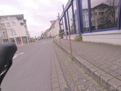
Kino Passage
Cinema and theater · 2.7 km
37 Bahnstraße, Erlenbach am Main
17:00+; Oct-Mar Su 10:00+ "Matinee"

Aussichtsturm Klingenberg
Scenic view · 0.9 km
Schlanker Turm mit geböschten Kanten und vorkragendem Zinnenkranz mit seitlichem ebenfalls zinnenbekröntem Scharwachttürmchen,...


Museums and landmarks67
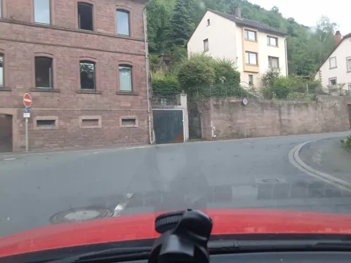
Weinbau- und Heimatmuseum
Museum
13a Wilhelmstraße, Klingenberg a.Main
Apr-Oct: Sa,Su,PH 14:00-17:00 "und nach Vereinbarung"



Numeruskastell Wörth
Monument and historic site · 3.1 km
Römisches Numeruskastell (ORL 36) am Beginn des Odenwaldlimes (ältere Limeslinie). Nutzung ca. 100-160 n. Chr.) Areal als schwache...

Dauerausstellung Römerzeit
Museum · 2.1 km
Sa,Su 14:00-17:00 "in Absprache mit der Museumsaufsicht im...

Upper German-Raetian Limes
Monument and historic site · 2.1 km
Portion of the Roman limes in Germany

ehem. Bunker 315
Monument and historic site · 3.9 km
Bunker 315 der Befestigungslinie - "Wetterau-Main-Tauber-Stellung"

ehem. Bunker 316
Monument and historic site · 4.1 km
Bunker 316 der Befestigungslinie - "Wetterau-Main-Tauber-Stellung"

ehem. Bunker 317
Monument and historic site · 4.0 km
Bunker 317 der Befestigungslinie - "Wetterau-Main-Tauber-Stellung"

ehem. Bunker 318
Monument and historic site · 3.5 km
Bunker 318 der Befestigungslinie - "Wetterau-Main-Tauber-Stellung"
55 more on the map.
Parks, trails and playgrounds18


6 more on the map.
Restaurants and cafes107

Carambolage
Restaurant · Burger, Pizza, German, Italian · 1.6 km
Bistro und Billard-Café
45 Frühlingstraße, Klingenberg a.Main
Mo-Th 16:00-22:00; Fr 16:00-01:00; Sa 11:00-01:00; Su 11:00-23:00;...
Mother India Restaurant
Restaurant · Indian
Indische Küche mit Biergarten
1 Hofstraße, Klingenberg am Main
Mo-Su 11:00-14:30; Mo-Su 17:00-22:00; Tu off
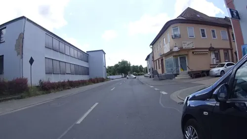
Zum Steinofen
Restaurant · Pizza · 1.9 km
Pizza und Grillspezialitäten
Landstraße, Wörth am Main
Tu-Sa 17:00-23:00; Su,PH 12:00-14:00,17:00-23:00
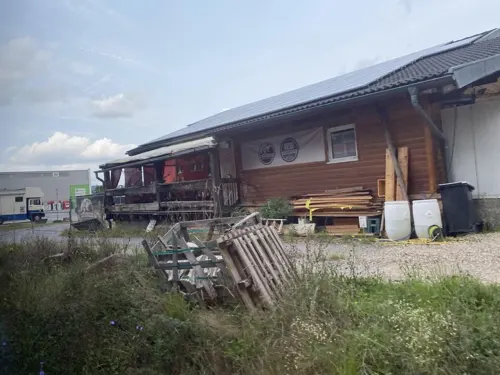
"Alte Güterhalle" am Gleis
Restaurant · Regional · 2.0 km
22 Luxburgstraße, Wörth am Main
"nur bei Veranstaltungen geöffnet"
Adria
Restaurant · Regional, Pizza, German
3 Rathausstraße, Klingenberg am Main
Mo,Tu,Fr,Sa 17:00-21:30; Su,PH 11:30-14:00;17:00-21:00; We,Th off
Alexanders Burgterrasse Clingenburg
Restaurant · Regional
5 Clingenburgstraße, Klingenberg am Main
We-Fr 16:00-21:00; Sa,Su,PH 12:00-21:00
DJK Ratskeller
Restaurant · Croatian, German · 1.9 km
6a Pfarrer-Adam-Haus-Straße, Wörth am Main
Mo-Sa 17:00-24:00; Su,PH 10:30-14:00,17:00-24:00; We off
Goldene Krone
Restaurant · Italian, Regional · 2.1 km
12 Landstraße, Wörth am Main
11:30-14:00, 17:00-24:00; Tu off
Hofstadel
Restaurant · Regional · 3.7 km
5 Siedlerhof, Mönchberg
Jan 01-15,Feb 01-15,Mar 01-15,Apr 01-15,May 01-15,Jun 01-15,Jul...

Ido Gelato
Cafe · Cake, Coffee Shop, Ice Cream · 0.6 km
31 Trennfurter Straße, Klingenberg am Main
Mo-Su 11:00-21:00
Mainterrasse
Restaurant · German, Thai · 1.3 km
124 Wilhelmstraße, Klingenberg am Main
Mo off; Tu 17:00-22:00; We 11:00-12:00,17:00-22:00; Th-Sa...
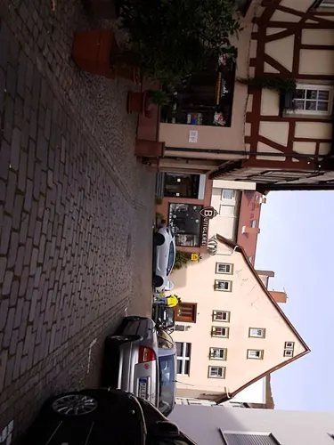


Ristorante Pizzeria Al Castello
Restaurant · Italian, Pizza
16 Hauptstraße, Klingenberg am Main
Tu-Su 11:30-14:00,17:00-22:00
95 more on the map.
History
A Roman worship stone, an early mediaeval circular rampart and the Grubinger Kirchhof (churchyard) on the road to Großheubach, likely going back to Alamannic times, are the oldest witnesses to Klingenberg's history. In the 2nd century, the Romans built the border fortifications of the Limes Germanicus through Germany, which ran along the Trennfurt side of the Main. The limes was strengthened with a fort in Trennfurt.
In 1100, a nobleman named Heinrich named himself after the old Clingenburg (castle). He belonged to the noble family of Reginbodo.
The Staufen-era Clingenburg was built around 1170 by Conradus Colbo, who was cup-bearer to Emperor Friedrich Barbarossa.
About 1250, the Bickenbach noble family moved into the castle; the Bickenbachs later held many influential offices in the Holy Roman Empire and many a time turned up in Imperial politics as brokers. In Bickenbach times, the town of Klingenberg beneath the castle had its first documentary mention, namely in 1276.
After the Bickenbachs died out in 1500, the town, castle and lordly domain passed to the Archbishop of Mainz. In 1552, Klingenberg's old town, like many other towns, was almost completely destroyed by the Albert Alcibiades, Margrave of Brandenburg-Kulmbach in the Second Margrave War. In the years that followed there was reconstruction.
From the History section of Klingenberg am Main on Wikipedia, under CC BY-SA 4.0.
Where to stay18
Churches and places of worship28
Shopping16
Gas and EV charging6
Schools, colleges and libraries13
Helios Berufsfachschule für Gesundheits- und Krankenpflege "Sankt Hildegard"
School · 3.3 km
50 Krankenhausstraße, Erlenbach am Main
BRK Berufsfachschule für Altenpflege und Altenpflegehilfe
School · 3.3 km
50 Krankenhausstraße, Erlenbach am Main
Healthcare5
Map of Klingenberg am Main
250 places. The map loads OpenStreetMap tiles when you open it.
Getting there and nearby towns
Frankfurt Airport (FRA) is the nearest airport with scheduled flights listed in OpenStreetMap, 53 km away.
- Mömlingen 11 km northwest, about 11 min by car
- Höchst im Odenwald 13 km west, about 13 min by car
- Großostheim 17 km northwest, about 17 min by car
- Michelstadt 18 km southwest, about 18 min by car
- Erbach 19 km southwest, about 19 min by car
- Groß-Umstadt 20 km northwest, about 20 min by car
- Aschaffenburg 21 km north, about 21 min by car
- Wertheim 24 km east, about 24 min by car
- Goldbach 24 km north, about 24 min by car
- Hösbach 25 km north, about 25 min by car
Drive times are estimates from straight-line distance, not routes.
Local news
Headlines from INDB.
Reviews, tips and questions
Loading what members have shared...
Sources and licences
- GeoNames (CC BY 4.0): population, coordinates, regions and time zone
- Mapillary (see each image): photos
- OpenStreetMap contributors (ODbL 1.0): places, airports, map data
- Wikidata (CC0 1.0): elevation, founding date, time zone, website, landmarks and historic places
- Wikimedia Commons (see each image): photos
- Wikipedia (CC BY-SA 4.0): overview and history text
Photo credits
- Klingenberg am Main, stadszicht met die katholische Pfarrkirche Sankt Pankratius DmD-6-76-134-32 foto11 2016-08-08 15.20, Michielverbeek, CC BY-SA 4.0
- Heuneburg (Heunenhügel) - Klingenberg am Main - Seltenbachschlucht 01, Commander-pirx, CC BY-SA 4.0
- Heuneburg (Heunenhügel) - Klingenberg am Main - Seltenbachschlucht 02, Commander-pirx, CC BY-SA 4.0
- Holzwachturm am rätischen Limes (Rekonstruktion) - Wp12 77, Haselburg-müller, CC BY-SA 3.0
- Clingenburg 1, Presse03, CC BY-SA 3.0
- Schmachtenberg Kirche 14072012, Total number of my uploaded files : 1116, CC BY-SA 3.0
- Hermann-Staudinger-Gymnasium, Tonnenkopf30, CC BY-SA 4.0
- Wörth am Main, St Nikolaus 001, Mattana, CC BY-SA 3.0
- Katholische Pfarrkirche St. Josef, Parmesan01, CC BY-SA 4.0
- Klingenberg Kirche, Tilman AB, Public domain
- Woerth am Main Altes Rathaus2, Salino01, CC BY-SA 3.0
- Woerth am Main Altes Rathaus, Salino01, Public domain
- Josefs-Säule Wörth am Main, Salino01, CC BY 3.0
- Bunker 315 Erlenbach, Freak-Line-Community, CC BY-SA 4.0
- Bunker 316 Erlenbach, Freak-Line-Community, CC BY-SA 4.0
- Bunker 317 Erlenbach, Freak-Line-Community, CC BY-SA 4.0
- Bunker 318 Erlenbach, Freak-Line-Community, CC BY-SA 4.0
- Wörth am Main Wendelinuskapelle, Salino01, Public domain
- Pfarrkirche Mariä Himmelfahrt in Klingenberg-Röllfeld, Salino01, CC BY 3.0
- Klingenberg Evangelische Kirche, Salino01, Public domain
- Karte Deutsche Westbefestigungen vor Westwall, K. Jähne, Public domain
- St. Nikolaus, Woerth am Main2, Reinhard Dietrich, Public domain
- Pfarrkirche St Pankraz Klingenberg am Main, Salino01, CC BY 3.0
- Seltenbachmündung, Freak-Line-Community, CC BY-SA 3.0
- Bunker 326 Klingenberg, Freak-Line-Community, CC BY-SA 4.0
- Altstadt Klingenberg, K1008, CC0
- 750-Jahre-Beleuchtung Klingenberg, K1008, CC0
- Klingenberg StPankratius NE 225 IMG 20240309 1035, Karlunun, CC0
- Burgruine Clingenburg-02, Muck, CC BY-SA 4.0
- Clingenburg 01, Freak-Line-Community, CC BY-SA 4.0
- Klingenberg, Freak-Line-Community, CC BY-SA 3.0
- Clingenburg 04, Freak-Line-Community, CC BY-SA 4.0
- Burgruine Clingenburg-01, Muck, CC BY-SA 4.0
- Clingenburg 02, Freak-Line-Community, CC BY-SA 4.0
- Burgruine Clingenburg-03, Muck, CC BY-SA 4.0
- Klingenberg Stadtmauer SE 225 IMG 20240309 1050, Karlunun, CC0
- Clingenburg 03, Freak-Line-Community, CC BY-SA 4.0
- Burgruine Clingenburg-04-Infotafel, Muck, CC BY-SA 4.0
- Klingenberg Brunntorturm S 350 IMG 20240309 1108, Karlunun, CC0
- Seltenbach2, Freak-Line-Community, CC BY-SA 3.0
- Aussichtsturm Klingenberg-03, Muck, CC BY-SA 4.0
- Street-level photo, changchun1, CC BY-SA 4.0
- Street-level photo, VIA_CH, CC BY-SA 4.0
- Street-level photo, ramap, CC BY-SA 4.0
- Street-level photo, changchun1, CC BY-SA 4.0
- Street-level photo, changchun1, CC BY-SA 4.0
- Street-level photo, changchun1, CC BY-SA 4.0
- Street-level photo, changchun1, CC BY-SA 4.0
- Street-level photo, troher15, CC BY-SA 4.0
- Street-level photo, ramap, CC BY-SA 4.0
- Street-level photo, ramap, CC BY-SA 4.0
- Street-level photo, VIA_CH, CC BY-SA 4.0
- Street-level photo, ramap, CC BY-SA 4.0
- Street-level photo, changchun1, CC BY-SA 4.0
- Street-level photo, changchun1, CC BY-SA 4.0
- Street-level photo, ramap, CC BY-SA 4.0
- Street-level photo, changchun1, CC BY-SA 4.0
- Street-level photo, changchun1, CC BY-SA 4.0
- Street-level photo, troher15, CC BY-SA 4.0
- Street-level photo, changchun1, CC BY-SA 4.0
- Street-level photo, changchun1, CC BY-SA 4.0
- Street-level photo, ramap, CC BY-SA 4.0
- Street-level photo, ramap, CC BY-SA 4.0
- Street-level photo, ramap, CC BY-SA 4.0
- Street-level photo, VIA_CH, CC BY-SA 4.0
- Street-level photo, VIA_CH, CC BY-SA 4.0
- Street-level photo, VIA_CH, CC BY-SA 4.0


Page built November 9, 2026. Spotted a mistake? Tell us or suggest a place.