


Kreuztal, Germany
Kreuztal is a town of 31,772 people in North Rhine-Westphalia, Germany.
Why visit Kreuztal
Townapedia lists 73 museums and landmarks, 51 parks and trails, 92 places to eat, 10 places to stay and 54 attractions in and around town.
Highlights include Kindelsberg, Kindelsbergturm, Grube Brüche and Kronprinz Friedrich Wilhelm Erbstollen.
Weather in Kreuztal
Forecast from MET Norway (CC BY 4.0). Full forecast
About Kreuztal
Kreuztal (German pronunciation: [ˈkʁɔʏtsˌtaːl] ) is a town in the Siegen-Wittgenstein district, in North Rhine-Westphalia, Germany.
From the Wikipedia article Kreuztal (this version), under CC BY-SA 4.0.
Photos of Kreuztal


Things to do54


Biolandhof Eichenhof
Farm and orchard · 2.9 km
Bio-Angus-Rindfleisch, Honig, Apfel-/Birnensaft sowie Brot aus eigener Produktion; Vollsortiment-Bioladen
1 Eichenhof, Kreuztal
Th,Fr 10:00-13:00,15:00-19:00; Sa 10:00-13:00; PH off
Hof Heckseifen
Farm and orchard · 5.3 km
Bioland-Produkte aus eigener Herstellung (Milch, Gemüse, Kartoffeln, Getreide); außerdem Molkereiprodukte, Eier, Brot, Säfte, Weine
Hof Heckseifen, Siegen
Fr 14:00-18:00; Sa 10:00-14:00


42 more on the map.
Museums and landmarks73

Grube Brüche
Monument and historic site · 3.3 km
Stollenmundloch des Tiefen Stollens der ehemaligen Grube Brüche

Kronprinz Friedrich Wilhelm Erbstollen
Monument and historic site · 0.9 km
Portal Kronprinz-Friedrich-Wilhelm-Erbstollen


Crombacher Backes
Monument and historic site · 3.8 km
Crombacher Backes Am Alten Heck 2
2 Am Alten Heck, Kreuztal

Hof Berghaus
Monument and historic site · 3.9 km
Hof Berghaus und Backhaus
1 Hof Berghaus, Kreuztal

Schloss Junkernhees
Monument and historic site · 2.8 km
202 Heesstraße, Kreuztal

Eichener Straße
Monument and historic site · 1.5 km
Steinbrücke Eichener Straße

Heimatmuseum
Museum · 1.6 km
Heimatmuseum Ferndorfer Straße 62
62 Ferndorfer Straße, Kreuztal

Stadtverwaltung
Monument and historic site · 0.9 km
Ehemaliges Schulgebäude Roonstraße 19
19 Roonstraße, Kreuztal
61 more on the map.
Parks, trails and playgrounds51



39 more on the map.
Restaurants and cafes92
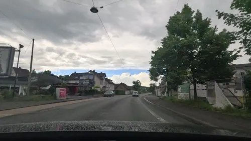
Ajeti Keksfabrikation
Cafe · Ice Cream, Waffle, Pastry · 2.3 km
176 Hagener Straße, Kreuztal
Mo-Sa 09:00-19:00; Su 12:00-19:00
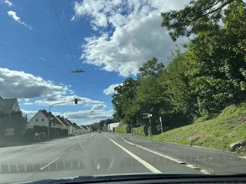
Bardolino
Restaurant · Mediterranean · 5.9 km
120 Wittgensteiner Straße, Hilchenbach
11:30+; Su-Th 11:30-22:00; Fr,Sa 11:30-23:00
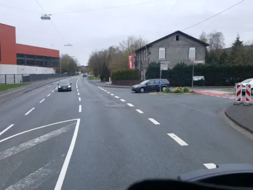
Hotel Restaurant Dahlbrucher Hof
Restaurant · Regional · 4.9 km
171 Wittgensteiner Straße, Hilchenbach
11:30-14:00,17:00+; We off
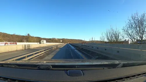
Olymp
Restaurant · Greek · 2.3 km
3 Langenauer Straße, Kreuztal
We-Sa 17:30-22:00; Su 11:30-14:30,17:30-21:00; Mo,Tu off

Der Stahlberg
Restaurant · Regional · 4.3 km
85 Hauptstraße, Hilchenbach
Th 17:00-23:00; Fr-Sa 17:00 - 01:00; Su 12:00 - 14:00, 17:30-23:00
La Piccola Bella Sicilia
Restaurant · Italian, Pasta, Pizza · 0.8 km
15 Marburger Straße, Kreuztal
Tu-Fr 11:30-13:30,17:00-21:00; Sa-Su,PH 17:00-21:00
Zum Kindelsberg
Restaurant · German · 2.7 km
1 Kindelsberg, Kreuztal
Th,Fr 17:00-23:00; Sa,Su,PH 11:00-23:00

80 more on the map.
History
The town of Kreuztal as it stands now is the child of the municipal reform of 1 January 1969. It came into being through the voluntary merger of the communities of Burgholdinghausen, Buschhütten, Eichen, Fellinghausen, Ferndorf, Kredenbach, Kreuztal, Krombach, Littfeld, Mittelhees, Oberhees and Osthelden.
The first documentary mentions go back to 1067, among which are found a place called "Berentraph", the later constituent community of Ferndorf, one of the earliest named places in the Siegerland. Until the town was founded, Ferndorf was the old Amt's namesake.
The constituent community of Ernsdorf was first mentioned in a document as "Erinstorff" in 1417-19. During the time of the Confederation of the Rhine, Ernsdorf was the local mayor's seat.
The name that the town now bears first cropped up in 1826 in the baptismal register of the community of Ferndorf.
Development in the town was sparked by the railway. In 1861, the Ruhr-Sieg line opened, leading Kreuztal to become a railway hub by 1880. Up to 1888, a spur to Erndtebrück, Bad Laasphe and Marburg was built. Also in the plans was a line to Olpe and Meinerzhagen, but this was only partly finished, as far as Krummenerl.
From the History section of Kreuztal on Wikipedia, under CC BY-SA 4.0.
More about Kreuztal
Geography
Kreuztal is a town in the low mountains of the northern Siegerland and lies at the western edge of the Rothaargebirge about 10 km north of Siegen.
Across the municipal area from the east flows the Ferndorfbach, swinging to the south in the inner town and leaving the municipal area through the constituent community of Buschhütten.
In the northern municipal area rises the Littfe, which then runs through the constituent communities of Burgholdinghausen, Littfeld, Krombach, Eichen and Fellinghausen before emptying into the Ferndorfbach in the inner town. Further tributary brooks to the Littfe are the Langebach, the Heimkäuser Bach, the Breitenbach, the Krombach, the Stendenbach and the Bockenbach.
In the town's west end rises the Heesbach, which then runs through the constituent communities of Oberhees, Mittelhees, Junkernhees and Fellinghausen, emptying into the Littfe at the footbridge. One tributary to the Hees is the Ostheldener Bach, which feeds the Robertsweier (pond). The Berghäuser Bach, which flows through the Berghäuser Weier (another pond), empties into the Ostheldener Bach downstream from the Robertsweier.
Economy
The municipal area is crossed from north to south by Federal Highway (Bundesstraße) B 54. Towards the south, running parallel to this road is also the B 54n, known as the Hüttentalstraße (HTS) and built as a Stadtautobahn (an Autobahn running through a built-up area). It connects the town with Autobahn A 45 to the south. Sometime in 2006, the B 54n is to be extended to Krombach in the north of the municipal area, where it will one day connect to the A 4, which is likewise under construction.
Eastwards run Federal Highways B 508 towards Hilchenbach and B 517 towards Kirchhundem and Lennestadt.
Arts and culture
At the Stadthalle, lying in the school centre, there are regular theatrical productions.
In Ferndorf is the local history museum (Heimatmuseum). On show here in about 200 m2 are finds from prehistory and early history, as well as handicrafts and exhibits about home décor in the 17th and 18th centuries.
On the Kindelsberg, the town's second highest peak at 618 m, stands the 22 m-high Kindelsbergturm (tower). It was built in 1907 by the Sauerländischer Gebirgsverein (Sauerland Mountain Club, or SGV) and has had further remodelling in the course of its history. From the top is a view over the municipal area, and in good weather, the viewer can even see into the Siebengebirge near Bonn.
The stately home of Junkernhees was originally built in 1523 by a Sir Adam (der Ritter Adam) with a moat around it. In 1698, it was expanded by being given a half-timbered gable. Two outbuildings, the former brandy distillery and the old mill from 1796, are also preserved.
This was built in the first half of the 13th century as Saint Lawrence's. It consists of a late Romanesque hall church with a western tower and a three-halled nave with a tower built before it.
Built in 1250, the main choir is one hall, and the nave two and a half. The pulpit was made in 1764 and the altar table in 1781. The tower that stands today was built in 1706, after the earlier tower was destroyed by a lightning strike.
From the Wikipedia article Kreuztal, under CC BY-SA 4.0.
Notable people from Kreuztal
 HauschkaGerman composer and pianist (born 1966)Photo: Bryan Berlin, CC BY-SA 4.0
 Johannes WinkelGerman politician (born 1991)Photo: Raimond Spekking, CC BY-SA 4.0
- Friedrich FlickGerman businessperson (1883-1972)
- Alma Siedhoff-BuscherGerman cabinetmaker and toy designer (1899–1944)
- Hans-Arnold StahlschmidtGerman World War II fighter pilot (1920–1942)
- Erwin DiekwischGerman pilot and Knight's Cross recipient (1920-2013)
Born in Kreuztal, according to Wikidata (CC0). Each name links to its Wikipedia article.
Where to stay10
Churches and places of worship49
Dörnschlade
Church · Roman Catholic · 6.8 km
50 Dörnschlader Weg, Wenden
St. Marien Geisweid
Church · Roman Catholic · 6.3 km
12 Hans-Böckler-Platz, Siegen
Shopping28
Gas and EV charging14
Schools, colleges and libraries32
Städtische Ernst-Moritz-Arndt-Realschule
School · 0.6 km
13 Hessengarten, Kreuztal
Adolf-Wurmbach-Grundschule Eichen / Teilstandort Eichen
School · 1.8 km
5 Schulstraße, Kreuztal
Healthcare10
MVZ Kreuztal-Kredenbach GmbH
Clinic and pharmacy · 3.2 km
47 Dr.-Stelbrink-Straße, Kreuztal
Map of Kreuztal
250 places. The map loads OpenStreetMap tiles when you open it.
Getting there and nearby towns
Siegerlandflughafen (SGE) is the nearest airport with scheduled flights listed in OpenStreetMap, 30 km away.
- Wenden 9 km west, about 9 min by car
- Hilchenbach 9 km east, about 9 min by car
- Netphen 10 km southeast, about 10 min by car
- Siegen 11 km south, about 11 min by car
- Freudenberg 11 km southwest, about 11 min by car
- Olpe 12 km northwest, about 12 min by car
- Kirchhundem 15 km northeast, about 15 min by car
- Drolshagen 16 km northwest, about 16 min by car
- Niederfischbach 16 km southwest, about 16 min by car
- Lennestadt 18 km north, about 18 min by car
Drive times are estimates from straight-line distance, not routes.
Towns near Kreuztal


Keep exploring
Local news
Headlines from INDB.
Reviews, tips and questions
Loading what members have shared...
Sources and licences
- GeoNames (CC BY 4.0): population, coordinates, regions and time zone
- Mapillary (see each image): photos
- OpenStreetMap contributors (ODbL 1.0): places, airports, map data
- Wikidata (CC0 1.0): elevation, founding date, time zone, website, landmarks and historic places
- Wikimedia Commons (see each image): photos
- Wikipedia (CC BY-SA 4.0): overview and history text
Photo credits
- Kreuztal Schloss Junkernhees, Bob Ionescu, Attribution
- Kreuztal Gelbe Villa, Bob Ionescu, Attribution
- Kreuztal – Friedrich-Wilhelm-Erbstollen 07, Bob Ionescu, Attribution
- Kreuztal Stollenhaus, Bob Ionescu, Attribution
- 490 In Kreuztal über Steine den Ferndorfbach überschreiten, um zum Bahnhof zu gelangen, Kersti, CC BY-SA 4.0
- Kreuztal Bhf and Alte lokschuppen, 3, Kevin Prince, CC BY-SA 2.0
- Kreuztal Bhf and Alte lokschuppen, 4, Kevin Prince, CC BY-SA 2.0
- Rail station at Kreuztal - panoramio, micovich, CC BY-SA 3.0
- Kreuztal Bhf and Alte lokschuppen, 2, Kevin Prince, CC BY-SA 2.0
- Kreuztal Bhf and Alte lokschuppen, Kevin Prince, CC BY-SA 2.0
- Kreuztal Ferndorfkirche, Bob Ionescu, Attribution
- KreuztalEichen schmiedeeisernesTor ehemaligerFriedhof, ThomasGerd, CC BY-SA 4.0
- KreuztalEichen Grabstaette GustavSchweisfurth ehemaligerFriedhof, ThomasGerd, CC BY-SA 4.0
- KreuztalEichen Grabstaette HAchenbach ehemaligerFriedhof, ThomasGerd, CC BY-SA 4.0
- KreuztalEichen Gruft Buerhaus ehemaligerFriedhof, ThomasGerd, CC BY-SA 4.0
- KreuztalEichen Grabstaette FuFSchweisfurth ehemaligerFriedhof, ThomasGerd, CC BY-SA 4.0
- 488 Schutzhütte am Weg vom Kindelsbergturm nach Kreuztal, Kersti, CC BY-SA 4.0
- 487 Schutzhütte am Weg vom Kindelsbergturm nach Kreuztal, Kersti, CC BY-SA 4.0
- 484 Weg vom Kindelsbergturm nach Kreuztal, Kersti, CC BY-SA 4.0
- 483 Weg vom Kindelsbergturm nach Kreuztal, Kersti, CC BY-SA 4.0
- Siegen Haardter Berg, PresseUniSiegen, CC BY-SA 4.0
- Kindelsberg von der HTS, Dbawwsnrw, CC BY 3.0
- Stolleneingang Brüche, KV 28 at German Wikipedia, Public domain
- Kreuztal Pfarrkirche Krombach, Bob Ionescu, Attribution
- Realschule Kreuztal, MadeleineSchäfer, CC BY-SA 3.0
- Evangelische Kirche (Oberholzklau) 04, Immanuel Giel, CC0
- StaedtischesGymnasiumKreuztal, Daderich, CC BY-SA 3.0
- Kreuztal – Kronprinz-Friedrich-Wilhelm-Erbstollen 08, Dbawwsnrw, CC BY 3.0
- SI Schloss Junkernhees Totale, Frank Behnsen, CC BY-SA 3.0
- Kirche Ferndorf, KV 28, Public domain
- Sankt Maria Immaculata, PeOe, CC BY-SA 4.0
- Talkirche Geisweid, Daderich, Public domain
- Kapelle Dörnschlade (Retusche), Stefan Flöper, CC BY-SA 4.0
- Naturschutzgebiet Berghäuser Bachtal 2, Danny S., CC BY 4.0
- Kindelsbergturm 2007 2, Stadt Kreuztal als Untere Denkmalbehörde, Public domain
- Kreuztal Eichen evangelische Kirche, Daderich, Public domain
- 02 St. Johannes, Werner Ochs, CC BY-SA 3.0
- Müsen, evangelische Kirche, Rauenstein, CC BY-SA 3.0
- Crombacher Backes, KV 28, Public domain
- Hof Berghaus, KV 28, Public domain
- Steinbrücke Eichen, KV 28, Public domain
- Dreslers Park Kreuztal (forest and bridge), Axel1963, CC BY-SA 3.0
- Gruben Weiher 01, J.H.Bock, CC BY-SA 4.0
- NSG Richelsbach und Alche, Danny S., CC BY-SA 4.0
- Marburger 81, KV 28 at German Wikipedia, Public domain
- Schulstr 1, KV 28, Public domain
- Aerial image of Stift Keppel (view from the southeast), Carsten Steger, CC BY-SA 4.0
- Altenberg-2, Danny S., CC BY-SA 4.0
- Siegen Zeughaus Fassade, Frank Behnsen, CC BY 3.0
- 2014.05. NSG Dollenbruch Kirchhundem, Olpe, Arnsberg, Nordrhein-Westfalen, Germany, Frank6789, CC BY-SA 3.0
- Street-level photo, uwekoch, CC BY-SA 4.0
- Street-level photo, uwekoch, CC BY-SA 4.0
- Street-level photo, uwekoch, CC BY-SA 4.0
- Street-level photo, klimakas, CC BY-SA 4.0
- Street-level photo, map_dav, CC BY-SA 4.0
- Street-level photo, poxonline, CC BY-SA 4.0
- Street-level photo, uwekoch, CC BY-SA 4.0
- Street-level photo, klimakas, CC BY-SA 4.0
- Street-level photo, uwekoch, CC BY-SA 4.0
- Street-level photo, klimakas, CC BY-SA 4.0
- Street-level photo, uwekoch, CC BY-SA 4.0
- Street-level photo, uwekoch, CC BY-SA 4.0
- Street-level photo, uwekoch, CC BY-SA 4.0
- Street-level photo, uwekoch, CC BY-SA 4.0
- Street-level photo, uwekoch, CC BY-SA 4.0


Page built November 9, 2026. Spotted a mistake? Tell us or suggest a place.