


Why visit Olpe
Townapedia lists 47 museums and landmarks, 74 parks and trails, 99 places to eat, 27 places to stay and 72 attractions in and around town.
Highlights include Stadthalle, Cineplex Olpe, Wendener Hütte and Turmhügelburg Attendorn.
Weather in Olpe
Forecast from MET Norway (CC BY 4.0). Full forecast
About Olpe
Olpe (German pronunciation: [ˈɔlpə] ) is a town situated in the foothills of the Ebbegebirge in North Rhine-Westphalia, roughly 60 km east of Cologne and 20 km northwest of Siegen. It is part of the Regierungsbezirk of Arnsberg and is the seat of the district of Olpe.
From the Wikipedia article Olpe, Germany (this version), under CC BY-SA 4.0.
Things to do72


60 more on the map.
Museums and landmarks47

Wendener Hütte
Museum · 6.7 km
Museum in Germany
6 Hochofenstraße, Wenden
Apr-Oct: Tu-Su 15:00-18:00


Herpeler Höhle
Monument and historic site · 6.0 km
Bergstollen für Kupfererz aus dem 18. Jahrhundert.

Drolshagener Labyrinth
Monument and historic site · 6.8 km
Heckenlabyrinth circa 750 Meter lang
Ehemaliges Bergwerk
Monument and historic site · 4.2 km
Ehemaliges bergwerk, gesichert und geflutet durch Bergamt 2025. Altbergbauschacht mit Gangkreuz
Ehrenmal
Monument and historic site · 5.1 km
Gedenkstätte für die Gewaltopfer des 1. und 2. Weltkriegs
Erdkamin
Monument and historic site · 3.3 km
Alter Industriekamin gemauert entlang des Berghanges
35 more on the map.
Parks, trails and playgrounds74




Freizeitbad Olpe
Sports field and stadium · 0.9 km
5 Seeweg, Olpe
Mo-Fr 08:00-20:00; Sa-Su 10:00-20:00

Gipperbachtal und Grauwackesteinbruch Stupperhof
Hiking and trails · 6.7 km
62 more on the map.
Restaurants and cafes99
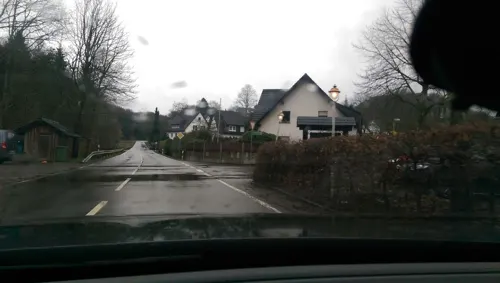


Il Duomo
Restaurant · Pizza · 1.2 km
28 Im Dohm, Olpe
Mo 12:00-14:00,18:00-23:00;We-Fr 12:00-14:00,18:00-23:00; Sa...
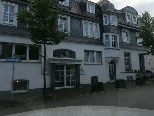
Restaurant L'isoletta
Restaurant · Italian
21 Westfälische Straße, Olpe
Mo, Tu, Th, Fr, Sa, Su 12:00-14:00,17:30-22:00

Restraunt Schürholz
Restaurant · International · 5.3 km
31 Hagener Straße, Drolshagen
Tu-Sa 11:30-14:30,17:30-22:00; Su 11:30-22:00
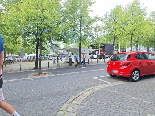
Goldener Löwe
Bar and pub
6 Am Markt, Olpe
Mo-Th 10:00-23:00; Fr 10:00-02:00; Sa 09:30-03:00; Su 09:30-22:00


87 more on the map.
History
Olpe supposedly got its name from an older name for the land at the forks of the Olpe and Bigge ("Ol-apa" = brook in moist meadowland)
The first archaeological finds in the Olpe area date to about AD 900: potsherds and slag (from iron mining and working) in the abandoned centre of Kimickerberg, coins in Dahl (from after 1005).
Olpe had its first documentary mention in 1220. In 1311 it was granted town rights on the Soest model by the archbishop-elector of Cologne, Count Heinrich II of Virneburg. In 1500, the Kreuzkapelle (Cross Chapel) was first mentioned. The first evidence of a shooting society followed in 1525.
History also records evidence of witch trials being held in the Olpe judicial area between 1587 and 1697.
In 1615, Olpe had its first schoolteacher, and in 1634 it had a great fire. The first vow to Saint Agatha of Catania for protection against conflagrations, however, was not recorded until 1665. Eight years later came the first vow to Saint Roch of Montpellier against the Plague and other pestilences. In 1696, the last witch was sentenced.
In 1711, the post first came to Olpe. In 1795, the Great Fire of Olpe destroyed 83% of the town. When the town was built once again, the old mediaeval appearance was cast aside in favour of a master plan that saw three broad, parallel streets built, connected by sidestreets running at right angles to them.
From the History section of Olpe, Germany on Wikipedia, under CC BY-SA 4.0.
Where to stay27
Churches and places of worship52
St. Antonius Einsiedler
Church · Roman Catholic · 6.1 km
9 Brachtpetalstraße, Drolshagen
St.Clemens-Kirche
Church · Catholic · 5.1 km
8 Kirchplatz, Drolshagen
Shopping23
Gas and EV charging22
Schools, colleges and libraries18
Gräfin-Sayn-Schule, Kath. Verbundgrundschule der Stadt Drolshagen - Teilstandort Drolshagen
School · Roman Catholic · 4.9 km
2 Am Buscheid, Drolshagen
Kath. Verbundgrundschule der Stadt Drolshagen - Teilstandort Schreibershof
School · Roman Catholic · 6.4 km
17 Listerstraße, Drolshagen
Healthcare14
Map of Olpe
250 places. The map loads OpenStreetMap tiles when you open it.
Getting there and nearby towns
Siegerlandflughafen (SGE) is the nearest airport with scheduled flights listed in OpenStreetMap, 39 km away.
- Siegen 21 km southeast, about 21 min by car
- Plettenberg 20 km north, about 20 min by car
- Waldbröl 24 km southwest, about 24 min by car
- Werdohl 26 km north, about 26 min by car
- Wilnsdorf 29 km southeast, about 29 min by car
- Schalksmühle 33 km northwest, about 33 min by car
- Ruppichteroth 33 km southwest, about 33 min by car
- Wipperfürth 33 km west, about 33 min by car
- Schmallenberg 33 km northeast, about 33 min by car
- Radevormwald 39 km northwest, about 39 min by car
Drive times are estimates from straight-line distance, not routes.
Local news
Headlines from INDB.
Reviews, tips and questions
Loading what members have shared...
Sources and licences
- GeoNames (CC BY 4.0): population, coordinates, regions and time zone
- Mapillary (see each image): photos
- OpenStreetMap contributors (ODbL 1.0): places, airports, map data
- Wikidata (CC0 1.0): elevation, founding date, time zone, website
- Wikimedia Commons (see each image): photos
- Wikipedia (CC BY-SA 4.0): overview and history text
Photo credits
- Olpe city wall, Donald Townsed, CC BY-SA 2.5
- Olpe - Auf der Fohrt 2-1, Peperkorn, CC BY-SA 3.0
- Mündung der Günse (klares Wasser) in die Olpe (trübes Wasser), Thimmey, CC BY-SA 4.0
- Olpe - Sankt-Franziskus-Gymnasium, Peperkorn, CC BY-SA 3.0
- Olpe - Felmicke 30-1, Peperkorn, CC BY-SA 3.0
- Olpe - Felmicke 37, Peperkorn, CC BY-SA 3.0
- Olpe - Koelner Strasse 2, Peperkorn, CC BY-SA 3.0
- Olpe - Felmicke 28, Peperkorn, CC BY-SA 3.0
- Olpe - Löherweg 01 ies, Frank Vincentz, CC BY-SA 3.0
- Evangelische Kirche, Olpe, Melvis, CC BY-SA 4.0
- Olpe - Kolpinghaus, Peperkorn, CC BY-SA 3.0
- Martinstraße, 1, Olpe, Landkreis Olpe, GeorgDerReisende, CC BY-SA 4.0
- Olpe - Westfälische Straße 05 ies, Frank Vincentz, CC BY-SA 3.0
- Olpe-Martinuskirche1-Asio, Asio otus, CC BY-SA 3.0
- Olpe-GoldenerLoewe1-Asio, Asio otus, CC BY-SA 3.0
- Olpe - Westfälische Straße 07 ies, Frank Vincentz, CC BY-SA 3.0
- Olpe-Kreishaus1-Bubo, Bubo, CC BY-SA 3.0
- Olpe - Kölner Straße 01 ies, Frank Vincentz, CC BY-SA 3.0
- Olpe-GasthofSauerland1-Asio, Asio otus, CC BY-SA 3.0
- Bushaltestelle Marktplatz, 1, Olpe, Landkreis Olpe, GeorgDerReisende, CC BY-SA 4.0
- Olpe - Imbergstrasse 3-3, Peperkorn, CC BY-SA 3.0
- Olpe - Alte Post, Peperkorn, CC BY 3.0
- Olpe - Alte Post-2, Peperkorn, CC BY-SA 3.0
- Olpe - Bruchstrasse 5-3, Peperkorn, CC BY-SA 3.0
- Olpe - Bahnhofstrasse 11-2, Peperkorn, CC BY-SA 3.0
- Olpe - Bruchstrasse 5-4, Peperkorn, CC BY-SA 3.0
- Olpe - Koelner Strasse 17-19, Peperkorn, CC BY-SA 3.0
- Olpe-Amtsgericht1-Bubo, Bubo, CC BY-SA 3.0
- Olpe - Die Villa-2, Peperkorn, CC BY-SA 3.0
- Bushaltestelle ZOB, 2011, 1, Olpe, Landkreis Olpe, GeorgDerReisende, CC BY-SA 4.0
- Stellwerk Olpe, Echtner, CC BY 3.0
- Olpe Empfangsgebäuse, Echtner, CC BY 3.0
- Olpe - Alte Schule 2, Peperkorn, CC BY-SA 3.0
- Olpe-AlteSchule1-Asio, Asio otus, CC BY-SA 3.0
- Olpe - In der Wueste 6, Peperkorn, CC BY-SA 3.0
- Bushaltestelle ZOB, 2011, 2, Olpe, Landkreis Olpe, GeorgDerReisende, CC BY-SA 4.0
- Bushaltestelle ZOB, 2011, 3, Olpe, Landkreis Olpe, GeorgDerReisende, CC BY-SA 4.0
- Wenden-WendenerHuette2-Bubo, Bubo, CC BY-SA 3.0
- St. Georg Kirche Neuenkleusheim (Olpe), ThomasGerd, CC BY 3.0
- St. Michael zu Sendschotten Umgang2012, MR731992, CC BY 3.0
- Katholische Kapelle St. Matthäus und Leonhard (Olpe), ThomasGerd, CC BY 3.0
- Motte Attendorn-Berlinghausen, -- Wolfgang Poguntke 20:03, 25. Feb. 2008 (CET), CC BY-SA 2.0 de
- Landwehr bei Kruberg, Wolfgang Poguntke 21:50, 23. Jan. 2008 (CET), CC BY-SA 2.0 de
- Olpe - Kurkölner Platz 03 ies, Frank Vincentz, CC BY-SA 3.0
- St. Antoniua Einsiedler Drolshagen-Iseringhausen, Dr. Hans Wiechers, CC BY-SA 3.0
- Drolshagen-StClemens1-Bubo, Bubo, CC BY-SA 3.0
- Olpe-RhodeKirche1-Bubo, Bubo, CC BY-SA 3.0
- Gerlingen, die Sankt Antoniuskirche foto4 2017-06-03 16.34, Michielverbeek, CC BY-SA 4.0
- Katholische Kreuzkapelle Olpe, ThomasGerd, CC BY 3.0
- Hotel Albus, Beireke1, CC0
- Alsmicke, Thariama, CC BY-SA 4.0
- Attendorn, NSG-Bremgetal und Seitentäler, Bärwinkel,Klaus, CC BY-SA 4.0
- The month of May, Raul Ghiran, CC BY-SA 4.0
- BiggeseeGilberg, Dietzel, CC BY-SA 3.0
- Drolshagen-Schuerholz1-Bubo, Bubo, CC BY-SA 3.0
- Street-level photo, live, CC BY-SA 4.0
- Street-level photo, maierkurt77, CC BY-SA 4.0
- Street-level photo, chuck, CC BY-SA 4.0
- Street-level photo, madonna100, CC BY-SA 4.0
- Street-level photo, maierkurt, CC BY-SA 4.0
- Street-level photo, uwekoch, CC BY-SA 4.0
- Street-level photo, rab, CC BY-SA 4.0
- Street-level photo, rab, CC BY-SA 4.0
- Street-level photo, map_dav, CC BY-SA 4.0
- Street-level photo, uwekoch, CC BY-SA 4.0
- Street-level photo, rab, CC BY-SA 4.0
- Street-level photo, map_dav, CC BY-SA 4.0
- Street-level photo, madonna100, CC BY-SA 4.0
- Street-level photo, baldur80, CC BY-SA 4.0
- Street-level photo, rab, CC BY-SA 4.0


Page built November 8, 2026. Spotted a mistake? Tell us or suggest a place.