


Lennestadt, Germany
Lennestadt is a town of 28,102 people in North Rhine-Westphalia, Germany.
Why visit Lennestadt
Townapedia lists 86 museums and landmarks, 46 parks and trails, 106 places to eat, 35 places to stay and 154 attractions in and around town.
Highlights include Elspe Festival, Atta Cave, Bergbaumuseum Siciliaschacht and Haus Bamenohl.
Weather in Lennestadt
Forecast from MET Norway (CC BY 4.0). Full forecast
About Lennestadt
Lennestadt (German pronunciation: [ˈlɛnəʃtat] , lit. 'Lenne Town'; occasionally also die Lennestadt) lies in the Sauerland in southeast North Rhine-Westphalia and is a municipality in Olpe district. It is the district's most populous municipality.
From the Wikipedia article Lennestadt (this version), under CC BY-SA 4.0.
Things to do154

Elspe Festival
Cinema and theater · 4.7 km
Theatre festival in Germany
1 Zur Naturbühne, Lennestadt

Atta Cave
Monument and historic site · 10.6 km
Dripstone cave in Germany


Hof Gerwin
Farm and orchard · 3.2 km
Bauernhofeis Milch Fleisch Eier Hähnchen Weihnachtsbäume und Tannengrün
2 Bettinghof, Kirchhundem
24/7

142 more on the map.
Museums and landmarks86


Galileo-Park
Museum · 1.3 km
Wissenschafts- und Rätselpark
4-7 Sauerland-Pyramiden, Lennestadt
Tu-Su 10:00-17:00; SH 10:00-17:00

Schloss Adolfsburg
Monument and historic site · 7.9 km
1 Hauptstraße, Kirchhundem

Burg Bilstein
Monument and historic site · 4.1 km
10 Von-Gevore-Weg, Lennestadt

Knochenmühle
Monument and historic site · 8.7 km
11 Schöndelter Straße, Finnentrop


Schloss Ahausen
Monument and historic site · 8.3 km
1 Ahausen, Finnentrop


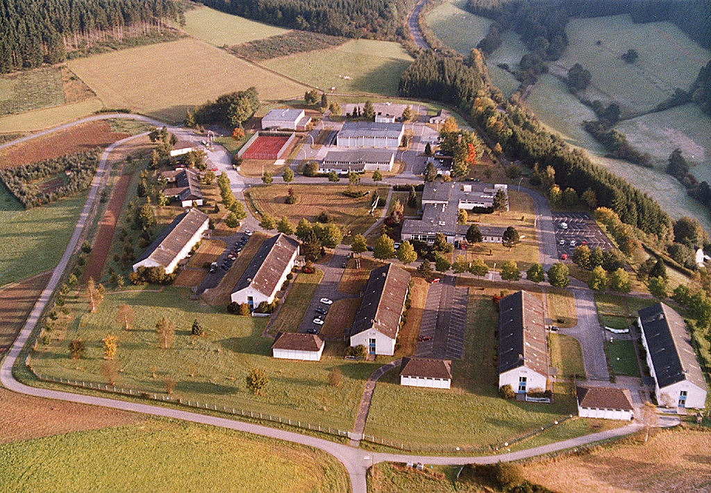
Industriegebiet Sauerlandkaserne
Monument and historic site · 8.0 km
74 more on the map.
Parks, trails and playgrounds46





34 more on the map.
Restaurants and cafes106

Landhaus Lenneper-Führt
Restaurant · Regional · 6.2 km
21 Selbecke, Kirchhundem
11:30-13:30,17:00-21:00
Landhotel-Ferienhof Gut Ahe
Restaurant · Regional, German · 8.2 km
1 Ahe, Kirchhundem
Mo-Sa 12:00-14:00,18:00-21:00; Su 11:30-20:00
Café-Restaurant Hohe Bracht
Restaurant · Regional · 4.0 km
1 Hohe Bracht, Lennestadt
Th-Sa 12:00-22:00; Su 12:00-18:00
Cannizaro's
Restaurant · Italian · 4.2 km
45 Bielefelder Straße, Lennestadt
Tu-Fr, Su 12:00-14:00, 18:00-22:30; Sa 18:00-22:30
Gasthof Kaiser
Restaurant · German · 8.2 km
48-50 Rinsecker Straße, Kirchhundem
We-Mo 12:00-14:00, 18:00-21:00;Tu off
Gasthof und Pension zu den Linden
Restaurant · Regional · 8.2 km
15 Hauptstraße, Kirchhundem
11:00+; Mo off
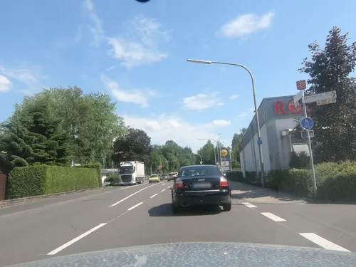
In Vino Veritas
Restaurant · Italian · 7.7 km
33 Bamenohler Straße, Finnentrop
Mo-Sa 12:00-14:30,18:00-24:00; Su 12:00-14:30,17:00-23:00; PH...
Skihütte Halberbracht
Restaurant · Pizza, German, Salad, Regional · 2.6 km
39 Im Hölzchen, Lennestadt
opening_hours:url=https://skihuette-halberbracht.de/kontakt/

Hesse
Bakery · 1.4 km
6 Helmut-Kumpf-Straße, Lennestadt
Mo-Fr 06:30-18:00, Sa 06:30-13:00; Su 08:00-11:00
Hotel Rameil - Flurschütz
Restaurant · 7.0 km
11 Auf der Jenseite, Lennestadt
12:00-14:00; 17:30-22:00; We off; Su 12:00-14:00


94 more on the map.
History
The town of Lennestadt was founded on 1 July 1969 as legal successor to the Amt of Bilstein out of seven former municipalities and outlying centres.
The earliest traces of settlers in the current municipal area date to the Early Middle Ages. The centres of Elspe and Oedingen were first mentioned in a document in 1000 that Emperor Otto III had issued. This makes them the oldest places in Olpe district.
In the 19th century, parts of the current town area were characterized by mining, ironworking and metalworking.
From the History section of Lennestadt on Wikipedia, under CC BY-SA 4.0.
Where to stay35
Churches and places of worship61
Pfarrkirche St. Servatius
Church · Roman Catholic · 5.5 km
4 Zum Kellenberg, Lennestadt
Pfarrkirche Sankt Peter und Paul
Church · Catholic · 3.8 km
47 Hundemstraße, Kirchhundem
Pfarrkirche St. Marien
Church · Catholic · 8.7 km
3 Oedinger Straße, Schmallenberg
Sankt Joseph
Church · Roman Catholic · 7.7 km
35 Alter Weg, Finnentrop
Shopping31
Gas and EV charging11
Raiffeisen Tankstelle Helden
Gas station · 7.9 km
3 Mecklinghauser Straße, Attendorn
Schools, colleges and libraries26
Healthcare11
Apotheke am Schützenplatz
Clinic and pharmacy · 4.2 km
62 Kölner Straße, Lennestadt
Map of Lennestadt
250 places. The map loads OpenStreetMap tiles when you open it.
Getting there and nearby towns
Siegerlandflughafen (SGE) is the nearest airport with scheduled flights listed in OpenStreetMap, 46 km away.
- Schmallenberg 16 km east, about 16 min by car
- Plettenberg 17 km northwest, about 17 min by car
- Olpe 18 km southwest, about 18 min by car
- Netphen 22 km south, about 22 min by car
- Werdohl 26 km northwest, about 26 min by car
- Siegen 27 km south, about 27 min by car
- Neuenrade 27 km northwest, about 27 min by car
- Meinerzhagen 29 km west, about 29 min by car
- Meschede 30 km northeast, about 30 min by car
- Lüdenscheid 33 km west, about 33 min by car
Drive times are estimates from straight-line distance, not routes.
Local news
Headlines from INDB.
Reviews, tips and questions
Loading what members have shared...
Sources and licences
- GeoNames (CC BY 4.0): population, coordinates, regions and time zone
- Mapillary (see each image): photos
- OpenStreetMap contributors (ODbL 1.0): places, airports, map data
- Wikidata (CC0 1.0): elevation, founding date, time zone, website, landmarks and historic places
- Wikimedia Commons (see each image): photos
- Wikipedia (CC BY-SA 4.0): overview and history text
Photo credits
- Rathaus Lennestadt, Stefan Flöper, CC BY-SA 4.0
- Lennestadt Ortskern FFSW 3236, Petra Klawikowski, CC BY-SA 3.0
- Amazona aestiva, Lennestadt (DE) -- 2020 -- 175505, Anil Öztas, CC BY-SA 4.0
- Amazona aestiva, Lennestadt (DE) -- 2020 -- 175741, Anil Öztas, CC BY-SA 4.0
- Lennestadt (DE), Bergbaumuseum Siciliaschacht -- 2020 -- 153952, Anil Öztas, CC BY-SA 4.0
- Lennestadt (DE), Sauerland-Pyramiden -- 2020 -- 154029, Anil Öztas, CC BY-SA 4.0
- Lennestadt (DE), Sauerland-Pyramiden -- 2020 -- 154038, Anil Öztas, CC BY-SA 4.0
- Lennestadt (DE), Sauerland-Pyramiden -- 2020 -- 154033, Anil Öztas, CC BY-SA 4.0
- Lennestadt (DE), Sauerland-Pyramiden -- 2020 -- 153933, Anil Öztas, CC BY-SA 4.0
- Lennestadt (DE), Galileo-Park -- 2020 -- 161201, Anil Öztas, CC BY-SA 4.0
- Lennestadt (DE), Sauerland-Pyramiden -- 2020 -- 171845, Anil Öztas, CC BY-SA 4.0
- Lennestadt (DE), Sauerland-Pyramiden -- 2020 -- 145045, Anil Öztas, CC BY-SA 4.0
- Lennestadt-Altenhundem FFSW-0809, Michael Kramer, CC BY-SA 3.0
- Lennestadt-Altenhundem FFSW-0806, Michael Kramer, CC BY-SA 3.0
- Luftaufnahme Elspe Festival Gelände, Cassidy71, CC BY-SA 3.0
- Atta-Höhle, Rainer Lippert, Public domain
- Bergbaumuseum Siciliaschacht Meggen-4, -- Wolfgang Poguntke--, CC BY-SA 2.0 de
- Burg Bilstein, Stefan Flöper, CC BY-SA 4.0
- Ruine Burg Borghausen, -- Wolfgang Poguntke 18:54, 8. Jul. 2007 (CEST), CC BY-SA 2.0 de
- Kirche Kirchveischede-2, -- Wolfgang Poguntke--, CC BY-SA 2.0 de
- St. Agatha in Altenh, Dr. Hans Wiechers, CC BY-SA 3.0
- GymSL Block A Haupteingang, Stefan Flöper, CC BY-SA 4.0
- Haus Bamenohl-front, Plettman, CC BY-SA 4.0
- Kirchhundem-Oberhundem Schloss Adolfsburg FFSW-0596, Michael Kramer, CC BY-SA 3.0
- Bamenohl Laufwasserkraftwerk bei Nacht, Christian Drüeke, CC BY-SA 3.0
- St. Bartholomäus Meggen, 2009, Dr. Hans Wiechers, Public domain
- Lennestadt-Altenhundem Maria Königin FFSW-0626, Michael Kramer, CC BY-SA 3.0
- Luftbild Sauerlandkaserne 2002, August Freimuth, CC BY-SA 3.0
- Schloss Ahausen-4, -- Wolfgang Poguntke 18:15, 29. Feb. 2008 (CET), CC BY-SA 2.0 de
- Bamenohl Germany Catholic-Church-St-Joseph-01, CEphoto, Uwe Aranas, CC BY-SA 3.0
- St. Peter und Paul Kirchhundem 2, Stefan Flöper, CC BY-SA 4.0
- Trespen-Schwingel-Kalktrockenrasen Naturschutzgebiet Bamenohl 6, Martin Lindner, CC BY-SA 4.0
- Naturschutzgebiet Hohe Lei, Martin Lindner, CC BY 3.0
- St. Elisabeth Benolpe, Stefan Flöper, CC BY-SA 4.0
- NSG OE-002 Einsiedelei 4, Stefan Flöper, CC BY-SA 4.0
- Evangelische Kirche Grevenbrück, Dr. Hans Wiechers, CC BY-SA 3.0
- Aussichtsturm Hohe Bracht mit Außenterasse (April 2018), Dr. Hans Wiechers, CC BY-SA 4.0
- Bracht Kirche, Stefan Didam - Schmallenberg, CC BY-SA 3.0
- Emmauskirche Würdinghausen, Stefan Didam - Schmallenberg, CC BY-SA 3.0
- St. Bartholomäus Würdinghausen, Stefan Didam - Schmallenberg, CC BY-SA 3.0
- Burg Bilstein 0003, Venetianer, CC BY-SA 3.0
- Albaumer Klippen 1, Dampftrain, CC BY-SA 4.0
- Breiter Hagen, Stefan Flöper, CC BY-SA 4.0
- Wunderwäldchen 9, Stefan Flöper, CC BY-SA 4.0
- Ahauser Klippen, Martin Lindner, CC BY 3.0
- Naturschutzgebiet Auf dem Hahne, Janine Klute, CC BY 4.0
- Naturschutzgebiet Bamenohl, Martin Lindner, CC BY-SA 4.0
- Naturschutzgebiet Rosenberg, Stefan Flöper, CC BY-SA 4.0
- Breiter Hagen 14, Stefan Flöper, CC BY-SA 4.0
- NSG OE-002 Einsiedelei 2, Stefan Flöper, CC BY-SA 4.0
- Kirchhundem-Oberhundem FFSW-0483, Michael Kramer, CC BY-SA 3.0
- Knochenmühle Fretter, Wolfgang Poguntke, CC BY 3.0
- Lennestadt (DE), Galileo-Park -- 2020 -- 161007, Anil Öztas, CC BY-SA 4.0
- Street-level photo, chuck, CC BY-SA 4.0
- Street-level photo, uwekoch, CC BY-SA 4.0
- Street-level photo, uwekoch, CC BY-SA 4.0
- Street-level photo, flugyflay, CC BY-SA 4.0
- Street-level photo, tobiasreg, CC BY-SA 4.0
- Street-level photo, baldur80, CC BY-SA 4.0
- Street-level photo, chuck, CC BY-SA 4.0
- Street-level photo, live, CC BY-SA 4.0
- Street-level photo, uwekoch, CC BY-SA 4.0
- Street-level photo, uwekoch, CC BY-SA 4.0


Page built November 8, 2026. Spotted a mistake? Tell us or suggest a place.