


Why visit Lahnstein
Townapedia lists 127 museums and landmarks, 66 parks and trails, 116 places to eat, 24 places to stay and 107 attractions in and around town.
Highlights include Städtische Bühne Lahnstein, Balduinbrücke, Bergbau Museum Grube Friedrichssegen and Kloster Bethlehem Klarissen-Kapuzinerinnen von der Ewigen Anbetung.
Weather in Lahnstein
Forecast from MET Norway (CC BY 4.0). Full forecast
About Lahnstein
Lahnstein (German pronunciation: [ˈlaːnʃtaɪn] ) is a verband-free town of Rhein-Lahn-Kreis in Rhineland-Palatinate, Germany. It is situated at the confluence of the Lahn with the Rhine, approximately 6 kilometres (3.7 mi) south of Koblenz. Lahnstein was created in 1969 by the merger of the previously independent towns of Oberlahnstein (or Upper Lahnstein) on the south side of the Lahn (above the river mouth) and Niederlahnstein on the north side (below the river mouth). In 2020, it had a population of 18,030.
From the Wikipedia article Lahnstein (this version), under CC BY-SA 4.0.
Travel tips from other travellers: Lahnstein on Wikivoyage (CC BY-SA 4.0).
Things to do107


Horchheimer Eisenbahnbrücke
Bridge · 4.0 km
Railway bridge across the Rhine in Germany

Lahnstein
Monument and historic site · 0.8 km
City in Rhein-Lahn-Kreis in Rhineland-Palatinate, Germany


Theater Koblenz
Cinema and theater · 6.6 km
Theater in Koblenz, Rhineland-Palatinate, Germany

Allerheiligenberg
Scenic view · 1.4 km
Der Name Allerheiligenberg stammt von der alten Kapelle, die 1671 erbaut wurde.



95 more on the map.
Museums and landmarks127

Bergbau Museum Grube Friedrichssegen
Museum · 2.4 km
Ahlerhof, Lahnstein
Apr-Oct: Tu 14:00-17:00 || "nach Vereinbarung"

Kloster Bethlehem Klarissen-Kapuzinerinnen von der Ewigen Anbetung
Monument and historic site · Catholic · 4.9 km
29 Hermannstraße, Koblenz





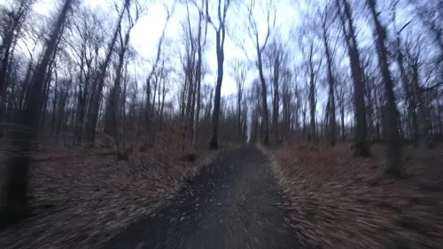
Ein Wirtschaftsgebäude der römischen Villa am Remstecken
Monument and historic site · 4.5 km
Teilrekonstruierte Grundmauern eines Wirtschaftsgebäudes der römischen Villa am Remstecken (Villa rustica) im Stadtwald von Koblenz.
24/7

Römische Villa (Typ: Villa Rustica)
Monument and historic site · 4.6 km
Teilrekonstruierte Grundmauern einer römische Villa (Villa rustica) am Remstecken im Stadtwald von Koblenz.
24/7

Ehrenmal des Heeres in Koblenz
Monument and historic site · 7.2 km
War memorial in Koblenz, Germany


115 more on the map.
Parks, trails and playgrounds66


Freibad Oberwerth
Sports field and stadium · 4.9 km
Haydnstraße, Koblenz
Mo-Sa 08:00-20:00; Su 09:00-20:00





Yachtclub Lahn e.V.
Marina and boat launch · 1.8 km
20 Emser Landstraße, Lahnstein
Dr.-Max-Otto-Bruker Heil- und Kräutergarten
Park · 1.9 km
Dr. Max-Otto-Bruker-Straße, Lahnstein
54 more on the map.
Restaurants and cafes116

Burgrestaurant Lahneck
Restaurant · German · 0.8 km
Urgemütliche Burgschenke sowie Terrasse mit Blick ins romantische Rheintal und in das anmutige Tal der Lahn. Regionale und klassische...
Burg Lahneck, Lahnstein
Mar-Oct: Tu-Th 11:00-20:00; Mar-Oct: Fr 11:00-21:00; Sa...

China Garden
Restaurant · Chinese · 0.6 km
94 Adolfstr.
Tu-Sa 11:30-15:00, 17:30-23:00; Su 11:30-23:00
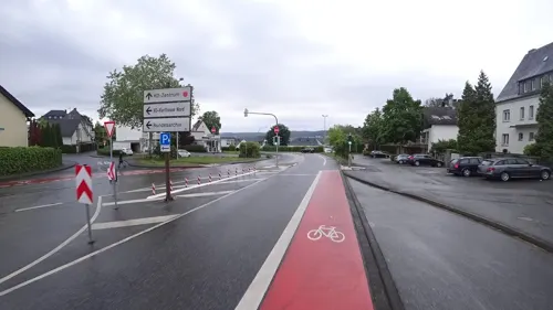
China Restaurant Jixiang
Restaurant · Chinese · 5.4 km
89 Simmerner Straße, Koblenz
Mo-Su,PH 11:30-14:00,17:30-21:30
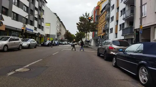

Fatih's Grill Restaurant
Restaurant · Kebab, Burger, Coffee Shop, Cake, Pizza, Turkish · 2.6 km
34a Koblenzer Straße, Lahnstein
Mo-Su 11:00-20:00
Gasthaus Zum Goldenen Schlüssel
Restaurant · German · 3.8 km
14 Marktplatz, Braubach
Mo-Tu,Fr-Su 11:00-24:00
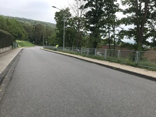


Haus Horchheimer Höhe / Soldatenheim
Restaurant · Regional · 3.8 km
3,5 Von-Galen-Straße, Koblenz
Mo-Fr 16:00+; Sa,Su,PH off
104 more on the map.
Where to stay24
Ehemaliges Kloster Allerheiligenberg – Haus Felsenwind
Motel and hotel · 1.4 km
63 Am Allerheiligenberg, Lahnstein
Churches and places of worship48
Shopping24
Gas and EV charging12
Schools, colleges and libraries29
Healthcare12
Asterstein Apotheke
Clinic and pharmacy · 5.2 km
1 Fritz-von-Unruh-Straße, Koblenz
Map of Lahnstein
250 places. The map loads OpenStreetMap tiles when you open it.
Getting there and nearby towns
Hahn Airport (HHN) is the nearest airport with scheduled flights listed in OpenStreetMap, 47 km away.
- Koblenz 7 km northwest, about 7 min by car
- Neuwied 18 km northwest, about 18 min by car
- Montabaur 21 km northeast, about 21 min by car
- Mayen 28 km west, about 28 min by car
- Limburg an der Lahn 32 km east, about 32 min by car
- Hadamar 34 km northeast, about 34 min by car
- Sinzig 38 km northwest, about 38 min by car
- Bad Schwalbach 37 km southeast, about 37 min by car
- Taunusstein 42 km southeast, about 42 min by car
- Remagen 42 km northwest, about 42 min by car
Drive times are estimates from straight-line distance, not routes.
Local news
Headlines from INDB.
Reviews, tips and questions
Loading what members have shared...
Sources and licences
- GeoNames (CC BY 4.0): population, coordinates, regions and time zone
- Mapillary (see each image): photos
- OpenStreetMap contributors (ODbL 1.0): places, airports, map data
- Wikidata (CC0 1.0): elevation, founding date, time zone, website, landmarks and historic places
- Wikimedia Commons (see each image): photos
- Wikipedia (CC BY-SA 4.0): overview and history text
Photo credits
- Stolperstein Lahnstein Sebastianusstraße 1 Adam Staudt, Gmbo 2013, CC0
- Stolpersteinlage Lahnstein Sebastianusstraße 1, Gmbo 2013, CC0
- Stolpersteine Lahnstein Mittelstraße 85, Gmbo 2013, CC0
- Stolperstein Lahnstein Mittelstraße 85 Johann Müller, Gmbo 2013, CC0
- Stolperstein Lahnstein Mittelstraße 85 Josef Müller, Gmbo 2013, CC0
- Stolpersteinlage Lahnstein Mittelstraße 85, Gmbo 2013, CC0
- Stolpersteinlage Lahnstein Mittelstraße 72, Gmbo 2013, CC0
- Stolperstein Lahnstein Mittelstraße 72 Anton Kessler, Gmbo 2013, CC0
- Stolperstein Lahnstein Wilhelmstraße 67 Josef Peter Weber, Gmbo 2013, CC0
- Stolpersteinlage Lahnstein Wilhelmstraße 67, Gmbo 2013, CC0
- Stolpersteinlage Lahnstein Adolfstraße 89, Gmbo 2013, CC0
- Stolperstein Lahnstein Adolfstraße 89 Gustav Kaufmann, Gmbo 2013, CC0
- B42 Niederlahnstein - geo.hlipp.de - 7518, Udo und Joan Fugel on geo.hlipp.de, CC BY-SA 2.0
- Lahnstein Oberlahnstein Wasserturm Bahn 2022, Oberlausitzerin64, CC BY-SA 4.0
- LahnsteinWasserturm, Colorgrafika, CC BY-SA 3.0 de
- LahnsteinWasserturm2, Colorgrafika, CC BY-SA 3.0 de
- Stolpersteinlage Lahnstein Adolfstraße 48, Gmbo 2013, CC0
- Lahnstein from the east - geo.hlipp.de - 1627, Derek Harper on geo.hlipp.de, CC BY-SA 2.0
- Stolperstein Lahnstein Adolfstraße 48Jakob Devers, Gmbo 2013, CC0
- Stolpersteinlage Lahnstein Hochstraße 56, Gmbo 2013, CC0
- A42 Lahnstein - geo.hlipp.de - 7537, Udo und Joan Fugel on geo.hlipp.de, CC BY-SA 2.0
- Stolpersteine Lahnstein Ostallee 11, Gmbo 2013, CC0
- Stolperstein Lahnstein Ostallee 11 Emil Baer, Gmbo 2013, CC0
- Stolperstein Lahnstein Ostallee 11 Johanna Baer, Gmbo 2013, CC0
- Stolpersteine Lahnstein Mittelstraße 12, Gmbo 2013, CC0
- Stolperstein Lahnstein Mittelstraße 12 Max Baer, Gmbo 2013, CC0
- Stolperstein Lahnstein Mittelstraße 12 Minna Baer, Gmbo 2013, CC0
- Stolperstein Lahnstein Mittelstraße 12 Barbetha Baer, Gmbo 2013, CC0
- Stolpersteinlage Lahnstein Ostallee 11, Gmbo 2013, CC0
- Johanniskirche Lahnstein 2009, Holger Weinandt, CC BY-SA 3.0 de
- Balduinbruecke in Autumn Sun, Cristina Sarasua, CC BY-SA 4.0
- Horchheimer Eisenbahnbrücke 01 Koblenz 2015, Holger Weinandt, CC BY-SA 3.0 de
- Pfaffendorfer Brücke 01 Koblenz 2014, Holger Weinandt, CC BY-SA 3.0 de
- Koblenz im Buga-Jahr 2011 - Theater 01, Holger Weinandt, CC BY-SA 3.0 de
- Koblenz im Buga-Jahr 2011 - Ehrenmal des Deutschen Heeres 01, Holger Weinandt, CC BY-SA 3.0 de
- Marksburg, Holger Weinandt, CC BY-SA 3.0
- Burg Lahneck 2010, Holger Weinandt, CC BY-SA 3.0 de
- St Josef 03 Koblenz 2013, Holger Weinandt, CC BY-SA 3.0 de
- Rittersturz, Gabriele Delhey, CC BY-SA 3.0
- Hoffnungskirche Koblenz 2012, Holger Weinandt, CC BY-SA 3.0 de
- Aussichtspunkt Rheinburgenweg Lahnstein (1), Joschi71, CC BY-SA 4.0
- Kaiserin-Augusta-Denkmal 11 Koblenz 2014, Holger Weinandt, CC BY-SA 3.0 de
- 00 6086 Koblenz - Preußisches Regierungsgebäude, W. Bulach, CC BY-SA 4.0
- Schloß Philippsburg und Marksburg (Braubach), Renate007, CC BY-SA 4.0
- Rhens, Sint-Dionysiuskerk, RomkeHoekstra, CC BY-SA 4.0
- Spay-lambertus01, Holgertsmännchen at de.wikipedia, CC BY-SA 3.0
- Pfarrkirche St-Menas Koblenz 2009, Holger Weinandt, CC BY-SA 3.0 de
- Rhens, St. Theresiakerk, RomkeHoekstra, CC BY-SA 4.0
- Lahnstein Theater, Gabriele Delhey, CC BY-SA 3.0
- Wirtshaus an der Lahn in Lahnstein, Holger Weinandt, CC BY-SA 3.0 de
- Maria Himmelfahrt 01 Koblenz 2014, Holger Weinandt, CC BY-SA 3.0 de
- Lahnstein Hospitalkapelle, Woscho, CC BY-SA 3.0
- Kloster Bethlehem 01 Koblenz 2014, Holger Weinandt, CC BY-SA 3.0 de
- FriedrichssegenLahnsteinBergbauMuseum2, LigaDue, CC BY-SA 4.0
- St. Elisabeth Krankenhaus in Lahnstein, Dobramus, CC0
- Braubach, Martinuskapel (2022), RomkeHoekstra, CC BY-SA 4.0
- Roemische Villa Koblenz, Holger Weinandt, CC BY-SA 3.0
- Eiserne Hand 01 Koblenz 2005, Holger Weinandt, CC BY-SA 3.0 de
- Ruppertsklamm Blick hinauf, Matthias W. Kamp, CC BY-SA 3.0
- Weiertal mit Orchideen Naturschutzgebiet Koppelstein-Helmestal, RheinRose, CC BY-SA 4.0
- Panorama Tongrube auf Escherfeld Koblenz 2013, Holger Weinandt, CC BY-SA 3.0 de
- DSC 7916 Braubach, Barbarakirche - 2022, Gerhard5256, CC BY-SA 4.0
- Koblenz, die Konpfortstraße und das Dreikönigenhaus, Dguendel, CC BY 3.0
- Schloss Stolzenfels 01 Koblenz 2015, Holger Weinandt, CC BY-SA 3.0 de
- Lahnstein - Naturpark Nassau - Wanderparkplatz B Allerheiligenberg, LightSpirit888, CC0
- Koblenz, das Freibad Oberwerth-1, Dguendel, CC BY 3.0
- Street-level photo, Vosgivince, CC BY-SA 4.0
- Street-level photo, chuck, CC BY-SA 4.0
- Street-level photo, chuck, CC BY-SA 4.0
- Street-level photo, chuck, CC BY-SA 4.0
- Street-level photo, chuck, CC BY-SA 4.0
- Street-level photo, troher15, CC BY-SA 4.0
- Street-level photo, slpaxe, CC BY-SA 4.0
- Street-level photo, bitnapper, CC BY-SA 4.0
- Street-level photo, miguel_andrade, CC BY-SA 4.0
- Street-level photo, chuck, CC BY-SA 4.0
- Street-level photo, kalcaaro, CC BY-SA 4.0
- Street-level photo, slp_gho, CC BY-SA 4.0
- Street-level photo, changchun1, CC BY-SA 4.0
- Street-level photo, slp_gho, CC BY-SA 4.0
- Street-level photo, bitnapper, CC BY-SA 4.0
- Street-level photo, chuck, CC BY-SA 4.0
- Street-level photo, bepolino, CC BY-SA 4.0
- Street-level photo, kalcaaro, CC BY-SA 4.0
- Street-level photo, Vosgivince, CC BY-SA 4.0
- Street-level photo, chuck, CC BY-SA 4.0
- Street-level photo, slplena, CC BY-SA 4.0
- Street-level photo, VIA_CH, CC BY-SA 4.0
- Street-level photo, kalcaaro, CC BY-SA 4.0
- Street-level photo, changchun1, CC BY-SA 4.0
- Street-level photo, bitnapper, CC BY-SA 4.0
- Street-level photo, slp_gho, CC BY-SA 4.0
- Street-level photo, bitnapper, CC BY-SA 4.0


Page built November 8, 2026. Spotted a mistake? Tell us or suggest a place.