


Why visit Lambsheim
Townapedia lists 22 museums and landmarks, 8 parks and trails, 53 places to eat, 4 places to stay and 4 attractions in and around town.
Highlights include Blattlaus Bio-Landbau Maxdorf, Pfälzer Frischebote, Grabkreuz and Kreisbad 'Heidespaß' Maxdorf-Lambsheim.
Weather in Lambsheim
Forecast from MET Norway (CC BY 4.0). Full forecast
About Lambsheim
Lambsheim (German pronunciation: [ˈlampshaɪm]) is a municipality in the Rhein-Pfalz-Kreis, in Rhineland-Palatinate, Germany. It is the seat of the Verbandsgemeinde Lambsheim-Heßheim.
From the Wikipedia article Lambsheim (this version), under CC BY-SA 4.0.
Photos of Lambsheim


Things to do4

Pfälzer Frischebote
Farm and orchard · 3.1 km
57 Freinsheimer Straße, Frankenthal (Pfalz)
Tu,Th 10:00-18:00; Sa 03:00-13:00
Hofladen Petry
Farm and orchard · 0.9 km
51 Marktstraße, Lambsheim
Mo,We,Fr 10:00-12:00; Mo-Th 16:00-18:00; Fr 14:00-18:00; Sa 16:30-18:00

Museums and landmarks22



Altes Pumpwerk Lambsheim
Monument and historic site · 0.8 km
Eppsteiner Weg, Lambsheim
Ferienwohnungen
Monument and historic site · 3.0 km
9 Bahnhofstraße, Weisenheim am Sand
Maxdorfer Blitzbaum
Monument and historic site · 2.5 km
Ein Baum der vor einigen Jahren vermutlich vom Blitz getroffen wurde. Auf einer Seite tot auf der anderen Seite sehr lebendig. Sehr...

10 more on the map.
Parks, trails and playgrounds8

Kreisbad 'Heidespaß' Maxdorf-Lambsheim
Sports field and stadium · 1.7 km
111 Heideweg, Maxdorf
Mo 13:00-18:00, Tu-Fr 13:00-21:30, Sa 11:00-18:00, Su 09:00-19:00;...


Restaurants and cafes53
Gaststätte ASV Birkenheide - Bellini Ristorante
Restaurant · Pizza, Italian · 3.4 km
1 In den Pfalzwiesen, Birkenheide
Tu-Su 11:00-22:00
Pfälzer Hof
Restaurant · German · 3.0 km
2 Dr. Welte-Straße, Weisenheim am Sand
Mo,Tu,Fr,Sa 18:00+; Su 11:30-15:00,17:30+
Restaurant 1891, Turn- u. Sportverein 1848 e.V., TuS Flomersheim
Restaurant · German · 3.0 km
16 Jahnstraße, Frankenthal (Pfalz)
Th-Su 17:30-22:30
TV 1864/04 Da Vinci
Restaurant · Italian, Regional
56 Weisenheimer Straße, Lambsheim
Mo-Sa 17:00-22:30; Su 11:30-14:30, 17:00-21:00
Pizza D'Art
Restaurant · Pizza · 3.3 km
Mo off; Tu-Fr 11:00-14:00, 17:30-21:30; Sa 17:00-21:30; Su 12:00-21:00
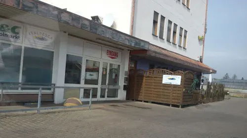
Restaurant Marktschänke
Restaurant · German · 3.2 km
Mo, Tu, Th, Fr 11:30-14:00, 18:00-22:00; Sa 18:00-22:00
Weingut Gehrig
Brewery and winery · 2.8 km
4 Ostring, Weisenheim am Sand
Mo-Fr 09:00-18:00; Sa 09:00-14:00

Da Giusi
Restaurant · Italian · 2.0 km
1 Am Neugraben, Maxdorf
Mo-Fr,Su 11:30-14:00; Tu-Su 17:00-23:00
Speisegaststätte DJK Sportfreunde 1924 Flomersheim-Eppstein
Restaurant · Regional · 3.5 km
Mo, Sa off; Tu-Fr 11:30-14:00,17:00-21:00; Su 10:00-14:00,17:00-21:00
Vereinsgaststätte Geflügelzuchtverein
Restaurant · Regional · 3.4 km
34 Nachtweideweg, Heßheim
Tu-Su 10:00-22:00
41 more on the map.
History
Lambsheim was first mentioned as Lammundisheim in the Lorsch codex in 768.
From the History section of Lambsheim on Wikipedia, under CC BY-SA 4.0.
Where to stay4
Hilzensauer Bernhard
Motel and hotel · 3.2 km
2 Wilhelm-Busch-Straße, Weisenheim am Sand
Churches and places of worship8
Christuskirche
Church · Protestant · 3.2 km
30 Dürkheimer Straße, Frankenthal (Pfalz)
Evangelische Kirche
Church · Protestant · 3.0 km
1 Kirchplatz, Weisenheim am Sand
Sankt Cyriakus
Church · Catholic · 3.3 km
29 Dürkheimer Straße, Frankenthal (Pfalz)
St. Laurentius
Church · Roman Catholic · 2.9 km
1 Bismarckstraße, Weisenheim am Sand
Stephanuskirche
Church · Lutheran · 3.1 km
11 Martin-Luther-Straße, Frankenthal (Pfalz)
Shopping10
Gas and EV charging2
Schools, colleges and libraries5
Healthcare6
Map of Lambsheim
122 places. The map loads OpenStreetMap tiles when you open it.
Getting there and nearby towns
City-Airport Mannheim (MHG) is the nearest airport with scheduled flights listed in OpenStreetMap, 17 km away.
- Maxdorf 3 km south, about 3 min by car
- Frankenthal 5 km northeast, about 5 min by car
- Herxheim am Berg 8 km west, about 8 min by car
- Mutterstadt 9 km southeast, about 9 min by car
- Bobenheim-Roxheim 10 km northeast, about 10 min by car
- Bad Dürkheim 10 km southwest, about 10 min by car
- Ludwigshafen am Rhein 12 km east, about 12 min by car
- Grünstadt 11 km northwest, about 11 min by car
- Mannheim 13 km east, about 13 min by car
- Limburgerhof 12 km southeast, about 12 min by car
Drive times are estimates from straight-line distance, not routes.
Towns near Lambsheim


Local news
Headlines from INDB.
Reviews, tips and questions
Loading what members have shared...
Sources and licences
- GeoNames (CC BY 4.0): population, coordinates, regions and time zone
- Mapillary (see each image): photos
- OpenStreetMap contributors (ODbL 1.0): places, airports, map data
- Wikidata (CC0 1.0): elevation, founding date, time zone, website
- Wikimedia Commons (see each image): photos
- Wikipedia (CC BY-SA 4.0): overview and history text
Photo credits
- Lambsheim Ortsmitte, The original uploader was Romantiker at German Wikipedia ., CC BY-SA 3.0
- Lambsheim - panoramio, Immanuel Giel, CC BY 3.0
- Rathaus Lambsheim - panoramio, Immanuel Giel, CC BY 3.0
- Kirchen in Lambsheim - panoramio, Immanuel Giel, CC BY 3.0
- Die Lambsheimer Kirchen - panoramio, Immanuel Giel, CC BY 3.0
- Lambsheim - panoramio - Immanuel Giel, Immanuel Giel, CC BY 3.0
- Lambsheimer Kirchen - panoramio, Immanuel Giel, CC BY 3.0
- Der Neutorturm, ein alter Wehrturm, war Teil der Lambsheimer Stadtmauer. - panoramio, Immanuel Giel, CC BY 3.0
- 1323 erhielt Lambsheim die Stadtrechte, was zur Folge hatte, dass Wehranlagen gebaut wurden. Von diesen Anlagen ist heute der Neutorturm, im Volksmund "Türmchen" genannt, erhalten. - panoramio, Immanuel Giel, CC BY 3.0
- Fuchsbach Lambsheim Bahnstrecke, Pfalz39, CC BY-SA 4.0
- Fuchsbach Lambsheim Brückelgraben, Pfalz39, CC BY-SA 4.0
- Lambsheim - panoramio - Immanuel Giel (1), Immanuel Giel, CC BY 3.0
- Palatina In Lambsheim - panoramio, Immanuel Giel, CC BY 3.0
- Lambsheimer Weiher - Flickr - Lutz Blohm, Lutz Blohm, CC BY-SA 2.0
- Lambsheimer Weiher, Dominik Lott, CC BY-SA 4.0
- Frankenthal-Epstein katholische Kirche, Immanuel Giel, CC BY-SA 3.0
- Katholische Kirche Maxdorf 01, Immanuel Giel, Public domain
- Kirche in Eppstein 01, Immanuel Giel, CC BY-SA 3.0
- Churches in Weisenheim am Sand-04, Immanuel Giel, CC BY-SA 3.0
- Stephanus Kirche in Flomersheim, Sciencia58, CC BY-SA 4.0
- Kirche St. Thomas Morus in Flomersheim, Sciencia58, CC BY-SA 4.0
- LH Kirche innen, K-Musiker, CC BY-SA 4.0
- Kriegerdenkmal - panoramio - Immanuel Giel, Immanuel Giel, CC BY 3.0
- Neutorturm - panoramio, Immanuel Giel, CC BY 3.0
- Brunnen vor dem Rathaus - panoramio (1), Immanuel Giel, CC BY 3.0
- Feuerwehrhaus - panoramio - Immanuel Giel, Immanuel Giel, CC BY 3.0
- Verkehrskreisel - panoramio - Immanuel Giel, Immanuel Giel, CC BY 3.0
- Bienenfresser (Merops apiaster) in Rheinland-Pfalz 02, Stephan Sprinz, CC BY 4.0
- Bienenfresser (Merops apiaster) mit gefangenem Taubenschwänzchen (Macroglossum stellatarum), Stephan Sprinz, CC BY 4.0
- Bienenfresser (Merops apiaster) in Rheinland-Pfalz 01, Stephan Sprinz, CC BY 4.0
- Turteltaube (Streptopelia turtur) in Rheinland-Pfalz, Stephan Sprinz, CC BY 4.0
- Fuchsbach Isenach, Pfalz39, CC BY-SA 4.0
- Kulturdenkmal Grabkreuz Maxdorf, Markantisimus, CC BY-SA 4.0
- Street-level photo, teddy73, CC BY-SA 4.0
- Street-level photo, wegavision, CC BY-SA 4.0
- Street-level photo, atze02, CC BY-SA 4.0
- Street-level photo, wegavision, CC BY-SA 4.0
- Street-level photo, changchun1, CC BY-SA 4.0
- Street-level photo, teddy73, CC BY-SA 4.0
- Street-level photo, wegavision, CC BY-SA 4.0
- Street-level photo, atze02, CC BY-SA 4.0
- Street-level photo, wegavision, CC BY-SA 4.0
- Street-level photo, wegavision, CC BY-SA 4.0
- Street-level photo, wegavision, CC BY-SA 4.0
- Street-level photo, teddy73, CC BY-SA 4.0
- Street-level photo, wegavision, CC BY-SA 4.0
- Street-level photo, wegavision, CC BY-SA 4.0
- Street-level photo, wegavision, CC BY-SA 4.0
- Street-level photo, wegavision, CC BY-SA 4.0
- Street-level photo, teddy73, CC BY-SA 4.0
- Street-level photo, teddy73, CC BY-SA 4.0
- Street-level photo, wegavision, CC BY-SA 4.0
- Street-level photo, wegavision, CC BY-SA 4.0
- Street-level photo, teddy73, CC BY-SA 4.0
- Street-level photo, teddy73, CC BY-SA 4.0
- Street-level photo, soulcover, CC BY-SA 4.0
- Street-level photo, teddy73, CC BY-SA 4.0
- Street-level photo, atze02, CC BY-SA 4.0
- Street-level photo, ramap, CC BY-SA 4.0
- Street-level photo, teddy73, CC BY-SA 4.0
- Street-level photo, teddy73, CC BY-SA 4.0


Page built November 9, 2026. Spotted a mistake? Tell us or suggest a place.