


Frankenthal, Germany
Frankenthal is a town of 47,438 people in Rheinland-Pfalz, Germany.
Why visit Frankenthal
Townapedia lists 132 museums and landmarks, 35 parks and trails, 215 places to eat, 18 places to stay and 10 attractions in and around town.
Highlights include Theodor Heuss Bridge, Theater Alte Werkstatt e. V., Speyerer Tor and Wilhelm-Hack-Museum.
Weather in Frankenthal
Forecast from MET Norway (CC BY 4.0). Full forecast
About Frankenthal
Frankenthal (Pfalz) (German pronunciation: [ˈfʁaŋkn̩taːl] ; Palatine German: Frongedahl) is a town in southwestern Germany, in the state of Rhineland-Palatinate.
From the Wikipedia article Frankenthal (this version), under CC BY-SA 4.0.
Photos of Frankenthal


Things to do10


Theater Alte Werkstatt e. V.
Cinema and theater · 1.4 km
109 Wormser Straße, Frankenthal (Pfalz)
Tu,Fr 10:00-13:00; We-Fr 17:00-19:00

Pfälzer Frischebote
Farm and orchard · 2.7 km
57 Freinsheimer Straße, Frankenthal (Pfalz)
Tu,Th 10:00-18:00; Sa 03:00-13:00
Hofladen Haas
Farm and orchard · 4.9 km
7 Mörscher Straße, Bobenheim-Roxheim
Mo-Tu,Th,Sa 08:00-12:30; We,Fr 08:00-12:30,14:30-17:30
Hofladen Petry
Farm and orchard · 4.6 km
51 Marktstraße, Lambsheim
Mo,We,Fr 10:00-12:00; Mo-Th 16:00-18:00; Fr 14:00-18:00; Sa 16:30-18:00


Museums and landmarks132


Wilhelm-Hack-Museum
Museum · 8.9 km
Art museum in Ludwigshafen, Germany


Kilometerstein Oppau
Monument and historic site · 4.3 km
Kilometerstein; Sandsteinzylinder

Stauschleuse Frankenthaler Kanal
Monument and historic site · 3.7 km

Pestalozzischule
Monument and historic site · 3.9 km
Mächtiger U-förmiger Baukomplex mit Torfahrt, dreigeschossige Walmdachbauten, expressionistische Motive, im Mittelteil figürliche...
8 Große Gasse, Ludwigshafen am Rhein

Kath. Pfarramt St. Martin
Monument and historic site · 3.9 km
8 Kirchenstraße, Ludwigshafen am Rhein
Mozartschule
Monument and historic site · 3.6 km
Sandsteingegliederter Putzbau auf Bossenquadersockel, Dachreiter mit Glockenhelm
120 more on the map.
Parks, trails and playgrounds35


23 more on the map.
Restaurants and cafes215
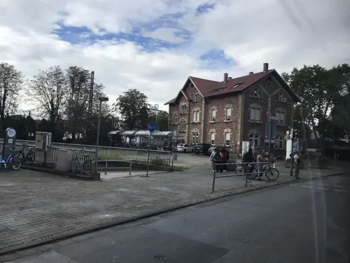
Jahnturnhalle
Restaurant · Greek · 3.8 km
2 Jahnstraße, Ludwigshafen am Rhein
Mo-We,Fr,Sa 17:00-21:30; Su 11:30-21:30
Oppauer Döner & Pizzahaus
Restaurant · Kebab, Pizza · 3.8 km
53 Friedrichstraße, Ludwigshafen am Rhein
Mo-Fr 11:00-22:00; Su 12:00-22:00
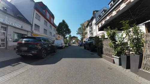
Poseidon
Restaurant · Greek
47 Speyerer Straße, Frankenthal (Pfalz)
Tu-Fr 11:30-14:30,17:00-24:00; Sa 17:00-24:00; PH,Su...
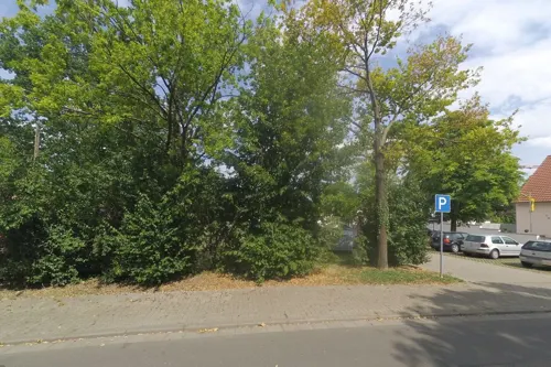
Restaurant 1891, Turn- u. Sportverein 1848 e.V., TuS Flomersheim
Restaurant · German · 3.0 km
16 Jahnstraße, Frankenthal (Pfalz)
Th-Su 17:30-22:30
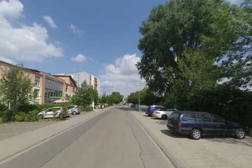
Restaurant Saloniki
Restaurant · Greek · 3.3 km
40 Ludwig-Wolker-Straße, Ludwigshafen am Rhein
Tu-Sa 17:00-23:00; Su,PH 11:30-22:00
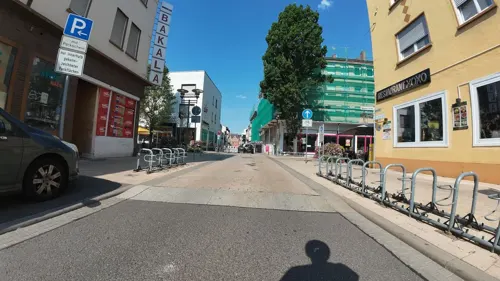
StadtRestaurantXOXO
Restaurant · Arab, Syrian
29 Speyerer Straße, Frankenthal (Pfalz)
Su-Th 11:00-21:00; Fr-Sa 11:00-22:00
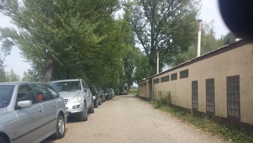
WSV Gaststätte
Restaurant · Mediterranean, German, Seafood · 4.7 km
2 Bremmenweg, Ludwigshafen am Rhein
Tu-Su 11:00-22:00

Pfälzerwald-Verein Hütte Oppau-Edigheim
Restaurant · German · 4.3 km
40 Muldenweg, Ludwigshafen am Rhein
Mo-Tu,Th-Su 11:00-21:00; We off

Bäcker Görtz
Bakery
2 Edigheimer Straße, Frankenthal (Pfalz)
Mo-Fr 05:30-17:00; Sa 06:00-12:30; Su 07:30-12:00
203 more on the map.
History
Frankenthal was first mentioned in 772. In 1119 an Augustinian monastery was built here, the ruins of which — known, after the founder, as the Erkenbertruine — still stand today in the town centre.
In the second half of the 16th century, people from Flanders, persecuted for their religious beliefs, settled in Frankenthal. They were industrious and artistic and brought economic prosperity to the town. Some of them were important carpet weavers, jewellers and artists whose Frankenthaler Malerschule ("Frankenthal school of painting") acquired some fame. In 1577, the settlement was raised to the status of a city by the Count Palatine Johann Casimir.
In 1600, Frankenthal was converted into a fortress. In 1621, it was garrisoned by English soldiers under Sir Horace Vere and besieged by the Spanish during the Thirty Years' War, and then successively occupied by troops of the opposing sides. Trade and industry were ruined and the town was not reconstructed until 1682.
In 1689, the town was burnt to the ground by French troops in the War of the Grand Alliance. The town did not fully recover from this for more than fifty years.
Read more of the history
However, in 1750, under the rule of the Elector (Kurfürst) Charles Theodore, Frankenthal was established as a centre of industry. To establish trade, a port was built between 1772 and 1781, numerous factories were opened and mulberry trees were planted for silk production. In 1755, the famous Frankenthal porcelain factory was opened, which remained in production until 1800. During this period, the town was also known in English as Frankendal.
In 1797, the town came under French occupation during the French Revolutionary Wars. It passed into the rule of Bavaria in 1816. The beginning of modern industrialisation is dated from 1859. In 1938, the Jewish synagogue, built in 1884, was burnt to the ground during the Kristallnacht.
In 1943, during a bombing raid, the centre of the town was almost destroyed. In 1945, at the end of World War II, its industries in ruins, it was occupied first by the Americans and then by the French. Since 1946, Frankenthal has been part of the federal state of Rhineland-Palatinate. Today the town is again the site of some medium-sized industries.
From the History section of Frankenthal on Wikipedia, under CC BY-SA 4.0.
Notable people from Frankenthal
 Franz NisslGerman neuroscientist (1860-1919)Photo: Unknown author Unknown author, Public domain
 Arnold FanckGerman film director (1889-1974)Photo: unknown, marked with P.E.Sol ,..., CC BY 3.0
 Konrad von MaurerGerman historian (1823–1902)Photo: Knud Bergslien, Public domain
 Jacob MarrelGerman Baroque painter (1614-1681)Photo: Jacob Marrel, Public domain
 Ludwig MarumGerman Jewish politician murdered by Nazis (1882-1934)Photo: Unknown author Unknown author, CC BY 3.0
 Abraham HeidanusDutch Calvinist ministerPhoto: Engraver Abraham Blooteling, after..., Public domain
- Oskar PerronGerman mathematician (1880–1975)
- Johann Philipp BeckerGerman revolutionary (1809-1886)
- Georg GehringOlympic medalist in wrestling
- Adolf MetznerGerman athlete (1910–1978)
- Selim TeberTurkish association football player (born 1981)
- August von ParsevalGerman aviator (1861-1942)
Born in Frankenthal, according to Wikidata (CC0). Each name links to its Wikipedia article.
Where to stay18
Hotel und Restaurant Knobelbecher
Motel and hotel · 4.3 km
34 Bürgermeister-Trupp-Straße, Ludwigshafen am Rhein
Katzenparadies Quadt
Motel and hotel · 3.5 km
32 Tullastraße, Ludwigshafen am Rhein
Churches and places of worship37
St.-Martin-Kirche
Church · Roman Catholic · 4.0 km
6 Kirchenstraße, Ludwigshafen am Rhein
Christuskirche
Church · Protestant · 3.2 km
30 Dürkheimer Straße, Frankenthal (Pfalz)
Heilig-Kreuz-Kirche
Church · Catholic · 2.6 km
13 Hauptstraße, Frankenthal (Pfalz)
Protestantische Kirche Edigheim
Church · Protestant · 2.8 km
4 Bürgermeister-Fries-Straße, Ludwigshafen am Rhein
Sankt Cyriakus
Church · Catholic · 3.2 km
29 Dürkheimer Straße, Frankenthal (Pfalz)
Kingdom Hall Jehovah's Witnesses
Church · Jehovahs Witness · 1.5 km
39 Schraderstraße, Frankenthal (Pfalz)
Shopping44
Gas and EV charging20
Winkler Automatentankstelle
Gas station · 3.2 km
44 Frankenthaler Straße, Beindersheim
Schools, colleges and libraries40
Healthcare24
West-Apotheke
Clinic and pharmacy · 0.8 km
23 Heßheimer Straße, Frankenthal (Pfalz)
Apotheke in der Schmiede
Clinic and pharmacy
12 Schmiedgasse, Frankenthal (Pfalz)
Albrecht-Dürer-Apotheke
Clinic and pharmacy · 1.2 km
2 Jakobsplatz, Frankenthal (Pfalz)
Map of Frankenthal
250 places. The map loads OpenStreetMap tiles when you open it.
Getting there and nearby towns
City-Airport Mannheim (MHG) is the nearest airport with scheduled flights listed in OpenStreetMap, 13 km away.
- Lambsheim 5 km southwest, about 5 min by car
- Bobenheim-Roxheim 6 km north, about 6 min by car
- Maxdorf 7 km southwest, about 7 min by car
- Ludwigshafen am Rhein 9 km southeast, about 9 min by car
- Mannheim 10 km southeast, about 10 min by car
- Mutterstadt 10 km south, about 10 min by car
- Worms 11 km north, about 11 min by car
- Lampertheim 11 km northeast, about 11 min by car
- Dannstadt-Schauernheim 11 km south, about 11 min by car
- Limburgerhof 13 km south, about 13 min by car
Drive times are estimates from straight-line distance, not routes.
Towns near Frankenthal


Keep exploring
Local news
Headlines from INDB.
Reviews, tips and questions
Loading what members have shared...
Sources and licences
- GeoNames (CC BY 4.0): population, coordinates, regions and time zone
- Mapillary (see each image): photos
- OpenStreetMap contributors (ODbL 1.0): places, airports, map data
- Wikidata (CC0 1.0): elevation, founding date, time zone, website, landmarks and historic places
- Wikimedia Commons (see each image): photos
- Wikipedia (CC BY-SA 4.0): overview and history text
Photo credits
- Frankenthal (Pfalz) Marktplatz, Kvikk, CC BY-SA 3.0
- Stolpersteinlage, 1, Sterngasse 2, Frankenthal (Pfalz), GeorgDerReisende, CC BY-SA 4.0
- Stolperstein Karl Huber, 1, Sterngasse 2, Frankenthal (Pfalz), GeorgDerReisende, CC BY-SA 4.0
- Stolperstein Moses Blumenstiel, 1, Speyerer Straße 34, Frankenthal (Pfalz), GeorgDerReisende, CC BY-SA 4.0
- Stolpersteinlage, 1, Speyerer Straße 34, Frankenthal (Pfalz), GeorgDerReisende, CC BY-SA 4.0
- Speyerer Straße 34, 1, Frankenthal (Pfalz), GeorgDerReisende, CC BY-SA 4.0
- Stolpersteinlage, 2, Fischergasse, Frankenthal (Pfalz), GeorgDerReisende, CC BY-SA 4.0
- Stolperstein Lotte Eva Adler, 1, Fischergasse, Frankenthal (Pfalz), GeorgDerReisende, CC BY-SA 4.0
- Stolpersteinlage, 1, Fischergasse, Frankenthal (Pfalz), GeorgDerReisende, CC BY-SA 4.0
- Stolperstein Alice Adler, 1, Fischergasse, Frankenthal (Pfalz), GeorgDerReisende, CC BY-SA 4.0
- Stolperstein Ludwig Adler, 1, Fischergasse, Frankenthal (Pfalz), GeorgDerReisende, CC BY-SA 4.0
- Stolperstein Ludwig Marum, 1, Fischergasse, Frankenthal (Pfalz), GeorgDerReisende, CC BY-SA 4.0
- Stolperstein Philipp Adler, 1, Fischergasse, Frankenthal (Pfalz), GeorgDerReisende, CC BY-SA 4.0
- Johannes-Mehring-Straße 5, 1, Frankenthal (Pfalz), GeorgDerReisende, CC BY-SA 4.0
- Rathaus Frankenthal und Marktplatz am 1. Mai 2012 - panoramio, Immanuel Giel, CC BY 3.0
- Stolpersteinlage, 2, Johannes-Mehring-Straße 5, Frankenthal (Pfalz), GeorgDerReisende, CC BY-SA 4.0
- Frankenthal BW 4, Berthold Werner, CC BY-SA 3.0
- Stolperstein Hannah Schottland, 1, Johannes-Mehring-Straße 5, Frankenthal (Pfalz), GeorgDerReisende, CC BY-SA 4.0
- Stolpersteinlage, 1, Johannes-Mehring-Straße 5, Frankenthal (Pfalz), GeorgDerReisende, CC BY-SA 4.0
- Stolperstein Edith Samuel, 1, Johannes-Mehring-Straße 5, Frankenthal (Pfalz), GeorgDerReisende, CC BY-SA 4.0
- Stolperstein Dr. Margit Gutmann, 1, Johannes-Mehring-Straße 5, Frankenthal (Pfalz), GeorgDerReisende, CC BY-SA 4.0
- Stolperstein Lotte Eva Adler, 1, Johannes-Mehring-Straße 5, Frankenthal (Pfalz), GeorgDerReisende, CC BY-SA 4.0
- Stolperstein Lieselotte Lina Blum, 1, Johannes-Mehring-Straße 5, Frankenthal (Pfalz), GeorgDerReisende, CC BY-SA 4.0
- Stolperstein Doris Thea Samuel, 1, Johannes-Mehring-Straße 5, Frankenthal (Pfalz), GeorgDerReisende, CC BY-SA 4.0
- Bahnhofstraße 16, 1, Frankenthal (Pfalz), GeorgDerReisende, CC BY-SA 4.0
- Frankenthal BW 5, Berthold Werner, CC BY-SA 3.0
- Das Erkenbert-Museum präsentiert die Kultur- und Kunstgeschichte der Stadt Frankenthal. - panoramio, Immanuel Giel, CC BY 3.0
- Dreifaltigkeitskirche Frankenthal (Pfalz) - panoramio, qwesy qwesy, CC BY 3.0
- Bahnhofstraße 2, 1, Frankenthal (Pfalz), GeorgDerReisende, CC BY-SA 4.0
- Stolpersteinlage, 2, Bahnhofstraße 16, Frankenthal (Pfalz), GeorgDerReisende, CC BY-SA 4.0
- Stolperstein Rosa Reinhard, 1, Bahnhofstraße 16, Frankenthal (Pfalz), GeorgDerReisende, CC BY-SA 4.0
- Stolperstein Hans Siegfried Reinhard, 1, Bahnhofstraße 16, Frankenthal (Pfalz), GeorgDerReisende, CC BY-SA 4.0
- Stolperstein Friedrich Josef Reinhard, 1, Bahnhofstraße 16, Frankenthal (Pfalz), GeorgDerReisende, CC BY-SA 4.0
- Stolperstein Bernhard Reinhard, 1, Bahnhofstraße 16, Frankenthal (Pfalz), GeorgDerReisende, CC BY-SA 4.0
- Stolpersteinlage, 1, Bahnhofstraße 16, Frankenthal (Pfalz), GeorgDerReisende, CC BY-SA 4.0
- Stolpersteinlage, 2, Bahnhofstraße 2, Frankenthal (Pfalz), GeorgDerReisende, CC BY-SA 4.0
- Stolperstein Meta Nachmann, 1, Bahnhofstraße 2, Frankenthal (Pfalz), GeorgDerReisende, CC BY-SA 4.0
- Stolperstein Kurt Siegfried Nachmann, 1, Bahnhofstraße 2, Frankenthal (Pfalz), GeorgDerReisende, CC BY-SA 4.0
- 2026-04-08 Achim-Lammerts D500-97379M Theodor-Heuss-Brücke, Achim Lammerts (Syntaxys), CC BY-SA 4.0
- Wilhelm-Hack-Museum in Ludwigshafen, Immanuel Giel, Public domain
- Ludwigshafen-Oppau-Auferstehungskirche, Immanuel Giel, Public domain
- Frankenthal BW 7, Berthold Werner, CC BY-SA 3.0
- Ludwigshafen-Oppau-St.-Martin-Kirche, Immanuel Giel, Public domain
- 2006-06-09-1148- FT-ErkenbertRuine, Mundartpoet at German Wikipedia, CC BY-SA 3.0
- Ludwigshafen-Edigheim-Evangelische-Kirche, Immanuel Giel, Public domain
- Feierabendhaus, ich selbst, CC BY-SA 3.0
- Frankenthal-Epstein katholische Kirche, Immanuel Giel, CC BY-SA 3.0
- Lutherkirche-FT-1rhb-cr, Rudolf H. Boettcher, CC BY-SA 4.0
- FT Erkenbertmuseum, -- Xocolatl ( talk ) 22:15, 27 September 2008 (UTC), Public domain
- Protestantische-Kirche-Moersch-03, Immanuel Giel, CC BY-SA 3.0
- Kirche in Eppstein 01, Immanuel Giel, CC BY-SA 3.0
- Katholische-Kirche-Moersch-02, Immanuel Giel, CC BY-SA 3.0
- Friedenskirche in Frankenthal Pfalz, Sciencia58, CC BY-SA 4.0
- Kirche St. Paul in Frankenthal Pfalz, Sciencia58, CC BY-SA 4.0
- Oppau Kilometerstein 1, Wegavision, CC0
- Tankstelle Ungefehr Beindersheim, Emilius123, CC BY-SA 4.0
- Frankenthal Hafenbecken 1830, Joseph Goetzler um 1830, Public domain
- Street-level photo, teddy73, CC BY-SA 4.0
- Street-level photo, teddy73, CC BY-SA 4.0
- Street-level photo, miguel_andrade, CC BY-SA 4.0
- Street-level photo, wegavision, CC BY-SA 4.0
- Street-level photo, wegavision, CC BY-SA 4.0
- Street-level photo, wegavision, CC BY-SA 4.0
- Street-level photo, wegavision, CC BY-SA 4.0
- Street-level photo, wegavision, CC BY-SA 4.0
- Street-level photo, wegavision, CC BY-SA 4.0
- Street-level photo, wegavision, CC BY-SA 4.0
- Street-level photo, mfa, CC BY-SA 4.0
- Street-level photo, teddy73, CC BY-SA 4.0
- Street-level photo, wegavision, CC BY-SA 4.0
- Street-level photo, teddy73, CC BY-SA 4.0
- Street-level photo, wegavision, CC BY-SA 4.0
- Street-level photo, knistertoni, CC BY-SA 4.0
- Street-level photo, knistertoni, CC BY-SA 4.0
- Street-level photo, atze02, CC BY-SA 4.0
- Street-level photo, wegavision, CC BY-SA 4.0
- Street-level photo, wegavision, CC BY-SA 4.0
- Street-level photo, changchun1, CC BY-SA 4.0
- Street-level photo, wegavision, CC BY-SA 4.0
- Street-level photo, wegavision, CC BY-SA 4.0
- Street-level photo, wegavision, CC BY-SA 4.0
- Street-level photo, wegavision, CC BY-SA 4.0
- Street-level photo, wegavision, CC BY-SA 4.0
- Street-level photo, wegavision, CC BY-SA 4.0


Page built November 9, 2026. Spotted a mistake? Tell us or suggest a place.