


Bad Dürkheim, Germany
Bad Dürkheim is a town of 18,698 people in Rheinland-Pfalz, Germany.
Why visit Bad Dürkheim
Townapedia lists 113 museums and landmarks, 42 parks and trails, 261 places to eat, 36 places to stay and 34 attractions in and around town.
Highlights include Bismarckturm Kallstadt, Apfelgut Zimmermann, Flaggenturm and Kriemhildenstuhl.
Weather in Bad Dürkheim
Forecast from MET Norway (CC BY 4.0). Full forecast
About Bad Dürkheim
Bad Dürkheim (German pronunciation: [ˌbaːt ˈdʏʁkhaɪm] ) is a spa town in the Rhine-Neckar urban agglomeration. It is the seat of the Bad Dürkheim district in Rhineland-Palatinate, Germany, and the site of the discovery of the element caesium, in 1860.
From the Wikipedia article Bad Dürkheim (this version), under CC BY-SA 4.0.
Travel tips from other travellers: Bad Dürkheim on Wikivoyage (CC BY-SA 4.0).
Things to do34


Apfelgut Zimmermann
Farm and orchard · 2.8 km
Mo-Fr 10:00-12:30,Mo,Tu,Th,Fr 16:00-18:30,Sa 09:00-16:00

Eckkopf Tower
Monument and historic site · 5.7 km
Observation tower on Eckkopf mountain near Deidesheim





22 more on the map.
Museums and landmarks113
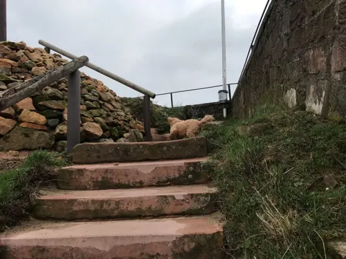


Heidenmauer
Monument and historic site · 1.4 km
Celtic ringwork in Rhineland-Palatinate, Germany

Spielzeugmuseum
Museum · 5.7 km
9 An der Bach, Freinsheim
Mar-Oct: 14:00-18:00; Nov-Mar: Sa,Su,PH 14:00-18:00


Burgruine Hardenburg
Monument and historic site · 3.6 km
Apr-Sep Tu-Su,PH 09:00-13:00,13:30-18:00; Mo off; Oct-Nov, Jan-Mar...

Pfannenstein
Monument and historic site · 4.9 km
Loogfelsen (Grenzmarkierung, erdverbundener Felsen) zwischen Deidesheim und Wachenheim an der Weinstraße, sowie der Gemeinde Forst an...


Palatinate Museum of Natural History
Museum · 1.7 km
Museum in Germany


101 more on the map.
Parks, trails and playgrounds42





30 more on the map.
Restaurants and cafes261

Dürkheimer Fass
Restaurant
1 Sankt-Michaels-Allee, Bad Dürkheim
Apr-Oct,Dec Mo-Sa 11:30-22:30; Apr-Oct,Dec PH,Su 11:30-22:00;...


Weingut von Winning
Brewery and winery · 5.7 km
8 Weinstraße, Deidesheim
Mo-Fr 08:00-18:00; Sa 10:00-18:00; Su,PH 11:00-18:00
Open in Google Maps · Wikipedia · +49 6326 966870; +49 6326 221
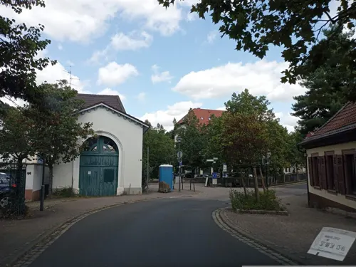
Da Robertino
Restaurant · Italian, Pizza
13 Eichstraße, Bad Dürkheim
Mo,Tu,Th,Fr,Su 11:30-14:00,17:00-22:00; Sa 17:00-22:00; We off

Hambels Restaurant
Restaurant · German, Regional · 2.7 km
17 Bahnhofstraße, Wachenheim an der Weinstraße
Tu,We 11:30-14:30; Th-Sa 11:30-14:30,17:30-22:00; PH off
Haveli Indisches Tandoori Restaurant
Restaurant · Indian
4 Eichstraße, Bad Dürkheim
Mo 16:30-22:30; We-Su 11:30-14:30, 17:30-22:30


Hotel Goldbächel
Restaurant · Regional · 2.9 km
99 Waldstraße, Wachenheim an der Weinstraße
Tu 16:00+; We-Su 12:00+
Hütte 'In der Weilach'
Restaurant · Regional · 2.8 km
In der Weilach
Sa-Su,PH 10:00-18:00; PH 10:00-18:00; Dec 25-26 10:00-18:00
249 more on the map.
History
Between 1200 and 500 BC, the area around the eastern end of the Isenach valley was settled by Celts, who also built the Heidenmauer ("Heathen Wall"), a Celtic ring wall.
In recent years, the ruins of a Roman villa have been uncovered in Bad Durkheim, known today as Villa Rustika. The site gives a fascinating insight into what life must have been like for the Roman elite and non-elite who lived and died in (what would have been considered) a “provincial backwater.”
The earliest documented appearance of the name of the town is in the Lorsch codex of 1 June 778, as Turnesheim. A letter of enfeoffment from the Bishop of Speyer in 946 mentions Thuringeheim. About 1025, building work on Limburg Abbey, today preserved only as ruins, was begun.
Town rights were granted on 1 January 1360, but were withdrawn again in 1471 after Elector Friedrich the Victorious of the Palatinate conquered the town and wrought considerable destruction. After the slow reconstruction, Dürkheim passed to the Counts of Leiningen in 1554.
From the History section of Bad Dürkheim on Wikipedia, under CC BY-SA 4.0.
Where to stay36
KNAUS Campingpark Bad Dürkheim - Reisemobilstellplatz
Campground · 2.0 km
1 In den Almen, Bad Dürkheim
Obsthof und Gästehaus Brust
Motel and hotel · 4.5 km
14 Bahnhofstraße, Erpolzheim
Churches and places of worship24
St. Georgs Kirche
Church · Protestant · 2.7 km
28 Weinstraße, Wachenheim an der Weinstraße
Shopping22
Gas and EV charging8
Schools, colleges and libraries15
Kurpfalzschule Grund- und Regionalschule
School · 2.5 km
3 Hinterm Graben, Wachenheim an der Weinstraße
Healthcare13
MEDIAN Klinik Sonnenwende Bad Dürkheim
Clinic and pharmacy · 1.2 km
86 Sonnenwendstraße, Bad Dürkheim
Map of Bad Dürkheim
250 places. The map loads OpenStreetMap tiles when you open it.
Getting there and nearby towns
City-Airport Mannheim (MHG) is the nearest airport with scheduled flights listed in OpenStreetMap, 25 km away.
- Herxheim am Berg 5 km north, about 5 min by car
- Grünstadt 11 km north, about 11 min by car
- Neustadt an der Weinstraße 13 km south, about 13 min by car
- Haßloch 13 km southeast, about 13 min by car
- Eisenberg 13 km northwest, about 13 min by car
- Böhl-Iggelheim 13 km southeast, about 13 min by car
- Mutterstadt 13 km east, about 13 min by car
- Frankenthal 15 km northeast, about 15 min by car
- Limburgerhof 16 km east, about 16 min by car
- Schifferstadt 17 km southeast, about 17 min by car
Drive times are estimates from straight-line distance, not routes.
Local news
Headlines from INDB.
Reviews, tips and questions
Loading what members have shared...
Sources and licences
- GeoNames (CC BY 4.0): population, coordinates, regions and time zone
- Mapillary (see each image): photos
- OpenStreetMap contributors (ODbL 1.0): places, airports, map data
- Wikidata (CC0 1.0): elevation, founding date, time zone, website, landmarks and historic places
- Wikimedia Commons (see each image): photos
- Wikipedia (CC BY-SA 4.0): overview and history text
Photo credits
- Bad Dürkheim Ansicht vom Vigilienturm, Altera levatur, CC BY-SA 4.0
- Straßen und Plätze in Bad Dürkheim, LoKiLeCh, CC BY-SA 4.0
- Straßen und Plätze in Bad Dürkheim 2, LoKiLeCh, CC BY-SA 4.0
- Straßen und Plätze in Bad Dürkheim 3, LoKiLeCh, CC BY-SA 4.0
- Die Bienenstöcke rund um Bad Dürkheim werden jedes Jahr vor dem Wurstmarkt eingesammelt und in ein anderes Tal gebracht und kommen nach dem Wurstmarkt wieder an ihren Standort zurück. - panoramio, Immanuel Giel, CC BY 3.0
- Aerial image of the Bad Dürkheim airfield, Carsten Steger, CC BY-SA 4.0
- 02.04.93 Bad Dürkheim 628289, Phil Richards, CC BY-SA 4.0
- Bad Dürkheim Kurpark Zürgelbaum 005 2021 10 10, Friedrich Haag, CC BY-SA 4.0
- Bad Dürkheim Kurpark Zürgelbaum 003 2021 10 10, Friedrich Haag, CC BY-SA 4.0
- Bad Dürkheim Kurpark Zürgelbaum 001 2021 10 10, Friedrich Haag, CC BY-SA 4.0
- Bad Dürkheim Kurpark Zürgelbaum 002 2021 10 10, Friedrich Haag, CC BY-SA 4.0
- Ludwigskirche Bad Dürkheim 7, LoKiLeCh, CC BY-SA 4.0
- KriemhildenstuhlMR2, Maik Riede, CC BY-SA 4.0
- Heidenmauer, Ulli1105, CC BY-SA 2.5
- 150322-Pfalzmuseum-05, BlueBreezeWiki, CC BY-SA 3.0
- Berntal, Wofl, CC BY 3.0
- Herxheim am Berg 05, Immanuel Giel, CC BY-SA 3.0
- Eckkopfturm, Kallistratos, Public domain
- Bismarckturm (Kallstadt), Jörg Braukmann, CC BY-SA 4.0
- Burgkirche Bad-Duerkheim 02, Immanuel Giel, CC BY-SA 3.0
- Riesenfass, The original uploader was Urbanus at German Wikipedia ., CC BY-SA 2.0
- Zeppelinturm, Muck, CC BY-SA 4.0
- Leistadt-april-2007, Paul Henning, CC BY-SA 3.0
- Bad Duerkheimer Schlosskirche, Immanuel Giel, CC BY-SA 3.0
- Wachtenburg bei wachenheim, Andreas Berger, CC BY-SA 3.0
- Hardenburg-01, Muck, CC BY-SA 4.0
- Bing Museum Freinsheim, Bing1512, CC BY 3.0
- Wachenheim an der Weinstrasse Weinstraße 28 002 2017 09 10, Friedrich Haag, CC BY-SA 4.0
- 003 2015 04 10 Kulturdenkmaeler Forst, Friedrich Haag, CC BY-SA 4.0
- Weilerskopf, Fränsmer, CC0
- WeingutDeinhard-2, Kallistratos, Public domain
- Seebach Klosterkirche 1, Altera levatur, CC BY-SA 4.0
- Salvatorkirche Kallstadt, Altera levatur, CC0
- Deidesheim Michaelskapelle, MR 2017, CC BY-SA 4.0
- Vigilienturm Frontseite, Altera levatur, CC BY-SA 4.0
- Kirchberg Deidesheim 2020-05-09, MR 2017, CC BY-SA 4.0
- Kirche-Erpolzheim-2, Immanuel Giel, CC BY-SA 3.0
- Friedelsheim Kirchgasse 1 003 2022 09 11, Friedrich Haag, CC BY-SA 4.0
- 2016 Pfälzerwald 226 Kaiser-Wilhelms-Höhe Bad Dürkheim, Steffen 962, CC0
- 2016 Pfälzerwald 227 Kaiser-Wilhelms-Höhe Bad Dürkheim, Steffen 962, CC0
- Wachtenburg, Unknown author, CC BY-SA 1.0
- Naturschutzgebiet Forster Bruch, MR 2017, CC BY-SA 4.0
- NSG-7332-175 No01, WeckWorschtWoi, CC BY-SA 4.0
- 20111002 großer Basaltsee bei Forst in der Pfalz, Aquatoney, CC BY-SA 4.0
- Rahnfelsen 2, Christian 56457, CC BY-SA 4.0
- Pfannenstein, Karotte3, CC BY-SA 3.0
- Werbung für den Spargelhof Zein - panoramio, Immanuel Giel, CC BY 3.0
- Street-level photo, miguel_andrade, CC BY-SA 4.0
- Street-level photo, changchun1, CC BY-SA 4.0
- Street-level photo, wegavision, CC BY-SA 4.0
- Street-level photo, changchun1, CC BY-SA 4.0
- Street-level photo, changchun1, CC BY-SA 4.0
- Street-level photo, changchun1, CC BY-SA 4.0
- Street-level photo, teddy73, CC BY-SA 4.0
- Street-level photo, teddy73, CC BY-SA 4.0
- Street-level photo, atze02, CC BY-SA 4.0
- Street-level photo, atze02, CC BY-SA 4.0
- Street-level photo, atze02, CC BY-SA 4.0
- Street-level photo, teddy73, CC BY-SA 4.0
- Street-level photo, knistertoni, CC BY-SA 4.0
- Street-level photo, mfa, CC BY-SA 4.0
- Street-level photo, atze02, CC BY-SA 4.0
- Street-level photo, VIA_DT, CC BY-SA 4.0
- Street-level photo, wegavision, CC BY-SA 4.0
- Street-level photo, changchun1, CC BY-SA 4.0
- Street-level photo, changchun1, CC BY-SA 4.0
- Street-level photo, changchun1, CC BY-SA 4.0
- Street-level photo, miguel_andrade, CC BY-SA 4.0
- Street-level photo, NorMan61, CC BY-SA 4.0
- Street-level photo, miguel_andrade, CC BY-SA 4.0
- Street-level photo, changchun1, CC BY-SA 4.0


Page built November 8, 2026. Spotted a mistake? Tell us or suggest a place.