


Why visit Lindlar
Townapedia lists 64 museums and landmarks, 53 parks and trails, 77 places to eat, 15 places to stay and 49 attractions in and around town.
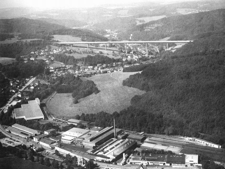
Highlights include Wiehltal bridge, Altenlinderstall, Engel-Museum and Industriemuseum Engelskirchen.
Weather in Lindlar
Forecast from MET Norway (CC BY 4.0). Full forecast
About Lindlar
Lindlar (German pronunciation: [ˈlɪndlaʁ]; Kölsch: Lenkeln [ˈléŋkəln]) is a municipality in the Oberbergischer Kreis, in North Rhine-Westphalia, Germany. It is located about 30 km east of Cologne.
From the Wikipedia article Lindlar (this version), under CC BY-SA 4.0.
Things to do49



37 more on the map.
Museums and landmarks64

Engel-Museum
Museum · 4.5 km
7 Engels-Platz, Engelskirchen
Tu-Th 10:00-13:00; We 14:00-17:00; Sa-Su 11:00-16:00
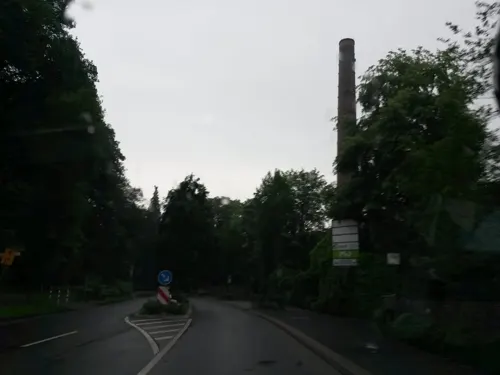
Industriemuseum Engelskirchen
Museum · 4.6 km
Eintritt 2026: 6,- EUR, Kinder u. Jugendlich bis 18 Eintritt frei. Jeder erste Freitag im Monat: Eintritt frei für alle.
2 Engels-Platz, Engelskirchen
2026 Mar 29-2026 Nov 01 Tu-Fr 10:00-17:00, Sa-Su,PH 11:00-18:00;...


Industriemuseum Oelchenshammer
Museum · 4.6 km
Apr-Oct: Su 14:00-18:00

Kraftwerk Ermen & Engels
Museum · 4.6 km
Industry Museum in a former energy plant of a cotton mill in Germany's Rhine area

Herrenhaus
Monument and historic site · 1.3 km
1 Heiligenhoven, Lindlar

Schloß Ehreshoven
Monument and historic site · 5.6 km
23 Ehreshoven, Engelskirchen



52 more on the map.
Parks, trails and playgrounds53

LVR-Freilichtmuseum Lindlar
Sports field and stadium · 2.1 km
5 Unterheiligenhoven, Lindlar
Mar-Oct 10:00-18:00; Nov-Feb 10:00-16:00



41 more on the map.
Restaurants and cafes77

Beim Rösi
Restaurant · German · 6.6 km
32 Johann-Wilhelm-Roth-Straße, Wipperfürth
May-Sep: Mo-Tu off; We-Fr 16:00-23:00; Sa,Su 14:00-23:00; Oct-Apr:...
In der Delling
Restaurant · German, Indian · 5.8 km
12 Delling, Kürten
We-Fr 12:00-15:00,17:30-22:00; Sa,Su 12:00-22:00

JESSIS - Der Ort zum Wohlfühlen
Cafe · Burger, Regional, Cake
7 Kirchplatz, Lindlar
We,Th 09:00-18:00; Fr,Sa 09:00-22:00; Su 10:00-18:00; Mo,Tu off
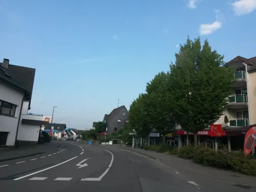
Kamps
Cafe · Coffee Shop, Sandwich
16a Kölner Straße, Lindlar
Mo-Fr 06:00-18:30; Sa 06:00-13:30; Su 07:30-17:00
Kemer Grill & Pizzeria
Restaurant · Turkish
1 Bachstraße, Lindlar
Sa off; Mo-Fr 11:00-20:00; Su,PH off; Su,PH 12:00-20:00
Landhaus Fuchs
Restaurant · German · 5.1 km
27 Unterbersten, Kürten
We-Fr 14:00+; Sa,Su,PH 11:00+; Mo,Tu off
Lindenhof
Restaurant · Greek
11 Hauptstraße, Lindlar
Mo 12:00-14:30,17:00-22:00; Tu off; We-Sa 12:00-14:30,17:00-22:00;...
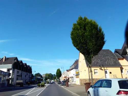


Ottimo
Restaurant · Turkish, German, Noodle, Pizza · 4.3 km
15 Märkische Straße, Engelskirchen
Tu-Sa 11:00-22:00; Su,PH 11:30-22:00
65 more on the map.
Where to stay15
Churches and places of worship39
Shopping24
Gas and EV charging10
Schools, colleges and libraries19
Healthcare12
Peter und Paul Apotheke
Clinic and pharmacy · 4.3 km
7 Bahnhofsplatz, Engelskirchen
Map of Lindlar
250 places. The map loads OpenStreetMap tiles when you open it.
Getting there and nearby towns
Cologne Bonn Airport (CGN) is the nearest airport with scheduled flights listed in OpenStreetMap, 24 km away.
- Wipperfürth 11 km north, about 11 min by car
- Overath 12 km southwest, about 12 min by car
- Marienheide 13 km northeast, about 13 min by car
- Much 13 km south, about 13 min by car
- Bergisch Gladbach 18 km west, about 18 min by car
- Wermelskirchen 17 km northwest, about 17 min by car
- Nümbrecht 17 km southeast, about 17 min by car
- Odenthal 18 km west, about 18 min by car
- Rösrath 19 km southwest, about 19 min by car
- Remscheid 22 km northwest, about 22 min by car
Drive times are estimates from straight-line distance, not routes.
Local news
Headlines from INDB.
Reviews, tips and questions
Loading what members have shared...
Sources and licences
- GeoNames (CC BY 4.0): population, coordinates, regions and time zone
- Mapillary (see each image): photos
- OpenStreetMap contributors (ODbL 1.0): places, airports, map data
- Wikidata (CC0 1.0): elevation, founding date, time zone, website, landmarks and historic places
- Wikimedia Commons (see each image): photos
- Wikipedia (CC BY-SA 4.0): overview and history text
Photo credits
- Lindlar, JensD, CC BY-SA 3.0
- Hauptstraße 23 (Lindlar) (1), DiAuras, CC BY-SA 4.0
- Steinhauerpfad Lindlar photo-01, Velopilger, CC0
- Pumpe Kirchplatz (Lindlar) (BD 109) (2), DiAuras, CC BY-SA 4.0
- Pumpe Kirchplatz (Lindlar) (BD 109) (1), DiAuras, CC BY-SA 4.0
- Hauptstraße 23 (Lindlar) (2), DiAuras, CC BY-SA 4.0
- Steinhauerpfad Lindlar photo-02, Velopilger, CC0
- Hauptstraße 25 (Lindlar) (2), DiAuras, CC BY-SA 4.0
- Pfarrgasse 2, 2a (Lindlar) (1), DiAuras, CC BY-SA 4.0
- Missionskreuz Kirchplatz (Lindlar) (BD 31), DiAuras, CC BY-SA 4.0
- Pfarrgasse 2, 2a (Lindlar) (5), DiAuras, CC BY-SA 4.0
- Pfarrgasse 2, 2a (Lindlar) (6), DiAuras, CC BY-SA 4.0
- Am Fronhofsgarten 2 (Lindlar) (2), DiAuras, CC BY-SA 4.0
- Pfarrgasse 2, 2a (Lindlar) (3), DiAuras, CC BY-SA 4.0
- Pfarrgasse 2, 2a (Lindlar) (7), DiAuras, CC BY-SA 4.0
- Pfarrgasse 2, 2a (Lindlar) (8), DiAuras, CC BY-SA 4.0
- Steinhauerpfad Lindlar photo-03, Velopilger, CC0
- Hauptstraße 25 (Lindlar) (1), DiAuras, CC BY-SA 4.0
- Am Fronhofsgarten 2 (Lindlar) (3), DiAuras, CC BY-SA 4.0
- Am Fronhofsgarten 2 (Lindlar) (4), DiAuras, CC BY-SA 4.0
- Marktplatz Lindlar - panoramio, MWTTCD, CC BY 3.0
- Pfarrgasse 2, 2a (Lindlar) (2), DiAuras, CC BY-SA 4.0
- Pfarrgasse 2, 2a (Lindlar) (4), DiAuras, CC BY-SA 4.0
- Grabsteine Kirchplatz (Lindlar) (BD 33), DiAuras, CC BY-SA 4.0
- Weihershagen, Jörg Kopp at de.wikipedia, CC BY-SA 3.0
- Industriemuseum Engelskirchen, Pingsjong, GFDL
- Aerial image of the Ehreshoven Castle (view from the south), Carsten Steger, CC BY-SA 4.0
- Ruine Eibach HDR, SerWal, CC BY-SA 3.0
- Neuenberg-1, Carsten Becher, CC BY-SA 3.0
- Ruenderoth 2006, Guido Schmickler, CC BY-SA 2.5
- Lindlar Gymnasium Turnhallenneubau, The original uploader was JensD at German Wikipedia ., CC BY-SA 3.0
- Halty turm 1, Guido Schmickler, CC BY-SA 2.5
- Jubilate-Kirche (Lindlar) (1), Chris06, CC BY-SA 4.0
- Hof Zum Eigen mit Zehntscheune, Pingsjong, GFDL
- Schloss heiligenhoven innen, JensD, CC BY-SA 3.0
- Lindlar Frielingsdorf - Sankt Apollinaris 01 ies, Frank Vincentz, CC BY-SA 3.0
- St. Peter und Paul (Engelskirchen) (02), Chris06, CC BY-SA 4.0
- KreuzkapelleLoope (6), Duschan1944, CC BY-SA 4.0
- SanktRochusKapelleLoope (04), Duschan1944, CC BY-SA 4.0
- Engel-Museum.1, Janclas, GFDL
- Evangelische Kirche (Ründeroth) (01), Chris06, CC BY-SA 4.0
- St. Severin (Lindlar) (01), Chris06, CC BY-SA 4.0
- Evangelische Kirche (Schnellenbach) (1), Chris06, CC BY-SA 4.0
- Evangelisches Paul-Schneider-Gemeindezentrum (Schmitzhöhe ) (1), Chris06, CC BY-SA 4.0
- Aggertalhoehle, Toksave, CC BY-SA 4.0
- Engelskirchen - Kastor - NSG Grube Kastor 13 ies, Frank Vincentz, CC BY-SA 3.0
- Oberes Lindlarer Sülztal bei Klemenseichen, DiAuras, CC BY-SA 4.0
- Engelskirchen oelchenshammer, Unknown author, CC BY-SA 3.0
- Ehem. Brechwerk Dolomit-Steinbruch bei Linde, DiAuras, CC BY-SA 4.0
- Street-level photo, uwekoch, CC BY-SA 4.0
- Street-level photo, uwekoch, CC BY-SA 4.0
- Street-level photo, wladimir, CC BY-SA 4.0
- Street-level photo, uwekoch, CC BY-SA 4.0
- Street-level photo, uwekoch, CC BY-SA 4.0
- Street-level photo, uwekoch, CC BY-SA 4.0
- Street-level photo, uwekoch, CC BY-SA 4.0
- Street-level photo, uwekoch, CC BY-SA 4.0
- Street-level photo, uwekoch, CC BY-SA 4.0
- Street-level photo, uwekoch, CC BY-SA 4.0
- Street-level photo, uwekoch, CC BY-SA 4.0
- Street-level photo, uwekoch, CC BY-SA 4.0
- Street-level photo, uwekoch, CC BY-SA 4.0
- Street-level photo, uwekoch, CC BY-SA 4.0


Page built November 8, 2026. Spotted a mistake? Tell us or suggest a place.