


Why visit Marktoberdorf
Townapedia lists 82 museums and landmarks, 13 parks and trails, 72 places to eat, 19 places to stay and 14 attractions in and around town.
Highlights include Hofladen Aufmuth, Stadtmuseum, Hartmannhaus and Elbsee Freibad.
Weather in Marktoberdorf
Forecast from MET Norway (CC BY 4.0). Full forecast
About Marktoberdorf
Marktoberdorf (German: [maʁktˈʔoːbɐdɔʁf] ) is the capital of the Bavarian district of Ostallgäu in the Regierungsbezirk of Swabia.
From the Wikipedia article Marktoberdorf (this version), under CC BY-SA 4.0.
Things to do14




2 more on the map.
Museums and landmarks82




Schloss Marktoberdorf
Monument and historic site
19 Kurfürstenstraße, Marktoberdorf



Freyberg
Monument and historic site · 7.6 km
Unvollendete Fliehburg in Bauweise einer Spornburg

70 more on the map.
Parks, trails and playgrounds13




1 more on the map.
Restaurants and cafes72

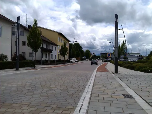
Elia
Restaurant · Greek
13 Bahnhofstraße, Marktoberdorf
Tu-Sa 11:30-14:30,17:00-23:00; Su 11:30-14:30,17:00-22:00; Mo off
Mooshütte
Restaurant · Regional · 8.2 km
Nov-Mar We,Sa 11:00-22:00; Su,PH 10:30-21:00; Apr-Oct Mo-Sa...
Rusticana
Restaurant · Pizza
5 Kurfürstenstraße, Marktoberdorf
Mo-Fr 11:00-14:00,17:00-23:00; Sa,Su,PH 11:00-23:00

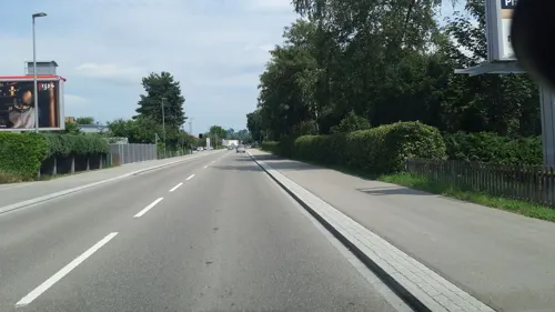

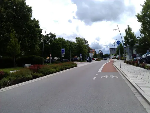


Gasthof Walburg
Restaurant · Regional · 4.8 km
Mo-Tu 17:00-24:00; Th-Fr 17:00-24:00; Sa 11:00-14:00,17:00-24:00;...

Hosp Fachmarkt
Brewery and winery · 2.7 km
40 Siemensring, Marktoberdorf
Mo-Fr 08:30-12:30, 13:30-18:00; Sa 09:00-12:30; Su,PH off
60 more on the map.
Where to stay19
Churches and places of worship67
St. Martin
Church · Roman Catholic
15 Kurfürstenstraße, Marktoberdorf
St. Georg
Church · Roman Catholic · 6.2 km
4 Kirchenstraße, Biessenhofen
Frauenkapelle
Church · Roman Catholic
14 Georg-Fischer-Straße, Marktoberdorf
Marienkapelle zur Unbefleckten Empfängnis
Church · Catholic · 2.1 km
7, Ruderatshofen
Pfarrkirche St. Michael
Church · Roman Catholic · 1.6 km
1 Burgstraße, Marktoberdorf
Pfarrkirche St. Peter und Paul
Church · Roman Catholic · 7.1 km
28 Dorfstraße, Stötten a.Auerberg
Shopping28
Gas and EV charging14
Schools, colleges and libraries24
Healthcare7
Map of Marktoberdorf
250 places. The map loads OpenStreetMap tiles when you open it.
Getting there and nearby towns
Memmingen Airport (FMM) is the nearest airport with scheduled flights listed in OpenStreetMap, 37 km away.
- Schongau 21 km east, about 21 min by car
- Peiting 23 km east, about 23 min by car
- Mindelheim 31 km north, about 31 min by car
- Peißenberg 34 km east, about 34 min by car
- Memmingen 39 km northwest, about 39 min by car
- Sonthofen 38 km southwest, about 38 min by car
- Weilheim 41 km east, about 41 min by car
- Murnau am Staffelsee 45 km east, about 45 min by car
- Schwabmünchen 46 km north, about 46 min by car
- Bad Wurzach 56 km west, about 56 min by car
Drive times are estimates from straight-line distance, not routes.
Local news
Headlines from INDB.
Reviews, tips and questions
Loading what members have shared...
Sources and licences
- GeoNames (CC BY 4.0): population, coordinates, regions and time zone
- Mapillary (see each image): photos
- OpenStreetMap contributors (ODbL 1.0): places, airports, map data
- Wikidata (CC0 1.0): elevation, founding date, time zone, website
- Wikimedia Commons (see each image): photos
- Wikipedia (CC BY-SA 4.0): overview and history text
Photo credits
- MOD - Amtshaus ehem, Marktbrunnen, Flodur63, CC BY-SA 3.0
- Marktoberdorf - panoramio, Richard Mayer, CC BY 3.0
- Postkarte von Marktoberdorf, BreTho, CC BY 4.0
- Alte Pfarrkirche Marktoberdorf 7, Ricardalovesmonuments, CC BY-SA 4.0
- Alte Pfarrkirche Marktoberdorf 6, Ricardalovesmonuments, CC BY-SA 4.0
- Motorradparkplatz Marktoberdorf Georg-Fischer-Straße, Gmbo 2013, CC BY-SA 4.0
- Alte Pfarrkirche Marktoberdorf 10, Ricardalovesmonuments, CC BY-SA 4.0
- Alte Pfarrkirche Marktoberdorf 8, Ricardalovesmonuments, CC BY-SA 4.0
- Alte Pfarrkirche Marktoberdorf 1, Ricardalovesmonuments, CC BY-SA 4.0
- Alte Pfarrkirche Marktoberdorf 9, Ricardalovesmonuments, CC BY-SA 4.0
- Alte Pfarrkirche Marktoberdorf 4, Ricardalovesmonuments, CC BY-SA 4.0
- Alte Pfarrkirche Marktoberdorf 3, Ricardalovesmonuments, CC BY-SA 4.0
- Alte Pfarrkirche Marktoberdorf 2, Ricardalovesmonuments, CC BY-SA 4.0
- Alte Pfarrkirche Marktoberdorf 5, Ricardalovesmonuments, CC BY-SA 4.0
- Marktoberdorf Abbruch Sankt Martin Grundschule, BreTho, CC BY-SA 4.0
- Bahnhof Marktoberdorf - panoramio, Richard Mayer, CC BY 3.0
- Bahnhof Marktoberdorf 2011 - panoramio (19), Richard Mayer, CC BY 3.0
- Hartmannhaus Marktoberdorf (1), Stefan Karl, CC BY-SA 4.0
- Hartmannhaus Marktoberdorf (2), Stefan Karl, CC BY-SA 4.0
- Künstlerhaus Marktoberdorf, Gras-Ober, CC BY-SA 3.0
- Aitrang - Wenglingen - Kapelle v W, Flodur63, CC BY-SA 3.0
- St. Martin Marktoberdorf 02, H.Helmlechner, CC BY-SA 4.0
- Pfarrkirche in Bertoldshofen, Herbert Wittmann, CC BY-SA 3.0
- Leuterschach 3, Richard Mayer, CC BY-SA 3.0
- Fürstbischöfliches Schloss Marktoberdorf, Sir Boris, CC BY-SA 3.0
- Altdorf, Katholische Pfarrkirche Mariae Himmelfahrt (1), Angela Huster, CC0
- St Georg Biessenhofen, Angela Huster, CC0
- MOD - Geisenried - Kirche v SO 180812, Flodur63, CC BY-SA 3.0
- Kapelle Hagmoos 1, Ricardalovesmonuments, CC BY-SA 4.0
- MOD - Frauenkapelle, Pfarrkirche, Altes Rathaus, Flodur63, CC BY-SA 3.0
- MOD - Hartmannhaus, Flodur63, CC BY-SA 4.0
- St Michael church in Thalhofen, Marktoberdorf, Germany, Alexis Reynouard, CC BY-SA 4.0
- Kapelle in Geisenhofen (Gem. Ruderatshofen), Herbert Wittmann, CC BY-SA 3.0
- Stötten Peter & Paul, Richard Mayer, CC BY-SA 3.0
- Martinsheim Marktoberdorf, Stefan Karl, CC BY-SA 4.0
- Wegkreuz oder Gipfelkreuz des Hungerbergs SW von Ebenhofen, EinEngener, CC0
- Friedensdenkmal Apfeltrang 2, Ordercrazy, Public domain
- Kriegerdenkmal auf dem Friedhof von Altdorf bei Biessenhofen, EinEngener, CC0
- Bertoldshofen 2, Dark Avenger, CC BY-SA 3.0
- St Martin Marktoberdorf 2008 hell, Juventum (Farben und Winkel: Rabanus Flavus ), CC BY-SA 3.0
- Street-level photo, changchun1, CC BY-SA 4.0
- Street-level photo, changchun1, CC BY-SA 4.0
- Street-level photo, sajut, CC BY-SA 4.0
- Street-level photo, sajut, CC BY-SA 4.0
- Street-level photo, sajut, CC BY-SA 4.0
- Street-level photo, changchun1, CC BY-SA 4.0
- Street-level photo, sajut, CC BY-SA 4.0
- Street-level photo, sajut, CC BY-SA 4.0
- Street-level photo, zuse, CC BY-SA 4.0
- Street-level photo, changchun1, CC BY-SA 4.0
- Street-level photo, derzornigemarkus, CC BY-SA 4.0
- Street-level photo, changchun1, CC BY-SA 4.0
- Street-level photo, changchun1, CC BY-SA 4.0
- Street-level photo, sajut, CC BY-SA 4.0
- Street-level photo, ente, CC BY-SA 4.0


Page built November 8, 2026. Spotted a mistake? Tell us or suggest a place.