


Why visit Namborn
Townapedia lists 33 museums and landmarks, 7 parks and trails, 50 places to eat, 2 places to stay and 18 attractions in and around town.
Highlights include Bergfried Liebenburg, Johannishof, Vicus Wareswald and Höckerlinie (Westwall).
Weather in Namborn
Forecast from MET Norway (CC BY 4.0). Full forecast
About Namborn
Namborn (German pronunciation: [ˈnambɔʁn]) is a municipality in the district of Sankt Wendel, in Saarland, Germany. It is situated approximately 7 km north of Sankt Wendel, and 25 km southwest of Idar-Oberstein. It is approximately 40 km northeast of Saarbrücken on highway B 41 and the Nahe Valley Railway line. The distance to the Bostalsee is about 10 km, and to the district seat St.
From the Wikipedia article Namborn (this version), under CC BY-SA 4.0.
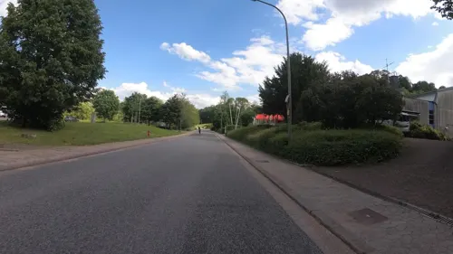
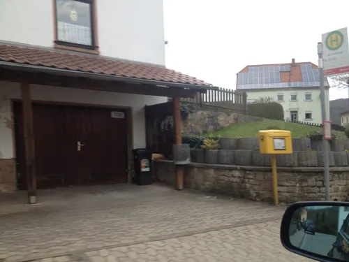
Photos of Namborn


Things to do18

Bergfried Liebenburg
Scenic view · 1.4 km
1170 erbaut, 1677 zerstört, 1976 auf Resten wieder aufgebaut
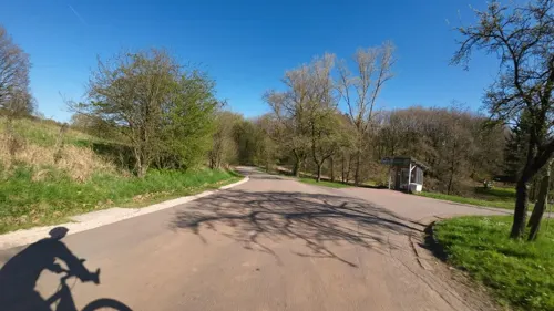

6 more on the map.
Museums and landmarks33

Vicus Wareswald
Monument and historic site · 6.7 km
Archaeological site in St. Wendel, Germany

Allerburg
Monument and historic site · 1.4 km
Fundamentreste, römerzeitliche Anlage, vermutlich eine leicht befestigte Strassenkontrollstation
Gedenkstein an die Gefallenen 1914 -18
Monument and historic site · 3.8 km
Unter der Inschrift oben stehen die Namen der im Krieg 1914/18 gefallenen Soldaten des Oetes. Das Kreuz dahinter steht auf dem Aussichts...
21 more on the map.
Parks, trails and playgrounds7




Restaurants and cafes50
Gasthaus Zum Bahnhof
Bar and pub · 4.3 km
Tu 19:00+ "Heimat-Abend"; Su 11:00+ "Stammtisch"


38 more on the map.
History
Numerous finds from the Celtic and Roman times, which were discovered or partially exposed in the communities of Baltersweiler, Eisweiler, Furschweiler, Bornerhof, Heisterberg, Hirstein, Namborn, and Roschberg, testify to an early settlement of the area. Liebenburg Castle, probably built around 1200 and first documented in 1220, is another indication of the importance of the area.
Over time the different parts of the district belonged to various regional authorities, and changed hands several times between French and German control. The district assumed its present composition following the administrative restructuring concluding in 1975.
From the History section of Namborn on Wikipedia, under CC BY-SA 4.0.
More about Namborn
Geography
Namborn is located in a low wooded mountain range between the rivers Nahe and Blies in the Saar-Hunsrück Nature Park. The highest elevation is the Friedenberg in Hirstein at 509 m; the lowest point is 298 m in Urweiler, where the Todbach leaves Namborn for St. Wendel. Recognized natural monuments are the Wendalinushöhle (Wendelin's cave) in Baltersweiler, a historic Linden tree in Furschweiler, the Allerbach rock wall in Namborn, and 3 Oaks in Roschberg.
Namborn is composed of the following ten districts: Baltersweiler, Eisweiler, Furschweiler, Gehweiler, Heisterberg, Hirstein, Hofeld-Mauschbach, Namborn, Pinsweiler, and Roschberg.
The Schlossberg, an approximately 10 hectare area in the Eisweiler district, has been protected since February 1937 because of the occurrence of several rare plant species, and since November 1957 as a nature reserve (Naturschutzgebiet ), making it the oldest nature reserve in Saarland. Since November 1983 there is a second reserve of 19.68 ha, Weiherbruch und Rohrbachwiesen , in the Namborn district and the neighboring community of Oberthal.
Additionally, parts of the districts of Heisterberg, Hirstein, Hofeld-Mauschbach, Namborn and Pinsweiler belong to the landscape protection area of the St. Wendel district. The entire municipality of Namborn is located in the Saar-Hunsrück Nature Park.
Arts and culture
In all districts except Pinsweiler village community rooms are available.
A popular destination for hikers are the ruins of the 12th-century Liebenburg in Eisweiler. Constructed in 1976/77 on the original foundation, this highly visible observation tower offers views over the village and the St. Wendel countryside, and houses a wedding reception hall.
The first-class hiking trail "Schmuggler-Pfad" (rated at 53 points), created in 2009, has a length of 12.8 km at an altitude of 310 to 480 m above sea level. At a medium difficulty level plan on a walking time of 4 to 4.5 hours. Starting point: at the Schützenhaus in Hofeld-Mauschbach along Furschweilerstraße (with clockwise direction recommended). For hiking groups, there is also the possibility of a guided hike. Telephone registration in the Namborner Rathaus.
The Street of Sculptures, which leads from St. Wendel to the Bostalsee, also touches the municipality of Baltersweiler.
The Westwall (Siegfried Line) passed through the area, of which only the ruins of demolished bunkers can be seen in Hirstein and Gehweiler, and in Hofeld-Mauschbach and Baltersweiler a few remains in the form of dragon's teeth.
Also worth seeing are the parish churches of the Assumption in Namborn and St. Willibrord in Baltersweiler. A similar church to the Assumption is St. Mark's in Braunshorn, Rheinland-Pfalz.
From the Wikipedia article Namborn, under CC BY-SA 4.0.
Where to stay2
Churches and places of worship13
Shopping11
Gas and EV charging4
Schools, colleges and libraries6
Healthcare3
Map of Namborn
147 places. The map loads OpenStreetMap tiles when you open it.
Getting there and nearby towns
Saarbrücken Airport (SCN) is the nearest airport with scheduled flights listed in OpenStreetMap, 34 km away.
- Oberthal 4 km west, about 4 min by car
- Sankt Wendel 6 km south, about 6 min by car
- Nohfelden 7 km north, about 7 min by car
- Tholey 9 km southwest, about 9 min by car
- Marpingen 10 km southwest, about 10 min by car
- Ottweiler 13 km south, about 13 min by car
- Nonnweiler 16 km northwest, about 16 min by car
- Schiffweiler 17 km south, about 17 min by car
- Illingen 18 km south, about 18 min by car
- Eppelborn 18 km southwest, about 18 min by car
Drive times are estimates from straight-line distance, not routes.
Towns near Namborn


Local news
Headlines from INDB.
Reviews, tips and questions
Loading what members have shared...
Sources and licences
- GeoNames (CC BY 4.0): population, coordinates, regions and time zone
- Mapillary (see each image): photos
- OpenStreetMap contributors (ODbL 1.0): places, airports, map data
- Wikidata (CC0 1.0): elevation, founding date, time zone, website, landmarks and historic places
- Wikimedia Commons (see each image): photos
- Wikipedia (CC BY-SA 4.0): overview and history text
Photo credits
- Hofeld-Schlossberg-20091019-20, Speifensender, CC BY-SA 3.0
- Namborn - Gehren - Alter Wasserbehälter - 20100523-03, Speifensender, Public domain
- Namborn - Gehren - Alter Wasserbehälter - 20100523-07, Speifensender, Public domain
- Namborn - Gehren - Alter Wasserbehälter - 20100523-04, Speifensender, Public domain
- Namborn - Gehren - Alter Wasserbehälter - 20100523-02, Speifensender, Public domain
- Namborn - Gehren - Alter Wasserbehälter - 20100523-01, Speifensender, Public domain
- Namborn - Gehren - Alter Wasserbehälter - 20100523-06, Speifensender, Public domain
- Namborn - Gehren - Alter Wasserbehälter - 20100523-05, Speifensender, Public domain
- Namborn - Gehren - Neuer Wasserbehälter - 20100523-03, Speifensender, Public domain
- Namborn - Gehren - Neuer Wasserbehälter - 20100523-04, Speifensender, Public domain
- Namborn - Gehren - Neuer Wasserbehälter - 20100523-05, Speifensender, Public domain
- Namborn - Gehren - Neuer Wasserbehälter - 20100523-01, Speifensender, Public domain
- Namborn - Gehren - Neuer Wasserbehälter - 20100523-02, Speifensender, Public domain
- Namborn - Gehren - Neuer Wasserbehälter - 20100523-06, Speifensender, Public domain
- Namborn-Acker-20081226-05, Speifensender, CC BY-SA 3.0
- Namborn-Acker-20081226-04, Speifensender, CC BY-SA 3.0
- Namborn-Wegekreuz-Im Ritt-2006-08-05-02, Speifensender, CC BY-SA 3.0
- Namborn-Wegekreuz-Im Ritt-2006-08-05-03, Speifensender, CC BY-SA 3.0
- Namborn-Wegekreuz-Im Ritt-2006-08-05-01, Speifensender, CC BY-SA 3.0
- Ausgrabungsstaette Wareswald, Pascal Dihé, CC BY-SA 4.0
- Hofeld-Schlossberg-20091019-08, Speifensender, CC BY-SA 3.0
- Bliesen St. Remigius 07, atreyu, CC BY-SA 3.0
- Hofeld-Schlossberg-20091019-20-cropped, Speifensender, CC BY-SA 3.0
- Oberthal, St. Stephanus (2), Cmcmcm1, CC BY-SA 3.0
- Baltersweiler St. Willibrord 01, atreyu, CC BY-SA 3.0
- Furschweiler, St. Anna (1), Cmcmcm1, CC BY-SA 3.0
- Hirstein, Evangelische Kirche (1), Cmcmcm1, CC BY-SA 3.0
- Walhausen, Evangelische Kirche (01), Cmcmcm1, CC BY-SA 4.0
- Gehweiler (Namborn), St. Michael (2), Cmcmcm1, CC BY-SA 4.0
- Strasse der Skulpturen Erdsäule, Gabriele Delhey, CC BY-SA 3.0
- Riesen-Bärenklau-20060805-1, Speifensender, CC BY-SA 3.0
- Riesen-Bärenklau-20060805-3, Speifensender, CC BY-SA 3.0
- Riesen-Bärenklau-20060805-2, Speifensender, CC BY-SA 3.0
- Erigeron annuus - Hofeld-Mauschbach - Auenrech - 2019-07-10, 3, Speifensender, CC0
- Street-level photo, teddy73, CC BY-SA 4.0
- Street-level photo, teddy73, CC BY-SA 4.0
- Street-level photo, teddy73, CC BY-SA 4.0
- Street-level photo, teddy73, CC BY-SA 4.0
- Street-level photo, teddy73, CC BY-SA 4.0
- Street-level photo, teddy73, CC BY-SA 4.0
- Street-level photo, teddy73, CC BY-SA 4.0
- Street-level photo, ramap, CC BY-SA 4.0
- Street-level photo, teddy73, CC BY-SA 4.0
- Street-level photo, teddy73, CC BY-SA 4.0
- Street-level photo, teddy73, CC BY-SA 4.0
- Street-level photo, teddy73, CC BY-SA 4.0
- Street-level photo, teddy73, CC BY-SA 4.0
- Street-level photo, teddy73, CC BY-SA 4.0
- Street-level photo, teddy73, CC BY-SA 4.0
- Street-level photo, teddy73, CC BY-SA 4.0
- Street-level photo, teddy73, CC BY-SA 4.0
- Street-level photo, teddy73, CC BY-SA 4.0


Page built November 9, 2026. Spotted a mistake? Tell us or suggest a place.